The Modern Antiquarian. Stone Circles, Ancient Sites, Neolithic Monuments, Ancient Monuments, Prehistoric Sites, Megalithic MysteriesThe Modern Antiquarian


Leubingen

Tumulus (France and Brittany)

<b>Leubingen</b>Posted by NucleusImage © Uwe Häberle 04/2019
Also known as:
  • Fürstengrab von Leubingen

Latitude:51° 11' 25.4" N
Longitude:   11° 10' 11.89" E

Added by Nucleus


Discussion Topics0 discussions
Start a topic


Show  |  Hide
Web searches for Leubingen
Show map   (inline Google Map)

Images (click to view fullsize)

Add an image Add an image
Photographs:<b>Leubingen</b>Posted by Nucleus <b>Leubingen</b>Posted by Nucleus <b>Leubingen</b>Posted by Nucleus <b>Leubingen</b>Posted by Nucleus <b>Leubingen</b>Posted by Nucleus Maps / Plans / Diagrams:<b>Leubingen</b>Posted by Nucleus

Fieldnotes

Add fieldnotes Add fieldnotes
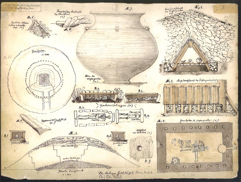
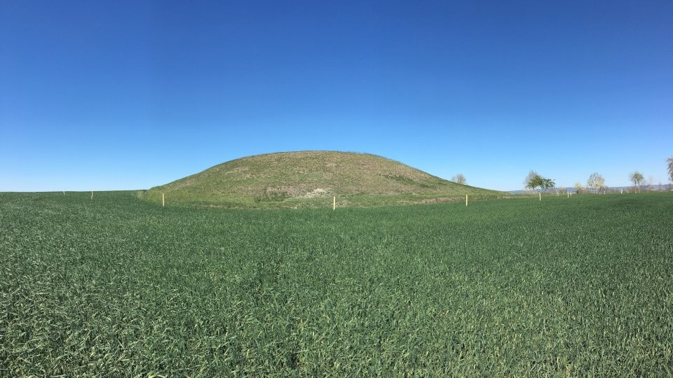
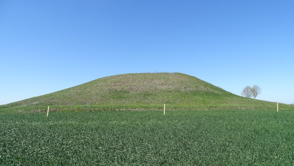
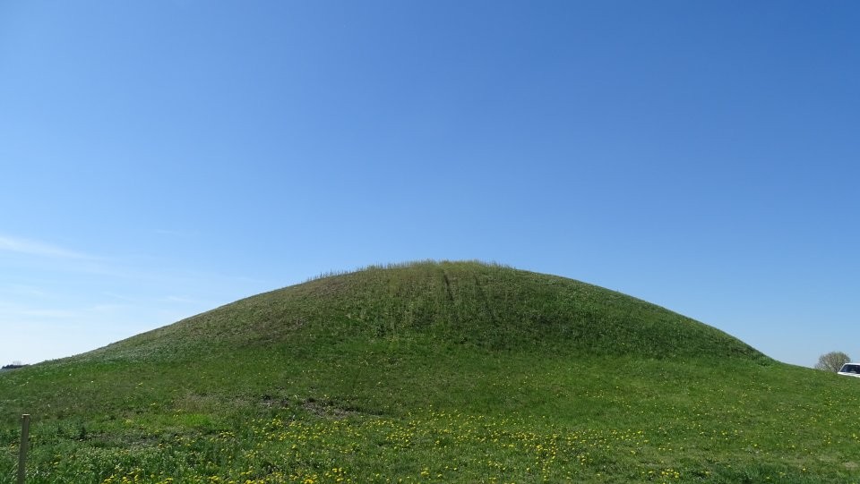
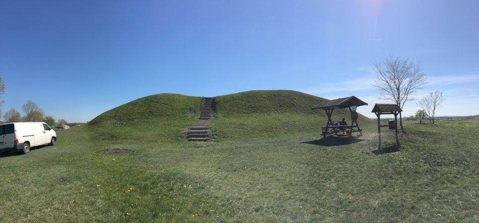
The princely tomb of Leubingen is the largest surviving Early Bronze Age princely tomb of the Aunitzitzer culture. It is located near Leubingen, a district of Sömmerda (Thuringia). The princely tombs of the Aunetitzer culture form a special type of graves, which stands out from the normal burials of this culture by huge, widely visible burial mounds with rich grave goods and which was the reason to call a whole culture as Leubing culture.

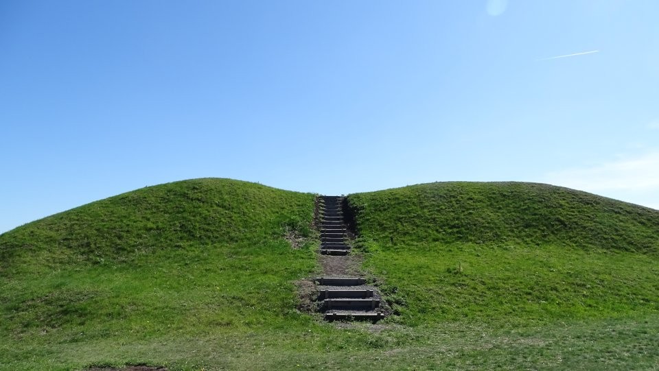
The mound lies east of the A71 motorway services Leubinger Fürstenhügel. From Leubingen take the (signed) Stödtener Strasse southeast. Around 300 m after you cross the A71, the mound lies right beside the road.

Visited April 2019
Nucleus Posted by Nucleus
10th June 2019ce
Edited 10th June 2019ce

Links

Add a link Add a link

Leubingen tumulus @ Wikipedia (English)


Nucleus Posted by Nucleus
10th June 2019ce