Image credit: Robert Gladstone


Looking across the entrance highlighting exposed passage lintels.

View across the interior.....


Wondrous....

The sheer scale of this broch is quite overwhelming... as was the weather, to be fair. This is the entrance, obviously.

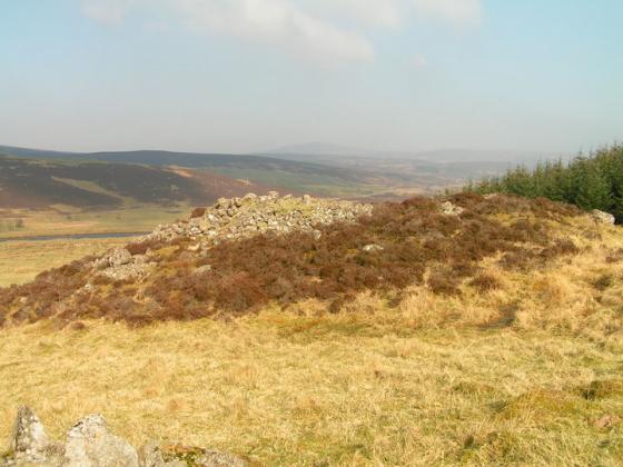
Backies broch photographed from a viewpoint higher up the hillside.
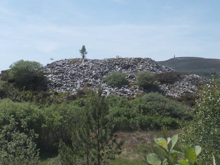
The tumbled exterior of Backies broch viewed from the foot of its supporting knoll.

Looking into the central court of Backies broch.

The wall at Backies Broch is some 5 metres in width.

This is an elevated view, raising the camera on a monopod, showing the external entranceway with its impressive leading lintel.

Fine courses of walling leading towards the entrance portal.

The entranceway at Backies broch viewed from the interior.

The lintels above the entrance passage viewed from the broch wall.

This is the view outwards, through the entrance portal, from ground level.
Neat walling courses reaching almost two metres from the floor of the broch at the right of the entrance doorway.

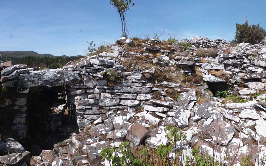
This doorway to a level 2 mural cell has an unusual lintel leading to a void above it.

A section of the broch wall with the entrance portal mid-way along it.

A composite panoramic view showing the entire structure of Backies broch.
Visited: June 25, 2018
Located no more than 3 km west of the A9, and not far from the town of Golspie on the Dornoch Firth, Backies must rate as one of the ‘must see’ brochs of northern Scotland. Considered to be a solid-based broch, Backies was excavated in 1846, and the spoils simply tossed over its walls to form a stoneheap all around it. In this respect, its profile is almost identical to that of Carrol Broch. Backies stands on a steep rocky knoll just north of the community of the same name, and the only feature evident from outside is the 5 metre long entrance passage and the entrance portal itself, surmounted by a huge lintel.
But the interior is another matter altogether. The foundation course is completely buried in rubble but the second level is virtually complete and still stands 2½ metres tall round the entire structure with a well preserved ledge scarcement at 1.7 metres. The second level is hollow, and a well constructed doorway leads into the intra-mural cavity. A feature of the doorway is a lintel below the top which serves as part of the scarcement ledge.
Canmore states that:
“Backies is a good example of a once well preserved, hollow-walled broch which is steadily falling into ruin. Only its remoteness has preserved it from greater destruction, but there can be little doubt that in a few more decades all the surviving traces of hollow-wall architecture in Level 2 will have disappeared.”
There is a huge amount of information about Backies broch on the Canmore website.
To access Backies broch, look out for a sign indicating left to ‘Backies’ just a few hundred metres north of Golspie as you drive north on the A9, and mid-way between Golspie and Dunrobin Castle. Follow this road for 2½ km till you encounter a sign pointing right to a Scottish Water Treatment Works (marker ‘W’ on the map). There is room for one car to park on the verge just before this sign. Head up the road to the Treatment Works, where there is a possibility of parking just past their building on the right (marker ‘P’).
From the Treatment Works, walk up the road for 80 metres or so till you encounter a well constructed sinuous road heading to the right (east). The road ends at a ruined croft house in sight of Backies broch (yellow line). Although the terrain towards the broch (marker ‘B’) looks a bit of a jungle of woodland thickets and bracken there is a narrow footpath to it (though I missed it and had to fight my way round to the broch).
On the road’s final bend, just a few metres before the ruined croft house, a drainage culvert passes under the road. The path to the broch, which I only discovered on the way back from it, starts immediately before the culvert and heads in nearly a straight line to the broch (cyan line on map). In summer, it’s just a case of searching for the trampled path beneath the bracken and following it as best possible.