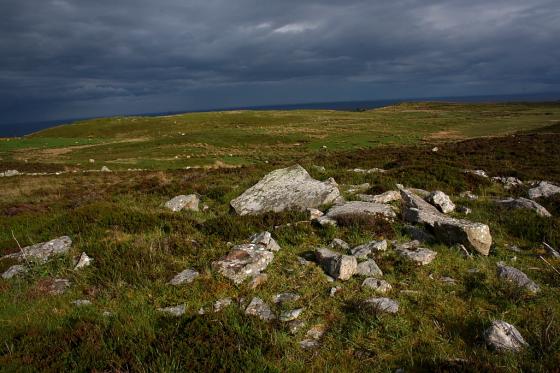
The Modern Antiquarian
Log in
|
Register
Home
Latest Posts
Forums
Maps
Help
Browse Sites
News
Blog
Contributors
The Books
Select
-
Belgium
Denmark
Eire
France
Germany
Greece
Italy
The Netherlands
Norway
Portugal
Republic of Malta
Spain
Sweden
Switzerland
United Kingdom
Scotland
Highland (Mainland)
Buoldhu
Chambered Cairn
Buoldhu (Chambered Cairn) on The Modern Antiquarian, the UK & Ireland's most popular megalithic community website. 2 images, 1 fieldnote, plus information on many more ancient sites nearby and across the UK & Ireland.
Image © thelonious
Nearest Town:
Wick (27km NE)
OS Ref (GB):
ND15013337 /
Sheets: 11, 17
Latitude:
58° 16' 51.53" N
Longitude:
3° 26' 57.94" W
Added by
thelonious
Images (2)
Fieldnotes (1)
0 discussions
Start a topic
Show |
Hide
Web searches for Buoldhu
Flickr
Google
Google Images
MAGIC
The Megalithic Portal
Bing
Stone Pages
Streetmap.co.uk
Wikipedia
Show map
(inline Google Map)
- Sites within 20 km -
-
Cuag (0.38km E) (4 posts)
Burn of Houstry (1.12km ESE) (5 posts)
Minera (1.23km NNE) (6 posts)
Houstry Broch (South) (1.31km NNE) (3 posts)
Loedebest (1.63km SW) (2 posts)
Carn Liath (1.65km SW) (13 posts)
Cnoc Na Maranaich (1.8km WSW) (6 posts)
Cnoc Na Maranaich (1.82km WSW) (6 posts)
Tiantulloch (1.83km N) (7 posts)
Cnoc Na Maranaich (1.84km WSW) (15 posts)
Loedebest West (1.95km WSW) (8 posts)
Loedebest Wood (1.98km SW) (5 posts)
Dunbrae (2.47km SSE) (2 posts)
Balantrath (2.73km S) (4 posts)
Dunbeath Broch (3.01km SSE) (15 posts)
Guidebest (3.44km ENE) (15 posts)
Knockinnon (3.45km ESE) (4 posts)
Upper Latheron (3.49km E) (6 posts)
Buldoo (4.98km ENE) (18 posts)
Wag of Forse (5.58km ENE) (9 posts)
Forse House (5.77km ENE) (2 posts)
Forse House (6.21km ENE) (1 post)
Forse, Latheron (6.44km ENE) (6 posts)
Upper Borgue (6.79km SSW) (4 posts)
Golsary (6.81km ENE) (5 posts)
Upper Borgue (7.12km SSW) (5 posts)
Rumster (7.19km ENE) (3 posts)
Loch Rangag (8.82km NNE) (13 posts)
The Great U of Stemster (9.12km NNE) (37 posts)
Achkinloch (9.17km NNE) (8 posts)
Backlass (11.42km WNW) (5 posts)
Rangag West (11.79km N) (11 posts)
Borgue Langwell (12.53km SSW) (9 posts)
Langwell (12.57km SSW) (7 posts)
Allt Preas Bhealaich (14.91km WSW) (3 posts)
Camster Stone Row (15.1km NE) (4 posts)
Grey Cairns of Camster (15.24km NE) (81 posts)
Hill O'Many Stanes (15.28km ENE) (29 posts)
Dirlot (15.39km NNW) (5 posts)
Tulach Mor (15.98km NNW) (12 posts)
Tormsdale Stone Rows (16.29km NNW) (1 post)
Tulach Beag (16.38km NNW) (5 posts)
Ousdale Burn (16.53km SSW) (22 posts)
Lower Camster (16.54km NE) (9 posts)
Bruan (17km ENE) (6 posts)
Kenny's Cairn (17.57km ENE) (14 posts)
Warehouse S (17.67km ENE) (14 posts)
Carn na Mairg (Carn Merk) (17.69km NNW) (11 posts)
Warehouse N (17.77km ENE) (8 posts)
Garrywhin Stone Rows (17.96km ENE) (5 posts)
Garrywhin Cists (17.96km ENE) (10 posts)
Garrywhin (17.96km ENE) (29 posts)
Garrywhin (18.04km ENE) (9 posts)
South Yarrows S (18.14km ENE) (16 posts)
Warehouse E (18.16km ENE) (10 posts)
South Yarrows N (18.31km ENE) (6 posts)
Watenan South (18.33km ENE) (7 posts)
Loch of Yarrows Archaeological Trail (18.47km ENE) (1 post)
Green Table (18.49km SW) (0 posts)
Tulach Buaile a'Chroic (18.54km NNW) (6 posts)
South Yarrows Broch (18.64km ENE) (15 posts)
Tulach Lochain Bhraseil (18.73km NNW) (4 posts)
Tulach an Fhuarain (18.76km NNW) (2 posts)
Ballone, Mybster (19.43km N) (5 posts)
- Add -
-
Add news
Add an image
Add fieldnotes
Add folklore
Add miscellaneous
Add a link
-
Add a site
Add a nearby facility
Add an alternative name/spelling
Images
(click to view fullsize)
Add an image
Fieldnotes
Add fieldnotes
03/08/2016 - Not much to see but it's only just up the hill from
Cuag
. Time's not been good to this one as most of the stones have been reused to build a stone structure on top of the grassy mound. All a bit sad really.
Comments (0)
|
Add a comment
|
Permalink
Posted by
thelonious
8th August 2016ce
Edited 9th August 2016ce