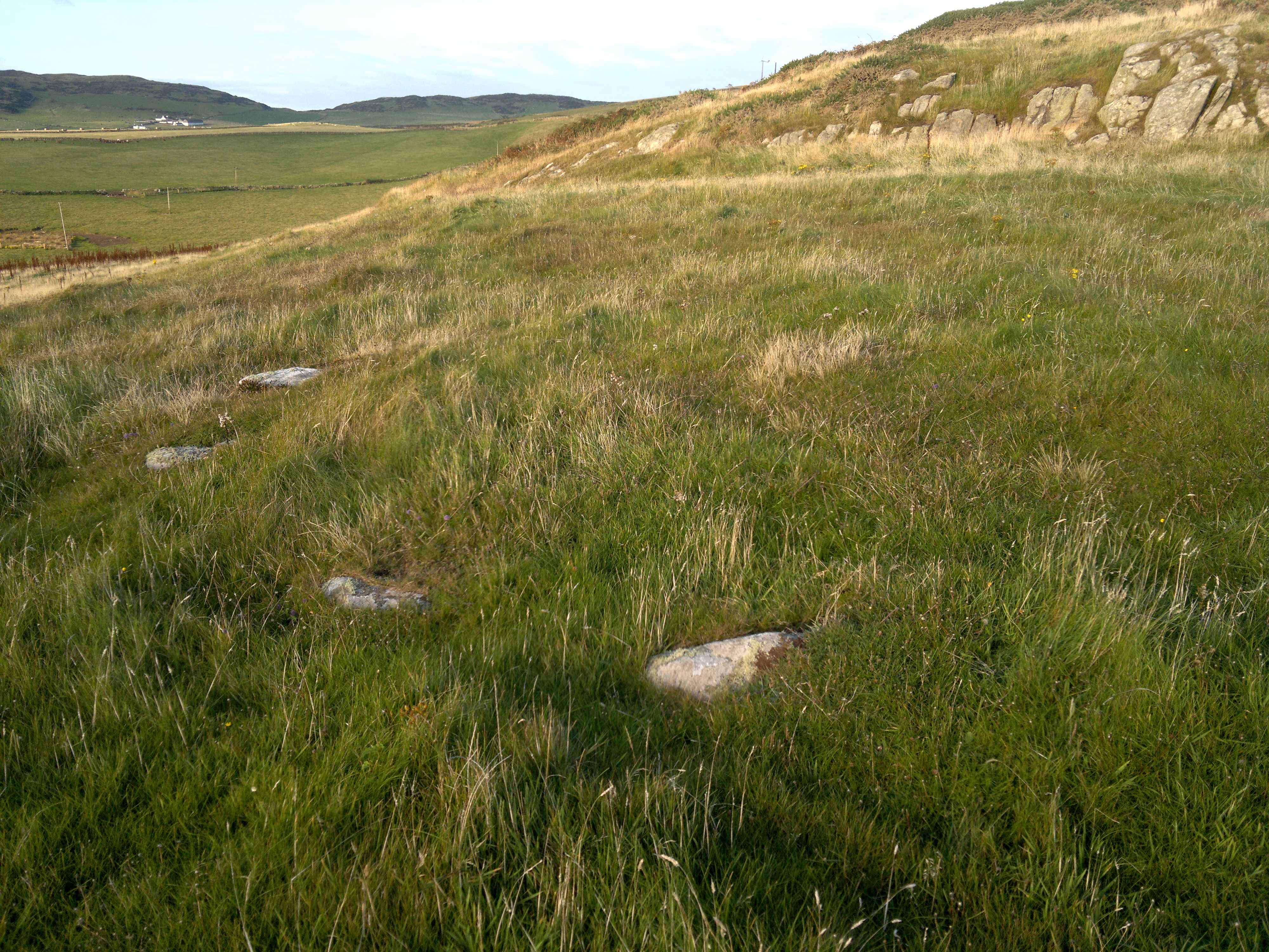
Having visited Crammag Head’s dun and then found what may be either a stone circle or setting while fieldwalking inland I started to head back to my car at Slockmill. Within a hundred feet of leaving the circle I realised I was walking upon the upper rampart of three of what I assume is a hillfort. These encircle a raised outcrop covered in gorse, and are for the most part are obscured by this. The three tiers of ramparts of the length that I was able to fieldwalk are connected not by ditches but by level terraces. I had found another example of a level terrace on the southerly side of the promontory fort up the coast, Kemp’s Wark. It is possible, though, that any ditches had infilled over time or that this is an incomplete structure – one image herewith showing what look like ramps between the tiers perhaps supports this. Ramparts may perhaps have been thought unnecessary on the western side owing to the presence there of a high stone outcrop. There is another example of a triple-tiered fort nearby, believed Iron Age, at nearby Kirkmaiden, called Core Hill. The stucture of the latter has been badly damaged, but the triple arrangement is discernible through stock erosion on its eastern side leading to the exposure of three bands of fine rocky material. Another example of a triple arrangement may be found down the coast at the southernmost of the Mull of Galloway earthworks, increasingly believed of Iron Age origin. Based on these similarities I am tentatively dating this site to the Iron Age also. An image of the eastern side of the fort showing the line of the ramparts also herewith. I did not attempt a full circumnavigation and fieldwalk due to my injured leg, but am reasonably confident that the large gorsey outcrop is almost completely encircled by earthworks after subsequently finding a photograph taken from the south from the much higher cliff fort at Dunman, which I have placed as a separate link, below, to these fieldnotes. The presence of only a single rampart in the vicinity of Slockmill stone circle – or setting – may be due to this western area being the entrance to the fort. NB, I named this site Slockmill fort after failing to find any reference to it on the internet, including Canmore, in order to distinguish it from the dun at Crammag Head, which some believe to be a fort also due to site reuse. It therefore seemed correct to ascribe the name Slochmill to the stone circle at Slochmill fort’s western base, and, due to aerial photographic evidence – see the entries for the stone circle and Crammag Head dun for links – showing a direct pathway or causeway and entrance connecting the stone circle to the circular features, possibly hut circles, within the neighbouring enclosure bounded by the dyke, name this feature similarily too. The name Crammag is not, apparently, known locally in any case. Should these sites already be known and named so be it. An aerial image showing the fort and its position relative to the enclosure and stone circle can be found as a link from my TMA fieldnotes for both – accessed by clicking on the ‘sites within 20km’ feature at the top of this page – in addition to the image linked to my entry for Crammag Head. Date of visit 3rd October 2015.