Skip to content
Julian Cope
presents
The Modern
Antiquarian
Latest
Posts
Sites
Map
Blog
Forum
search
Search
⚠️
Sign in
more_horiz
Eire
County Kerry
Dromod
Stone Circle
V543692
expand_more
Nearest town:
Waterville (5km SW)
OS reference:
V543692
OS sheets:
83, 84
Latitude:
51° 51' 22.14 N
Longitude:
10° 6' 54.15 W
Added to TMA by
Meic
Images (3)
Add
content
Images
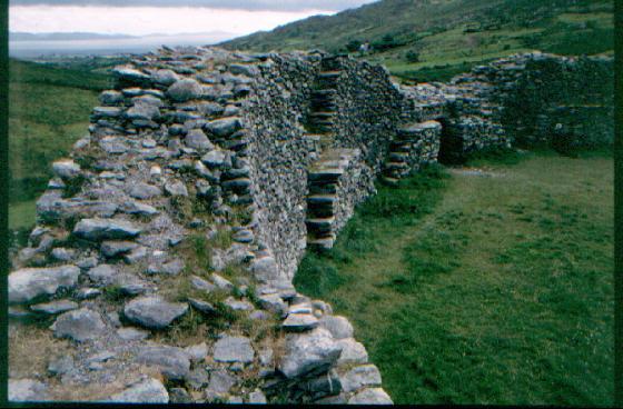
July 2014
Image credit: Michael Mitchell
Meic
Aug 4, 2014
July 2014
Image credit: Michael Mitchell
Meic
Aug 4, 2014
July 2014
Image credit: Michael Mitchell
Meic
Aug 4, 2014
Sites within 20km of
Dromod
Waterville
Standing Stone / Menhir
•
4.94km SW
photo
3
Eightercua
Stone Row / Alignment
•
5.45km SW
photo
20
description
2
Coomnahorna East
Standing Stones
•
8.5km SSE
Loher
Stone Fort / Dun
•
8.53km SSW
photo
13
ondemand_video
1
description
1
Staigue Cashel
Stone Fort / Dun
•
8.98km ESE
photo
21
Cahernageeha
Burial Chamber
•
9.47km S
photo
4
description
1
Coomatloukane North
Wedge Tomb
•
9.48km SSW
photo
11
Staigue
Standing Stone / Menhir
•
9.6km ESE
Coomatloukane
Wedge Tomb
•
9.65km SSW
photo
16
Staigue Bridge
Cup and Ring Marks / Rock Art
•
9.67km ESE
photo
10
description
2
link
1
Caherdaniel
Stone Fort / Dun
•
9.99km SSE
photo
3
description
1
Darrynane More
Standing Stone / Menhir
•
10.32km S
photo
7
description
1
Oghermong
Standing Stone / Menhir
•
10.91km WNW
description
1
Cahersiveen
Standing Stone / Menhir
•
12.38km WNW
photo
3
Dromtine
Cup and Ring Marks / Rock Art
•
12.5km ENE
photo
4
Kilcaskan
Standing Stone / Menhir
•
12.69km NNW
photo
1
Ballynahow Beg
Cup and Ring Marks / Rock Art
•
12.94km NNW
photo
3
forum
1
Toon
Standing Stone / Menhir
•
13.66km N
photo
6
Leabaleaha
Wedge Tomb
•
14.13km WSW
photo
11
Caherlehillan
Stone Fort / Dun
•
14.78km N
photo
2
Cahergal
Stone Fort / Dun
•
14.8km WNW
photo
7
description
1
Caherlehillan South
Wedge Tomb
•
15.07km N
photo
4
Leacanabuile
Stone Fort / Dun
•
15.15km WNW
photo
5
description
1
Gortnagulla
Stone Row / Alignment
•
15.31km N
photo
3
Caherlehillan North
Wedge Tomb
•
15.31km N
photo
3
Tullakeel
Cup and Ring Marks / Rock Art
•
15.91km ENE
photo
3
description
1
Derryleagh
Cup and Ring Marks / Rock Art
•
16.47km ENE
photo
2
forum
1
description
1
Glanleam
Standing Stone / Menhir
•
16.48km W
photo
2
Keeltrasna
Standing Stone / Menhir
•
16.67km NW
photo
3
Cool East
Wedge Tomb
•
17.99km W
photo
6
Cool
Standing Stones
•
18km W
photo
3
description
2
Coomasaharn
Cup and Ring Marks / Rock Art
•
18.27km NNE
photo
2
description
1
Hag of Beara
Natural Rock Feature
•
18.52km ESE
photo
5
description
4
Kealduff (331)
Cup and Ring Marks / Rock Art
•
18.93km NNE
photo
4
Kealduff (334)
Cup and Ring Marks / Rock Art
•
18.97km NNE
photo
1
Kealduff (337)
Cup and Ring Marks / Rock Art
•
18.97km NNE
photo
1
Kealduff (333)
Cup and Ring Marks / Rock Art
•
19.06km NNE
photo
1
Ballycrovane
Standing Stone / Menhir
•
19.84km ESE
photo
16
description
2
Like all websites everywhere,
we use
cookies
.
OK
search
I’m looking for…
location_on
photo
ondemand_video
forum
description
link