Skip to content
Julian Cope
presents
The Modern
Antiquarian
Latest
Posts
Sites
Map
Blog
Forum
search
Search
⚠️
Sign in
more_horiz
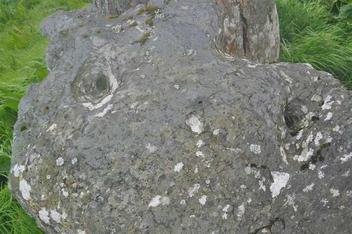
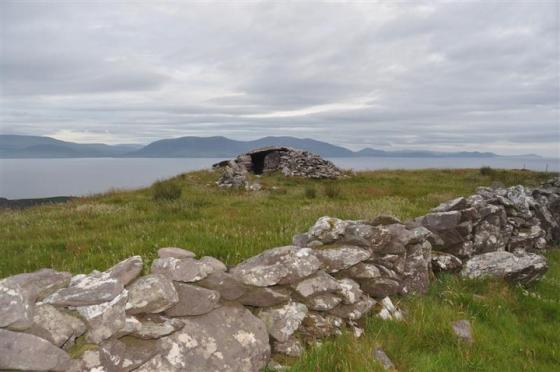
Eire
County Kerry
Toon
Standing Stone / Menhir
expand_more
Nearest town:
Cahershiveen (10km WSW)
Latitude:
51° 58' 38.57 N
Longitude:
10° 4' 55.74 W
Added to TMA by
bogman
Images (6)
Add
content
Images
Image credit: Charles Coughlan
bogman
May 22, 2011
Image credit: Charles Coughlan
bogman
May 22, 2011
Image credit: Charles Coughlan
bogman
May 22, 2011
Image credit: Charles Coughlan
bogman
May 22, 2011
Image credit: Charles Coughlan
bogman
May 22, 2011
Image credit: Charles Coughlan
bogman
May 22, 2011
Sites within 20km of
Toon
Caherlehillan
Stone Fort / Dun
•
1.12km N
photo
2
Caherlehillan South
Wedge Tomb
•
1.42km NNE
photo
4
Caherlehillan North
Wedge Tomb
•
1.67km NNE
photo
3
Gortnagulla
Stone Row / Alignment
•
1.67km NNE
photo
3
Ballynahow Beg
Cup and Ring Marks / Rock Art
•
3.87km WSW
photo
3
forum
1
Kilcaskan
Standing Stone / Menhir
•
5.02km WSW
photo
1
Kealduff (331)
Cup and Ring Marks / Rock Art
•
6.64km NE
photo
4
Kealduff (337)
Cup and Ring Marks / Rock Art
•
6.72km NE
photo
1
Kealduff (334)
Cup and Ring Marks / Rock Art
•
6.72km NE
photo
1
Coomasaharn
Cup and Ring Marks / Rock Art
•
6.74km ENE
photo
2
description
1
Kealduff (333)
Cup and Ring Marks / Rock Art
•
6.77km NE
photo
1
Coolnaharagill Upper
Cup and Ring Marks / Rock Art
•
8.25km NE
photo
2
Keeltrasna
Standing Stone / Menhir
•
8.36km W
photo
3
Cahersiveen
Standing Stone / Menhir
•
10.81km WSW
photo
3
Cahergal
Stone Fort / Dun
•
12.27km WSW
photo
7
description
1
Leacanabuile
Stone Fort / Dun
•
12.53km WSW
photo
5
description
1
Oghermong
Standing Stone / Menhir
•
12.77km WSW
description
1
Dromod
Stone Circle
•
13.66km S
photo
3
Dromtine
Cup and Ring Marks / Rock Art
•
15.77km ESE
photo
4
Glanleam
Standing Stone / Menhir
•
17.21km WSW
photo
2
Derryleagh
Cup and Ring Marks / Rock Art
•
17.24km ESE
photo
2
forum
1
description
1
Doonmanagh (Puicin an Chairn)
Wedge Tomb
•
17.36km NW
photo
9
description
3
Minard
Wedge Tomb
•
17.56km NW
photo
4
Tullakeel
Cup and Ring Marks / Rock Art
•
17.72km ESE
photo
3
description
1
Lugnagappul
Cairn(s)
•
17.86km NNW
photo
3
Waterville
Standing Stone / Menhir
•
17.91km SSW
photo
3
Aghacaribble 1
Cup and Ring Marks / Rock Art
•
17.93km NW
photo
7
description
1
Ardamore
Stone Row / Alignment
•
17.99km NW
photo
13
description
1
Ardamore
Cup and Ring Marks / Rock Art
•
17.99km NW
photo
5
description
1
Kinard East
Cup and Ring Marks / Rock Art
•
18.06km NW
photo
2
Graigue
Standing Stone / Menhir
•
18.18km NNW
photo
10
description
1
Eightercua
Stone Row / Alignment
•
18.79km SSW
photo
20
description
2
Foheraghmore
Standing Stone / Menhir
•
18.8km NW
photo
4
Staigue Cashel
Stone Fort / Dun
•
19.73km SSE
photo
21
Derrynablaha 11
Cup and Ring Marks / Rock Art
•
19.77km E
forum
1
Derrynablaha 11
Cup and Ring Marks / Rock Art
•
19.87km E
photo
3
search
I’m looking for…
location_on
photo
ondemand_video
forum
description
link