Skip to content
Julian Cope
presents
The Modern
Antiquarian
Latest
Posts
Sites
Map
Blog
Forum
search
Search
⚠️
Sign in
more_horiz
Eire
County Kerry
Cool East
Wedge Tomb
expand_more
Nearest town:
Cahershiveen (10km ENE)
Latitude:
51° 54' 41.76 N
Longitude:
10° 21' 41.4 W
Added to TMA by
bogman
Images (6)
Add
content
Images
Image credit: Uwe Häberle 06/2014
Nucleus
Jul 3, 2014
Image credit: Uwe Häberle 06/2014
Nucleus
Jul 3, 2014
What an impressive capstone...
Image credit: Uwe Häberle 06/2014
Nucleus
Jul 3, 2014
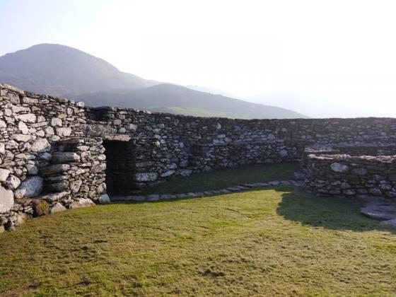
Image credit: Charles Coughlan
bogman
Jul 8, 2010
Image credit: Charles Coughlan
bogman
Jul 8, 2010
Image credit: Charles Coughlan
bogman
Jul 8, 2010
Sites within 20km of
Cool East
Cool
Standing Stones
•
0.36km SSW
photo
3
description
2
Glanleam
Standing Stone / Menhir
•
3.48km NE
photo
2
Oghermong
Standing Stone / Menhir
•
8.32km ENE
description
1
Leacanabuile
Stone Fort / Dun
•
8.5km NE
photo
5
description
1
Cahergal
Stone Fort / Dun
•
8.64km NE
photo
7
description
1
Cahersiveen
Standing Stone / Menhir
•
9.67km ENE
photo
3
Leabaleaha
Wedge Tomb
•
10.4km SE
photo
11
Keeltrasna
Standing Stone / Menhir
•
14.53km NE
photo
3
Kilcaskan
Standing Stone / Menhir
•
15.54km ENE
photo
1
Waterville
Standing Stone / Menhir
•
16.54km ESE
photo
3
Ballynahow Beg
Cup and Ring Marks / Rock Art
•
16.71km ENE
photo
3
forum
1
Eightercua
Stone Row / Alignment
•
17.62km ESE
photo
20
description
2
Dromod
Stone Circle
•
17.99km E
photo
3
Loher
Stone Fort / Dun
•
19.39km ESE
photo
13
ondemand_video
1
description
1
search
I’m looking for…
location_on
photo
ondemand_video
forum
description
link