Looking north towards the rath from the top of the ancient trackway that leads to it.
Image credit: ryaner
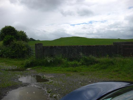
Looking north towards the rath from the top of the ancient trackway that leads to it.

Part of the outer ditch that surrounds this complex.

The large ringfort/rath is in amongst that vegetation. The wall is modern.

Small hut-circle with the large rath.

If you ever head this way and are broke...
Rathnew is a large rath, with a deep embankment and fosse and a smaller, conjoined section about half its size on its western quarter. Not much remains of the houses that once stood here, but there is much of intrigue to make the megalithic adventurer happy.
In the western ‘annex’ is a circle of low stones, mostly embedded into the ground, some proud of the ground by about a maximum of 20 cms. It’s about 5 metres in diameter with a standing stone at its centre. This stone is about three quarters of a metre tall and is a place for offerings, coins of varying worth on the day I visited. MacAllister notes it as a “dolmen-like stone”. Like a few places on Uisneach that day, it had a magical air about it. It also must be pointed out that the ring is probably modern, as mentioned elsewhere and it doesn’t appear in MacAllister and Praeger’s plan.
The annex has two entrances, at the west and south. The defensive works here are impressive – an outer bank, a fosse (now darkened and alley-like under the covering trees) and an inner bank. The fosse continues onto the bigger part of the rath at the north, but starts to fill up fairly quickly in this sector.
Slightly north of east, there is an opening, with two seeming jambstones or gate stones. South of the entrance the fosse clears out again. Inside this large rath there are the remains of habitation structures, one of which MacAllister and Praeger excavated and left with quite an extensive plan. In its western sector, before it meets the annex, is a souterrain, now filled in and inaccessible. Pity.
This is a fascinating place, somewhere I’d like to explore in greater depth, and intend to do so now that I have the plans of the place.
Entry on the National Monuments database, interesting because it lists the monuments on the Hill of Uisneach (I believe there are more):
Description: One of a cluster of monuments situated on the Hill of Uisneach. Nearby monuments include a barrow (WM024-173----) 200m to the N, an earthwork (WM024-068) is 390m to the SE, an ancient road (WM024-067) runs onto the S side of the monument, a ringfort (WM024-063) and holy well (WM024-60) are located 390m to the SSW, an earthwork (WM024-065) is 290m to the W, a second earthwork (WM024-062) is 270m to the WNW, a pond (WM024-064002-) is 170m to the NW. The monument was described in 1963 as a ‘large pair of conjoined ringforts, with hut-foundations (WM024-066002-) visible in the either part’ (SMR file 1963). This ringfort was excavated in 1925-8 by R. A. S. Macalister, who believed that the larger ringfort was the mythological ‘palace of Tuathal Techtmar’. On the 1837 edition of the OS 6-inch map the monument is depicted as a large circular ringfort with D-shaped annexe on the E side of the ringfort. On this map a ‘Cave’ or souterrain is annotated and depicted in the centre of the ringfort, the E quadrant of the ringfort interior has been divided into two small areas defined by earthen banks which run off the N & E side of a rectangular shaped platform located in the S quadrant of the ringfort. This rectangular platform appears to be the foundations of a hut site. A second possible hut site is depicted in the centre of the W annexe on the 1837 edition of the OS 6-inch map.
Compiled by: Caimin O’Brien
Date of upload: 26 January 2011