Skip to content
Julian Cope
presents
The Modern
Antiquarian
Latest
Posts
Sites
Map
Blog
Forum
search
Search
⚠️
Sign in
more_horiz
Eire
County Westmeath
Portloman
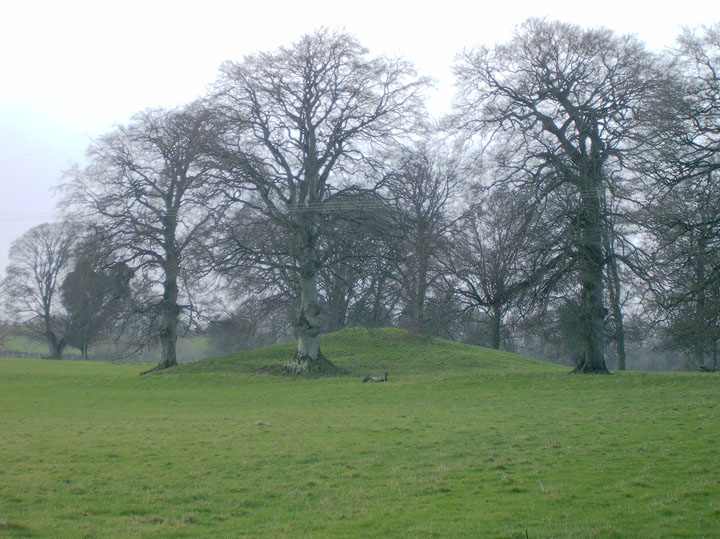
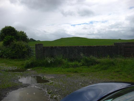
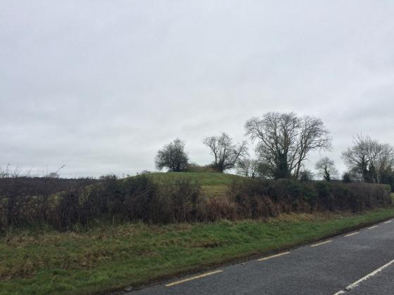
Round Barrow(s)
N389580
expand_more
Nearest town:
Mullingar (7km ESE)
OS reference:
N389580
OS sheet:
41
Latitude:
53° 34' 13.6 N
Longitude:
7° 24' 45.94 W
Added to TMA by
Alan Lee
Images (3)
Add
content
Images
Image credit: Alan Lee
A
Alan Lee
Dec 12, 2006
Image credit: Alan Lee
A
Alan Lee
Dec 12, 2006
Image credit: Alan Lee
A
Alan Lee
Dec 12, 2006
Sites within 20km of
Portloman
Portloman
Standing Stone / Menhir
•
0.36km E
photo
4
Coolnahay
Round Barrow(s)
•
4.59km SW
photo
3
description
1
Tuitestown
Standing Stone / Menhir
•
5.76km SSW
photo
3
description
1
Tannenhausen
Passage Grave
•
7.26km SW
photo
12
description
2
School Boy
Crannog
•
9.06km SE
Ballinlug
Cup and Ring Marks / Rock Art
•
9.65km WSW
photo
2
description
2
Tullanisky
Round Barrow(s)
•
10.42km SE
Loughan
Round Barrow(s)
•
10.42km WSW
photo
4
description
1
Ballymorin
Bullaun Stone
•
12.14km WSW
photo
3
description
1
Corbally
Standing Stone / Menhir
•
12.25km ESE
Glomerstown
Standing Stone / Menhir
•
12.55km SSW
Taghboyne
Standing Stone / Menhir
•
12.81km SW
Mweelra
Round Barrow(s)
•
12.91km SW
photo
2
Rathnew
Rath
•
13.12km SW
photo
5
description
2
Hill of Uisneach Cairn
Cairn(s)
•
13.27km SW
photo
5
Ushnagh Hill
Round Barrow(s)
•
13.27km SW
Cappaghjuan
Standing Stone / Menhir
•
13.33km WSW
photo
2
description
1
Lalistown/
Rathnew
Ancient Trackway
•
13.33km SW
Ushnagh Hill
Rath
•
13.54km SW
photo
2
Ushnagh Hill
Sacred Well
•
13.54km SW
photo
1
Aill na Mireann
Standing Stone / Menhir
•
13.68km SW
photo
7
description
1
Kellybrook
Round Barrow(s)
•
13.69km SW
Lalistown
Standing Stone / Menhir
•
13.79km SW
Lilliput
Standing Stone / Menhir
•
14.02km S
Dunboden Park
Round Barrow(s)
•
14.34km SE
Kileen
Standing Stone / Menhir
•
14.61km SSW
St. Brigid’s Well
Sacred Well
•
14.63km SW
photo
2
Beggstown
Standing Stone / Menhir
•
14.82km SE
Gibbonstown
Rath
•
15.49km SE
Calverstown
Standing Stone / Menhir
•
15.94km SSE
Lakill and Moortown
Barrow / Cairn Cemetery
•
16.04km NE
photo
12
Lakill and Moortown
Barrow / Cairn Cemetery
•
16.1km NE
Rathskeagh Upper
Round Barrow(s)
•
16.5km WSW
Killulagh
Bullaun Stone
•
17.38km ENE
photo
2
Fore
Barrow / Cairn Cemetery
•
17.7km NE
photo
4
Lickbla
Wedge Tomb
•
18.04km NNE
photo
9
description
1
Sarsfieldstown/
Rathwire Upper
Barrow / Cairn Cemetery
•
18.04km E
photo
3
description
1
Christianstown
Round Barrow(s)
•
18.5km NE
photo
5
Greenan
Round Barrow(s)
•
18.73km E
photo
1
Curry
Cairn(s)
•
18.87km NNE
Pass of Kilbride
Round Barrow(s)
•
19.04km ESE
photo
4
description
1
Balrath North
Standing Stone / Menhir
•
19.28km E
photo
1
description
1
Glenidan
Round Barrow(s)
•
19.34km NE
photo
2
Bigwood
Hillfort
•
19.5km NNE
photo
7
Boolies
Standing Stone / Menhir
•
19.58km E
search
I’m looking for…
location_on
photo
ondemand_video
forum
description
link