Skip to content
Julian Cope
presents
The Modern
Antiquarian
Latest
Posts
Sites
Map
Blog
Forum
search
Search
⚠️
Sign in
more_horiz
United Kingdom
Scotland
Highland (Mainland)
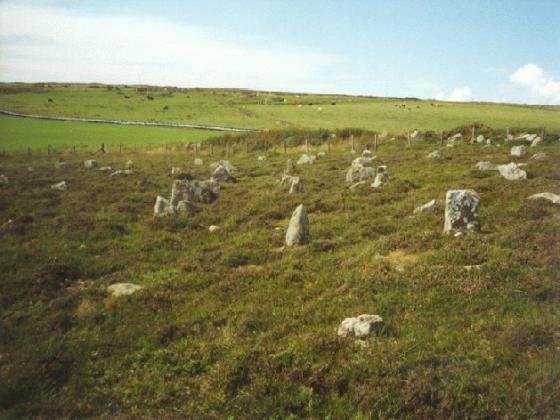
Ackergill Mains
Standing Stone / Menhir
ND35285424
expand_more
Nearest town:
Wick (3km SE)
OS reference:
ND35285424
OS sheet:
12
Latitude:
58° 28' 18.33 N
Longitude:
3° 6' 34.89 W
Added to TMA by
baza
Images (2)
Add
content
Images
baza
Aug 15, 2010
baza
Aug 15, 2010
Sites within 20km of
Ackergill Mains
The Pap
Broch
•
3.67km ESE
description
1
Elsay
Broch
•
4.03km E
description
1
link
2
Cirn of Humster
Broch
•
5.75km SSE
description
1
Keiss
Broch
•
6.85km NNW
photo
7
description
2
Whitegate
Broch
•
6.92km NNW
photo
5
description
1
Kirk Tofts
Broch
•
7.24km NNW
photo
7
description
1
Thrumster Little
Broch
•
8.56km S
photo
5
description
1
Nybster
Broch
•
9.01km N
photo
17
description
2
link
4
Burn Of Swartigill
Ancient Village / Settlement / Misc. Earthwork
•
9.05km SSW
description
3
Thrumster Mains
Broch
•
9.44km SSW
photo
7
description
1
Gansclet
Standing Stone / Menhir
•
9.6km S
description
1
Watten
Standing Stone / Menhir
•
10.8km WSW
photo
5
description
1
link
1
Borrowston
Broch
•
10.95km S
photo
4
description
1
South Yarrows Broch
Broch
•
11.7km SSW
photo
13
description
1
link
1
Loch of Yarrows Archaeological Trail
11.78km SSW
description
1
South Yarrows N
Chambered Tomb
•
11.86km SSW
photo
4
description
1
link
1
South Yarrows S
Chambered Tomb
•
12.13km SSW
photo
14
description
1
link
1
Lower Camster
Stone Row / Alignment
•
12.51km SW
photo
9
description
2
link
2
Warehouse E
Chambered Tomb
•
12.69km SSW
photo
8
description
2
Warehouse N
Chambered Tomb
•
12.93km SSW
photo
6
description
2
Warehouse S
Chambered Tomb
•
13.11km SSW
photo
12
description
2
Garrywhin
Hillfort
•
13.45km SSW
photo
9
Watenan South
Broch
•
13.58km SSW
photo
6
description
1
Garrywhin Stone Rows
Stone Row / Alignment
•
13.7km SSW
photo
5
Garrywhin Cists
Cist
•
13.7km SSW
photo
8
description
2
Garrywhin
Chambered Cairn
•
13.7km SSW
photo
23
forum
1
description
4
Grey Cairns of Camster
Cairn(s)
•
13.78km SW
photo
67
description
6
link
2
Camster Stone Row
Stone Row / Alignment
•
13.93km SW
photo
2
description
1
link
1
Kenny’s Cairn
Chambered Tomb
•
14.08km SSW
photo
13
description
1
Stone Lud (Bower)
Standing Stone / Menhir
•
15.09km W
description
2
link
1
Bruan
Broch
•
15.34km SSW
photo
2
description
3
link
1
Hill O’Many Stanes
Multiple Stone Rows / Avenue
•
16.83km SSW
photo
18
description
6
link
3
Ballone, Mybster
Broch
•
19.07km WSW
photo
4
description
1
Rangag West
Standing Stone / Menhir
•
19.86km WSW
photo
6
description
2
link
3
search
I’m looking for…
location_on
photo
ondemand_video
forum
description
link