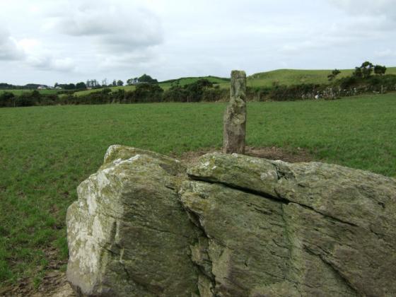
Looking east at the entrance-like grouping arrangement, leading in towards the highest boulder. Close-by to the rear is a ringfort.
Image credit: Gordon Kingston
Looking east at the entrance-like grouping arrangement, leading in towards the highest boulder. Close-by to the rear is a ringfort.

The triangular grouping, looking south.

A ground-levelish picture showing support stones.

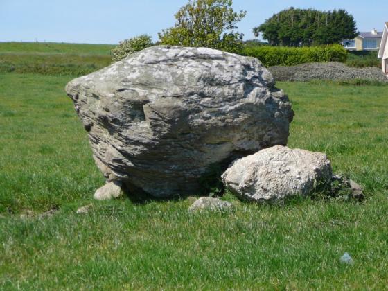
The rather fungal cap of the southwestern BB.

The exterior of the souterrain, in the centre of the adjacent ringfort, capped with a slab.

The interior of the open chamber? and passage leading south.
An interesting combination of features are present at this site, set by a minor junction to the Clonakilty-Enniskeane road, though the town-land name may prove confusing to those of you more familiar with the Knocks stone circles or row – located in an identically named area about 6km southwest, on the other side of Rossmore.
On the left-hand side as you enter the field gate is a well marked ring fort, filled and outlined with mature hawthorn, its southern arc incorporated in the field/road boundary. A slab in the interior partially covers the opening to what the Archaeological Inventory classifies as a possible souterrain, exposed after a ground collapse in 1985 and a southward-heading tunnel is clearly visible inside.(1)
Less than 10m west of the ring fort perimeter is one of the very occasional multiple groupings of Cork/Kerry boulder-burials, missed in this instance by O’Nuallain in his 1978 survey but described in the Inventory as ‘Three boulder-burials set in form of triangle c. 1.5m apart.’(2)
It’s curious how ordered the stone placement is in these cases; four boulders forming a square with a NE-SW axis at Breeny More, three boulders in a N-S line at Mill Little, two boulders forming a rough, yet defined, E-W avenue to a third stone here and a similar triangular arrangement punctuated by a fourth boulder at Derrymihan West.(3) There is further documentary evidence of a line of three at Lackadotia in North Cork.(4) Of course, any order may have been for its own sake rather than a product of ritual variation or necessity.
Incidentally, if you choose to see boulder-burials as mushroom-like, or if that was any part of the original intention then the southwestern capstone here was an excellent choice – it looks like someone already took a nibble out of the top of it. Permission to visit this site can be obtained from the farmhouse to the south, on the right-hand side of the main road.
(1) Archaeological Inventory of Cork Vol. 1, 1992; No.2344; 250.
(2) ibid.; No.124; 32.
(3) O’Nuallain, PRIA 78 C, 1978; No.18; 90, 105.
(4) ibid.; No.1; 83