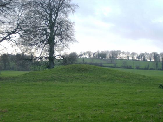
The Modern Antiquarian
Log in
|
Register
Home
Latest Posts
Forums
Maps
Help
Browse Sites
News
Blog
Contributors
The Books
Select
-
Belgium
Denmark
Eire
France
Germany
Greece
Italy
The Netherlands
Norway
Portugal
Republic of Malta
Spain
Sweden
Switzerland
United Kingdom
County Westmeath
Hill Of Uisneach
Hill of Uisneach Cairn
Cairn(s)
Hill of Uisneach Cairn (Cairn(s)) on The Modern Antiquarian, the UK & Ireland's most popular megalithic community website. 5 images, plus information on many more ancient sites nearby and across the UK & Ireland.
Image © Bawn79
Nearest Town:
Mullingar (15km ENE)
OS Ref (IE):
N291490 /
Sheet: 48
Latitude:
53° 29' 24.76" N
Longitude:
7° 33' 41.52" W
Added by
FourWinds
Images (5)
0 discussions
Start a topic
Show |
Hide
Web searches for Hill of Uisneach Cairn
Flickr
Google
Google Images
The Megalithic Portal
Bing
Stone Pages
Wikipedia
Show map
(inline Google Map)
- Sites within 20 km -
-
Ushnagh Hill (0km N) (0 posts)
Mweelra (0.41km ENE) (2 posts)
Rathnew (0.45km E) (7 posts)
Kellybrook (0.45km SSW) (0 posts)
Aill na Mireann (0.51km S) (8 posts)
Ushnagh Hill (0.51km SSE) (1 post)
Ushnagh Hill (0.51km SSE) (2 posts)
Lalistown/Rathnew (0.64km ESE) (0 posts)
St. Brigid's Well (1.43km WSW) (2 posts)
Lalistown (1.7km SE) (0 posts)
Cappaghjuan (2.2km WNW) (3 posts)
Taghboyne (2.32km E) (0 posts)
Ballymorin (3.1km NW) (4 posts)
Loughan (3.38km NNE) (5 posts)
Glomerstown (4.19km E) (0 posts)
Rathskeagh Upper (4.41km W) (0 posts)
Ballinlug (4.5km NNE) (4 posts)
Kileen (4.65km ESE) (0 posts)
Tannenhausen (6.63km ENE) (14 posts)
Tuitestown (8.07km ENE) (4 posts)
Lilliput (8.16km ESE) (0 posts)
Corgarve (8.52km S) (0 posts)
Snimnagorta (8.58km WSW) (0 posts)
Mullenmeehan (8.64km WSW) (0 posts)
Coolnahay (8.71km NE) (4 posts)
Cartron Glebe (9.91km SSW) (0 posts)
Moyvoughly (10.93km WSW) (1 post)
Ballycloghduff (12.09km WSW) (5 posts)
School Boy (12.36km ENE) (0 posts)
Drumraney (12.67km WSW) (0 posts)
Portloman (13.27km NE) (3 posts)
Portloman (13.36km NE) (4 posts)
Clonaglin (14.02km SE) (0 posts)
Calverstown (14.31km E) (0 posts)
Garryduff Barrow (14.4km SE) (0 posts)
Tullanisky (15.04km E) (0 posts)
Dunboden Park (15.32km E) (0 posts)
Shanballynakill (15.84km SSW) (3 posts)
Knockdommy (15.89km SW) (0 posts)
Greenville or Garryduff (16.57km SSW) (7 posts)
Beggstown (16.72km E) (0 posts)
Corbally (17.15km E) (0 posts)
Gibbonstown (17.34km E) (0 posts)
Cappanrush (18.79km ESE) (0 posts)
Montrath (18.9km ESE) (0 posts)
Moorock (19.62km SSW) (0 posts)
Cartronbrack (19.69km WNW) (4 posts)
Loughaun (19.71km SSE) (0 posts)
Ballycumber (19.8km SSW) (1 post)
- Add -
-
Add news
Add an image
Add fieldnotes
Add folklore
Add miscellaneous
Add a link
-
Add a site
Add a nearby facility
Add an alternative name/spelling
Images
(click to view fullsize)
Add an image