Open Source Environment agency LIDAR
Image credit: © Environment Agency copyright and/or database right 2015.
Open Source Environment agency LIDAR

The view back from the summit of the headland.

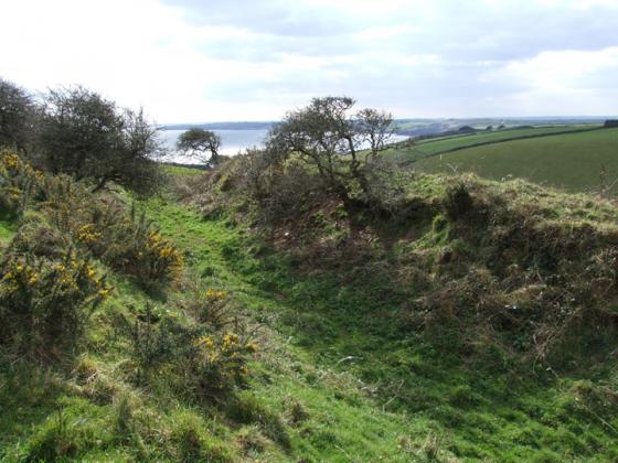
The main ditch on the eastern side of the narrow neck...a good 20 ft deep I would think. St Austell bay in the distance....Chez Hamhead in the very far distance!

Black Head from the South West Coast Path on a perfect summers day/
Black Head juts out into St Austell bay on its west side. Very little remains of any antiquity except two high banks and one deep ditch on the east side of the istmus.
The headland can be reached via the SWCP from a car park at Trenarren, but it is still at least half a mile away...great views on a good day!
Mentioned by Craig Weatherhill, in “Cornovia: Ancient Sites of Cornwall & Scilly” (Cornwall Books – 1985, revised 1997 & 2000) – “This headland has three lines of defence across its neck. The outer rampart is slight, and its ditch virtually untraceable. The central bank is set back from it; it is 5.2m high and fronted by a ditch 2.1m deep. The innermost rampart is of similar height. None of these Iron Age defences is so well preserved on the south side of the headland.”
Just off the coastal footpath, on National Trust openland