
Photo taken looking over the steep south west ramparts of the ringarounds site near Veryan.
Image credit: D Mitchell
Photo taken looking over the steep south west ramparts of the ringarounds site near Veryan.

Open Source Environment agency LIDAR

Looking towards the fort from further inland. The photo clearly shows the plateau at the centre of the view.
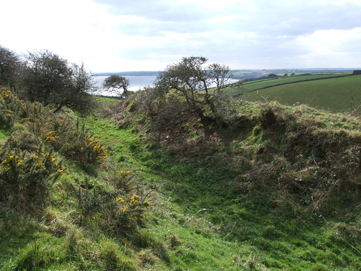
Ditch and banks looking south west towards the sea.

visited March 2002

Reached by a road running northwest from the beacon and then taking a path across a field on the left. Keep to hedge to far end and go over stile...the fort is infront of you.
A large ditch and banks seperates field from a flat area that then drops away into the valley. This is an unusual site and thought to be Iron Age in date. It is in a great setting and would be easy to protect from all sides.
Superb views out to sea.
Mentioned by Craig Weatherhill, in “Cornovia: Ancient Sites of Cornwall & Scilly” (Cornwall Books – 1985, revised 1997 & 2000) as “curiously positioned on the side of a steep valley which has been cut and filled artificially to accommodate it. The central enclosure measures 55m by 45m internally, and has a south-facing entrance. The uphill side of the enclosure is protected by a bank 2,.0m high, with an outer ditch 2.5m deep. The ploughed remains of two outworks, one topped by a modern wall, lie beyond. The west side of the onclosure, formed by fill, falls away as a scarp at least 8m high. No occupation sites are visible. Locally called the Ringaround”.
The site is very near Carne barrow a.k.a. Veryan barrow.
Veryan is a pretty little village also worth a visit .
It has several unusual Round houses. It is said the houses were built round so that the Devil couldn’t hide in the corners.


