The Modern Antiquarian
Log in
|
Register
Home
Latest Posts
Forums
Maps
Help
Browse Sites
News
Blog
Contributors
The Books
Select
-
Belgium
Denmark
Eire
France
Germany
Greece
Italy
The Netherlands
Norway
Portugal
Republic of Malta
Spain
Sweden
Switzerland
United Kingdom
County Carlow
Rathgeran
Standing Stone / Menhir
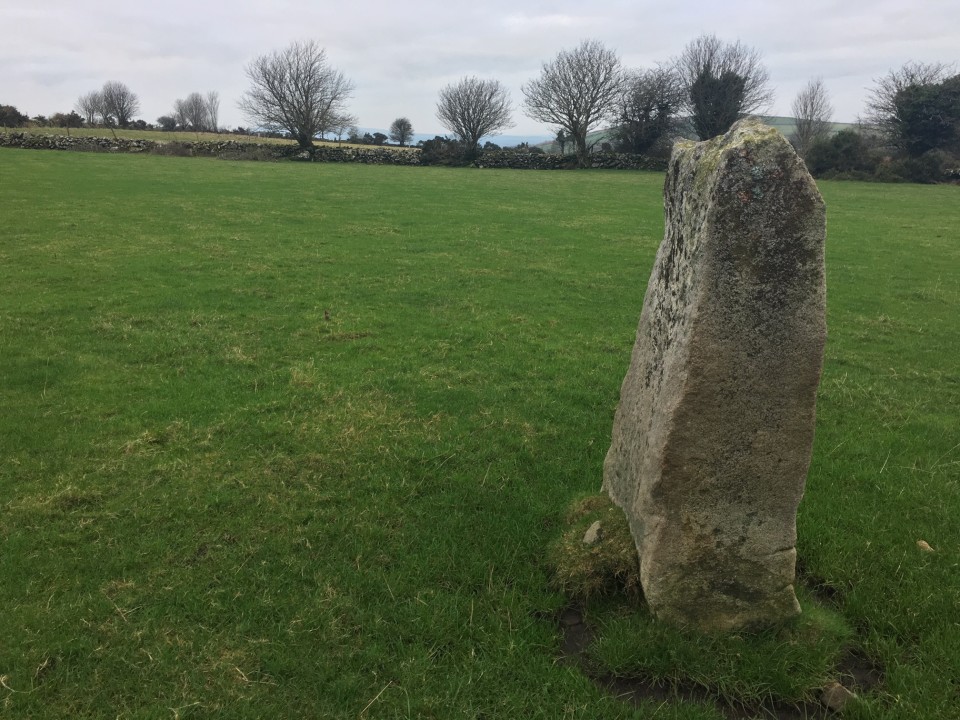
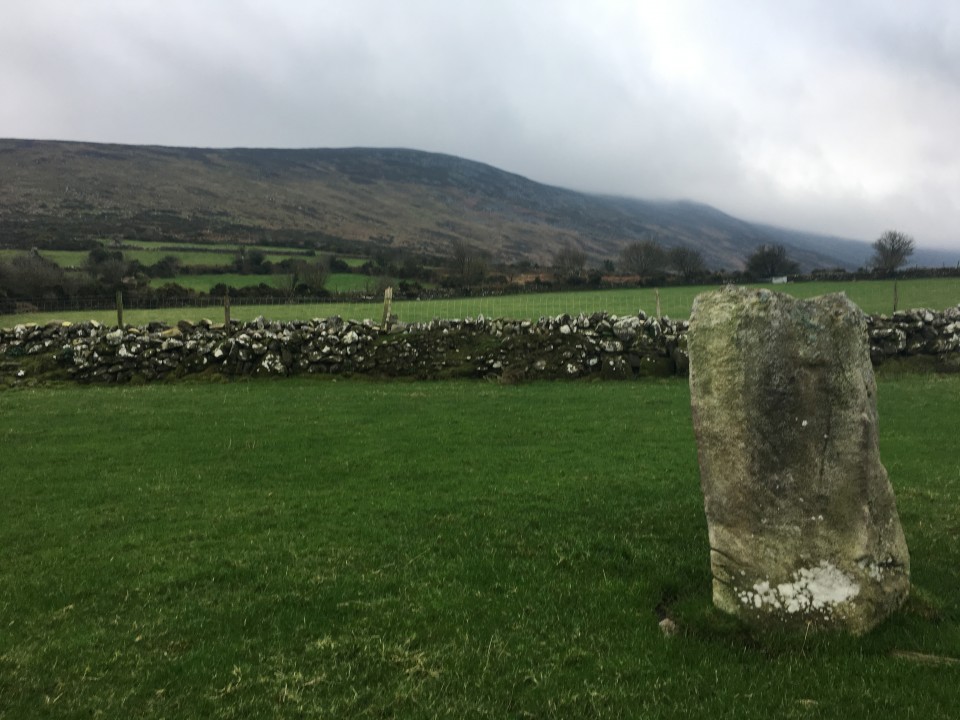
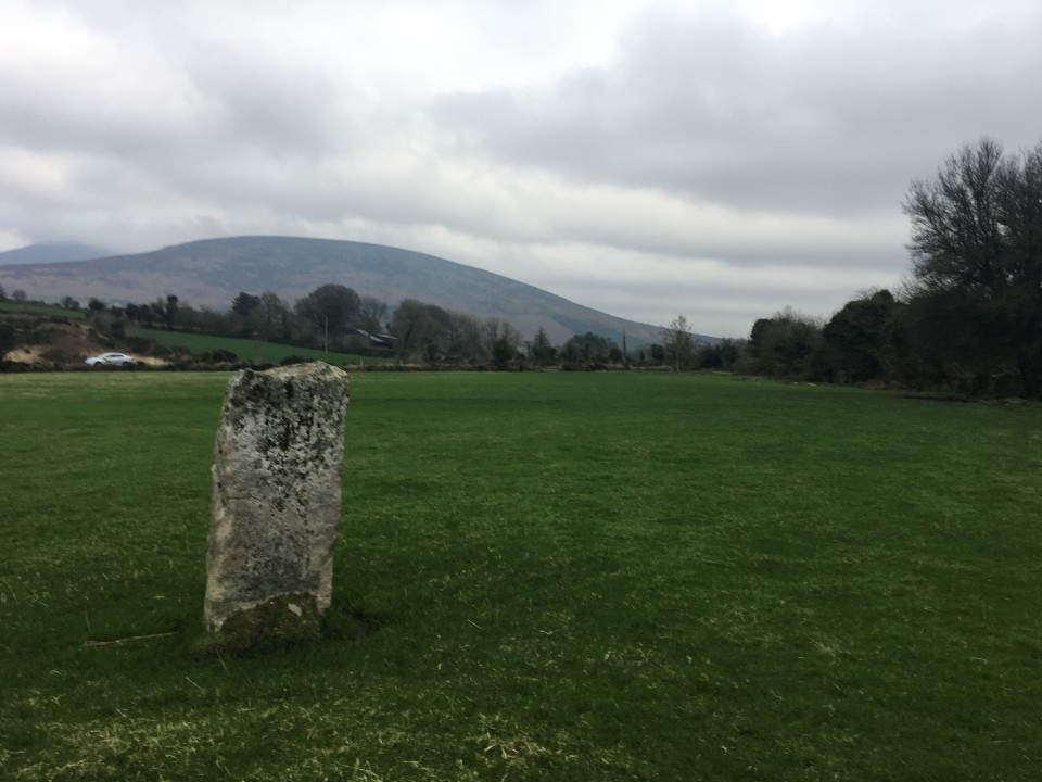
Rathgeran (The Blacklion Stone) (Standing Stone / Menhir) on The Modern Antiquarian, the UK & Ireland's most popular megalithic community website. 4 images, plus information on many more ancient sites nearby and across the UK & Ireland.
Image © Ryaner
Also known as:
The Blacklion Stone
Nearest Town:
Borris (8km W)
OS Ref (IE):
S801474 /
Sheet: 68
Latitude:
52° 34' 19.53" N
Longitude:
6° 49' 6.35" W
Added by
ryaner
Images (4)
0 discussions
Start a topic
Show |
Hide
Web searches for Rathgeran
Flickr
Google
Google Images
The Megalithic Portal
Bing
Stone Pages
Wikipedia
Show map
(inline Google Map)
- Sites within 20 km -
-
Rathgeran Upper (0.82km WSW) (3 posts)
Rathgeran Hill (1.36km W) (8 posts)
Kilmissan (1.4km WSW) (0 posts)
Rathgeran (1.43km W) (7 posts)
Kilmissan (1.52km W) (0 posts)
Knockmore (2.48km WNW) (2 posts)
Knockroe (2.56km ENE) (6 posts)
Knockroe (3.1km NE) (9 posts)
Kyle (3.36km W) (0 posts)
Crannagh (4.08km NNE) (3 posts)
Tinncarrig (4.3km WSW) (5 posts)
Crannagh (4.51km N) (0 posts)
Gowlin (4.9km SW) (0 posts)
Newtown (5.97km WSW) (2 posts)
Spahill (6.28km WNW) (2 posts)
Knockscur (6.45km NW) (0 posts)
Killoughternane (6.62km NW) (0 posts)
Killoughternane/Knockscur (6.62km NW) (4 posts)
Aghnaglear (7.11km S) (3 posts)
The Nine Stones (7.37km N) (4 posts)
Slievebawn (7.41km N) (5 posts)
Mount Leinster (7.41km N) (5 posts)
Ballinasilloge (7.42km WNW) (11 posts)
Ullard (7.72km W) (5 posts)
Carriglead (8.68km WSW) (0 posts)
Coolasnaghta (9.27km N) (2 posts)
Dranagh Cairn(s) (9.28km SSW) (2 posts)
Rossard (9.72km ENE) (0 posts)
Dranagh (9.77km SSW) (2 posts)
Dranagh (9.88km SSW) (2 posts)
Brandon Hill (10.07km WSW) (2 posts)
Dranagh Standing Stone 2 (10.09km SSW) (4 posts)
Ballinkillin (11.33km WNW) (3 posts)
St Mullin's Well (11.72km SW) (2 posts)
Tomdarrach (11.73km W) (2 posts)
Ballinkillin (11.73km WNW) (0 posts)
Ballyellin and Tomdarragh (11.77km W) (3 posts)
Dranagh (now in St. Mullins) (11.82km SW) (6 posts)
Curraun (12.56km SSW) (2 posts)
Kilgraney (12.57km WNW) (11 posts)
Brandon Hill (12.63km WSW) (0 posts)
Myshall (12.81km N) (3 posts)
Toberbride (12.95km NW) (0 posts)
Kilcruit (13.26km WNW) (2 posts)
Ballinvarry Irish (13.33km SW) (1 post)
Knockbrack Cairns (14.44km NNE) (0 posts)
Knockbrack (14.53km NNE) (2 posts)
Knockbarragh (15.03km NNE) (0 posts)
Cullaun (15.09km SW) (0 posts)
Fenniscourt (16.1km WNW) (7 posts)
Kildreenagh (16.61km NW) (5 posts)
Kildreenagh 2 (16.67km NW) (2 posts)
Curraghacruit (16.88km NW) (0 posts)
Dunleckny (17.41km NW) (1 post)
Clonegall (17.55km NE) (0 posts)
Sragh (17.71km NNE) (0 posts)
Robinstown Great (18.2km SSE) (11 posts)
Scarawalsh (19.08km E) (0 posts)
Killabeg (19.08km E) (2 posts)
Commons or Newtown (19.11km S) (4 posts)
Kilmurray (19.17km N) (0 posts)
Killabeg Tumulus (19.18km E) (2 posts)
Lacken (19.21km S) (0 posts)
Enniscorthy (19.69km E) (2 posts)
Rathwade (19.87km NW) (0 posts)
- Add -
-
Add news
Add an image
Add fieldnotes
Add folklore
Add miscellaneous
Add a link
-
Add a site
Add a nearby facility
Add an alternative name/spelling
Images
(click to view fullsize)
Add an image
 Image © Ryaner