Image credit: Robert Gladstone


No artificial defences needed here... to the east overlooking Drumnadrochit.

Nature’s reclaimed this promontory fort now. Good thing, too, in my opinion. As long as we recognise it for what it is and hold a little bit of the vibe within for the darker days...

The fort overlooks Urquhart Bay.. not bad.

A bit of Burns, if I recall correctly (?)... Seemed very appropriate upon this glorious natural fortress.

Toward Urquhart Bay from the site...


Rest assured no way up from down there carrying a sword and shield. Not that I tried it. Sword and shield were in the car....
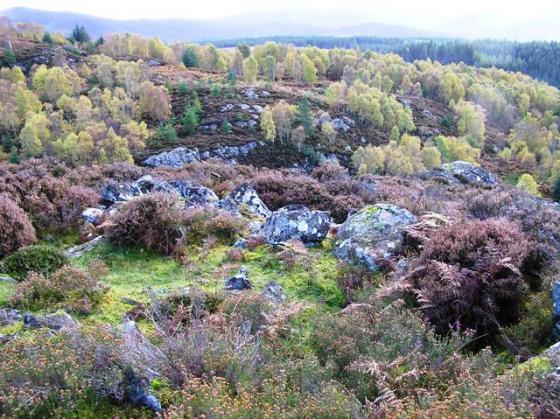
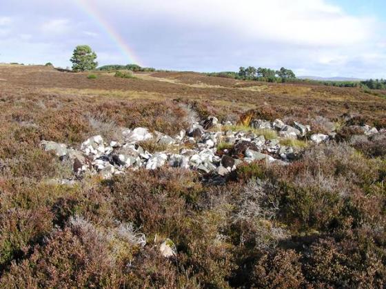
Travellers seeking to be overawed by towering ancient ramparts should perhaps look elsewhere .... since here at Craig Mony it is the natural defences – the perpendicular rock face, the wooded hillside plunging steeply to valley bottom – that impress the visitor. Or at least this one. However that is not to say artificial defences are entirely absent, the fragmentary remains of a dry stone wall still to be seen running across the neck of this promontory, isolating the rocky eminence from the hinterland to the west. But, as far as I’m aware, that’s yer lot (and unfortunately I left the site without taking any images, I guess due to the pretty unpredictable weather.... a poor excuse, to be honest).
Nevertheless I would highly recommend a visit to Craig Mony, the natural aesthetics a joy to behold. The enclosure is depicted upon the 1:50K OS map as a ‘viewpoint’, which, I confess, was what caught my eye in the first place. I approached from the south, a road signposted for ‘Divach Falls’ (incidentally well worth a look for aficionados of plunging cataracts, having seen them myself a decade back) heading approx south-west from Drumnadrochit toward Glen Coiltie. A little before the bridge carrying said road across the River Coiltie it is possible to park at the start of a ‘forestry road’ to the right, overlooked by houses to the north. I head uphill toward these and, keeping to their left – and to the right of a reservoir – follow the ridge to its highest northern point. Well eventually, anyway. Which is what matters.
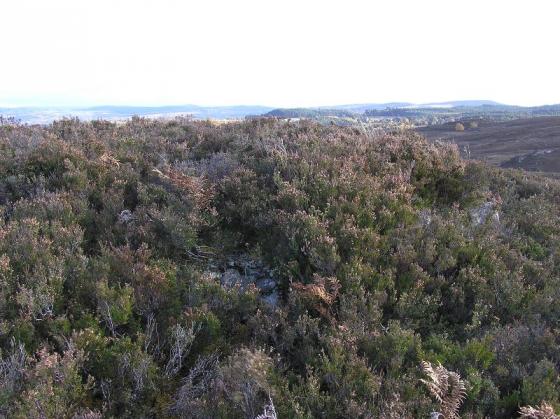
The promontory is heavily wooded; hence I initially mistake the remnants of defensive cross wall for a field wall. As you do. Clarity is not forthcoming as I ascend to the summit of the enclosure, either, it being difficult to decipher whether the numerous rocky crags were utilised for defence or not. Then, however, I arrive at the eastern extremity of the site, crags falling vertically to forestry, and decide to sod all that and just enjoy the moment. Yeah, the occupiers of this ancient enclosure chose well since it was clearly more or less unassailable from any direction save the west, that being duly defended by the dry stone wall. For me the piece de resistance, the crowning glory, is a fabulous vista toward Urquhart Bay and Loch Ness. Yeah, that’ll do nicely. Well worth periodic pastings from fast moving weather fronts ushered along Glen Urquhart by a pretty substantial wind. No point in removing waterproofs, there’ll be another along in a minute.....
Truly there are worse places to ride the storm than an ancient enclosure overlooking Loch Ness.