Looking over to Loch Nan Geadas, the third last stop of an exhausting day.
Image credit: drew/B
Looking over to Loch Nan Geadas, the third last stop of an exhausting day.

The facing stones mentioned by Canmore.
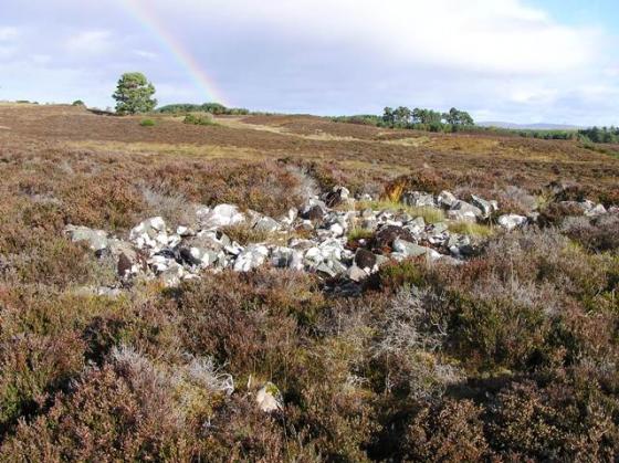
The wee climbers cairn.

Looking back to Loch Duntelchaig, a nice walk, no soaking as well :-)

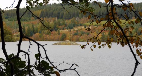
Looking over to Loch Ness.

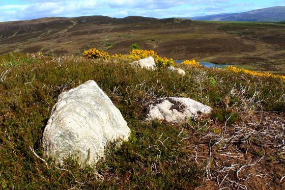
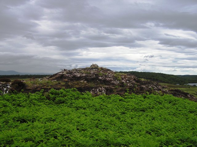
The heather has recently been burnt.

This from the junction to the north west.

Perhaps the archetypal marker cairn crowns the summit of the ‘fort.

Formidable natural defences protect the eastern flank of the ‘fort.... not least the inclement weather.

Excellent natural defences....


The eastern flank wouldn’t have needed much in the form of artificial defences... looking toward Loch Duntelchaig.

Sunburst... all set for another soaking...

Toward Loch Ness......


Toward Loch Duntelchaig from the dry stone defences


The fort from the south, showing the two lines of stone ramparts.

Loch Duntelchaig from the outer rampart. The snow-covered Monadhliath mountains rise on the skyline beyond.

Entrance gap in the inner southern rampart.

Looking north along the western rampart. The approaching storm front brought a soaking of sleet and snow.

The western rampart, looking towards the Great Glen and Loch Ness.

A small walker cairn marks the highest point of the rocky fort interior. Looking NE towards Loch an Eoin Ruadha and Loch Duntelchaig.

Looking SE along the inner southern rampart towards Loch Duntelchaig.

The inner rampart from the outer.

Looking NW along the outer rampart.

The outer southern rampart.

Impressive surviving stonework of the outer southern rampart.

Approaching the fort from the SW.
From the Merchant’s Stone we, avoiding the road, headed south between the Lochs Na Curra and Lochan an Eoin Ruadha. Despite gathering clouds it remained dry and underfoot conditions, sometimes squelchy, where for the most part fine with the occasional steam to jump. Ashie Moor had been tamed thanks to the dry spell.
As Gladman’s superb notes mention the weather changes quickly. Over at Loch Ness it appeared to be torrential rain, which it was, whilst at the fort it was dry. One big difference was that the heather had been burnt making the small climb to the fort easier.
Also like Mr G, I also thought about the disaster at Culloden as clansmen ran for their lives and also General Wades roads. A good place to sit and ponder turbulent times past and present.
Visited 1/7/2017.
Upon (reluctantly) leaving Kinchyle of Dores the weather turns progressively more violent – unpredictably so – as afternoon merges, almost imperceptibly, to the onset of a typically prolonged highland evening. No rest for the antiquarian traveller in these parts, it has to be said. So, where to next? Well, the map depicts a ‘fort upon Ashie Moor which, as I recall from TSC’s photos when browsing TMA, appeared worth a visit. Yeah, Caisteal an Dunriachaidh. The assumption is duly proved to be valid as I approach and park at the B862’s junction with the (even more) minor road bisecting the moor to the north-east.
Initially the location strikes me as a forlorn, desolate spot, the isolated crag bearing ancient fortifications looming above the long, tussocky grassland of the moor as if a solitary ship overwhelmed by the vastness of the unforgiving ocean. Suddenly, however, a great fracture is rent in the jet black cloudscape, sun rays streaming through to flood the landscape with light, illuminating all in a golden glow. Hey, who turned on the lights? Not to mention the waterworks, a front of hail arriving out of nowhere to give the windscreen a severe lashing. Perfect conditions to visit a hillfort and lose yourself in the melodrama! It is a short walk to the south-western corner of the site, a correspondingly easy ascent to view the drystone walls – or at least what remains of them – that still girdle this flank of the crag. These are quite impressive; not overwhelmingly so, but still substantial enough to impart a sense of having been built to last. Clearly they must have done the job required of them back in the day when people actually lived up here. Much more striking, however... of far greater and lasting impact upon the memory... are the defences Mother Nature saw fit to assign to the eastern flank of the fortress. Here a steeply angled ‘wall’ of naked rock plunges to the soggy surface of Ashie Moor below forming a quite extraordinary natural ‘glacis’ rampart. How good is that? Made to order.
Conditions remain somewhat, er, volatile, the light show created, choreographed and orchestrated by duelling sun and cloud mantle culminating in a succession of multiple rainbows arching overhead, arguably – no, surely? – one of Nature’s most fragile, insubstantial, yet nevertheless finest creations. All too soon they are gone, superseded by further hail fronts sweeping along a glowering Loch Ness to the west. For me it is times such as this when Loch Ness, otherwise a pretty benign, massive body of water, lives up to iconic status accorded it.... a gigantic rift in the very fabric of Scotland brooding beneath similarly immense cracks in the sky. A magnificent symmetry. Perhaps only Turner could’ve conveyed the scene in any meaningful manner.
Curiously such ‘Wagnerian’ imagery seems to harmonise with more random, abstract thoughts generated as I sit near the modern cairn crowning the highest point of the enclosure... clansmen fleeing the not so distant battlefield of Culloden, plaid discarded in their desperation to escape, perhaps turning for last ditch stands against pursuing government troops here? Yeah, truly monumental events occurred in this corner of Scotland, events with far reaching consequences which sometimes seem to have permeated the very landscape itself. An illusion, no doubt, but what is the past if not to help us focus upon what may come?
Caisteal an Dunriachaidh is a good place to linger for a while.
This fort is well protected by sheer cliffs here on Ashie Moor.
In the parish of Dores, and about three miles from Loch ness, are vestiges of a fort called Castel-Dunreachan, or Castal-Dun-richuan, i.e. Castle of the King of the Ocean*, a name perhaps imposed when the king of Norway was master of the sea. To the eastward of that fort, are several cairns, one of which, called Ashi’s hill, is fabled to be the spot where Fingal killed Ashi, son of the Norwegian monarch.
*Yes this all sounds highly unlikely. But names need explanations. From ‘The Topographical, Statistical, and Historical Gazetteer of Scotland’ (1819)
You can see a photo of the fort on Geograph.
Canmore description:
This fort occupies a rocky ridge; a sheer cliff forms the E side and the only easy access is from the SW. The highest part of the ridge has probably been surrounded by a stone wall, of which only the W half survives, enclosing a roughly-circular area measuring about 30m in diameter. The wall is 3.8m thick and stands to a height of up to 2m; the entrance is on the SW. A second wall extends from the cliff-edge on the SE to take in a terrace below the inner wall and swings in a gentle arc to end on the top of the cliff on the NE. The remains of a third line of defence can be seen on the NW, where a ditch with an outer upcast bank flanks the base of the ridge; on the N it appears as a stony band rising up the side of the ridge to join the outer wall. On the date of visit deep heather obscured what may be the SW extension of this work, located by the OS, cutting across the back of the ridge.
(USN93 156)
Visited by RCHAMS (PJD) 22 October 1992.