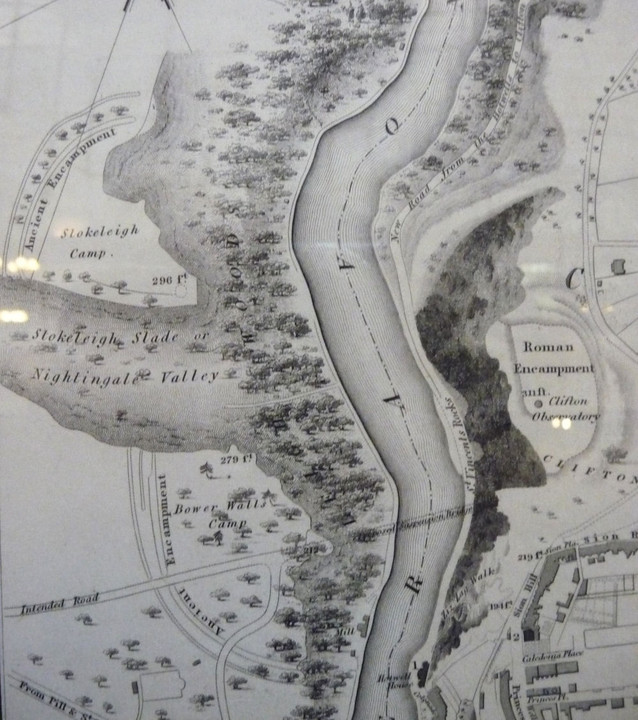
 Detail from G. C. Ashmead's 1833 map of Bristol, showing all three riverside forts: Stokeleigh Camp (top left), Clifton Down (right, shown as "Roman Encampment") and the pre-destruction Burgh Walls (bottom left), marked as "Bower Walls Camp". Note the "intended road" cutting through the camp to the not-yet-built suspension bridge.
Apologies for lighting glare, the map is behind glass on the Museum wall.
|
|
 Image Credit: G. C. Ashmead/Bristol Museum and Art Gallery (1.5.1833)
Posted by thesweetcheat
24th March 2013ce
Edited 24th March 2013ce |
NB: Unless otherwise stated, this image is protected under the copyright of the original poster and may not be re-used without permission.
|
|


