|
|

|
thesweetcheat’s TMA Blog |
|
Lost in a Fforest – Storey Arms to Glyntawe 12 February 2011
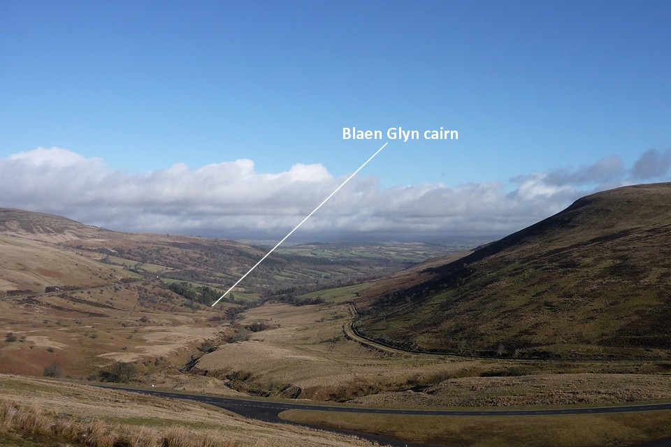
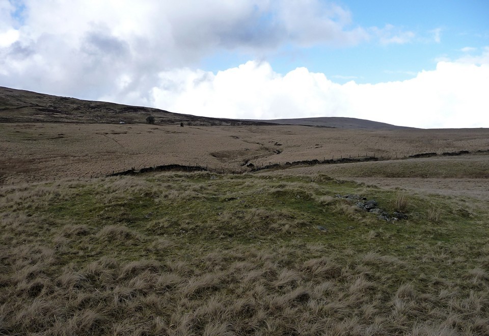
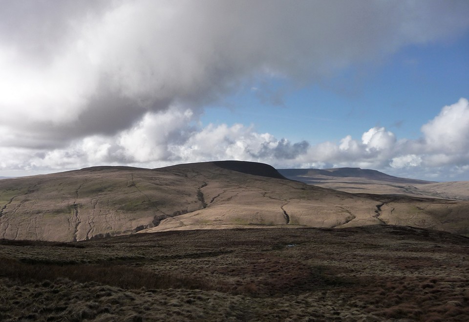
| Situated between the iconic twin peaks of Corn Du and Pen-y-Fan and the rocky scarps of Y Mynydd Du, the grassy ridges of the Fforest Fawr mountains are probably the quietest and least-frequented of the ranges that together make up the Brecon Beacons. Although the name means “Great Forest”, most of the upland area is treeless and the name derives from its medieval past as a royal hunting ground. Now you’re more likely to find grazing sheep, occasional ponies and tired soldiers on exercise than any crowned heads wielding crossbows (thankfully). The Romans also made their mark here, leaving behind marching camps and the mountain-traversing Sarn Helen road. Far older than any monarchical playground or imperial frontier, the range is also home to plentiful prehistoric remains, from the desecrated cairns of its high peaks to one of Wales’ finest standing stones in a plunging valley in between. Nature herself is prominent here, not least as two of South Wales’ most scenic rivers, the Afon Nedd and Afon Mellte, rise in this range before dropping through a series of spectacular waterfalls on their way to a confluence at Pontneddfechan and then to the sea beyond Neath. My last trip out was to the moors below Y Mynydd Du, a frozen visit to Nant Tarw and Cerrig Duon & the Maen Mawr. My start point on that occasion was the reservoir at Crai and the running of buses to that relatively remote spot, public-transport wise, planted the seed of the idea for the walk today. The intention is to get the bus to Storey Arms, best known as the start of the busy path up Pen-y-Fan, and take a linear route across several of the Fforest Fawr tops to finish at Glyntawe, not far from the Dan-yr-Ogof caves. As ever, the constraint is time – the last bus back from my destination is not late and a cold February isn’t the time to be stranded. I’m filled with the usual mix of feelings as the bus drops me at Storey Arms. Some trepidation, not helped by the fact that Corn Du is enveloped in low cloud as I arrive, but pleasurable anticipation at the sights to be seen, helped by the contrasting blue skies to the north and west. And then that wonderful feeling of freedom that a walk in empty hills always brings. Begone dull care indeed. The initial part of my route follows the Beacons Way long distance path, gaining height steadily below the watchful gaze of Fan Fawr, the highest of the range’s mountains. Once above the cliffs at Craig y Fro, a terrific view of Glyn Tarell opens up. Somewhere down there, alongside the river, is the bronze cairn of Blaen Glyn, definitely one for another day. Blaen Glyn — Images31.01.13ce
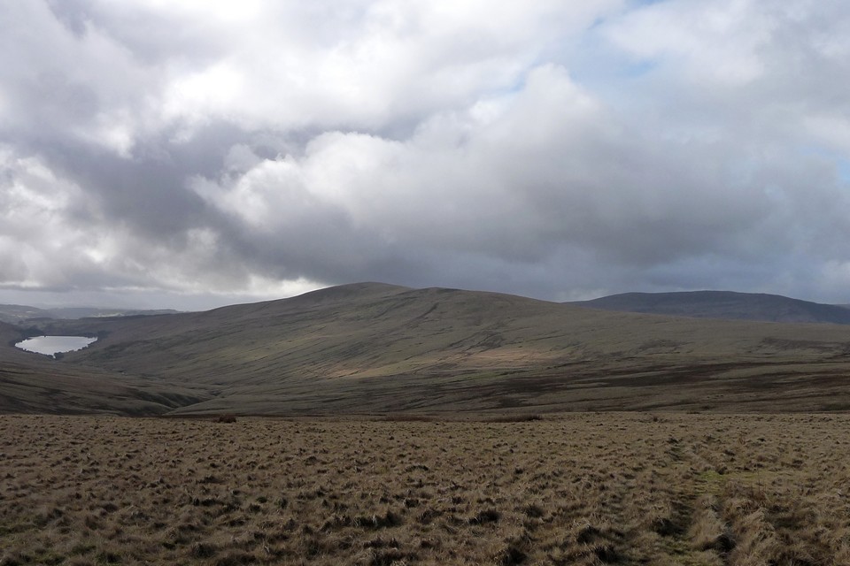
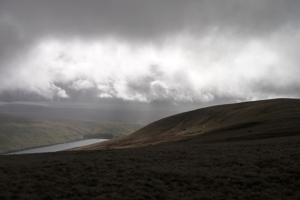
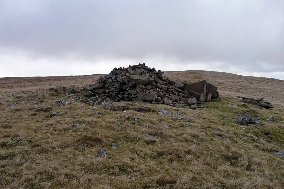
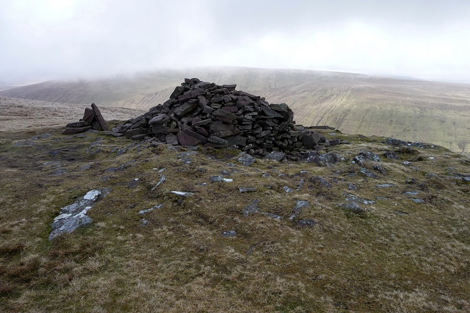
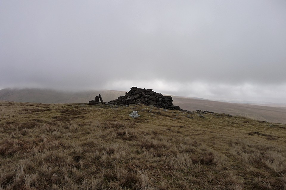
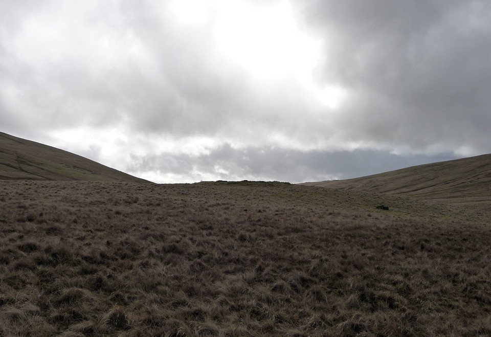
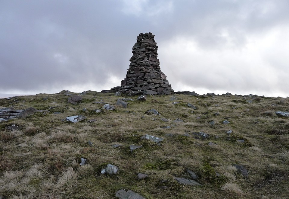
Reaching the crest of the ridge, another vista unfolds to the west, swathed In ragged cloud. To my left, the long ridge of Fan Dringarth, the start of the Fan Llia ridge heads out of sight. Beyond that, the unmistakeable scarp of Y Mynydd Du’s eastern flank can be seen, a link to my last walk and a reminder, were any needed, of the wonderful natural setting that the builders of the circles and cairns had as their backdrop. Truly awesome. Behind me, Corn Du finally emerges from the cloud cover. The blue sky is now mostly behind me, and the next few miles stretching ahead have acquired the threat of less favourable weather. It’s a long pull across the tussocky grass of Rhos Dringarth, enlivened by the continually unfolding view. A darkly shadowed Fan Nedd appears behind Fan Llia and the waters of the Ystradfellte Reservoir provide a patch of silver in the valley ahead. What from a distance appears to be a cairn turns out on closer inspection to be a modern marker built on an oblong rock outcrop. Ponies provide the only signs of mammalian life, even the sheep are absent from this lonely spot. Onto Cefn Perfedd, where a better view of Fan Nedd presages the first sight of one of the day’s objectives, Maen Llia, a speck in the valley below. Fan Llia — Fieldnotes12.02.13ceAs I make the Fan Dringarth ridge, the thick grey cloud is now right over my head and the temperature drops as I walk into an increasingly strong wind. Here I meet a group of three walkers, the only other people I will see on the whole of the walk today. At length the summit of Fan Llia comes into view ahead, a straightforward plod to the top. The summit itself, at 632m OD, turns out to be marked only with the concrete base of an otherwise vanished trig pillar, but enjoys very decent views of the surrounding peaks. The cairn is further south, off the very highest point but still on the summit ridge. Unfortunately, as I get to within 100 yards of the cairn, it starts to hail, the wind blasting the icy bullets straight into my face. Not the nicest way to make your first site of the day! Even less nice is the poor treatment that has been inflicted on the cairn itself. There is the usual turfed footprint of a large cairn, boasting excellent views to the south that are lacking from the summit and emphasise the obvious reasons for its positioning at the end of the ridge. Sadly, the mound itself has been badly “altered” by walkers. The stones are flat slabs of sandstone, heaped up into a somewhat shapeless pile. Other, larger slabs have been leant and propped up around the perimeter, giving the whole thing the air of half-built neglect. It’s difficult to respond to such a wilful lack of respect with anything but anger. All that said, the setting is terrific, even the ongoing hail doesn’t detract on that score, although it doesn’t help photography much! It’s too cold and windswept to linger here for long, body temperature quickly dropping when not I’m moving. Besides which, it looks like a cruel up-and-down to get from here to Fan Nedd, the next summit on my route and so I head westwards off the top, not following any particular path but making generally towards the visible block of Maen Llia far below me. Needless to say, the hail stops within a minute of leaving the cairn. Fan Llia — Images31.01.13ce
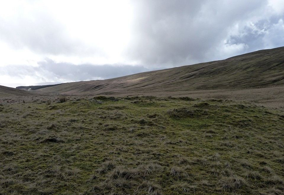
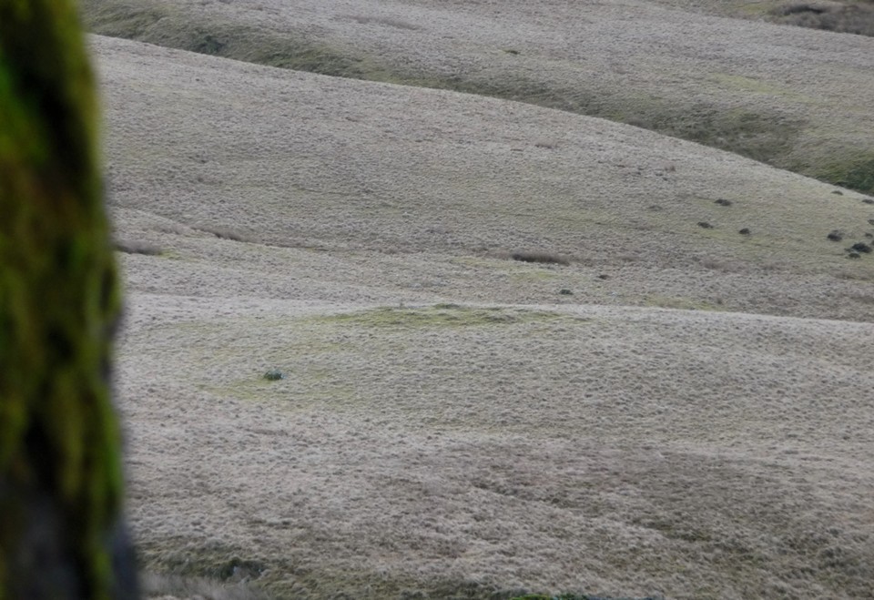
Rhyd Uchaf — Fieldnotes12.02.13ceIn a line between the standing stone and my route is a green mound, which will prove to be the Rhyd Uchaf cairn. To get to it, there are a couple of deceptively steep-sided streams to cross. Although ruined, the placing of the cairn is nicely judged, on a little knoll surrounded by various tributary streams of the nascent Afon Llia, the water source that may well have provided the inspiration for the siting of the little complex of monuments here and of this cairn in particular. Rhyd Uchaf — Images13.02.11ce
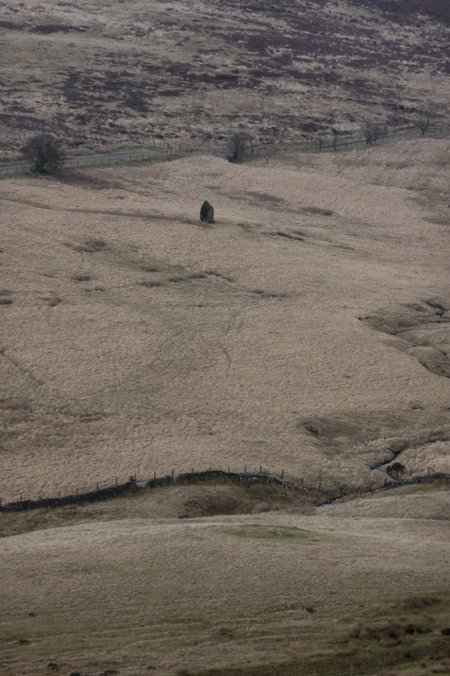
Maen Llia — Fieldnotes12.02.13ceThe cairn is separated from the Maen Llia monolith by the Afon Llia itself, fast-flowing and not as easy to cross as it looks, with peaty banks quick to crumble underfoot. But cross I must, as the pull of the stone, one of South Wales’ undoubted megalithic stars, is too much to avoid for long. This will be my second visit here. The last time I came with a friend by car and to be honest I had little hope of ever making it back here under my own steam. It’s a wonderful, wonderful stone, enjoying a lovely view down the valley between the two steeply rising mountains that flank its either side. The shaggy coat of moss gives it a primordial look, and even years’ old graffiti can do little to undermine its towering charm. I spend a good while here, undisturbed by any other visitors, although an empty car is parked nearby. Time stops briefly, and I recharge for the next and steepest of today’s climbs. When the time comes to bid farewell – adieu hopefully – I do so with some sadness. This is a site that rewards the effort of getting here tenfold. Maen Llia — Images13.02.11ce
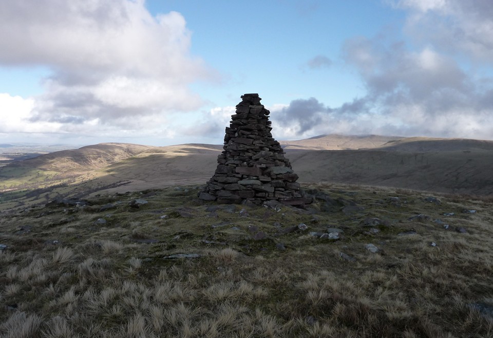
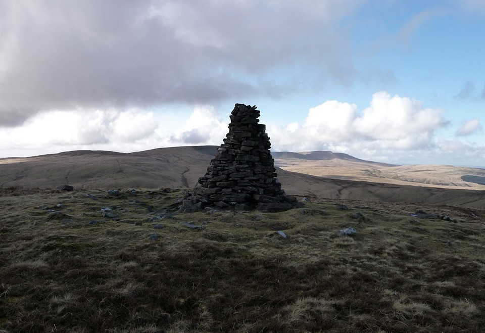
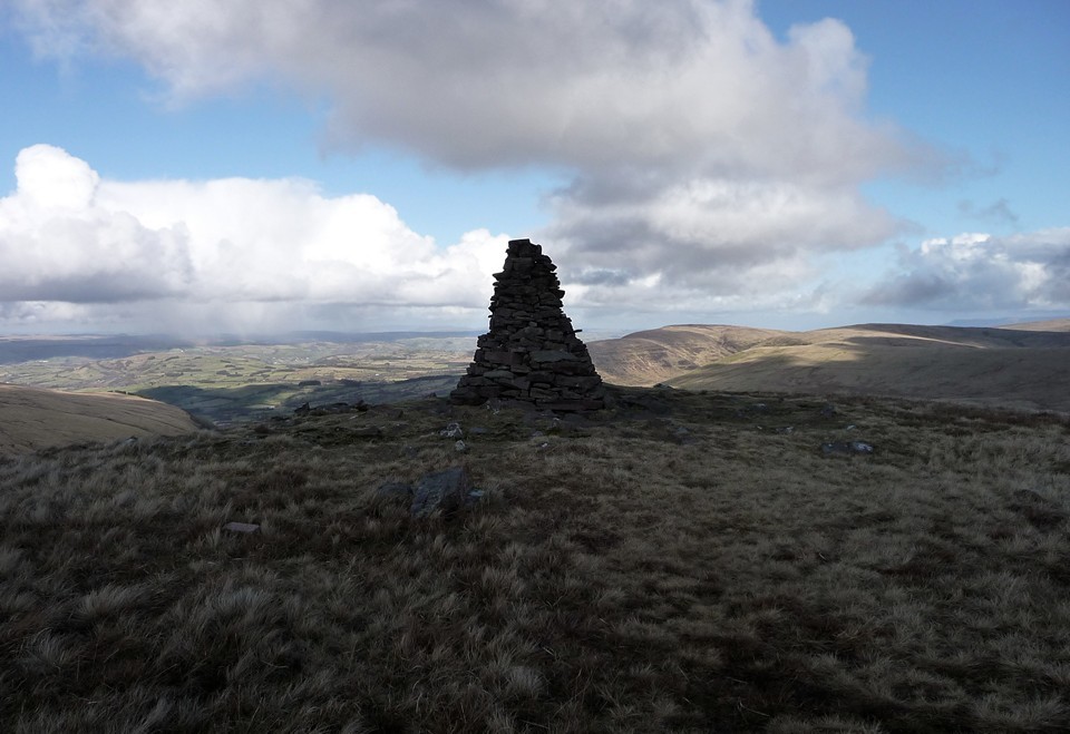
Fan Nedd (Northern summit) — Fieldnotes12.02.13ceA ladder stile leads onto the tussocky lower slopes of Fan Nedd. There is no obvious path and so I’m left to pick a route that is reasonably direct to the summit. Due to time constraints after the lengthy stop at Maen Llia, I’ve decided to abandon a visit to the two cairns on the eastern slopes of the mountain and to concentrate on getting to the top of the mountain. I confess to a certain feeling of unfinished business here. A couple of years ago I came here a matter of hours after Gladman had been (small world). On that occasion the slopes were snow-covered and going was slow. My friend and I made it to the pointy cairn on the ridge in a hailstorm (what is it with these tops and hail?) and very stupidly mistook it for the summit trig point marked on the map. As such, we didn’t reach the summit and I’ve been keen to come back and rectify the error. So today I head straight up the mountain’s eastern flank. This proves to be very hard going, the slope is very steep and the vegetation is ankle-knee deep. Only the occasional stops to look back at Maen Llia, dwindling into a black dot below, and the unfolding view of Fan Llia across the valley, make the ascent anything other than a trial. But reaching the ridge, close to the trig, the views to the west make up for the aching knees. Once at the summit (663m OD), the views to Fan Gyhirych and Y Mynydd Du are magnificent and far-reaching, clear of the clouds of earlier. From the summit it’s a fairly easy stroll north along the ridge towards the “pointy” cairn. About halfway along the ridge I come across a recumbent slab, unworked but with a hole drilled in it. No-one is likely to have ever put a fence up here, so perhaps a fallen boundary stone? The pointy cairn is every bit as ludicrous looking as the last time I came here. But what’s this? It rests on a turfed over mound of much greater diameter, with stones protruding through the thin covering. Suspicions start to grow and I get the feeling that the walker-made pyramid conceals something much, much older. The positioning is typically clever, allowing the maximum panoramic view, particularly northwards, absent at the mid-ridge summit. It is certainly similar in construction to the cairn on neighbouring Fan Gyhirych. [A post-visit Coflein check suggests that the instinct was correct and that these are the remains of a bronze age cairn, positioned with the usual fine attention to detail.] Fan Nedd (Northern summit) — Images13.02.11ce
Fan Gyhirych — Images13.02.11ce
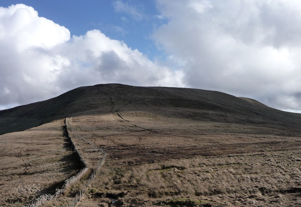
From here, it looks like I have a long way to go. Fan Fraith, my last summit of the day, appears far off and I know that the route onwards from there down to Glyntawe is a long one, albeit downhill nearly all the way. I quickly drop down to boggy Bwlch y Duwynt (“Pass of the Black Wind”) for a lovely view of Blaen Senni, before joining a better track that heads uphill again between Fan Fraith and Fan Gyhirych. The OS 1/25000 makes the approach to the summit of Fan Fraith look very easy, but maps can lie can’t they? In fact, it turns out to involve crossing a horrible area of bog, with little to recommend the summit once attained. At 668m OD, Fan Fraith is the highest point I will reach today and the last of the 2,000ft Fforest Fawr summits that I had yet to visit. However, it is flat-topped, with views rendered unimpressive by an expanse of bog in all directions and no swooping drop to valleys below. There is nothing much to mark the highest point, other than small pile of stones – certainly no ancient monument here. In some ways, this is an instructive stop-off, as it highlights the fact that a bronze age cairn is unlikely to be located in such a spot as much as the visits earlier in the day highlighted precisely why they are where they are. There’s no substitute for getting out and looking at these places on the ground. Dismissing any lingering thoughts of a return to Fan Gyhirych, I’m now up against the bus timetable. The highlight of the final section of the walk is the view of sun-dappled Cribarth across the Tawe valley. The last couple of miles, thankfully downhill, pass in a stumbling jog-trot as I realise just how close to missing the bus I’m getting. The aim is to cross the Tawe near Craig-y-Nos, where the map shows a handy “ford” a field away from the road. This turns out to be the only major mistake of the day. In my haste I plunge into the ford without really considering the depth of the water, which comes straight over the tops of my boot and soaks my foot. I retreat, but too late. So, with a waterlogged boot I take a slightly longer route to the road, where I have less than five minutes to attempt to dry off before the bus comes. Perhaps not the best end to what has been a hugely rewarding walk across some of South Wales’ best walking country. But feet dry soon enough and I can’t deny the pleasure had from my day in these remote hills, where the traces of hunting kings are long gone but remnants of a far more ancient past survive for those who are prepared to seek them. |
 Posted by thesweetcheat
12th February 2013ce Edited 29th January 2023ce
thesweetcheat's TMA Blog
Latest TMA Blog Posts
|


Comments (3) |
|
| Brilliant stuff TSC, really enjoyed reading that. |
13th February 2013ce |
|
South Wales’ best walking country. remote hills, ancient past, consider me there. |
 Posted by postman
13th February 2013ce |
|
Cheers ED, much appreciated. It was a fun walk. Chris, if you've not been it's definitely somewhere you should get to. I prefer Y Mynydd Du on the whole, but this area is a lot less frequented. |
Posted by thesweetcheat 13th February 2013ce |
| You must be logged in to add a comment | |