

The flanks of the SW barrow are gradually being reclaimed by the gorse.

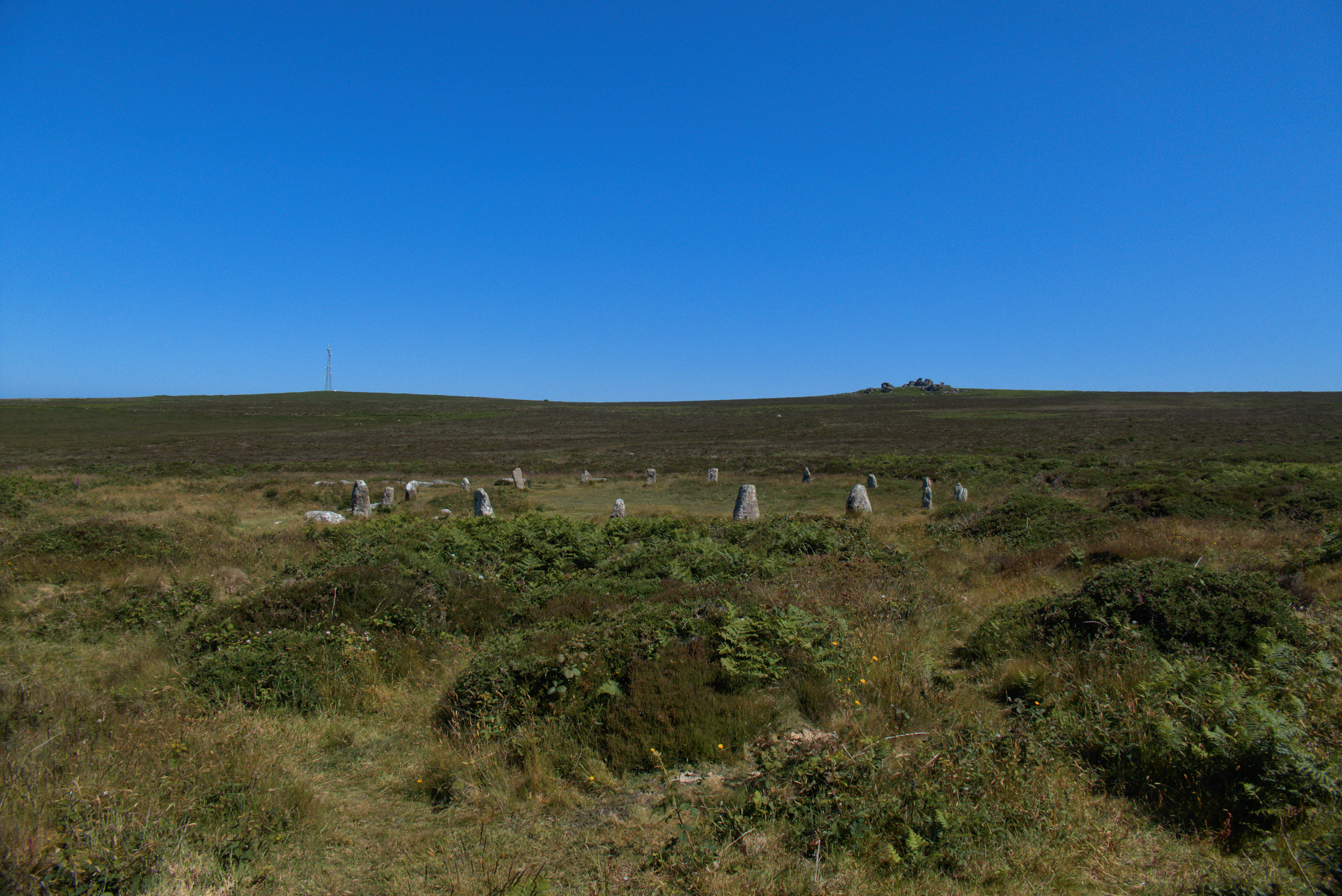


The pointed top of modern cairn that sits on Carn na Faire can be seen on the skyline. The Gaelic name for this bay is Port na Righ… ‘Port of the King’. As far as I can establish there are only two other places in Scotland that bear this name, the modern Portree on Skye and a bay at Carradale, East Kintyre. Not an everyday name.


I found this immediately to the west, alongside the cairn – which is of an unusually large size. I believe this to be the true lookout point which affords shelter, unlike the exposed to the elements top of that cairn, whose Gaelic translation is ‘pile of stones watch point’. A watch point for where? Reckon I have found the answer to that downslope when fieldwalking. As of date of publication of this image fieldnotes and images are yet to be uploaded but local official bodies have already been informed. Perhaps I’ve found hidden in the vegetation the most important prehistoric site on the island… we’ll see…
The following is quoted from Gregory, Donald., Country Churchyards In Wales, (2002); (2015), pp. 223-224:
“There is no churchyard in Wales where there is a longer history of burial or where there is so obvious an example of the continuity of the religious use of one particular site. … All the churches built in this place, from the earliest religious settlement in the llan to the present early nineteenth century edifice, have stood inside a Bronze Age alignment of stones. This calculated choice of sites by early Christians adds weight to the arguments of those who believe that in former times great importance was attached to the magic powers associated with circles. … the present-day churchyard wall at Ysbyty Cynfyn contains five stones that belonged to a Bronze Age circle, of which probably three are still in their original positions, the other two having at some time been moved to act as gate posts. There are no ifs or buts about Ysbyty Cynfyn, which provides an impressive example of the continuity of religious association in a burial ground.”
We’ve put some of our research regarding Ysbyty Cynfyn over on our website.


Gladman poses the question as to whether this is the most remote of all stone circles, even more so than its northerly counterpart White Moor. I made the trek to the latter 12 years ago and was inspired to write my first (self-congratulatory) fieldnote. Amongst the responses was one from The Sweetcheat suggesting Stall Moor as my next serious quest and four years ago I finally got round to making the attempt. Alas my companion at the time was in the process of recovery from Long Covid so had run out of puff by the time we’d made it to Stalldown stone row so continuing on to the circle was out of the question.
I’d been promising myself another go ever since and it finally came about yesterday with my daughter and her partner volunteering to accompany me on the expectedly lengthy but massively worthwhile expedition. The notes about suggested walks on The Cornwood Inn website indicated that parking between the village and the gate to the water treatment plant was a no-no; four years ago I’d been able to park the other side of the gate but this time I didn’t want to risk driving up there and finding it padlocked (as it was) so we parked in the village and walked the lanes which added a good couple of miles to what turned out to be at least 3/3 and a half from the gate to the circle.
That bit was relatively easy, a gravel path following the river all the way to the weir then picking our way steadily uphill until with the aid of my trusty binoculars I spotted what had to be the circle on the horizon to the north. We crossed the Bledge Brook and trudged through the tussocky grass, giving a Dartmoor pony and her foal a decently wide berth, and there it was.
OK, it’s not the prettiest of circles and bar one the stones are on the small side but for its setting with a tremendous sightline all the way down the Erme Valley it’s second to none. The Sweetcheat says it better than I can in his fieldnote; its very remoteness and the majesty of the surrounding landscape give it a presence that belies its appearance. Yes, the sense of achievement in getting to it – I still can’t decide if it’s technically more remote than White Moor but there can’t be much in it – undoubtedly amplified the exhilaration I experienced in my final few steps. To think it’s been here for 4.000 years, largely undisturbed and unvisited for probably at least three quarters of that timespan.........it’s a special place and I feel privileged to have briefly intruded on its solitude. A big thankyou to my distinguished TMA forerunners for pointing me in its direction.

An engraving of Avebury, published in ‘The Mirror of Literature, Amusement, and Instruction,’ 15th November 1828. The accompanying article has a fair amount of dramatic flourish, drawing from William Stukeley’s theory that Avebury was built by the Druids.


The very steep drop off on the E side, Loch Etive beyond

The view from the W ramparts along Loch Etive, North Connel, and archaeological ‘hot spot’, in the distance, overlooking the Falls of Lora.

The heavy duty boulders that line the western side’s outer defence.. the ridge beyond, S, the dun’s normal access route in occupation.

The approach from the west… the bracken already making its presence felt in mid May

The W side, seen from the shore of Loch Etive
Supposing you should spot something other than cupmarks carved into the stone:
Long Tenure. – The following tenure on the Earl of Haddington’s estate in East Lothian may vie with that on any nobleman or gentleman’s property in the country.
Mr John Dudgeon, present tenant of Easter Broomhouse, near Dunbar, in the year 1769, carved his name on a monumental stone on that farm. Under the noble family of Haddington, Mr Dudgeon’s father and grandfather were successively tenants of Easter Broomhouse, neither of whom were short-lived. We know that Mr Dudgeon, who is now considerably upwards of eighty years of age, is in excellent health, and has a second time, in 1839, carved his name on the same stone as tenant of the farm. – Edinburgh Courant.
Reprinted in the Court Gazette, 26th October 1839.

Ho or Howe Stone, Balcunnin.
There is a very large stone called the ‘Ho or Howe Stone’ in a field near Balcunnin crossroads. One going along the main road from Lusk to Skerries can view the ‘Ho stone’ in the field on the right hand side of the road. It is only a distance of twenty yards from the Balcunnin Cross Roads. It is about five feet in height and must weigh about 3 or 4 tons in weight. There is a smaller stone near it but whether this was broken from the original stone it would be difficult to state.This ‘Ho stone’ resembles the Cromlech stones which are to be seen in many parts of Ireland but there is no visible inscription on it. Some say that it was part of Baldungan Castle that was destroyed in the rebellion of 1641 but this would belie the suggestion that the castle was destoryed by Cromwell from the sea as it is situated on the same road as Cromwell’s Bush. If Cromwell destroyed Baldungan Castle from Loughshinny by cannon fire it is very unlikely that a mass of stone weighing some tons could be blown for such a distances, as it is almost a half mile from the site of the castle.
Local tradition states that it covers the entrance to a cavern or passage which leads to Baldungan Castle but no effort has ever been made to prove this assertion. The defenders of the Castle are supposed to have retracted into this passage with their valuables and when the Castle was levelled the passage is supposed to have caved in on them. There seems to be no entrance from Baldungan Castle at present to this supposed passage, but the entrance may have been choked by falling debris which still remains concealing the entrance.
Collected from Mr Caffrey, Balcunnin, Skerries, by Mr Byrne, NT Milverton, Skerries.
From the 1930s Schools Collection of folklore, online at Duchas.ie.
The Old Grave in the Kill of the Grange.
On the entrance of the old grave yard of the old Kill of the Grange you will see an old grave, which has a legend attached to it. A servant lady who was a Catholic worked for a Protestant people and soon forgot her religion. One morning she went to Holy Communion and after receiving she took the Holy Sacrament from her mouth and put it into her pocket. When she reached home, she cut it with a knife and it started to bleed. Six months later she died a most agonising death. At her funeral the hearse stopped at the gate and would not go any further so they had to bury her at the gate.
I’d like to hazard that this story (a.k.a. terrifying threat to children to frighten them into being obedient serious Catholics) refers to the stone? What do you think, Ryaner? It was collected and written down in the 1930s as part of the Schools’ Collection of folklore (now to be seen at Duchas.ie.
Visited 26.04.12
It was 13 years ago so I don’t have good recall of my visit to Carn Liath (Morangie Forest). I used OS Mapping to plot a route to the cairn. It is 2.2 miles from Aldie Burn Car Park with c. 95 yards total ascent. Walking and cycling are permitted. The main unknown is access from the forest track to the forest clearing due to fallen trees obscuring the forest rides.
Directions to Carn Liath (Morangie Forest): Take the Scotsburn turn off the A9 Tain Bypass. Follow the road for c. 1.8 miles to the right turn for Aldie Burn Car Park. Turn left into the car park after 50 yards. You can proceed from here on foot or by mountain bike. Take along a forest track heading NW which winds W along forest tracks for c. 2.2 miles to reach NH 7296 7969. Look for a forest ride heading NW then turn N towards a stony cairn in a large clearing. My walking route is viewable on Carn Liath (Morangie Forest).

It shows as a low bank not far inside the inner bank.


