Latest Fieldnotes

Fieldnotes 2,576-2,600 of 19,536 fieldnotes

July 7, 2018

Backies

Visited: June 25, 2018

Located no more than 3 km west of the A9, and not far from the town of Golspie on the Dornoch Firth, Backies must rate as one of the ‘must see’ brochs of northern Scotland. Considered to be a solid-based broch, Backies was excavated in 1846, and the spoils simply tossed over its walls to form a stoneheap all around it. In this respect, its profile is almost identical to that of Carrol Broch. Backies stands on a steep rocky knoll just north of the community of the same name, and the only feature evident from outside is the 5 metre long entrance passage and the entrance portal itself, surmounted by a huge lintel.

But the interior is another matter altogether. The foundation course is completely buried in rubble but the second level is virtually complete and still stands 2½ metres tall round the entire structure with a well preserved ledge scarcement at 1.7 metres. The second level is hollow, and a well constructed doorway leads into the intra-mural cavity. A feature of the doorway is a lintel below the top which serves as part of the scarcement ledge.

Canmore states that:

“Backies is a good example of a once well preserved, hollow-walled broch which is steadily falling into ruin. Only its remoteness has preserved it from greater destruction, but there can be little doubt that in a few more decades all the surviving traces of hollow-wall architecture in Level 2 will have disappeared.”

There is a huge amount of information about Backies broch on the Canmore website.

To access Backies broch, look out for a sign indicating left to ‘Backies’ just a few hundred metres north of Golspie as you drive north on the A9, and mid-way between Golspie and Dunrobin Castle. Follow this road for 2½ km till you encounter a sign pointing right to a Scottish Water Treatment Works (marker ‘W’ on the map). There is room for one car to park on the verge just before this sign. Head up the road to the Treatment Works, where there is a possibility of parking just past their building on the right (marker ‘P’).

staticmap?center=57.998,-3.97968&zoom=16&maptype=hybrid&markers=size:mid|color:white|label:W|57.997527,-3.986349&markers=size:mid|color:white|label:B|57.9976,-3.9733&markers=size:mid|color:white|label:P|57.998263,-3.981811&path=color:0xffff00ff|weight:2|57.997527,-3.986349|57.997782,-3.985069|57.997480,-3.982582|57.997660,-3.982024|57.998534,-3.981855|57.998874,-3.981181|57.998421,-3.978033|57.998477,-3.976732|57.998509,-3.975282&path=color:0x00ffffff|weight:2|57.9985,-3.975282|57.998,-3.974812|57.9974,-3.974&size=640x400&sensor=false&key=AIzaSyCp6JckL_ykPLQNTeiT2zJYsaR9v2NDwpk

From the Treatment Works, walk up the road for 80 metres or so till you encounter a well constructed sinuous road heading to the right (east). The road ends at a ruined croft house in sight of Backies broch (yellow line). Although the terrain towards the broch (marker ‘B’) looks a bit of a jungle of woodland thickets and bracken there is a narrow footpath to it (though I missed it and had to fight my way round to the broch).

On the road’s final bend, just a few metres before the ruined croft house, a drainage culvert passes under the road. The path to the broch, which I only discovered on the way back from it, starts immediately before the culvert and heads in nearly a straight line to the broch (cyan line on map). In summer, it’s just a case of searching for the trampled path beneath the bracken and following it as best possible.

Carrol

I’m aware that most generalisations proffered are, by their very nature, likely to be sent packing back to whence they came in short order. That being said, however, I reckon it’s fair to suggest that many areas of these British Isles feature what might be termed a ‘signature’ type of prehistoric monument. Consider: Cornwall has its quoits; Wessex has its overwhelming multi-vallate hill forts; Dartmoor has its interminable stone rows; Wales its seemingly boundless supply of upland cairns, to all intents and purposes forming one huge Bronze Age cemetery in the (all too frequent) clouds; Ireland... spoilt for choice... but I’ll go with its raths. Yeah, but what of Scotland? OK, Aberdeenshire is famed for its RSCs, granted. But, upon reflection, I think it has to be the broch. Those idiosyncratic, double-skinned, dry stone ‘cooling towers’ of yore erected with such sublime skill the mind boggles. It would seem we have a consensus that some 500-odd brochs may still be seen gracing the landscape today. Not that I’ve undertaken the arithmetic myself, you understand.

Of all the brochs I’ve had the pleasure of spending some time at over the years arguably few (Allt a’Bhurg, perhaps?) offer a better appreciation of the archetypal ground plan, the inherent component parts, than that overlooking Loch Brora above Carrol farm. Now fellow Essex man Martin Gore may well caution against employing a strict ‘policy of truth’... however I must confess to not having a Scooby about the existence of the monument prior to some hasty, last minute research a few days before my visit. But there you are. That, after all, is what TMA is for and, following a short drive south along the A9 from my overnight stop within the wondrous Glen Loth, I park up before the (rather fine) suspension bridge spanning the River Brora. A notice informs the curious traveller that said bridge was erected to assist local children travelling to/from school. Tsk... soft, mollycoddled kids of today. What are they like? Commuting in a Ford not good enough, eh?

Anyway, the plod along the estate track following the river back toward its inception is, well, quite a plod, albeit one enlivened by anticipated watery views to the right upon breaking free from forestry above Leadoch. To the left tower the deceptively impressive crags of Duchary Rock harbouring a (so it transpires) rather fine hill fort. My ‘plod’ morphs into more of a purposeful ‘stride’ as the way ahead becomes more focussed, an islet within the loch (Eilean nam Faoileag) apparently bearing the remains of a castle (what price replacing an earlier structure?), the tall, wire fence defining my other flank ensuring no serpentine deviation from my route into the once again prevalent forestry. Len’s stile, preceding the Allt Coire Aghaisgeig, is easily spotted, a brief, sweaty struggle – sorry, I don’t wear deodorant when walking – earning an audience with the elevated broch. So, that’s the water source sorted, then? Check.

From afar the broch resembles a rather impressive chambered cairn. That this is manifestly not the case becomes apparent, however, upon clambering up to the summit of the stone pile to find the structure hollow, albeit in a strictly ‘structural’ sense. For one thing, the circular central court is occupied by some industrial strength vegetation – forget the Weedol, we’re talking flamethrowers, or a harangue by that appalling wee Sturgeon woman; furthermore there is nothing remotely ‘empty’ about the vibe here, the silence, punctuated now and again by the rhythmic call of the cuckoo, pervading an atmosphere seemingly pregnant with implied meaning. If only one had the ‘key’ to facilitate the delivery of such knowledge, such insight. Hey, just what is the landscape trying to say? After 30 years doing this I actually think I’m beginning to get it, to understand. However trying to communicate it is another matter entirely. Tell me about it.

The broch itself is, frankly, quite superb, the entrance passage arguably the most well preserved I’ve seen to date, complete with door jambs and draw bar slot, not to mention lintels still in situ. The attendant ‘guard cell’ – not sure about the veracity of such a classification since the draw bar didn’t seem operable from within? – is intact, a crawl inside revealing the superb ‘dry stone corbelling’ construction technique illuminated by natural light streaming from above, the chamber an oasis of cool from the heat without. Even with me in it. Yes, really. Hey, are we sure this is Scotland? Above, the wall head exhibits intra-mural passages and steps; in fact all the ‘brochy things’ one would anticipate, but not always get. Hey, there’s also a low, surrounding wall and what appears to be a proto-’barbican’ protecting the entrance... although whether these are original elements of the design or remnants of later settlement I guess might well be open to debate within musty academic circles.

The sweeping vista across Loch Brora is very much in order, too, complementing the archaeological excellence. To be honest I could’ve sat here all day watching cars trundle along the minor road traversing the far side of the loch, content in the knowledge that no muppet was likely to venture up here to shatter the idyll, this perfect symmetry of past and present. However the hill rising more-or-less immediately south above Coire Aghaisgeig draws the eye. Not for itself – although it’s hard to believe it’s only c856ft high – but for what lies beyond: Duchary Rock and its hill fort. I decide to forego an easy return, put myself out a little and go have a look.

July 5, 2018

Balvalaich

Visited: June 28, 2018

To visit this broch (which lies about 4½ km west of Kilphedir) park on the verge beside a large stone walled enclosure to the south of the road through the Strath of Helmsdale at NGR NC 945 188. The broch cannot be seen from the road, but it lies only about 100 metres uphill. Across the road, a path heads uphill towards a gate bearing a notice that this is part of the Suisgill Estate. Pass through the gate and follow the path uphill, looking to the right for the pile of rubble that signifies the remains of Balvalaich broch, and cut across to it.

Balvalaich broch is severely denuded, having been quarried for stone when the original road was laid through the strath. All that remains in the interior is a wilderness of small stones. Nevertheless, both inner and outer wall faces can still be traced, with some particularly large foundation course stones surviving on both the southwest and eastern quadrants.

Dun Viden

Visited: June 28, 2018

When you visit Dun Viden broch you will undoubtedly also encounter the Orkney-Cromarty type Neolithic chambered cairn of the same name; in fact, you will most probably walk over it as you leave the path.

Visually, the site appears to be a set of large stones resting on the top of a heather-clad mound. These are residual chamber slabs from the severly robbed tomb. The small stones that once covered the cairn are long gone, and it is surmised that they may well have been used in the construction of the nearby broch.

Canmore adds that: ” ... the cairn has been removed and its edge cannot be traced, although the situation dictates that it could not have been more than 11 metres in diameter. The chamber has been about 3 metres wide and entered from the east”.

Kilphedir

Visited: June 25, 2018

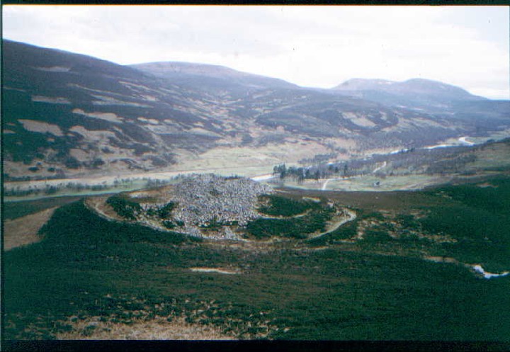
No journey up the Strath of Kildonan would be complete without inspecting the impressive remains of Kilphedir broch. Invisible from the roadside, the broch sits 90 metres up the hillside just east of the Allt Cille Pheadair (Kilphedir burn), and about four kilometres from Helmsdale. There is ample parking at the bridge over the burn, from where a rough land rover track leads uphill, soon revealing the broch as a huge pile of tumbled masonry perched on a knoll some 400 metres to the east. The broch is surrounded by outworks consisting of a deep ditch, an outer rampart wall over 3 metres wide, and an outer ditch, well illustrated by Greywether’s photograph.

The external wall face is completely hidden beneath tumbled masonry, the only feature remaining being the entrance passage on the northwest—almost five metres long—where three lintels remain in place. The interior on the other hand displays much of interest with walls four metres thick rising to eight courses around most of the structure’s circumference.

There is a doorway leading into an intra-mural passage where a stairway (no longer evident) was reported early in the 20th century.

You can learn much more about this broch by following this link to the Canmore website.

July 4, 2018

Dun Viden

Visited: June 28, 2018

Dun Viden lies in Strathnaver, some ten kilometres south of Bettyhill and just 250 metres to the east of the River Naver. It can be reached by driving to the end of the metalled road to Skelpick, then walking an excellent (though rough in places) estate road for a further 4 km. As the broch comes into view, you will be aware of a number of standing stones just west of the road, the only surviving evidence of a Neolithic Tomb. At this point, cut across the heather to the broch.

The broch sits atop a grassy, twenty metre tall, conical knoll which slopes steeply down on all sides except the east. The structure has been severely robbed, almost certainly to aid construction of the Settlement (a so-called ‘Clearance Village’) that still stands immediately adjacent to the southeast of its knoll.

Although badly ruined, Dun Viden still has a recognisable entrance passage to its southeast, but most of the walling and interior have been reduced to a field of amorphous rubble. There are, however, a few places where large foundation level stones along the external wall face can still be seen.

Dun Viden must have been a great look-out point in its day; and remains so.

July 2, 2018

North Sannox 2

This site has been clear-felled. Though I should stress the ground is NOT clear. It is an almost un-navigable wastleand of treestumps, holes, deep tyre-ruts and such-like. The cairns where I have been able to locate them, have ALL been respected by the plantation fellers. However the ground surrounding the cairn resembles The Somme in 1917. Here is the current state of North Sannox 2 which I was completely unable to locate last year despite the clear-felling. It was just too much of a wild jumble...

canmore.org.uk/collection/1665555

Canmore’s photo perfectly shows the same orientation in my first “forested” photo of the chamber back in July 2012 when it was deep in Spruce Plantation.

themodernantiquarian.com/img_fullsize/109247.jpg

July 1, 2018

Dun Creagach

Visited: June 26, 2018

June 2018 proved to be an exceptionally good time to visit Dun Creagach. Normally perched on a small island, and accessible only via a causeway of rough boulders, the drought had so lowered the waters of Loch Naver that I could actually walk completely round the broch on the dried-out loch bed without fear of getting a boot wet!.

Dun Creagach is huge and mighty impressive. Possibly because of its relatively remote location, stone-robbing does not seem to have been an issue here, as evidenced by the unusually large quantity of tumbled masonry that buries much of the broch’s outer walling: certainly there are no dykes or signs of former habitation—so often the prime reason for destructuring—anywhere nearby. Of course, over the centuries, Nature has taken her toll in the shape of vast heaps of tumbled stone, mainly outside the structure. Even so, the broch walls still tower to over three metres almost everywhere around its periphery, and everywhere, the outer face stands at least a metre above the surrounding tumble.

Despite the all-encompassing rubble, there is a lot to see in the interior of the broch. The largely blocked entrance passage with its massive inclined lintel, a large almost square doorway that leads into the intra-mural galleries, and several locations where gaps in the tumble suggest strongly a void within the walls. Indeed, Canmore states that Dun Creagach ”is certainly a true hollow-walled broch“.

Dun Creagach can most easily be accessed from Altnaharra, from a point just south of the village, walking up the road that heads to Klibreck Lodge. Just 50 metres south of this point, on the A836, is an enlarged passing place, where there is room to park several cars without compromising its use by road traffic.

The distance to the broch is almost exactly 4 km, the first 1.5 km on a metalled road as far as the Lodge. On reaching the Lodge, head right for a few meters then left round the building to a field gate and continue along a good dirt road that continues east. Two streams (marked ‘ford’ on the OS map) are actually now crossed by footbridges before the path peters out at the edge of a wooded plantation.

Now comes the tricky part: It is important to continue due east through woodland to a third stream. This is where I came unstuck, losing direction and heading away from Loch Naver. On reflection, I might have been better following the second stream to the shore, then continuing along the lochside to the broch.

In all, it took just an hour and a quarter to reach Dun Creagach, but underfoot conditions were particularly easy with the ground being parched: there were none of the usual bogs to negotiate.

This is a broch for the connaisseur, with much to see and enjoy. It takes more than the usual effort to make its acquaintance—a round trip on foot of some eight kilometres—but has so much to offer in return.

Assycombe Hill

I went the same way as Meic, his directions are spot on, I counted the number of crossroads, but didn’t really have to, it’s a long straight track, when it forks take the right track, stones are on the right, unmissable.
The walk was really rather nice, in the forest mostly out of the sun, we saw a couple of young deer. Always a bonus.
I’ve wanted to come here for a number of years now, it looks a real belter of a stoney site. But it really took me this one did, got under my skin, I wanted to stay.
Eric once more plonked himself down under a small tree at the top of the clearing, seemingly going to sleep, leaving me free reign to linger longer, to get to know the site. It’s not a site, it’s a beautiful woman, imagine going on a date with Charlize Theron, she’s very pretty, but she also likes prehistory, loves star trek, superheroes and she too has no sense of smell, I hope you get those analogies. I went to see a nice stone row but found much more.
At the top of the hill is a lovely little cairn circle with a faint cist at it’s center, then tall stones wibble and lean and off down the steep hill go two stone rows. Half way down is a long stoney bump across the row perpendicular to it. At the bottom of the row is a single terminal stone, there was probably two but hey what are you going to do. Have a look at the awesome hut circle just off to the side, that’s what, I wonder what it’s occupiers thought of the rows, is the house the same age or later, did they use the rows, did they build it, and got buried up the hill. Such a thought provoking place.
Back up at the top, Eric is still crashed out, so I join him for a while and lie down on the big flat stone next to the cairn, a big flat stone? did it once stand? is it a really over sized cist cover? I close my eyes and begin to drift.
Not to sleep but into memories, memories of stones of times past, trips out with my toddling children, they’d have followed me into a volcano if I’d have told them it’ll be cool, anything so long as we’re together. In the end perhaps that’s what keeps me going, trying to recapture those bucolic idyllic days, days with no worries, lying around on the grass and introducing my children to the world. Those memories come with me always, there not as good as real children laughter, or complicated questions with absurd sounding answers. Am I rambling? It’s Assycombe’s fault. A life with stones and a life with children, two things I’m most glad I’ve done.

Ringmoor Cairn Circle and Stone Row

I’ve been a good boy and waited eleven years for my next chance to say hello to Ringmoor, patience is a virtue they say, but having no money is a poor mans excuse for patience.
I’m not going to bother with the kerb circle, TMA doesn’t believe it’s ancient, so to ensure that I have the time to see everything I want, I am willing to sacrifice the maybe kerb circle, Burl seems to believe in it though. Perhaps I should have gave it a few minutes look.
Like Brisworthy this cairn circle was re-erected in 1909, presumably by Rev H.H Breton of Sheepstor. A good man I’m sure.
Eric has taken his leave and hidden amid the tall grass in the middle of the ring, to hide from the sun and my camera, and to rest his poor little feet. No rest for the wicked though, so off I go down the hill north following the stones of the row. An odd row it is too, sometimes a double row, sometimes single, stones this side and stones that side, I can only assume it’s pretty knackered. Like me, I couldn’t even make it to the last stone, I should have, but god I was tired.
Back up the hill to the stone circle, I choose a stone and sit leaning against it, “you can come out now if you want Eric”
“Nah, it’s cool in here”
Strange lad.
Anyway it is time once more to be moving on, there is one more thing I want to look for whilst were here, stupid map says it’s a cairn circle, maybe, we didn’t find it, it was a cist anyway, no wonder we couldn’t find it.

Brisworthy Stone Circle

The first time I came here it all felt a bit complicated to find, we even had to ask someone who was in their front garden for directions. But this time I threw caution to the wind, I drove all the way to the end of the road, by the farm, tucked the car as far out of the way as possible and walked off quietly down the footpath.
I wasn’t sure if we were going the right way, there’s no Brisworthy stone circle signs pointing the way, I was just following my nose, ha good one Chris.
The footpath leads out onto a rough pasture type field, in the far corner is a path, I doubt it is thee footpath though, either way, from there I could see some grey blobs shimmering in the midday midsummer sun, we made for them, and made them, they were some stones. Terrific.

Eric slumped against the tall oddly shaped stone that has been likened to a leaping Dolphin, whilst I go round inspecting the stones. A little over a century ago only three stones still stood, thank god it was restored, by a Reverand no less, H H Breton, thanks Rev.
Out of all the places we’re going today this is the only one I’ve been to before, as it happens, exactly 11 years ago to the day, I brought my 8yr old daughter last time after an aborted sunrise attempt at Downtor, but this time the weather can only be described as perfect, everything today has been perfect. To add to that perfection, Eric has agreed to go where ever I go, unlike daughter who last time didn’t want to go up the hill to the Ringmoor sites, I’ll be back one day I said. Eleven fricking years though. We leave Brisworthy for now and tread wearily up the hill.

Parknasilogue

Quick fieldnotes for Parknasilogue: This site is in danger of being lost forever. The land that it is on is being sold for housing development under the auspices of NAMA. The old thorn tree that used to stand guard over the chamber is gone and the site is inundated with brambles. See Fourwind’s shots here: megalithomania.com/show/site/16/parknasilog_kist.htm better than my own old ones on TMA. I couldn’t see into the impenetrable brambles to check if the tomb is still extant. In my opinion, this is to be added to a list of a few other endangered sites in the South Dublin/North Wicklow area, all under threat because of the mad dash for housing. Another example is at themodernantiquarian.com/site/1664/laughanstown.html where a new town is already under construction. Remember themodernantiquarian.com/site/1258/brittas.html

June 30, 2018

Auchoish

I’m sure Stephen Hawking – now of course occupying his rightful niche between Mr Newton and Mr Darwin in eternity (although why we have the remains of two exceptional atheists within Westminster Abbey is, er, rather puzzling) – would’ve been able to forward a convincing theory as to where the time goes... however it’s 17 years since I first ventured forth into the verdant Kilmartin Glen, a more-or-less megalithic illiterate seduced into undertaking the nightmare-inducing drive from Essex by the siren call of Mr Cope’s garishly coloured tome. A lot of water has flowed under both the allegorical bridge and that which connects my home island to the mainland in the interim; however one aspect of my life that has proved pretty constant is the compulsion to seek out new places associated with those pioneers responsible for laying the foundations of the – admittedly ‘wobbly’ – edifice we call civilisation.

So yes, while the great linear grouping of monuments gracing the glen will rightly take precedent for newcomers, the periphery exerts a far greater attraction for me nowadays. I mean, with time so limited why repeat oneself when there is so much more to discover? Such as the Auchoish chambered cairn where all but Greywethers fear to tread. It is therefore with a fair degree of irony that, following an overnighter beside the mighty Loch Awe, I note, upon perusing the map, that an approach to said chambered cairn will mean passing the tourist honeypot that constitutes the Achnabreck rock art panels. Hey, but while I’m here.... guess it would be pedantic, if not downright rude not to have a look. What can you do?

Furthermore it is doubly – nay, trebly – ironic that, despite consciously avoiding the goddam place for all these years, I duly find myself captivated by the beguiling, swirling, circular motifs and depressions carved into the naked rock. Touch, arguably that most sensual of senses, confirms the growing feeling that executing such designs must’ve been a very time consuming process indeed. And then some. A serious undertaking surely only justifiable by a correspondingly high accepted ‘worth’ of the finished ‘product’. Hell, this art must’ve really meant something. OK, no doubt the (almost) complete absence of other punters this overcast, drizzly morning lent a positive cadence to the silent symphony playing out within my head... but even so, isn’t it great to have such specific preconceptions proven so emphatically wrong in such an overwhelmingly affirmative manner? Yeah, I can handle that.

So.… moving on I pick up the forestry track heading east. Now stomping along such tracks – while not my favourite of pastimes – does have compensations, such as the clean scent of pine pervading the muggy, moist atmosphere; appealing enough in lieu of a fragrance of a more deciduous origin. Or Chanel No.5 in the nape of a woman’s neck. Sadly the compensations do not extend to a chat with Keith Flint... well, seeing as a notice informs the traveller this is also the ‘Twisted Fire Starter’ mountain bike trail. But there you are. To be fair the unusually coiffured gentleman did appear rather athletic performing within the video back in the day; but then again we are all inexorably advancing in years, are we not? And ‘Breathe’ was by far a better tune. The route duly swings abruptly south before veering north (thankfully conflagrations are not in evidence), passing an old quarry prior to crossing the Auchoish Burn where one should select the left hand fork.

Unfortunately things now get a bit complicated (I won’t say ‘interesting’ upon the assumption that disciples of Donatien Alphonse François tend not to favour seeking out Neolithic chambered cairns upon Scottish hillsides) the monument being located ‘somewhere’ upon the thickly afforested rise to the right. According to the 1:25K OS map matters should be straightforward enough; however the trees are so dense that an attempt to head straight to the tomb on a compass bearing is a non-starter. Consequently I head further along the track before making a very rough ascent to the highest ground in the locale and taking a bearing from there. This allows me to pick up the heavily overgrown run depicted upon the map and, knee deep in mud, systematically force my way through to the monument within its clearing. Brute force is not something to be admired. However sometimes needs must.

It is immediately apparent that all this effort is so, so worthwhile: the elongated ‘Clyde’ cairn is aligned on a SW/NE axis with the significant remains of a façade/forecourt to north-east... a number of the orthostats still standing before the hollow ghost of a chamber, albeit with traces of stone work also to be seen within the latter. For me, however, it is the relatively well preserved lateral chamber subsumed within the lower, south-western section of the substantial cairn that represents the structural pièce de résistance. Greywether reckons there could even be a rare ‘porthole’ stone in situ. Didn’t realise at the time, but in retrospect I’m not going to disagree with the suggestion since there are definitely two segments here with curiously shaped dividing stones.

However at a fundamental level the primary motivation to visit sites such as Auchoish is surely the response to the question ‘how does it make me feel to be here?’ Hence the discerning Citizen Cairn’d will surely wish to make the effort to come for the – in my opinion – truly exceptional vibe further enhanced by the site’s isolation from the general (relative) hubbub of the area. Yeah, unlike the arguably over manicured monuments within Kilmartin Glen itself the silence here is absolute, a serenity so total the atmosphere is electric. If you excuse the oxymoron.

Despite the drizzle-laden cloud sweeping, quite literally, through the treeline according optimum conditions for the midge – that wee awful woman aside – Scotland’s most appalling inhabitant, I stay for approx three hours before retracing my steps. A diversion to the enigmatic, moss-clad remains of Dun Na Maraig ensures I reach the car in no fit state to do anything but sleep. To be fair a man can ask for no further reward from a day pottering around in the damp forest: obscure chambered cairn, hill fort and.... well …. how does one begin to describe, to attempt to decipher the meaning inherent in those symbols? Then again, perhaps it is best that we never do so. That we simply allow them to inspire that symphony in the head?

June 24, 2018

Hart Tor

Greywether says there are two stone rows here, a double and a single row of stones, but the single stone row is called, at least on the TMA, Black Tor. Which is it?
This unexpected delight was my final site of the day, it wasn’t on my list of sites that I wanted to get to, but I’d decided to put Trowelsworthy warren stone circle back for another day, so I had a bit of time left over. What I want now is a place that’s not far from the road, the very road I’m travelling along homewards. Black Tor fits the bill, it’s got a Logan stone (Zip it Stan Lee) and a rock basin. I like both of them things so I leave Eric dozing in the car and, stagger? across the moor. I couldn’t find the rock basin and couldn’t decide which if any of the balanced rocks would move under my weight. Disappointed, I look down to the river valley, look again at the map and decide that I can see the stone row, So, just one more then.

The river is crossed via a metal plank, as I did so a pony was drinking from the small pool, stood on the plank watching the scene, I decided this was as good a Dartmoor scene with no stones in it as Iv’e seen, the water was so clear and clean looking, even the pony looked in very good health. Sharpitor and Leather tor provide the best of backdrops.
Fresh over the river a cairn hangs out, no stone row or cist that I could see. So straight over to where the double stone row bangs against the river then follow them up the hill. The now, almost compulsory drainage ditch cuts through it, keep going up, to where the stone rows joins forces with a particularly good cairn circle. Adjacent, almost conjoined, is another cairn, no circle stones, but it does have a single row of stones that reaches beyond the ditch.
Even if there were no megalithic site here it would still be a good place, rocky tors, ponies, clean and clear river, a gorgeous day, but there is a megalithic site here too, and my mind is blown, damn it I’ve got to go home.

Sharpitor

If your stopping to have a look at the stone row that is right next to the muddy pool, then be advised, it is very ruinous, but there are two more stone rows very close by and they are both in better condition than the one you stopped for.
Views abound.

Sharpitor cairns

Apparently not associated with the very nearby very ruinous stone row, but is in line with it.
I only stopped for a quick look on my way home in the late of afternoon, but was glad I did, the stone row may be a bad one but the cist is 75% perfect, the stone circle of the cairn maybe 20% perfect, the view 90% perfect. It had been a long and expensive day but the percentages don’t lie, there’s always more to see on Dartmoor.

June 23, 2018

Girdle Stanes & Loupin Stanes

We took this trip because Littlestone wanted to take some books down to the Samye Linge Tibetan Monastery. I checked for what was in the area as far stone circles were concerned and came up with the Girdle/Loupin stone circles. We stayed at Marilyn’s Motel in Eskdalemuir which consisted of two wooden buildings decorated in Tibetan style and very comfortable, though we were slightly squashed in the smaller building. Samye Ling was a mile and a half down the road, and a place to visit just for the joyous (and slightly over decorated temple) and also a vision of ‘wedding cake’ stupas.

The landscape of hills, valleys and rivers is marred to a certain degree by industrialised forestry and yet the beauty of it all is captured as one drives along the lanes round here. The stone circles are easy enough to get to (and only about a mile from Marilyn’s) that is if you do not have a weak ankle! But glorious when you do get to them. Situated close to the White Esk river which burbles quietly over a shallow bed. This river in fact took the other half of the Girdle Stanes as it moved over the landscape through the centuries.

The story is that perhaps half the Girdle Stanes were taken by the river after which the Loupin Stanes were erected, there is supposedly a stone row joining the two circles, rather uneven, but it could also be interpreted as station stones along the way.

We are going back to this area, the Girdle stone circle is very serene.

As a matter of interest there is a prehistoric trail to take; three Iron Age forts to climb, and of course the circles and a settlement. Castle O’er looks good.

langholmwalks.co.uk/pht/sitelist.html

A Victorian interpretation!
archive.org/stream/langholmasitwashhysl#page/n37/mode/2up

Buttern Hill Chambered Cairn.

We approached the burial chamber from Buttern hill stone circle, where by you just go straight up and over the hill. But no matter what direction you come from just look for the large walled enclosure on the east side of Buttern hill, walk round it til you find the chamber on the east side of the enclosure, at it’s south east corner.
This site isn’t going to set your megalithic world on fire, it is a fairly luke warm place. But there aren’t many chambered cairns on Dartmoor, no wait, actually there’s probably loads, but they’re not what Dartmoor does most of, so we decided to go back to the car this way.

Right at the corner of the walled enclosure there are some big stones that look like they could well have been part of some now toppled monument, I thought they were what I was looking for but they didn’t look anything like the pictures on here and on the Portal. So I kept on looking, one place immediately took my eye, bracken growing out of some stones, they must surely be it. They are.

It’s pretty ruined, the chamber is recognisable, and because you can see the chamber all the other parts fall into place, passage stones, portal stones one up one down. The view east is quite extensive, but crosses only over farmland.
Hunger had made itself known to me some time ago, every footfall now wobbled pains around my stomach. We quit the hill, and made a bee line for the road, retrieving the car at quarter to nine, a little over four hours had passed. Cosdon stone row, stone circles White moor and Buttern hill and here, all seen.

Buttern Hill Stone Circle

Eric and I approached Buttern hill stone circle from White moor stone circle, two kilometers to the north west. There was no path, except those made by sheep, and who knows what governs their movements. So we were guessing really, I have a map and compass, but they only play a secondary role to guesswork. From White Moor standing stone strike out for the south edge of Kennon hill, stopping momentarily at the old settlement marked on the 1;25,000 map. Then keep going in a south east direction heading for Buttern hill, at the lowest point between hills Kennon and Buttern, turn south, the stones will appear, have faith, they are there.

Most of the stones here are having a lie down, Eric is easily lead, so he took their advice and lay down on the longest stone. I tried to photograph the stones as best as I could without letting the lazy boy into them, but in the end i followed suit and lay down on the second longest recumbent. The sun, by now, had dried out the grass and stones, we got pretty comfy, apart from the internal ever present scream of damaged ear drums, the only sound came from an over achieving Skylark, seemingly screaming his shrill melody right at us.
Opening my eyes, I was gratified to see that we hadn’t gone mad and poetry still doesn’t move me, so I suggested we could possibly get a move on to the last site on this particular walk. After he’d vacated the longest stone, I took some more photos, and off we went.

White Moor Stone Circle

It’s a fair old walk of two and a half kilometers from Cosdon hill stone rows to White Moor stone circle, following the well obvious footpath we stayed clear of Raybarrow pool, indeed why would you even try to go through it, you’d have to be mad to stray from the path, I’m always straying, but when the path goes straight to where your going?
After much wet feet based japery, the stones finally come into view, my heart missed a beat, and I got that giddy Brodgar feeling, it’s been so long coming, has this stone circle, and such a long walk, even my goosebumps had goosebumps. Eric, as ever took it in his coolest of strides, he asked which way were going next, sat, and waited for me to drink my fill of White moor, he knows the score.

I’ve been on lots of moors, hillsides and commons, fields and heaths, and, do you know, none of them have been white, not a one, and this place is also decidedly not white, it’s most definitely green, bright, shiny, wet and very green, almost, you might say, as green as grass, why isn’t this place called Green Moor? That’s what I’d have called it, is there even a green moor anywhere? Bet not.

Even my feet are wet now, and I’m beginning to join Eric in his fantasies about Thanos clicking his fingers and getting rid of wet feet the universe over, but wet feet are still another small price to pay to be here, now.
I walk around the stones, there’s no need to touch them, they’re hard and wet, I know. There’s two things I do at an ancient site, photography and sitting, it’s still quite wet, so sitting is out. Walking round and round, clicking the little back box at it all, and yes a slight caress of the tallest stone, a pretty and thin slab, and telling Eric yes I’ll be done shortly, he’s over by the outlier now and I can tell how tall it is, it’s maybe twice as tall as any of the circle stones, I walk over to it, little knowing that I was walking away from the circle of my dreams.

The outlier has been graffitised, by someone with the initials DC and TP and just T, later that morning I see that DC also went to the long stone on Shovel down, a repeat offender. The outlier is almost pointing us in the direction of Buttern hill stone circle. I tell Eric that we’re now on our way back to the car, just one stone circle and chambered cairn on the way. He leads me away, with only time for a quick wistful look over my shoulder, I whisper bye stones to the stones of White moor, still a stupid name though.

Cosdon Hill

I had no clear idea where to catch this years summer solstice sunrise from, only that we were going for a big one on Dartmoor, it might be Down Tor, it might be White Moor, it might be Brisworthy, it all depends on timing, the longer it takes to get here, the less time we have to get across Dartmoor. I like leaving things til the last minute, I really don’t, but I do, and today was no exception, running out of time we head for the nearest name on today’s list, Cosdon hill.

I was trying to come from the nine stones area south of South Zeal, but missed it and went up a small lane that terminates at a ford by a bridleway entrance. Not an ideal parking place, but there was just enough room for a horse to get by, should there be one out and about in the lanes of Dartmoor at half four in the morning. Eric and me accessed the hillside further south than I knew, so it took us longer to find the stones, just as I was beginning to wonder where on earth they were, the sun came. We stopped and photographed the absolutely perfect sunrise (two in a row now) scrutinised the map and local topography, made a decision on where to find them and went that way. I was fair gobsmacked when I saw the stones and shouted stones ahoy, pointing them out to Eric, who let out a gasped hooray, he stayed awake with me all the way here, and was in trainers that aren’t waterproof, tired and wet feet isn’t the best way to start one of the longest megalithic walks on the list.

The most beautiful kind of sunlight ever created bathed the triple row of stones and indeed everything as far as the eye could see, which was far. The dew on the grass took in that sunlight turned it into a trillion little rainbows and reflected it all into my eyes. Sometimes it’s clear to me why we do this, no sleep, a five hour drive and a long walk up an uncooperative hill, a very small price to pay to see something like this.
None of the stones are very tall, waist height at the most, but there’s so many, and so much going on in such a small place. The cairn, has two cists, and maybe five circle stones on it’s circumference, going down hill, the three terminal stones separate the cairn from the rows of stones, then the rows wander uncoordinated down hill, like a drunken army squad. Then there’s a drainage ditch, but the stones carry on, but more sporadic, then they just kind of fade out into the hillside. I walk back up to the cairn where Eric is sitting out of the wind, and sit for a while next to him, he grudgingly admits that the stones are quite impressive and the sunrise a good one. You can’t ask much more than that from a sixteen year old.

June 18, 2018

Klecken

South of the village Klecken close to the K12 lies this impressive 48x6m restored hunebed. According to the information board it is the best preserved archaeological monument in the district of Harburg. As with many tombs in Germany, many stones were removed to use them as building material. 1892 the hunebed was restored by the forestry official Schneemann, who filled some of the gaps and had some of the fallen stones erected. Today we can see 76 kerbstones and in the northern end the burial chamber. The guardian stones set up at the corners are not original.

Access and parking is quite easy, there is a parking space on the opposite of the street.

Visited June 2018

June 17, 2018

Rossie Law

08/06/2018 – On route from the Isle of Bute to Aberdeen we decided to stop by and visit Rossie Law hillfort near Perth. I’d looked at the this one on the map many times and had been wanting to visit.

Parking at the start of the track to Tarnavie on the B8062, we started the walk uphill on a decent track. We both felt like zombies. This was on the way back from a fortnight of walking and we were so tired.

After a mile or so the track turns south. We left it here and crossed the Banekist burn to walk up the Slack, which is on the south side of Rossie Law. Gets a little tricky here as the south of the hill is scree. We approached this through the trees and then headed west round it to make the steep final climb to the top. Not too bad and quite fun.

The summit area is large and pretty flat. The surrounding wall quite far down off the top.

It’s a good fort this one and the views are great. After resting a while we headed back to the car.

It had been a long 14 days away and I knew I was done.

Carnbaan

07/06/2018 – Last full day on Bute and we had a tricky decision to make. Where to go? It was a choice between heading north to visit 4 chambered cairns on the coast or heading to Scalpsie Bay and have a walk over a few tops with 1 chambered cairn. Both looked good but we went for Scalpsie Bay, just for the walk really.

Early afternoon found us back at the car and in need of a coffee shop. The one at Ettrick Bay was so fine we decided to go again. Parking at the south end of the bay we walked along the lovely beach to get there. It’s a great area for a stroll or paddle in the sea.

Refreshed I looked at the time, it was just past 3. Still thinking about the cairns to the north we started walking the coast road towards them. To visit all four cairns would have been about 8 miles and than another 1 to get back to the car. I was tired already from the morning visit to Bicker’s Houses cairn so I thought the walk to see any was too far. An hour later we were closing in on the first cairn. Bit stupid really as my feet were killing. I did like Glecknabae cairn though.

The next cairn wasn’t far so on we went again. Up hill now, it’s well signposted. The approach to the Carnbaan cairn is lovely through a wood. The sunlight through the leaves and branches was so nice.

When first getting to the site the size of it didn’t immediately become apparent. Probably like most visitors my attention went straight to the central chamber, it’s great. It’s only after you start walking about does the size and length of this long cairn reveal itself. It’s massive with chambers at both ends as well. The setting in the trees is lovely but the undergrowth hid things a little. Tricky place to photograph too.

The cairn is positioned close to a stream where just on the banks is a massive stone. I wondered if this was once part of the cairn just a short distance away.

It was getting late now and the car was a long way back. The last two cairns would have to wait for another trip. Always good to have a reason to come back. My feet moaned most of the way back. A long day out and I was sore by the end but well worth it. Tops cairns round here.

June 16, 2018

Bicker’s Houses

07/06/2018 – Starting from the viewpiont for Scalpsie Bay, we followed in the footsteps of Greywether (hard not to in the highlands and islands) and headed north to find Bicker’s Houses chambered cairn.

The path(!) to Bicker’s Houses is waymarked from the car park. I lay the challenge down right now. If you ever come here and can actually find and follow the waymarked path all the way to Bicker’s Houses, you win the pathfinder of the year award. Don’t know whether it was just because we were sleepy, it had been a long couple of weeks away (excuses, I know) but there just wasn’t one. We decided we were using up more energy looking for it than just bashing in a straightish line to the cairn through the bracken and grass. Luckily for us the ground was very dry from the good run of weather we’d been having.

It’s not a bad walk really and we did eventually get to the site of the cairn. Maybe not the best time of year as the bracken was starting to get high. Only the big stones were showing above it.

Got to admit, I liked this one. Maybe more for the setting and the walk but the stones that we could see were good as well.

We looped back via Barmore Hill and Quien Hill. A nice area for a potter, a little off the beaten (nonexistent) path.