|
|

|
Latest Posts — Weblog |
FINSTOWN TO GRIMESTON April 6th 2013 |
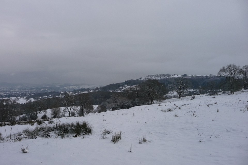
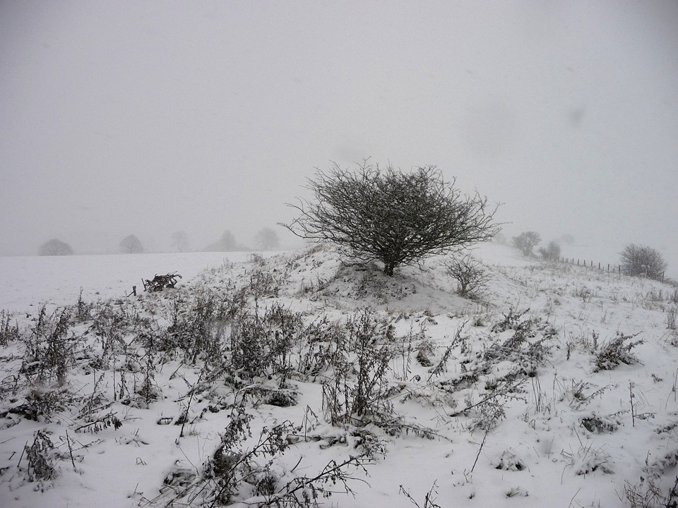
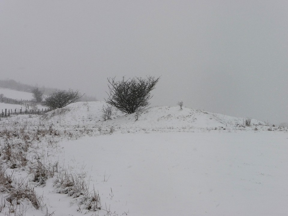
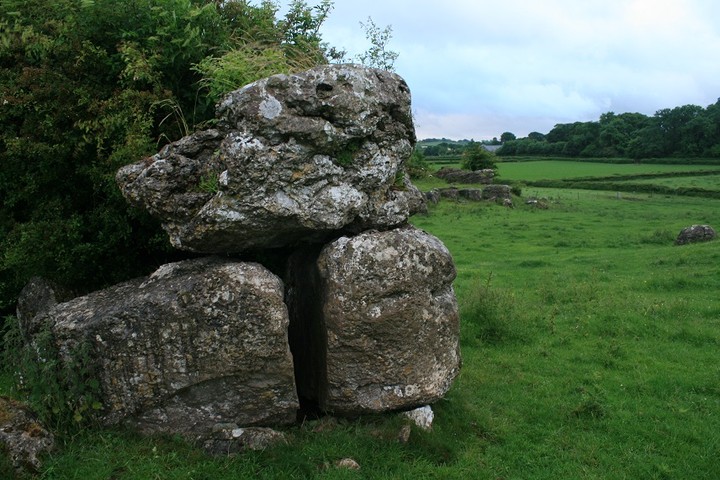
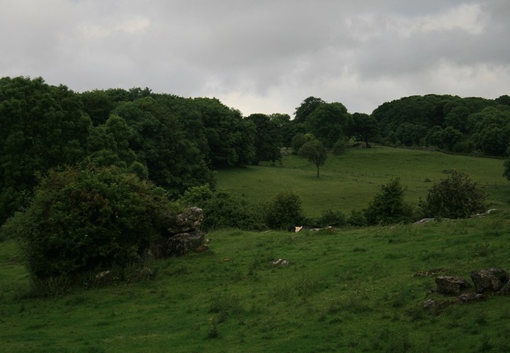
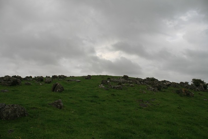
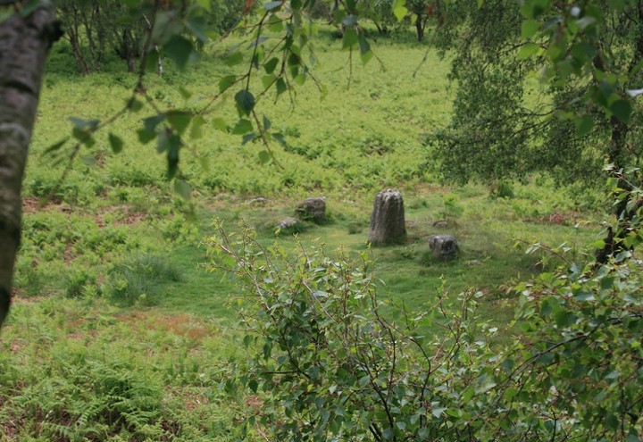
FINSTOWN TO GRIMESTON April 6th 2013Took the track down to the start of Binscarth. From outside the wood shining fair with only a few shadowed limbs to make shapes within the mass effect. Though it stayed daybright inside I simply followed the farmtrack winding at the upper edge of the plantation, the uneven track bordered by a ribbon of low grass and the downhill side contained by a border of thin withies. The Loch of Wasdale being the lowest I have ever seen it invited me down to the islet again. The causeway looks simply a compact line of stepping stones. Indeed the larger stone blocks are most noticeable on the shore at the landward side, even given that we can't see down to the loch bottom even here, the opposite of what you'd expect. Or perhaps the precarious nature of the way over misleads me, all those wobbles. At one point the jump takes you onto the edge of an upturned slab rather than a horizontal surface. Despite my damaged ligaments I made it over safely apart from dipping my startled foot accidentally into the loch. Of course on the way back I twisted my foot on some nothing whilst still safely on land ! My self-appointed task this time was to go to the back and take photos of this side. Standing as far out as I could and camera at its widest angle had to deal with the effect of scratches on my lens flaring. A wall section at the back of the mound is the best evidence for this having been an Iron Age structure, other places this end it is difficult to plump for either wall collapse or re-use as being the cause for features. There appears to be a perimeter going around the northern side but it seems a little straight on the ground. Seagulls apear to be nesting on the occasional islet at the loch's northern end, which archaeologists have now plumped for being purely natural (so where is the burial place that should go with the southern islet's kirk ?). On reaching the Harray Road I continued up to the Stoneyhill Road and turned onto Staney Hill. At the next junction I turned left and then left again, taking me up the other side of the field with the standing stone. A pair of skylarks kept landing in a field by me, and thought I did manage a couple of shots the out-of-focus barbed wire messed up the photo opp'. Still at least I have them on the ground to my own satisfaction. In the field to my right Henge now has the NMRS record no. HY31NW 114 with a grid reference of HY32201565. Which places it much closer to the highest point of Grimeston district than I had realised. The summit is at HY323157 and I had my eye on a very small tump there as prominent. Luck being with me by now the gate just before the first house this side lay open, and I seized the chance for a closer view. What I see is a lot more than is visible than I'd seen from the road before. Which simply affirms that before dismissing a site it is necessary to have been on it, not simply viewed from a distance, however small that distance may be. Rather than a pimple I found a slight but broad rise with noticeable topography. Ah, but from the ground I could not get enough height to take photos of what I found, my images only showed lowly bumps with a few small stones exposed even though there is enough stuff to show darkly on the aerial photo accompanying the Henge record on CANMORE. Certainly there are several types of site around here ; for instance there's Henge, the summit [I believe], Staney Hill Standing Stone (HY31NW 10 at HY31951567), then at no great distance on the eastern side of the Stoneyhill Road are 'Feolquoy' barrow (HY31NW 20 at HY31761571), a chambered long cairn (HY31NW 51 at HY3164158) and HY31NW 106 at HY318157 consisting of several stones some think either were part of a stone circle or intended to be one. Plus there is something going on with that brood sweep of large stones trailing eastwards from close by the long cairn. Stopping short of Newark I reversed direction back onto the Germiston Road. On my right a lesser road attracts my attention. The nearest building has one of those peedie bell-towers (I think that's the right term) at the far end of the roof. And before becoming a house this started off life as the Kenwood Congregational Church. An impressive tall drystane wall runs beside the road, and because the kirk sits in one corner rather than centrally it might well pre-date that. On my photos I see that the far end of the wall is in actuality a seperate segment. The corner is curved, so I wonder if this is earlier yet. All of which is pure conjecture as I continued down into Lankskaill. There are several steading buildings at Fursbreck but also the Germiston threshing mill. The mill is by the burn on the right, identifiable by a square green door on one end. Though I took pictures of several of the buildings I didn't know what I was seeing or I would have made a point of photographing the wheellpit at the side of the mill. You have to be careful using a camera near houses if you are a solitaire, so my directions were limited. Down at Vola I turned left again ansd struck out for the south leg of the Germiston Road. There are some lovely views to be had here. There are several interesting bumps at Hindatown, so it is unsurprising there are several mounds and tumuli in the vicinity of Nistaben and West Nistaben. Coming back up towards the main road I saw a long ruin to the north, which must be Stoneywoo. There were two buildings, one with its remaining end towards me and the other across my line of sight with both ends still standing. One of those ends comes with a circular structure which is most likely a corn kiln. Or that whole building was a kiln-barn. From the junction with the Harray Road the hills of Binscarth follow you down to the main road with a long line of trees even before the wood itself is reached, as if the whole hillside were wooded. Must have been a verly low tide as coming into Finstown the Ouse held my eyes, the sides of the tidal inlet very exposed. |
28th July 2013ce |
Over the misty mountains II – Foggy, boggy Berwyns 20 February 2011 |
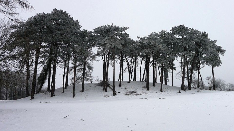
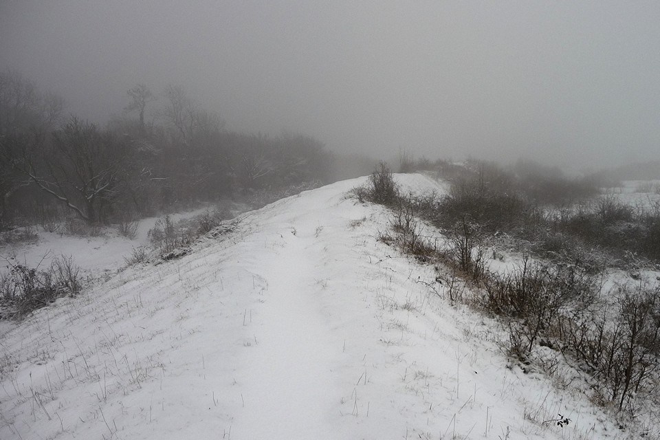
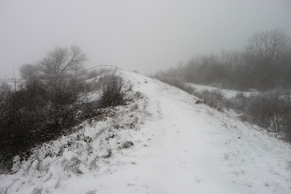
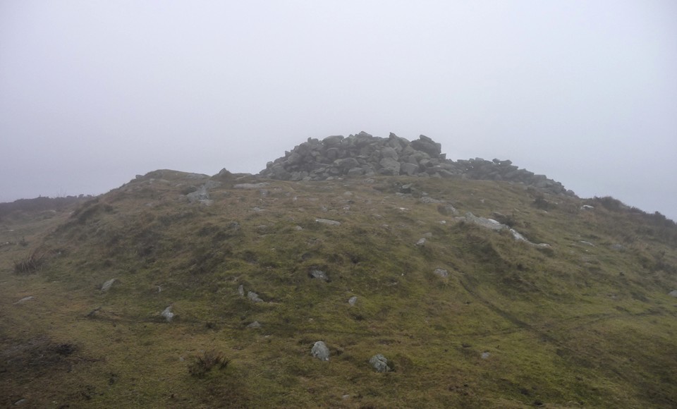
Over the misty mountains II – Foggy, boggy Berwyns 20 February 2011It’s day two of our Llangollen long weekend. Yesterday we undertook the important business that brought us here, completing the easy Offa’s Dyke Path section from Llangollen to Chirk Castle Mill without mishap, crossing “that old snake they call the Dee” in good order. After that largely flat route, today is a day reserved for the hills. Weather-dependent, I had a couple of options in mind, including a first-time trip into the Berwyns or a walk up Llantysilio Mountain to Moel y Gaer and Moel y Gamelin. The worse-weather option is to pay a visit to the ring cairn of Moel Ty Uchaf. Sadly the morning opens similarly to yesterday, thick mist rising above the Dee valley. At least Castell Dinas Bran is (just) visible today, so that’s an improvement, but not really the day for the conical Llantysilio. So the plan that takes shape involves getting to Moel Ty Uchaf and then see how things are. Moel ty Uchaf — Fieldnotes28.07.13ceWe take the bus towards Llandrillo, passing the visible remains of the Tan-y-Coed chambered tomb. The driver very obligingly drops us off at Pont yr Hendwr (“Bridge of the Old Water”), from which a minor road takes us southeast, climbing steadily at first, then with increasing steepness up into the Berwyn foothills. By the time we reach the end of the road to join a rather muddier bridleway, we are both out of breath and overheating under our waterproof coats, while the mist has thickened into a fog that reduces visibility to a hundred yards or so. We hear rather than see some voices ahead, presumably other walkers heading off to the main Berwyns ridge, their voices brought nearer by the weird sonic effects of the fog. The final approach to the ring cairn is up a steep, grassy slope. The circle doesn’t come into view until we are almost at the top – luckily the fog is thin enough to at least show us where to go. The local sheep look on, bemused by the stupid humans coming into their midst in these conditions. Sadly, the far-reaching views from the ring cairn are entirely absent, but we do at least get plenty of solitude to enjoy the stones themselves. The name, pronounced “Moil Tee Ickavv”, translates as “house on the highest bare hill”, which certainly seems apt today, when the undoubtedly higher hills normally visible in just about every direction are blanked out. A rounded boulder lies a little way to the west, described by Burl as an outlier of the circle. The circle itself is made up of chunky stones, some round shouldered, others squared, not graded but nevertheless very aesthetically pleasing. There is a “gap” at the SSW, although the ring continues across it by use of seven or eight much smaller stones. Inside the ring are the remains of a cist or central cairn, on the largest stone of which someone has scratched a crude pentagram. Other than that, the place is devoid of signs of human intrusion, no litter or offerings (tat), just the stones on their grassy hilltop. Perfect. The fog makes for a strangely intimate visit, not exactly claustrophobic, but there is a sense that the world may not extend much beyond our immediate surroundings. I’m reminded of the Doctor Who story “Warrior’s Gate”, where the TARDIS becomes trapped in a slowly-shrinking, featureless void between universes. A wonderful site this, but a return on a clear day is now assured. We make our own escape from the void by dropping off the hilltop to the southwest, to investigate the two cairns shown on the map, somewhat unusually placed in the saddle between Moel Ty Uchaf and the rising ground to the east. The two cairns differ greatly in construction, the northeastern being a wide, low platform, kerbed liberally with small blocks of local quartz that stands out brightly against the turf covering much of the contruction. The southwestern cairn is much smaller, covered in several flat slabs of stone and overgrown with reeds. The stones of the circle standing proud on the hill above are visible from the cairns, an obvious relationship between them all. Moel ty Uchaf — Images21.02.11ce
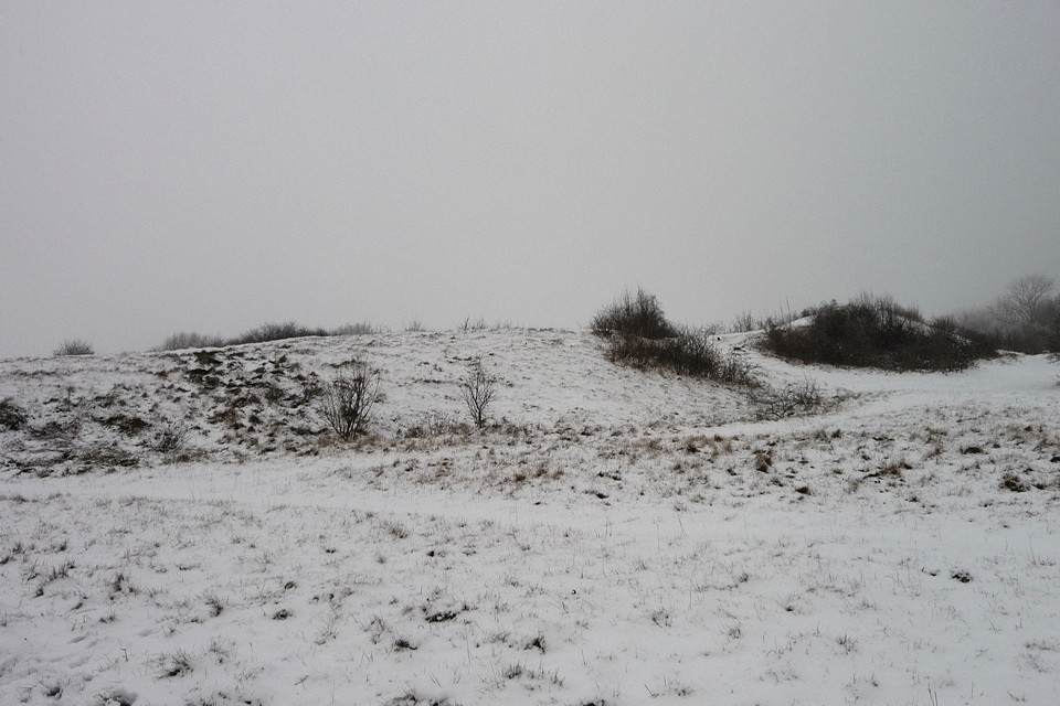
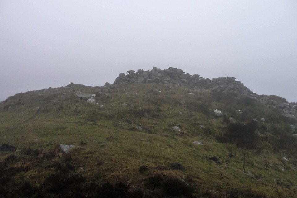
It’s late morning by now and the fog is showing no signs of lifting. I’m torn between a desire to climb at least one mountain and the more sensible option of heading off the hills, perhaps taking in a visit to Tyfos ring cairn. According to my little Nuttalls book, there is a one summit, the faintly ridiculously-named Pen Bwlch Llandrillo (north top), within reasonably easy reach of where we are. I suggest this to G/F as an objective and receive no objections, so we leave the cairns and join the stony track heading eastwards and upwards towards Pont Rydd-yr-hydd, an old stone bridge crossing the Nant Cyllyll that tumbles and splashes over broken rocks from the slopes above. Shortly after this we meet a group of trail riders out on their bikes, the first and last people we will encounter today. Below Pen Bwlch Llandrillo (north top) is a memorial to “A Wayfarer, a lover of Wales”. We stop here for a snack before leaving the comfort of the track for a rougher path along the fence, heading north to the summit above us. The fog is thickening and progress is slow, but at length we reach the highest point we can find, a small pile of stones on top of an outcrop, at 621m OD. Not the most impressive for my first North Walian summit and G/F’s first Welsh mountain! Sadly there are still no views, so little to recommend this today. Not even a prehistoric summit cairn to cheer us. From here we have to decide on a route onward, either to go back to the track and homewards or continue on to the most northerly of the Berwyns’ summits, Moel Fferna. With hindsight, the decision made here was the wrong one, but hey, that’s the problem with hindsight! We decide to go on, rather more my choice than G/F’s, it has to be said. Moel Fferna — Fieldnotes28.07.13ceOn the map, the route looks straightforward, with little in the way of ascent or descent over the three miles or so between Pen Bwlch Llandrillo (north top) and Moel Fferna. The Nuttalls helpfully inform us “a path has developed beside the fence which runs the whole way, making walking and route-finding quite straightforward”. Sounds fine, even on such a fog-bound day as today. What neither map nor guidebook tell us is just how miserable a slog the next three miles will turn out to be. For a start, on heading northeast we have found ourselves more exposed to a wind now blowing in keenly from our front-right. The wind carries with it a stinging rain, quickly lowering our temperature and splattering my glasses to render the already limited visibility almost non-existent. Secondly, the “path” that “has developed” is barely anything more than a boggy rut cutting through heather and mud. The surface is anything but level, every few steps requiring a detour around a crumbling peat hag or muddy pool. The heather drags at our shins, making each lift of the leg a trial. With no visibility, it becomes near-impossible to gauge how far we’ve come and how far we still have to go. Instead, we concentrate all our efforts into placing our feet and forcing ourselves on into the soaking, freezing wind. Although there is little real up-and-down, each minor rise becomes an impediment of cliff-like proportions. By the time we reach Cerrig Coediog, we’ve pretty much had enough, but we’re so close that it would be a waste of our efforts so far to turn back. We plod on down to the bwlch, from where one last climb to the summit awaits us. At first a broad, muddy path heads away north, but soon reaches an area of waterlogged, impassable bog. The only option is to divert around to the west, but this involves leaving the path to force a way through the tough heather that characterises these Berwyns slopes. Progress is very, very difficult. G/F’s leg is playing up at the constant lifting needed to negotiate the vegetation. Despite waterproof boots, her feet are now quite wet (mine aren’t much better) and there is little in the way of enjoyment to be had from any of this. Eventually we hit a narrow path running laterally across our route, we still can’t see the summit so it’s difficult to know how far we have left to go. We take this and soon meet up with the main path again, still making its way north and upwards. The final straw looms out of the mist in the shape of a stile. You know those stiles that you sometimes find on uphill routes where even getting your leg onto the lowest board is a struggle? One of those. I have been with my G/F for a long time, but never have I seen such an expression of “I’m going to kill you” as I do when she sees this stile. Any comment I could make along the lines of “nearly there” is unlikely to help now. But we climb the stile and plod on, across yet more featureless bog. At last, a shape looms out of the mist ahead of us. The unmistakable shape of a sizeable summit cairn. We’ve made it! It’s taken us 1 hour and 50 minutes since leaving Pen Bwlch Llandrillo (north top) but it feels like several weeks have passed. Much as I dislike the idea of a Bronze Age summit cairn being turned into a shelter, we have little choice but to embrace its waiting charms. The only solution now is hot tea, and quickly. Perhaps it’s because we’re British, but the restorative power of hot tea, even the metallic variety from a cheap flask, should not be underestimated. Out of the wind and rain, we start to feel like we may survive the walk back to the bus. Suitably envigorated, I also take some time to have a look at the cairn that we’ve come so far to see. It’s a big bugger, despite its mistreatment over the years. Slumped on one side, there is still a substantial amount of material here. Just a shame that the undoubtedly superb views are absent today. Some snow still clings to the base of the cairn, a reminder that it’s only February and we’re above 2,000 ft here. Moel Fferna — Images21.02.11ce
We take our leave once we’re feeling warmer and re-energised. We head back the way we had come, but somehow manage to find a slightly easier route back to the bwlch without resorting to quite the heathery nightmare of the way up. We elect to take the easiest route we can back to Cynwyd, following a relatively easy footpath heading WNW. A few days earlier I had discovered the Nant Croes-Y-Wernen stone circle on Coflein, but although it’s only a few hundred yards away, it might as well be a thousand miles now. One for Postie to be the first to get to! The way through Cynwyd Forest is easy, losing height rapidly along firm forestry tracks. At length and with much relief we reach the village, where we have a cold and tired 40 minute wait for the next bus back to Llangollen. Our introduction to the mountains of North Wales has hardly been auspicious, but what doesn’t kill you only makes you stronger, so they say. To misquote a certain northern singer, we can laugh about it now, but at the time it was terrible. Here’s to the foggy, boggy Berwyns. |
 Posted by thesweetcheat
28th July 2013ce |


HARRAY JUNCTION - WINKSETTER - BINSCARTH July 6th 2013 |
HARRAY JUNCTION - WINKSETTER - BINSCARTH July 6th 2013To save a little time, and perform last August's journey with several reversals, I took the bus to the Harray Road junction. Today's walk I undertook in order to confirm my memory of a couple of things I saw walking the farmroad to Winksetter back then as well as place them more firmly on my map [good job because I had confused two completely different ruins !]. The bog cotton has put on a magnificent display this year. Starting at the Harray junction I could have happily spent several hours simply photographing all the clumps and swathes whitening the countryside with their glossy heads. And then there were the other blooms. Throughout my travel I saw several different species in combinations such that I could go on to take pics of several 'pairings' at each place after snapping the initial grouping. The first patch lay on the verge ; orchids, daisies, trefoil, kidney vetch and buttercups. Ragged Robin pierced the bog cotton with its pink ribbons sometimes. The WWII structures came further up the Harray Road than I thought, having remembered them as much nearer the stuff by the junction whereas actually they are near the southern end of the Grimeston Road, opposite Duntroon. They're still standing several courses high. There is still no record for them, but knowing their whereabouts I can read their locations from CANMAP as being at HY33741431 and 33801439, by the north side of the track show running around the southern end of the loch and up to the farmtrack. At the crossroads with the Stoneyhill Road instead of going straight over the Howe road to Winksetter I reversed last August journey by continuing up the Harray Road then turning right onto the Lyde road and thence down the Manse Road to reach Howe and Geroin. Where this straightens out looking to the east I could clearly see what had been a fairly broad farmtrack running through a roadside field alongside the northern fieldwall. It presents like an old farmroad but comes to a halt where it meets other fields at a tear-shaped enclosure. On the map it points meannglessly north of Trattlaquoy, but then I remember the mound I found where the Trattlaquoy road meets the Lyde Road, and that seems a likely fit for a terminus whatever it used to be. From modern Nettletar about half to two-thirds of the way to the Geroin farmtrack if you look NW of road to about halfway between that and Burn of Nettleton there is a cist site, HY31NW 109 at HY3283017460, which contained a crouched inhumation with a calibrated date of 3030~2620. Continuing this line quickly brings you to another cist site, HY31NW 102 at HY32881751, on the southern side of a hillock - one can imagine that this grassy knoll once extended as far as the first cist. The 2004 excavation found the second cist to be made up of four interconnected side slabs with horizontal base slabs at the centre. This dates later, to the Bronze Age (calibrated dates of 1880~1690 and 1740~1530). On the central floor they found copper-alloy, burnt bone and pottery. Where the road bends again a short track leads to Geroin Cottage - in "Harray - Orkney's Inland Parish" the Germiston tunship map places the Fa'an Stane O'How's position prior to break up and removal at the point of the field below the cottage i.e. HY33151705. A track by the western fieldwall goes to the point (and there is/was a nearby well/wellspring, which may be a connection with the stone). I had hoped to find another candidate for the mound Howe had been named for but coming from this direction there are so many possible mounds either side of the road and nothing to the undulating landscape that looks other than natural. Some rain came to try dampen my spirits. I had opted to take a packamac (rather than my nowadays uncloseable lightest jacket). Which kept the water out only to hold the heat in ! At least full blazing sun never came out this day. Still tempting to cut my walk short at the next junction. However I can be unbelievably stubborn and needed to place things accurately so I didn't make a major boo-boo in the blog. When the showers finally left I then 'hit' clouds of midges, my flailing hands mostly to no account. Became even worse when I turned right at the junction, not stopping until almost at the farm. In a field south of the road are the remains of a large quarry. On the opposite side of the farmtrack a field at HY338167 is associated with the names Howinawheel and Howinalinda in the Harray book. The first element appears to denote a larger mound like the sixty-footer Howana Gruna. Wheel could refer to resting e.g. the pausing of a funeral cortege or a herders rest. Howinalidna, Heuon a Lidna in the 1790's, means 'mound in the slope'. Which is a pity as I can see at least three suspect bumps in the field, no hill-slope in my sight. This hasn't always been a rectilinear field - in the earlier maps a very roughly circular piece of land is shown instead. Could it be that rather than being the name of a mound Howina-wheel refers to a circular enclosure containing Howinalidna ? For some reason my memory had placed my putative unrecorded Winksetter mound where the quarry is, rather than at HY343167 behind Winksetter. This is oh so not a quarry, there are oodles of these depicted on the maps elsewhere and none of them anywhere near - all I could find nearby having been a small triangular body of water. This is a very busy area archaeologically, one of dozens on Orkney Mainland. From the modern buildings look south to the earlier Winksetter and then some 200 yards to the east of that Howan mound (HY31NW 17 at HY34211652) sits at ~250' OD close to the W end of a prominent ridge. The barrow's grass covers an earthen mound mixed with small stones. Before parts were removed (at the end of the 19thC or start of the 20th) this tumulus was much bigger than its present 39'D and 2.5-3' height. 250-300 yards SW of the farmhouse used to be a very large burnt mound, HY31NW 21, with a bit of a hollow on one side. It sat in a field corner with a dyke running across it and in tight association with a well at its SW side. Of course burnt materials do not only a burnt mound make, pity we don't know what they were. Roughly 500 yards east of Winksetter two mounds 12~15' are reported close together on the hill (and that is all that is known of them). Yet further away there might be settlement remains, HY31NW 19, on a piece of marshy ground periodically damp enough to be called the Loch of Shunan [not to be confused with The Shunan, a full-time loch further north]. The original report is that the scant remains of a stone structure at the foot of a hill were spread over a large area, with flint arrowheads and tools found on adjacent lands. The only stones now found, at HY34191610, don't resemble anything (they are "on a slight eminence" anyway). Going north of the track I was on the south outlier of Knowes of Trotty is no great distance away.at HY34201727 . Having placed 'my' mound on the map as best I could I turned around to head straight back. I thought I would quickly draw level with a couple coming back from the Knowes of Trotty barrow cemetery. Then Flora called. Several more of those flower groupings, only in miniature. Cinquefoil dominated, then tiny white cross-shaped flowers and almost equally small pale purple flowers with light violet honey-guides and stamens like long eyelashes (a speedwell ?). Spent some time trying for the right shots. On the way back to the Harray Road located and placed on the map the kiln-barn and adjacent mound (HY32931635 and HY330163). Wonder if Bruntquina 'burnt enclosure' field is a reference to (what had been) the 'collection of ancient buildings' that Tufta next door owed its name to. Thought about following the Tufta road up around but opted for the straight deal instead - enough excitement for one day, uncertain weather etc. Tempted to have another peek at the high point of Germiston. Thought I could add nothing more. Only afterwards, on using CANMAP another time, did I find that Henge now has an NMRS record and an aerial view that shows it to be further upfield than I realised, so that rather than the summit looking westwards over Henge it is almost directly due east !! Because both features are visible. Germiston top is a rough irregular oval whilst Henge is an almost too perfect circle delineated by bright arcs (?water). The photo shows Henge perimeter clipped by the road, but before this road a track ran through the circle. Is it a coincidence that the Sandwick Road formerly ran through the Ring of Brodgar or could there have been a reason to drive animals this way, a fireless Beltane ?? Archaeological research has no finality. Down at the Refuge junction I turned off into Wasdale. The Slap of Setter was the opening in the boundary dyke seperating Firth from Harray and there are a few interesting erect stones both sides of the road until you get to the end of the Seatter farmroad. Still can't find a name for the ruin at the junction, most annoying. Birds pleeping at me as I neared the loch shore, then one perched on a nearby post. Thought this an over-sized plover at first but soon realsed that it wasnae - something about the beak. Later worked out it were a sandpiper, but even a bird book stuffed full of photos couldn't help me narrow it down and no-one on Orkney Live has said owt. The good thing about the nesting season is that as I walked along the sandpiper let me get quite close before flying off a few more posts away. In fact this was a pair of birds - mostly one parent flirting with me on the roadside fence whilst another one held the shore. Continued in this fashion for a fair while before they left me alone. It seemed to me that the islet was the most exposed I had ever seen it. Remembering that an archaeologist reckoned on there having been an 'apron' it suddenly occured to me that perhaps causeways and 'aprons' go together the way that a broch tower entrance and its guard-cells do. Looking at a photo later the face of a stone in the causeway looked to have moulding. Next photo showed several more, but appearing more geological in appearance, thin strata layers. Not the kind of stones I have come across in Orkney if they are. So are they natural and brought here or are they from the former kirk on the island. Please, oh pretty please. A gate sits across the next bit of track but the large stone block at the wall end is above this. Obviously meant for a larger, perhaps more ornamental, gate, but could have been re-used from another place it seems to me. Took a few more pictures of the Howe Harper cairn on the hillside above. Still of the opinion that where it is and how it sits very like Cuween or Whiteford Hill tombs. Probably someone else thought that too, hence the ? excavation scar. Though the trail is still deeply rutted at least today the water did not fill them in. Below the low trees there were beautifully underlit clumps of fern with a topping of sunlight. Didn't go through the wood as I had to confirm that there are no signs to prohibit vehicles parking at this end when kie occupy the field by the other. There aren't. Just be sensible. Anyways the farm is a very interesting mix of styles and structiures. From this direction the first thing that hits you is a blue-tinged corrugated iron pyramidion topping a square tower with doorways (I take it) top and bottom. Come to the top of the road and there is another such structure without the blue hue. At the top this one has a small window or slide surmounted by a decorative slab arch. Then comes the long building I noticed before. Below the eaves are two rows of projecting horizontal slabs. Central to these is a blocked-off window, the thin slabs at its bottom 'breaking into' the lower row and having an extra-long lintel across the top. Below all these is a large sliding wood door. Downhill has more normal window spaces and doorways.The downhill end forms part of the entrance into the farm. The end of this building has a a big wide round arched doorway with damn thick walls. And above an oriel window. First thought is stables. The other side of the entrance is a smaller building with a hgh hipped corner which, IIRC, makes it easier for carriages to turn round. Eighteenth or nineteenth century I'd hazard. These are only some of the buildings here. Having taken the edge off my curiosity I continued to the main road and turned left. I reached the bus shelter opposite Baikie's Stores with time to spare. |
24th July 2013ce |
I'll just take a quick picture of that. |
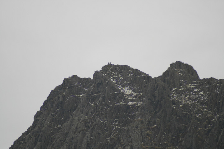
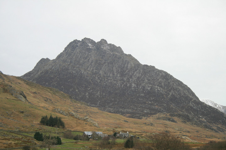
I'll just take a quick picture of that.It's been a long time coming has this trip, conceived of more than a year ago, everything has come together, like a Hannibal-plan, "well". For weeks I've been envisaging the kind of weather I'd like to have whilst climbing Tryfan, warm, blue skies and small fluffy white clouds. How hard can it be ? The weather reports and the drive along the A55 reveals the heat wave has indeed still got some legs in it, so we make hay while the sun shines because all too soon normal scheduling will be resumed. The car park at Idwal cottage at the west end of Llyn Ogwen was full, but the first lay by down the road had many parking spaces. For the first time ever I'm preparing to climb a mountain in just a T shirt, there are trousers and boots too, to be sure, but it aint gonna rain or be too windy. Perfect, now wheres me camera ? ummmm, Oh yeah right it's in the hall at home just feet from the front door, presumably where I wouldn't forget it. Absolute and complete consternation . The walk starts up some well laid steps, but soon fades away into grassy oblivion. This part proves to be the hardest part of the walk, no clear path over uneven ground, leaping over streams, it's well hot, and still loads left yet. We head for a big high waterfall and luckily meet up with the main path, another well laid affair, this path takes us up to llyn Bochlwyd. A vaguely kidney shaped beautifully reflective lake, slowly being heated by the over enthusiastic Sun. The views from here are wonderous, east is our companion for the day rocky Tryfan, south is the massive rock wall that is the north face of the Glyderau, west is Y Garn, Elidir Fawr and Carnedd y Filiast, also made of rock, and north is Pen yr Ole Wen and the Carneddau, strangely more rock there too. This is the home of the Rock Gods. Plus two low flying screaming Hawk jets flew through the valley, at the same height as us, you don't get that at an air show. From Llyn Bochlwyd we can see the path wending it's way up to Bwlch Tryfan, it's from there that the walk starts to get interesting, with added interest. The walk from the lake was a good one, easier, and it's good to be able to see where the path goes and where it ends. Had I a camera I'd take a picture about now, several maybe. Sooner rather than later we reach the wall that separates east and west Bwlch Tryfan follow the wall south and your in a world of hurt, Bristly ridge to be exact and it wears its name well. North and the wall goes up to a Tryfan subsidiary peak, far south peak to be more exact. We follow the wall north but skirt around the bottom of south peak. As we approach the start of the climb up to the Adam and Eve central peak a group of walkers are just getting to the bottom of it, surely they have got turned round somehow, they are coming down what looks definitely like the hard way, we move on and find the right way, it looks like the easy way, steep but exhilarating, tiring but a good cardiovascular workout, beautiful but with no camera I feel like a buffoon, a prize banana. Look hard, and remember. A very good scramble ensues, I'm sticking to the rock like spider-man, probably because the sun is melting the rubber souls of my boots, not really, but I am feeling confidant, like I already have the freedom of the mountain , without doing the idiots leap. I climb quicker and quicker, desperate almost to get to the top, the scenery changes subtly every time we turn round, I'm hungry for the final explosive view from the very top, a full 360 degree dream come true. But this isn't the very top, we can see it, its close, from where we sit and eat butties we watch intrepid walkers and crazed climbers doing the jump from Adam to Eve, or Eve to Adam. There are school parties up here, no balloons and such, but kids much in abundance, boys Erics age and girls Phils age, two things occur to me, firstly could I get my kids up here ? doubtful, secondly, and I thought how cool am I for getting up here, and there are school kids up here, how hard can it be ? not that hard at all really as it turns out. Butties consumed, we wait for the summit to clear somewhat and were on our way up, it's now I remember my cell phone has a camera, it's a crap one for sure, but better than nothing, click. Right at the very top we share the summit with at least a dozen other people, some stay only five minutes some linger longer, some do the jump but others just sit and watch. A lone seagull flies round and round waiting for a dropped crust, I get really dizzy watching it. The view is as you'd expect, adequate to say the least, proportional to the energy expended in getting here, so good that one could almost launch oneself off the side if they didn't have a camera, almost everyone up here is taking a picture. I make out that I do this all the time and have no need for appliances. Cell phone cam, click. Adam and Eve — Images14.03.08ce
Adam and eve stand almost right on the edge of the eastern edge of the summit, flat topped and two to three feet distant. From the summit a truly giants cairn must be climbed to get to the seemingly small stones, but from the other side there are no boulders, and you can see that one stone is firmly planted in the ground and over ten feet tall, the other stone just rests on another rock, neatly fitting together like some Inca temple. I am tempted to do the jump, but honestly, I couldnt even get up without soiling my self never mind stand up on it and then jump off. Not today. We notice that time has gotten away from us, if we plan to carry on with the planned walk we need to go, and quickly. One more miserable phone cam click and were outta there. I've never been as sad to leave a mountain top, they've all meant something more than just getting to the top, but this one is truly special, but, I leave nonetheless, bye stones. Adam and Eve — Images14.03.08ce
We get down easy enough, I find it easier coming down than going up, as the dizzies only occur whilst i'm looking up. Back at Bwlch Tryfan we have to amend the plan, theyre always open to reinterpretation, we end the mountain part of the plan here, vowing to get back soon to enjoy the Glyderau from upon them. Its a little bit cooler now, we are a little bit cooler now too, cool enough to give the Fonz a run for his money, but not too far 'cause my legs are just a bit wobbly right now. Back in the car and round the block, through Betws Y Coed to llanwrst, up a very determined mountain road and we park up for some afters. Hafodygors wen, or even Hafod y Gors wen, Coflein calls it a cairn, but notes the four stones set into it resembling a Scottish four poster. Its a firm favorite of mine and I jump at the chance to get someone else to see it. But after our mountaineering, the walk in the hot afternoon sun was longer than Its ever been, drier, but further. My removal of Gorse bushes in the last couple of years are nicely covering up, the four poster, I cant be swayed from seeing it otherwise, has never looked better. Alken seemed to like it a lot, and the surroundings. A great way to end an epic day. Camera camera camera ! ! ! |
 Posted by postman
22nd July 2013ce Edited 25th August 2013ce |
BINSCARTH -WINKSETTER - GRIMESTON August 25th 2012 |
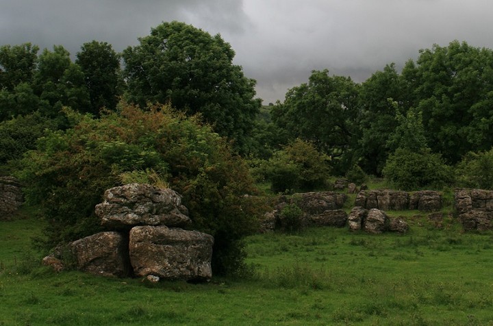
BINSCARTH -WINKSETTER - GRIMESTON August 25th 2012Alighted at Finstown and headed off down to Binscarth Wood, a plantation like every Orcadian wood except Berriedale on Hoy. You cross into the trees where the millstream exits the wood (having started life from the southern end of the Loch of Wasdale then taken a circuitous route) but can then take a farmtrack above them if in a grand hurry - this has a copse strip running alongside for interest. Fortunately this area was dry, as it does hold a lot of moisture that somtimed turns the track to mud. In times past this wood has been turned ito an ornament by the use of wall-lined paths wending their way hither and thither, and you can still follow these in parts. Right near the beginning in a clear space next the burn a tree stump played host to several large pale mottled toadstools. These are about a handspan and I think they might be beefsteak fungus. Some were turning an inky black as they themselves decomposed after these fruiting bodies had given their all for the great mother below. Next to the stump were further fungi, the yellow of chanterelles but not stuck together, flat-capped and utterly dwarfed by an ash key beside them. Bairns and the child-like enjoy a curve in the burn you can often cross, and where there is water furniture relating to its former use as a millstream. Down here the wood is well wooded and tree limbs can make you scramble. But as I head away from the burn and uphill the top corner is almost regimented, light and airy with trees well-spaced and straight trunked. This almost ornamental stand goes back to the mansion house heyday (there was a seperate greenhouse area east of Binscarth House) as the plants are not native - on the ground beneath there are long soft cones like the tip of a pangolin's tail. Coming out of this wood there is a walled 'garden' set back below the house. When NoSAS were based at Binscarth we would chop wood gathered here, but I'm fairly sure this piece isn't open to the public so I don't go there now - I wonder if the naturalists still rent it from the guv. The track now goes between hedgerows, and since the trail became official this has become rather churned up, forming big muddy puddles after bad weather (not quite as bad as the Seatter track though). This brings you out into Wasdale, which once hosted a market of sorts. Down in the loch the islet is enchanting as ever, softly curved with an off-centre pimple and having a penumbra of water-loving grass fanned about it like the rings around Saturn. Just relised the profile is like a shield-boss, I knew there was something niggling at me. As I see it there are two ways of looking at this site's watery ring, that the vegetation-less channel about the land is due to suppression by buried stonework or that it represents a stoneless gap between the islet and buried stonework (not wide enough to be outbuildings I feel). This day the causeway is underwater as per usual. It seems to me that the farm has been better in the past - as well as the market there is a disused quarry stretched across the hillside above. I have still been unable to find a name for the steading remains sitting above the Wasdale track at the junction with that going up to Setter. The Dyke of Setter marks the boundary between Firth and Harray, the Slap of Setter being where there was a gap (in Harray only Winksetter tunship lacks slaps). My next turning point is just beyond Rosebank (which has no age to it). At the junction with the Howe road a ruin on a slight rise is is down on the NMRS as Woodwyn- it isn't named on the 25", so I would place it with Boardhouse ? What isn't on NMRS is a longer building of several parts. further east at HY32931635. I would have thought it had once beem important because rather than drystone places such as the wall corners use carefully carved stone. Possibly the stone came from somewhere else though, or an earlier structure, as its use is a little random in parts. Only one small section of roof remains in place. At the southern end is what seems to have been a kiln - a kiln barn perhaps, or another walkerhouse. I imagine the ruin I believe to be Stoneywoo would have looked like this. This ruin is seperated from Tufta by a field called Bruntquina. IIRC quina is a variant of quoys, which would give Bruntquina as 'burnt enclosure'. Tufta is (I gather) the plural of toft and meant a collection of ancient buildings. Would be nice if the ruin had been the original Tufta but it is equally close to Appiehouse. When I saw stones eposed in a mound south of it in the same field I thought I had found that Howe was named after, only a year later do I know I confused Tufta with Howe, though it is the only mound before reaching Winksetter to show likely evidence for being other than a grass-covered earthen hillock it ain't much. The level (well, kind of level) piece of my walk ended just beyond Winksetter a little further on from where you start north for the Knowes of Trotty (the seperate mounds of the barrow cemetery almost visible to the unaided eye). At this part you are several metres above the valley floor. I go to the edge of a big bend and below me see another unmarked little ruin, perhaps a shieling for a seasonal farm labourer. This bit of the farmtrack has been cut into the hillside more laterally than vertically. Coming around the corner of the bump/hillock I could see something behind and climbed up over it to investigate. There is a long mound with a stepped profile like a low-backed settee viewed from the front and a bump by one end. Unlike the nearby heathery slopes it has a covering of bright green grass. There are large stones scattered liberally on and in it, a few with square corners. When I went back nearly a year later going by the fences and walls I made it out to be roughly at HY343167 (it lies between one of each). The sceptic in me said it might be an old quarry, but though the area is peppered with disused quarries on the maps it is well away from all the quarries shown on the 1st O.S. and subsequently. Coming back I decide to extend my walk by going up the Howe road to the Lyde Road, a lovely rolling farmroad, a dark ribbon. Past Manse I turn left over to the main road. That is when my body announced my exhaustion ! The track on the other side goes around the top of the hill and can be used to avoid a tricky corner. Going down the main road there is a single-storey stone building with a slight L-shape, 18th/19thC I would guess by the small roof slabs the size of tiles. This is down as Brough smithy, HY31NW 65 at HY3197917216, described as rubble-built. The L bit at the left has a piece blocked off by red bricks. This was the access to the hearth within this gable end, which has two peedie windows and a broad chimney (this now with a strong-ish lean) as if the ground floor had been taken off of your average two-storey house. What I myself find cute is small rubble-built enclosure abutting the north end, built of stones of much more variable sizes than the smithy - and no mortar either IIRC. Must have gone down the Stoneyhill Road and across to the north leg of the Grimeston road as I took another picture of the summit (HY323157) of Grimeston tunship. This is in the same field as the standing stone. I have a feeling that what I picked out at the summit relates to the Henge site in the field across the road (now on record as HY31NW 114 at HY32201565). Still looks like a tiny tump from the road, but in April 2013 discovered this to be highly deceptive as well as it's having an even closer association with the henge (rather than simply being up high overlooking the site). Once more back onto the main road, and down the final straight to the junction, I saw again two wartime remains in the corner of a field on the east side of the road. Surely I will have snapped them from roadside before and no energy left to enter for more now. Coming to the junction there are lovely views of Bincarth's wood and hedgerows, strung out with Wideford Hill visible in the far distance. Took a couple of pics of the Bincarth Farm complex and one of the buildings I could see had a strange piece on one side with two parallel lines of horizontal slabs leaving a space as if some long large billlboard had been taken away. So a year later I made a point of examining the farm more closely and thoroughly. And then I took the bus home. |
18th July 2013ce |
Dig to begin in Cardiff |
Dig to begin in CardiffArchaeologists are starting a dig in Cardiff at what is being classed as a significant Iron Age hill fort. Limited trial excavations at the fort in Ely, next to a link road from the M4 in the west of the city, took place last year. Evidence of Iron Age pottery was found along with Bronze Age and Roman activity as well as Norman ringwork. The Norman fort is next to a 13th Century church which is now a fragile ruin. An impression of the Ely hillfort It is believed the fort was once a stronghold of the powerful Silurian tribe who inhabited this part of Wales before the arrival of the Romans. Dr Dave Wyatt, a lecturer in early medieval history and community outreach at Cardiff University, is behind the project. "People have know about it for quite a long time but what's interesting is that no-ones ever thought to research it," he told BBC Radio Wales. "The Romans in the early days of archaeology always attracted all of the interest and there is in fact a Roman villa near by in Ely in Trelai field which was excavated in the 1920s. "This enormous hill fort is monumental - it's one of the biggest and most impressive historical sites in Cardiff yet no-one really knows about it. "There's been no research about it until we started our project about two years ago. Our project is working with archaeologists and the community. "It's very much a community project... to rediscover and find out about the heritage of this amazing site and to try to put it back on the map." He added: "The pottery dates to around 600BC so that gives you some kind of idea as to how long this Iron Age hill fort was in occupation before the Romans even showed up. "It really was a power centre for the whole of south east Wales." http://www.bbc.co.uk/news/uk-wales-23026691 |
Posted by Supermacintyre 24th June 2013ce |
Swartland Drovers Road trail, June 20th 2012 |
Swartland Drovers Road trail, June 20th 2012The above is the name of this advertised trail, though the section walked only just comes into Swartland itself (and in the end our little party stopped just short at the Burn of Clett, not finishing on the B road). I do not know the start and end points of the full drovers road, thought the southern end would seem to be the Loch of Bosquoy. The only other Orkney drovers road that I know of started at Groundwater in Orphir and ended at Walliwall quarry in St Ola, though being a carters road may not be the same thing (there is a Carters Park in Kirkwall itself - park 'enclosure'). After all this time this blog is all archaeology, as with one exception (proving that day's rule) that is all that I photographed. Flowers there were I'm sure, even pointed one out to the others, but all I have is a vague memory of violets in the track that may be from this. Heading north to Skaebrae/Skeabrae, first off a reminder of modern times. Very obvious west of the track are the remains of Second World War RAF Skeabrae. Later NATO considered combining what remained of RAF Skeabrae and RAF Tern (Twatt airfield) into one grand new airbase - back in the sixties I believe, perhaps later. All that remains standing of NMRS record no. HY22SE 59 are a couple of perimeter huts, the bomb store and a combined cinema-gym, and several air-raid shelters. The runways survive as distinct entities, as do the dispersal bays (some of these have been converted for agricultural use and others are stripped of their protective banks). Furthest from me is an imposing two-storey rectangular building that I took for a control tower. but that is reduced to only a depression. There are windows, so obviously not the bomb store. That will be the gmnasium-cum-cinema then. Much closer to me are some big squat buildings of brick. Though all records appear to show the airfield only west of this road I did find a solitary building on the east side southwards of the main surviving buildings, a beautiful red brick construction (with a few blue bricks). Not rectangular, either six or eight sides, more likely eight. No sign of there having been a roof. There is a gap in one of the sides and a (now leaning) wall of the same material faces this side, having at the top the remains of a vertical slot six to eight courses deep. All the walls I make to be of the same height at some 24 courses high [good camera]. Where the track meets the modern road the group leader chose to go back, though the 'official' route is not long past this point, finishing level with Swartland Farm. I would like to have checked to see if the marked Burnt Mounds are really gone, but most disappointed not to have been able to look for the Quinni Moan tumulus. At some point the record for this has erroneously attached to itself the 1869 report of a series of excavations that properly belongs not with this Queenamoan (Quinni Moan) in Sandwick but with Quoynamoan in Stenness ('behind' Tormiston) - I take "The Orcadian" over Petrie's Notebook as no-one wrote in to say the parish had been wrong. Coming back down on the east side a long rectangular field by the 28 on the 1:25,000 map is the Benzieclett site, HY22SE 54 at roughly ~HY279206, where in 1903 an underground passage turned up on the property of Vola owned by a John Kirkness. It is uncertain from the article whether a roof had been removed in the past or this had been done when found. The considerably curved 30' long passage, aligned N/S, looked to have been entered from the south (that end was filled with earth though). It measured roughly 4' high by 2'9"-3' wide and is described as having at least one of the sides built using large stones, with small niches, and having at the other end some edgeset stones. The less substantial side had suffered greatly at someone's hands since finding. In the passage were shaped stones "used for certain purposes". If the airfield extended to both sides of the drovers road could this have been the Skeabrae souterrain, HY22SE 3 at HY27272013, removed in making the aerodrome ?? Thought that would mean the local had it wrong and his location does go nicely with the broch on the airfield (with the Quinni Moan burnt mound as the third member of the trio maybe). Further along the east side are the remains of Nether Benzieclett. This long house with all its parts is said to be one of the best representations of its type. Unfortunately its appearance has deteriorated since the photos and the roofs have gone. Just a few metres eastward of Nether Benzieclett at HY28152054 is the Sandwick Congregational chapel. This was founded in or before 1812 by George Reid of Lerwick but didn't hold meetings after about 1882. There are two buildings here. The church had four rectangular windows on the side I can see, and at the end a narrow doorway with a semi-circular arch. The smaller building has its entrance facing the far end of the chapel and has a slanting roof, so of its time (in Kirkwall they used slates). Yet further east is the Burn o' Roo boundary dyke, which I could not detect for certain from the road. Near the sewage works the Burn of Hourston empties into Muckle Water, nowadays known as the Loch of Harray. Where the drovers road meets the burn there are a large footbridge, big enough to have four decent size spans, and a ford. The ford is obviously of late construction. A wide 'path' of long rectangular stones (presumably edgeset) lead down into the water on either side, rather than only embedded in the stream-bed like others I have seen in Orkney - definitely an England-shire feel to it. On the works side the bridge base to the road has a straight wall but on the north side there are two slightly curved offset walls one above the other. Had a look at the west side of the bridge and vertical drystone walls form the banks. Coming back from there I held tight onto the fence and moved carefully along, only for my foot to disappear into a hole. There I fell backwards and hung over the burn whilst a tree root neart the top of the hole held me in an ankle lock. With the others not near took a while for the others to hear me - strangely, though I had no control over my full-blooded screams there was no pain involved ! Eventually after a few attempts they were able to release me. Felt like ten minutes all told but in actuality a little under five minutes between taking photos of the bridge and of Wasum. The ligaments still haven't healed. When I mentioned it to a doctor 11 months later the advice given was "keep on walking, and if it hasn't healed in a while go see a specialist". Like I'm a millionaire !! South-west of the sewage works, between its legend and the stepping stones one is the former site of a tumulus, HY21NE 50 at HY28841971. Wasum (wass 'water' - don't know the second element and that u to me is simply the a with additional short lines) is in the Orkney Name Book as a burial mound, but even the first 25" map at about the same time merely shows "site of Wasum". Of course like a lot of things labelled as site of Wasum does just about survive (visually near the water's edge), and I could see a few stones in the rise. The record says farming has further reduced what had been a large mound and that ploughing often brings up large edgeset stones Next I picked out a small unnamed holm that I had spotted lying off the shore on my way up. This is one of several items going under the name Hourston. HY21NE 93 at HY28891957 as an NMRS record only goes back to 2010. It is allocated the site types of causeway and island, though the narrow causeway is shown on maps from 1882 to present as stepping stones. Comparing it on the map with the Wasdale islet ("causewayed island dun") in Firth and it is roughly the same length but only half the width, giving as very approximate dimensions 35m by 12m. It is not anywhere nearly as high and one would assume the site type is interim as it is surely a crannog as much as those recently so listed in the Voyatown and Swannay districts ? I see a level mound or platform occupies the central half, with the sides gradually going down to loch level. On top I can make out inmy photos at least three large stones (one erect) and a couple more at the back (perimeter wall ?). What I take to be the stepping stones seem to start near or at the mound platform. On the old 25" map the stepping stones are running NNW, and following that line it shows what appears to be the remains of a circular stone cairn offshore at HY28881965 (say halfway between this holm and Wasum). At the farm of Howaback there is a tumulus by the garden wall that goes under that name and Hourston. HY21NE 32 at HY29341955 appears on the present 1:25,000. In 1928 this earth and small stones barrow stood nearly 6' high and 40' across, in 1966 barely 4' in height but only about 5' smaller - either way I didn't (AFAIK) see it. At some time the top and sloping sites were excavated and a mix of partially and wholly burnt bones found in a short cist, small and square, not visible in 1928. Another barrow I didn't see (hidden on the other side of the Howaback hill, ~130 yards almost due south of the farm) contained a similar cist, found whilst farming. HY21NE 34 at HY29381942 is now much spread out, so only shows as an ill-defined rise (though 1966 report made whilst area under crop). But in 1928 the size was estimated to have been about 45'D, possibly more. This site goes under the names of Hourston and Cogeraback/Gogeraback Confusingly another site also bears the names of Howaback and Hourston. HY21NE 33 at HY29551935 is the tumulus marked on the 1:25,000 close to Grut Ness. This grassy barrow sits on a slight rise, stands nearly a yard high and is some ten yards across. My attention was brought to it by twa rabbits running onto it, bringing it into focus whilst also giving me an idea of size. The present record opines that it is a chiefly earthen barrow, with a few protruding stones. But in 1928 RCAMS felt differently, noting a number of rather large stones lying in [sic] the hollowed top and more sticking out of its slopes at intervals, which indicates a more structured composition. Near the junction with the Russland Road I noticed a few interesting lumps and bumps. Perhaps the Knowes of Coynear do actually exist as a seperate thing from the Conyar mounds east of the main road despite not showing on the 25" maps ?? I must point out neither do those ! We didn't get to do the final stretch to the Merkister Hotel, instead decamping to the Standing Stones Hotel for a proper tea meal. |
23rd June 2013ce |
From Lake to Peak |
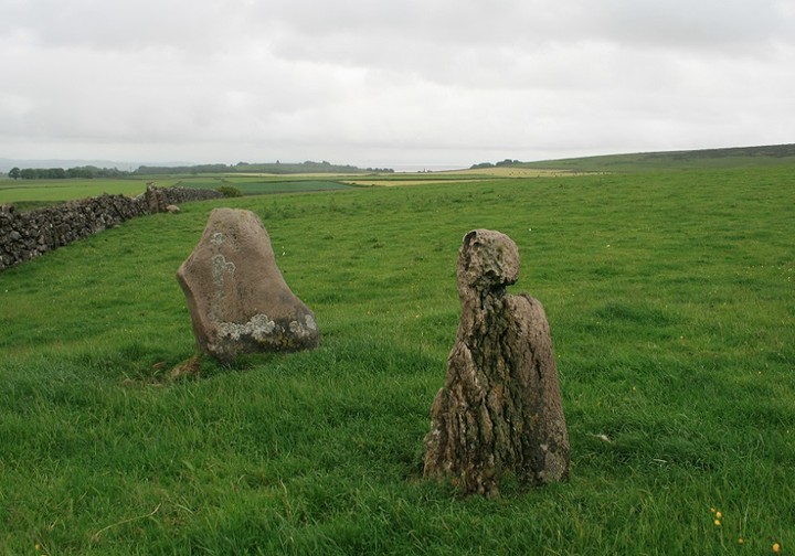
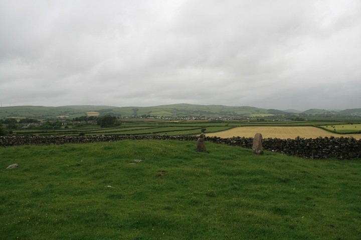
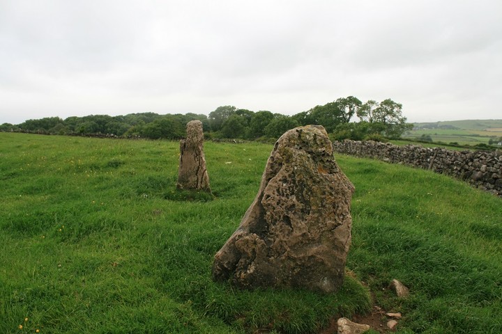
From Lake to PeakThe original plan was for a sunrise up at Brats hill with its neighboring circles, then off to Copt Howe. But a last minute change in plans had me putting it off for a day. The weather report wasn't saying favourable things (rain everywhere) but they aren't always up to scratch so I went for it anyway. The day begins at 2.00am, whilst loading the car, it is, as predicted, raining, I almost go back to bed. It rains on and off all the way up the M6 too, by the time I reach junction 36 it's just light enough for the day to reveal itself as decidedly miserable. So contingency plan-F swings into action, I head for Ulverston. I have a bit of a thing for sites with Druid or Druids in the name and it's been nigh on ten years since my one and only time here, so it will be good to get reacquainted, and see how the stones fared against the red paint that some brainless moron slapped upon them, gone, faded or otherwise. I park in the big obvious car parking place that is not more than a hundred yards from the circle, but, unnervingly, there is half a dozen less than new motor homes enjoying an adhoc camping trip here too. I'm hoping the throng at the ring wont be too big. Waterproofed, more against the dew than the rain which has by now mercifully eased off, I head off along the grassy path, sooner than I'd anticipated the stones come into view, and Kalookalaylee, there's no one there, I have the Druids circle to my self, or so I thought. The Druid's Circle of Ulverston — Images23.06.13ce
Firstly I inspect the stones for red paint, one stone, the biggest one still has the gory stuff on it , but it is fading and lichen is growing over it. After bemoaning the current state of humanity I take a few low light pictures, and start to cut away some nettles that are overcoming one of the stones. Then I walk round the circle and stop at an overflowing bag of rubbish, I swear out loud and and give it an experimental tap with my foot. This elicits a loud and piercing bark from an unseen dog, then from the other side of a clump of ferns a large plastic sheet moves about. Crap ! someone has slept here overnight. I make my way over to the other side of the circle and take a few nervous pictures, a crusty dread-locked head peers at me over the ferns and says "Good morning" I return his salutation and take a pew upon a relevant stone, turning my back upon his crustiness. Perhaps now he's up he'll have somewhere else to go. He sits upon the stone next to me, Alsatian at his feet and says " no sun today, can you crash me a fag", I realise, he's been here all night, this is his somewhere else. Sadly I didn't have a fag for him but I did roll one of his for him, his hands were too cold and wet. We both sit staring off across Bardsea and Morecambe bay. I can take but a few minutes of this before I have to excuse my self and go for a wander, up here, round there, back in the car and away. To Great Urswick. It has been a similar ten years since I was last here as well. It wasn't a place high on my re-visit list but seeing as its so close and en route between the Druids circle and Copt Howe, via the Giants Grave, I more or less had to go have another look. I'm very glad I did too. My biggest memory of it is not being sure of it's authenticity, sure it's a big a stone resting on two other stones, but it's not obviously a burial chamber. Great Urswick — Images23.06.13ce
Visible from the road, once you know what and where it is, it is but a five minute stroll across a field over a stile and up hill a hundred yards. Some cows were close by but they hadn't even got up yet so they just watched me from there small dry patches. I sat amid the low branches of the Hawthorn inspecting the rear of the big three stones, there are many more big stones under the tree, can we safely presume they are from the chamber and not just dumped there by the farming dude. I take a good look around the Limestone outcropping as well, always looking back at the stones, from the east on the limestone rocks the chamber is hidden by the Hawthorn. The Cows are getting up now and one even mooed at me, my change of socks are already soaked through, boots stopped being waterproof months ago, so I bid a fond farewell to Great Urswick burial chamber, and leave with a new found appreciation of this under valued site. Really close by is Great Urswick hill fort and a too close to ignore tumulus, so I decide to have but a quick look round before I go off to find The Giants Grave which we so spectacularly failed to find for a second time last year. I park/dump the car by a footpath sign north of the fort and follow the wall in the appropriate direction, the path is on the other side of the wall but so are a herd of still seated bovinators, so at the top of the field I have to jump a wall, just twenty yards east is the tumulus, I tell it i'm just going up to the fort then I'll come back for a good look, it has stones on top. Great Urswick Fort — Images23.06.13ce
The ramparts are not well preserved, they are very worn down, but the large limestone outcrops still guard its western edge. In clearer conditions good views are to be seen all round, but todays conditions are anything but clear. I start the walk back down to the tumulus with stones on top when I get a text on me phone, it's my daughter, shes encountered a childminding malfunction and I have to return home at once. I promise to do so straight away, and continue down to the barrow, swearing as I go, the kind of swearing one does when there is no-one to hear you. No Giants Grave, no Copt Howe, what a bummer. The tumulus turns out to be a long barrow, not a particularly long individual, but to make up for a lack of length it has two small standing stones on it's eastern end. One stone is so gnarled it appears to be a tree stump at first but a closer look reveals it's stoney nature, the other stone is wider. Skelmore Heads Longbarrow — Images23.06.13ce
I cannot give it the time it deserves, I have to go. But as I leave I hatch a plan, to get home as quick as possible, pick up my no longer little girl and without missing a beat drive off to the Peak District, before I'm even back on the M6 I've decided that a return to Stoke Flat stone circle upon Froggatts Edge is what the day needs to be rescued. Everything goes according to plan, the only thing I didnt take into account is the frailty of the human body, I was so tired that when we parked up at the little parking area near Froggatts edge I fell swiftly asleep. After Phil listens to six songs on her MP3 I awaken to bright sunshine, jumping to life we exit the vehicle and take the pleasant walk along the edge to the circle. Stoke Flat — Images23.06.13ce
As usual for this time of year the circle is busy getting buried and choked by the infernal bracken, Phil sits around impersonating a teenager that isn't bovvered whilst I take my little shears to the ferns. The big main stone in the circle has many solstice offerings on it's basin like top, a silvery bracelet, some small change, woven twigs, a wax effigy and so on. I reveal as much of the ring as my back can take then begin to photograph the circle. Phil used to be very camera friendly always posing with a sweat smile ,but now she cant bear to be even in the photo, how those times a change. When the inevitable "can we go now" comes I climb a couple of trees monkey boy like to get a more aerial view, without much success it has to be said. But it really is time to go now, the solstice is definitely over for this year. Now I've got to get Phil to her friends, pick Eric up from his Mum's, and sleep for England on the sofa, interrupted only by microwave related questions and the information that some one is sleeping at Lukes. I was, as they say, not with it. |
Posted by postman 23rd June 2013ce Edited 25th June 2013ce |


Neolithic settlement evidence; Wideford to Cuween |
Neolithic settlement evidence; Wideford to CuweenA FERTILE PLAIN Colin Richard has finished a three week dig in Orkney on an Early Neolithic house on the lands of Smerquoy across from where the Old Finstown Road bottoms out at the base of Wideford Hill. along from Redworth. From the old trail to the tomb this seems to stand at the head of an old burn system. Given the time constraints the decision was made to concentrate on this part of a suspected settlement, at HY403113. At the beginning he said he believed that there are further settlements hereabouts. Other settlements have been excavated in recent times based on flint scatters. Over towards Rennibister there was the 'Wideford Meadow' dig at HY407126 and north of the Quanterness tomb the Crossiecrown settlement at HY423137. In 2008 I saw [what seemed to me to be] likely-looking cropmarks at HY406122 in the field directly below the Wideford tomb, perhaps an extension of 'Wideford Meadow' ? Between here and the main road came the Old Dyke of Quanterness (i.e. Gorse Dyke) flint scatter HY407126. A flint scatter came from near Rennibister, at HY398123. A mace head fragment was found on the lands of Kingsdale (in the area of HY377117), and at nearby Rossmyre 'horse marsh' a leaf-shaped flint arrowhead came to light (roughly HY382120). Further towards Finstown a hammerstone was discovered in the Grimbister region, though these artefacts are less dateable. And then below Cuween Hill another settlement was dug on the Stonehall farmland HY366126. |
27th May 2013ce |
Callanish - visit to Lewis 2013 |
Callanish - visit to Lewis 2013Arrived on Lewis after experiencing the particular joys of a rough crossing over the Minch. Although slightly the worse for wear made my first quick visit to Callanish on the way to our holiday accommodation on Great Bernera (Friend stayed in the car as was still suffering the after effects of severe sea sickness). First visit was of our Callanish week was a bit wild and windy setting the tone for visits later in the week. We had arranged to meet Margaret Curtis on the Monday so we spent a beautifully warm Sunday walking to Bostadh with its Iron Age House tucked in at the small sandy cove. The weather was a gift - we saw a pair of ravens straight off and at Bostadh a pair of white-tailed sea eagles circled over the cliffs. Our walk back took us along the narrow single track road and there on the ridge to our left sat a golden eagle – it took flight and flew directly over us before circling back to watch our progress from its vantage point on the ridge. A moment I’ll never forget. Later that evening we drove back to Callanish to try and catch the sun setting – it clouded over while we were there so we just wandered around the stones occasionally chatting to the few other visitors. Monday … a complete change weather wise, in fact cold and windy, remaining so for most of the week. We planned to visit Callanish II, III, and what turned out to be IV before meeting up with Margaret Curtis -- as it turned out we did it backwards. Our first visit was to a five stone lichen covered stone circle we had seen on our drive past to and from Great Bernera. Wonderfully atmospheric on top of moorland overlooking Loch Ceann Huglabhig and standing in boggy water where the peat had been cut away. Next we drove to Callanish III – Cnoc Fhillibhir Bhig. Still very much absorbing the unique atmosphere of Lewis, we walked up to the circle then down to Callanish II – Cnoc Ceann A’ Gharrah. (This site should really be visited first when walking from Callanish.) We kept our appointed time with Margaret, ending up spending four hours with her instead of the one we had budgeted for. She charges £30 per hour to explain the astronomical alignments she discovered with her first husband Gerald Ponting. Her early work is condensed in a small book written by Gerald Ponting and published by Wooden Books (I bought a copy of this after our session which has proved useful to help me recap). Tuesday we visited North Lewis – Carloway Broch; the Blackhouse Village at Garenin (Na Gearrannan) and the Norse Mill and Kiln at Shawbost/Siabost Village by Na Muilne. Wednesday, still cold and windy but bright with sunny intervals and massive cloudscapes. This was the day we decided to drive down to Harris and had invited Margaret along in lieu of payment for the extra time she had given us without charge. What wonderful company she turned out to be – her innate intelligence and deep knowledge of the island which is now her home added to our trip considerably. The mountains, aquamarine sea and white shell beaches make Harris a spectacular place to visit. We had magnificent views of Cailleach na Mointich aka Sleeping Beauty – the group of hills that resemble a sleeping woman, famously viewed from Callanish at the lunar standstill every eighteen and a half years. Margaret pointed out a burial chamber which stands secluded in someone’s front garden by Horgaborst beach and just a little further along the road we saw the Clach Steineagaidg Standing Stone which is all that remains of a stone circle overlooking the Sound of Taransay. In a way this was one of my highlights – Friend and Margaret stayed the car while I ran down to the stone with the bright wind blowing me along and the sea sparkling in front of me. I think its called being in harmony with the Universe. Thursday was the one day when the elements kept us largely indoors for much of the day as the wind whistled and gales blew in horizontal rain and sleet. We did venture out though, back down to Bostadh, though this time in the hire-car. Braved the the wind and rain for a short walk before visiting the Museum of Great Bernera at Braecleit near where we were staying. Small but very interesting. Friday was quiet, the wind had dropped and it was quite warm - we drove down to Uig and spent some time shell/pebble hunting on the sandy beach at Cliff before heading back to visit the remains of Achmore Stone Circle which has amazing views towards the Sleeping Beauty hills. This circle was excavated by Margaret and her second husband Ron (now deceased). The fascinating information board up there which tells you so much more than is visible to the eye was also sponsored by Margaret and Ron Curtis. We rounded off our last full day on Lewis by going back to Callanish for a wander around in the warm sunshine before calling into see Margaret to thank her for adding so much to our stay. She can be found at her house on the border of the villages Callanish and Breascleit; although now just over 70 and living alone with her many cats and a few chickens, I can guarantee spending time with her is a real privilege. She can also be contacted via the Callanish Visitors Centre. Lewis is probably one of the most difficult places in the British Isles to get to from the south of England. For us it involved an overnight stay at Birmingham Airport, the flight up to Inverness and a hired car to drive across to Ullapool for another overnight stay (Balnuaran of Clava aka Clava Cairns visited along with stops at Rogie Falls and Corrieshalloch Gorge on route, made the drive from Inverness definitely part of the holiday). The ferry journey to Lewis is two and half long, the sea was rough that day; all in all quite a tiring journey. So very worth the effort though and a week I’ll never forget. |
 Posted by tjj
27th May 2013ce Edited 20th April 2014ce |
The Cotswold Way IV – Dowdeswell – Cooper’s Hill 20 April 2013 |
The Cotswold Way IV – Dowdeswell – Cooper’s Hill 20 April 2013Two days after a wind-driven Carneddau walk with Postman, I contemplate still-aching legs and the promise of a sunny spring morning. Promising myself not to walk far, the pull of the hills is too strong as usual and I find myself taking the short bus trip to Dowdeswell, where I finished my last section of Cotswold Way. This has the unfortunate distinction of being the lowest point of the route today, so I’m faced with an immediate climb. The ascent is not too steep at first and I startle a deer on reaching the treeline, a good omen for the day I think. As the path reaches Lineover Wood, one of the lovely beech hangers that characterises the Cotswolds every bit as much as the limestone escarpment, there is little noise but birdsong. Some of the trees here are a few hundred years old, ancient in beech lifespans. Aching legs begone, it’s going to be a lovely day. Lineover — Fieldnotes06.05.13ceReaching a field at the edge of the wood, the worst of the climb over, I leave the Cotswold Way route along another footpath, heading southwest. From here the view opens up beautifully to the north, where Cleeve Hill fills the skyline, with Cheltenham spread out below to the northwest. The reason for my temporary diversion lies just over the crest ahead of me, in the next field. Lineover long barrow has suffered greatly over the years. Now resembling an elongated round barrow, there is little to paint an obvious family resemblance to its near neighbours at Belas Knap or Crippetts. But pause a little longer – the positioning gives away its undoubted blood ties, perched below the highest point of the hill, but enjoying extensive views over the edge of the escarpment. Typical Cotswold-Severn long barrow location in fact. I’ve not been here for about 18 months, the grass is cropped shorter than on my previous visits. The barrow still stands to a height of over a metre and various large pieces of limestone can be seen resting here and there on the mound. There is no livestock in the field today, although the hardened prints around the field edge indicate that cows are still the usual occupants. The only real detraction from a visit remains the horribly busy A436, where I doubt many of the drivers ever notice the long barrow they pass in an eye-blink. The inevitable crump of shotguns can also be heard, far off. Still a worthwhile stop-off, an old friend to revisit, renew acquaintances and share some time together. Lineover — Images06.05.13ce
The Cotswold Way has been re-routed since my Explorer map was published, so it now comes up to the corner of field in which the Lineover barrow stands. From here it heads back into the woods, and what lovely woods they are too. Sunlight filters through the canopy, all is well in the world. Towards the southwestern edge of the wood, work on restoring a beautiful drystone wall is ongoing, a party of volunteers hard at it as I pass. The re-routing of the path means that a section across the steep slopes of Ravensgate Hill is now avoided, as the path clings to the lip of the escarpment instead. Out of the woods, the view north opens instantly. Although it’s hazy today, there is a good retrospective of my last walk over Cleeve Hill and towards Bredon Hill across the border in Worcestershire. Ahead, the steep scarp of Leckhampton Hill now looms, the easier dip slope of which will represent the next climb of the day. The Malverns are a distant smudge of blue. The top of Wistley Hill is a terrific place to stop awhile and drink in the views (and some water). The route turns almost south, dropping fairly sharply towards Severn Springs (a place crying out for some watery folklore, I would think), where a busy road crossing over the A435 awaits. This done, I’m climbing again, more gradually this time, as the route makes its way northwards up Hartley Hill, offering yet more fine views over Charlton Common and back towards Wistley Hill. Cleeve Cloud — Images07.05.13ce
Leckhampton Hill — Fieldnotes06.05.13ceComing from the east (unusually for me), old quarrying scars blight the first approaches to Leckhampton Hill, but the views over the escarpment are particularly fine, despite the haze today. After a couple of bridle gates, the path eventually comes to some rather enigmatic earthworks stretching away from the fort, their overall layout and purpose not really clear. Following the path onwards, it soon reaches the northern section of the ramparts proper. This is the best-preserved part of the defences, and a walk to the northern tip offers a terrific aerial viewpoint off the near-vertical quarried cliffs and across Cheltenham. I can indeed see my house from here (well, my street anyway). Although I’ve been up here many times now, there is always something new to see. In this case, it’s the northern rampart, below the lip of the escarpment, much more clear of vegetation than I have seen before. I sit up here for a while, perched high above home and contemplate my choices. I had intended a short walk after the North Wales efforts earlier in the week, but the day is still young and the sunshine is calling me onwards. Besides which, this is one of those parts of the route where ending here would require an otherwise unnecessary climb at the start of the next walk. I decide to press on, at least as far as Crippetts. Leaving the fort, I head down to one of the many quarries hacked into the hillside, this one serving as a carpark now. I hunt around unsuccessfully for fossils, but to my astonishment, tucked into a crevice in the limestone, I find a pile of chalk-covered flint nodules, some quite large. Nothing worked that I can see, but I have always thought that flint was alien to this part of the Cotswolds, any flint tools being imports from the eastern downs (or further afield). Not so, it seems. Well, you live and learn. Leckhampton Hill — Images07.05.13ce
The path runs south now, then west past Ullenwood to the woods that bracket the wonderful Crippetts long barrow. I don’t stop off for long today, it’s not long since my last visit and I have decided to carry on to Crickley Hill. I’ll just say, once again, that this is a fabulous long barrow, well worth your attention. Crippets Long Barrow — Images07.05.13ce
Crickley Hill — Fieldnotes06.05.13ceMy last visit to this fine site was in falling snow and a black and white world. Not so today. The walk through the woods of Crickley Hill Country Park to the northeast is lovely, sun streaming down. I stop at the Visitor Centre briefly, it’s usually been closed when I’ve been here before and it’s worth a look to see the information boards, together with some prehistoric finds and a model reconstruction of the site. The site itself is quite magnificent, probably the best hillfort encountered so far along the Cotswold Way as, unlike Cleeve Cloud and Leckhampton Hill, it hasn’t been so badly damaged by quarrying (although it hasn’t entirely escaped). The Way passes through the impressive Iron Age ramparts that cut off a large wedge-shaped promontory. Inside this, various hut circles are marked out by concrete posts, although there’s nothing else remaining of them. The main features of the view today are Robinswood Hill and Churchdown Hill, two conical outlier of the Cotswold escarpment. The Malverns are but dimly seen through a haze more reminiscent of summer. The most enigmatic part of the site is the circular feature at the northern end of the Neolithic earthwork, although little remains of it now. The circle, 8 metres across, was enclosed by stones and had a central hearth. “Ritual” purposes abounded, no doubt. From the western tip of the promontory, my route ahead comes into view for the first time, Barrow Wake across the steep-sided valley that now houses the A417, with Birdlip Camp, Witcombe Wood and Cooper’s Hill beyond. The Mother River, the Severn/Hafren, lies broad and glinting to the southwest. It’s busy here today, as you’d expect on such a lovely day, and before long the impulse that pushes me onwards, away from the crowds, comes back. The Cotswold Way turns back along the southern edge of the promontory, where the ground falls away most steeply, before leaving the fort into yet another delightful beech wood. Crickley Hill — Images07.05.13ce
Birdlip Camp — Images07.05.13ce
The peace and quiet are soon cut through by the looming prospect of two rather nasty roads to cross, the second and worst of which (over the A417) has to be made twice to allow a detour to another rather unmissable site passed by the Way, Emma's Grove round barrows. Emma's Grove — Fieldnotes06.05.13ceLike nearby Crickley Hill, my last visit here was in a worsening snow fall. The contrast couldn’t be more extreme today, coming to the barrows in lovely spring sunshine, every footfall releasing the scent of wild garlic. The disadvantage of a spring visit, even after such a late winter, is that the barrows are quite overgrown and much of the vegetation is of the brambly kind, trying to trip me up and making even a walk around the two barrows quite a challenge. Don’t bother coming in high summer! Actually the barrows repay the effort, the larger of the two is as fine an example of a sizeable Bronze Age burial mound as you will find in these parts. Emma's Grove — Images08.05.13ce
By now my path is both far from home and far from a bus stop, with Shurdington far below the Cotswold edge the only reasonable prospect if I leave the path now. I decide instead to plough on, to make the most of the lovely weather. After a second dice with death on the A417 (I’m not exaggerating this, it’s a horrible road to cross here), I leave the road and find myself back on the open escarpment at Barrow Wake, which offers fine views, especially across the valley back to Crickley Hill. My next stop-off, Birdlip Camp, is straight ahead, a jutting wooded promontory. Birdlip Camp — Fieldnotes06.05.13ceAfter a rather up and down walk along the face of the escarpment, it’s something of a relief to reach the trees that mark the promontory fort, where I'm greeted by the rat-a-tat of a woodpecker looking for lunch. The Cotswold Way enters the wood at the single rampart, which is at its most impressive at this northern end. It has been damaged by quarrying; there’s a big pit across the path outside the camp. Aside from this feature, there is little visible to indicate the presence of Iron Age occupation. The interior is covered in trees, albeit a light deciduous wood that allows plenty of visibility through the site. The ground falls away very steeply on the north and south sides – my path runs to the end of the promontory and then back along the opposite side. Reaching the southern end of the rampart, there is hardly anything left of the earthwork here. It’s a pleasant spot on a sunny day, but don’t expect to be blown away by the visible remains. Birdlip Camp — Images08.05.13ce
And that concludes the prehistory for the day. My earlier plan (well, about plan C or D by now) had been to leave Birdlip by the steep road off the escarpment, dropping down to Great Witcombe. But this would mean a couple of miles off the path that would have to be repeated in reverse next time. Despite rather tired legs by now, I decide to carry on round the escarpment through Witcombe Wood to Cooper’s Hill, where I will be within a spit of the bus route home. This proves to be a good choice, the sunlit woods and general downhill trend of the path making for very pleasant walking indeed. Somewhere in the woods above me is West Tump long barrow, my favourite woodland site of the Cotswolds, but she warrants her own visit and is very difficult to leave, so I eschew that option and press on. The final flourish of the walk comes courtesy of a break in the trees above Witcombe, where a magnificent vista is revealed, from Churchdown Hill and the Malverns, across the Witcombe reservoirs back to Crickley Hill and my earlier route. Crickley Hill — Images08.05.13ce
|
Posted by thesweetcheat 6th May 2013ce Edited 8th May 2013ce |
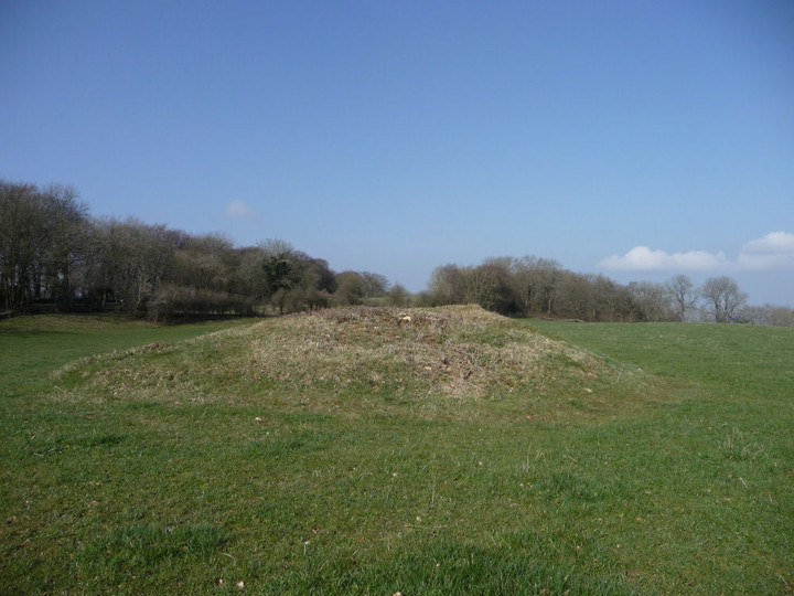
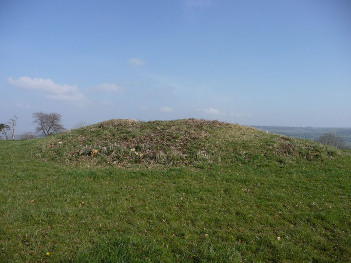
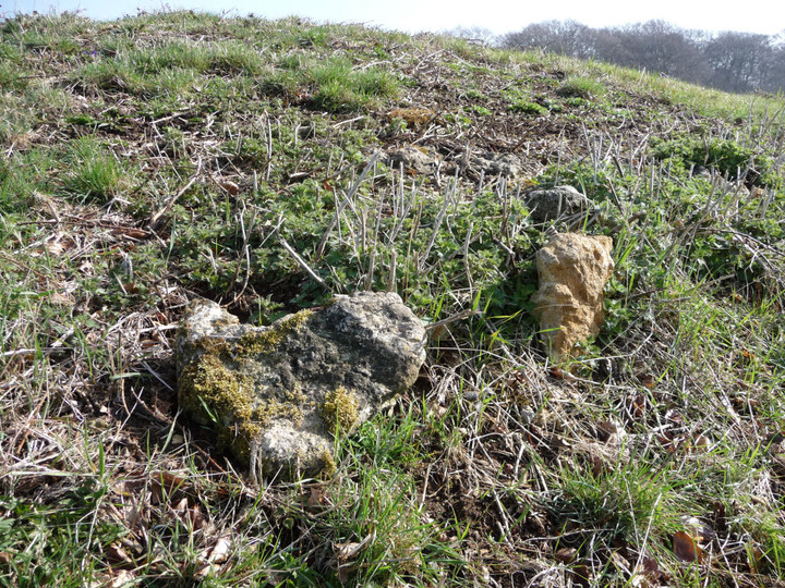
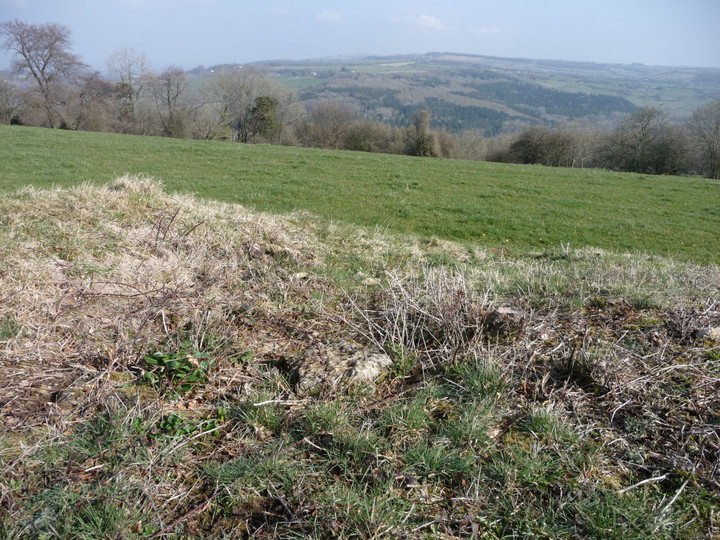
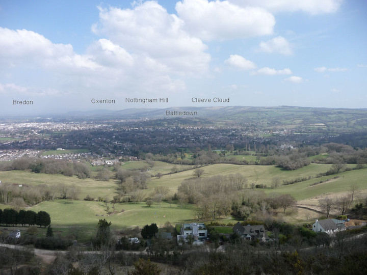


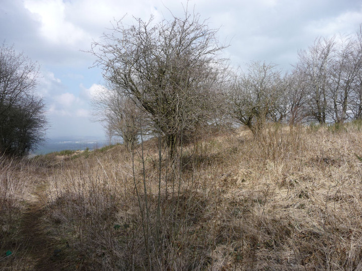

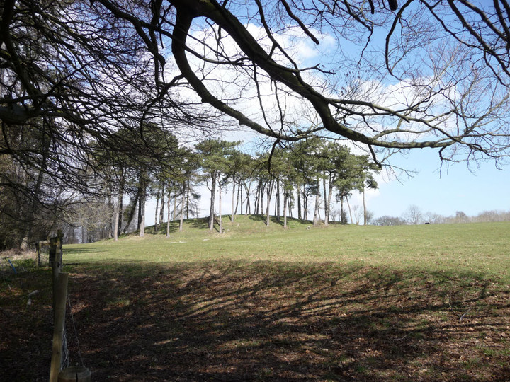
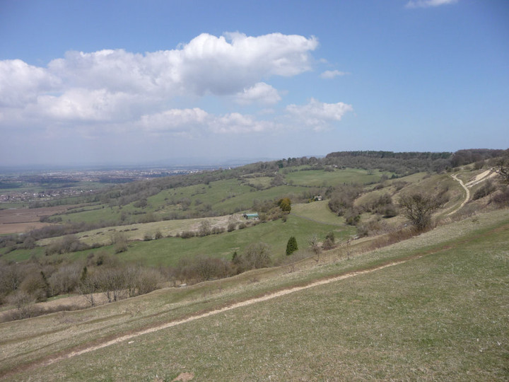
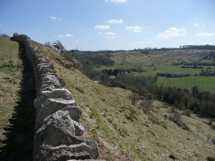
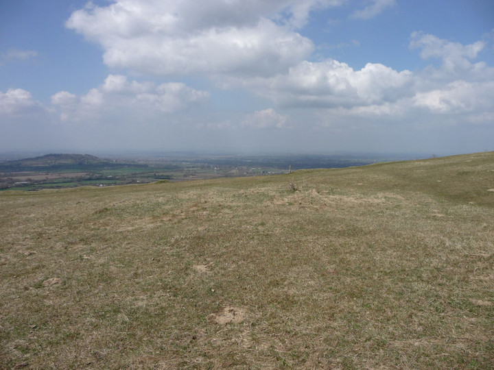
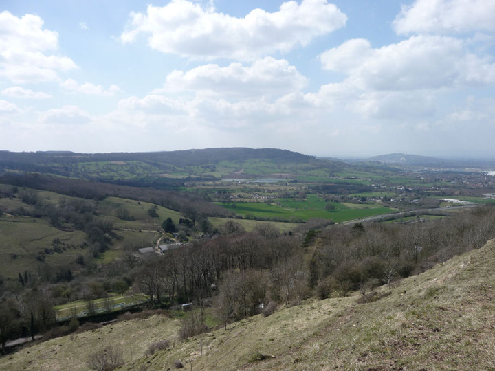
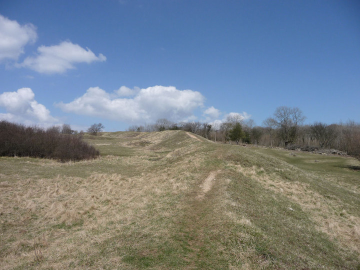
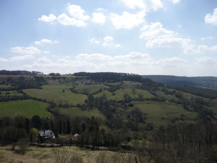


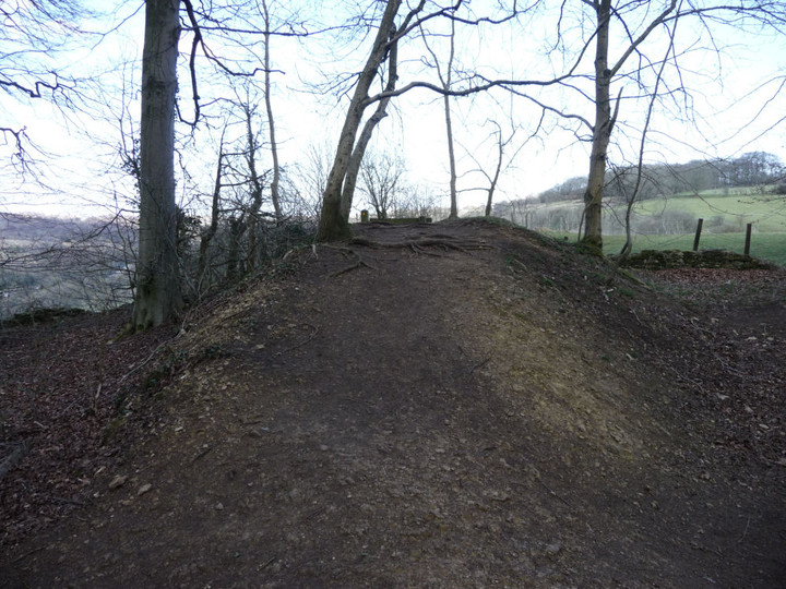
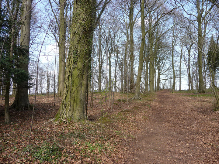
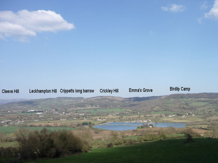
Into the Empty Quarter – Drosgl and the Berau 18 April 2013 |
Into the Empty Quarter – Drosgl and the Berau 18 April 2013Uneventful train journey over (why is it always raining in Stafford?), the road is hit with much enthusiasm. Today Postman and I are heading to the western Carneddau, the range’s empty quarter now, although once people lived and loved and died in the high valleys, millennia past or just yesterday, depending on your perspective of Time. I’m nervously excited about the walk ahead, easily the biggest test of my slow-mending leg and within sight of where that happened last summer. But the pull – or is it a push? - is too great to ignore, as ever. We park up at the end of a series of prosaically named streets (Short Street, Long Street, Hill Street) in Gerlan, just uphill from Bethesda. Stepping out of the car, the wind is keen and promises to offer a stiff challenge to our progress. The first section of the route takes us steadily uphill, past a very ruined settlement with views of Moel Faban, then across muddy fields to Tan-y-Garth, the first and last homely house we’ll come to for a good long time today. Moel Faban, Carneddau — Images21.04.13ce
Carnedd Moel y Ci — Images21.04.13ce
It’s a tiring climb up the grassy slopes, not helped by a succession of false crests that keep the top from us – luckily the strong wind is at our backs to push us up the final climb. I’ll be honest, I wasn’t expecting much from this first summit, on the map it appears very much a trivial subsidiary of Drosgl. The reality proves immensely better, once it finally comes into sight. A long ridge, lying at right angles to our route, each end of which is topped with a lovely natural cheval-de-frise of mini-pinnacles. From the northern end of the ridge there is a fine view of Moel Wnion, with the sea beyond. The wind up here is absurd, constantly threatening to knock us over. Postie reckons it’s not as bad as it was on Foel Grach last year – we’ll see. Drosgl awaits. Moel Wnion — Images21.04.13ce
Bwlch ym Mhwll-le (Llefn) — Images21.04.13ce
Carnedd Llewelyn — Images22.04.13ce
Drosgl Cairns — Images21.04.13ce
Drosgl Cairns — Fieldnotes21.04.13ceA rather narrow and meandering path heads up the slopes of Drosgl from Gyrn Wigau, fairly gentle at first then steepening after we cross a footpath running up from the direction of Moel Wnion. Rounding the shoulder of the mountain it becomes obvious that the path will not take us up to the summit, so we head off and upwards over increasingly rocky terrain. The wind that has been at our backs so far now blows across our route, trying to steer us off course and making progress difficult. At length we make it up onto the rounded summit plateau. The main prehistoric cairn here is enormous. As Gladman notes, it doesn’t crown the summit itself (that honour being left to a pointy modern effort) but instead turns its face to the northern panorama. The vista is awe-inspiring, the wonderful Ynys Mon to the northeast, with Moel Wnion in the foreground. To the north the sea stretches away, and there is a fine view of Llwytmor to the northwest with the Orme in the distance beyond. At our backs, the highest Carneddau tops drift in and out of the clouds. Oh yeah. Just a few metres north is a smaller cairn (apparently restored after excavation) with a neat kerb of larger blocks. Plenty of suitable material to choose from on this entirely rocky summit. It’s interesting to ponder the relationship between the two cairns and the people who were lain to rest in them. Were they contemporaries? Or did hundreds of years separate their interments? Only the wind might know the answer, but it’s speaking in a language we don’t understand. We sit in what little shelter we can find, contemplating the next move. My leg feels okay, and the rocky tops of Bera Mawr and Bera Bach look sooo close. Happily Postie is up for an extension of our walk to take them in, so we leave the cairns and head off the top. It’s a blessed relief to get out of the wind as we descend the eastern slopes to the boggy col below. Drosgl Cairns — Images22.04.13ce
Crossing a patch of resolutely frozen snow, my foot breaks through the crust into a void below, dropping me fully up to my thigh into nothingness. Woah. Care is clearly needed up here. Bera Mawr (“Big Ricks”) is crowned with a tor of superb rock pinnacles, with two natural monoliths reminiscent of Adam and Eve on Tryfan. The whole place brings to mind an ancient fortress. A scramble up amongst the rocks provides shelter for a while, although the highest point is a bit of a scary perch in the pummelling winds. The effort is more than rewarded by the view northwards down the valley of Afon Rhaeadr-fawr (Aber Falls) and of Maes y Gaer hillfort. Moel Wnion — Images23.04.13ce
Maes y Gaer — Images23.04.13ce
Drosgl Cairns — Images23.04.13ce
It’s a short walk onwards to Bera Bach (“Little Ricks”), which despite its name is the higher of the two summits and the highest point of our trip today at 807m. Unlike its sibling, this summit’s most compelling views are landwards, over Cwm Caseg to Carnedd Llewelyn, lovely Yr Elen and Carnedd Dafydd and south to Elidir Fawr and western Glyderau. The clouds lift on cue, the sky gods are certainly on our side today. The panorama is too much, 360 degrees of wonder. I can’t help but laugh out loud at the immensity of it all. A few months ago I had real doubts that I’ve ever make it back up into these wonderful mountains and frankly I’m overcome. Drink in the view, it really – really – doesn’t get any better than this. Cwm Caseg, Carneddau — Images23.04.13ce
Carnedd Llewelyn — Images23.04.13ce
Carnedd Dafydd — Images23.04.13ce
Carnedd Moel y Ci — Images23.04.13ce
Drosgl (Northern slopes) — Fieldnotes21.04.13ceAt length we head off the rocks, descending steeply to the west. We round the eastern slopes of Drosgl this time, passing a strange little shelter sculpted into the hillside, before carrying on round to the north, heading towards Moel Wnion. Our route crosses the small stream that, a couple of miles north, turns into the roaring water elemental at Aber Falls. Passing a little sheepfold and weirdly splayed dead sheep (presumably a victim of the late snows), Postie spots something – “Is that a cairn?” And so it is, a little modern marker surmounting the larger circular footprint of what looks undoubtedly like an ancient one. [Coflein obligingly confirms.] Despite its position down the slopes, the cairn enjoys excellent views, particularly of Llwytmor and Bera Mawr. A fine addition to the monuments on this mountain, certainly. Drosgl (Northern slopes) — Images24.04.13ce
Cwm Ffrydlas, Carneddau — Fieldnotes21.04.13ceShortly after leaving the cairn and heading to the col, the heavens open and a stinging sideways rain blasts into us. We reluctantly abandon any intention of visiting the cairn on Moel Wnion, instead pressing onwards, around the shapely cone of Gyrn. The rain finally relents as we reach the ancient settlement at Cwm Ffrydlas. There are a couple of curving external boundaries, but the remains are pretty scanty and quite difficult to make sense of. However, the settlement is beautifully positioned, at least as far as the scenery goes, with an awesome view across the valley to the Glyderau and Moel Eilio. It’s also sheltered down here, out of the winds that have blasted us for most of the day. A remote place now, on a day when we haven’t seen a soul, but people called it home once. Cwm Ffrydlas, Carneddau — Images24.04.13ce
Bwlch ym Mhwll-le (Llefn) — Fieldnotes21.04.13ceWe continue to descend to Bwlch ym Mhwll-lle, when I spot a circular lump to our left. This reveals itself to be an apparent cairn with a central slab looking suspiciously cist-like [Coflein concurs]. A great little spot this, astonishingly not even marked on the OS map – did they not bother to come here? From here we drop down into the steeply sided Bwlch itself, which Postie quite properly notes would benefit from a little footbridge for weary travellers. The OS’s lack of diligence also means that we don’t realise that there’s an even bigger cairn just to the north of the cist. This comes to light as we start our climb of the slopes of Moel Faban, but we’re both too weary to retrace our steps. Another visit to the Pass of No Bridge is clearly required. Bwlch ym Mhwll-le (Llefn) — Images24.04.13ce
Moel Eilio — Images30.04.13ce
Moel Faban, Carneddau — Fieldnotes21.04.13ceIt’s a steep climb for tired legs up onto the Moel Faban summit ridge, and the horizontal rain chooses this point to restart its assault. Gladman may wish to look away now, but we take shelter in the hollowed-out centre of the northern of the summit’s sizeable cairns. This one reminds me very much of some of the big examples on the western tops of Y Mynydd Ddu in South Wales. The rain relents a little, to the north the blue skies pretending it’s still a lovely day. We emerge from hiding and carry on along the ridge. All the cairns here are magnificent, and the views from this relatively modest hill are superb. A fine example of how a look at the map is no substitute at all for a visit. And a great finish to the day with plenty left to come back for another time. Moel Faban, Carneddau — Images30.04.13ce
It’s with much weariness that we make our final descent past Pen-y-Gaer (Bethesda), crawling along the same prosaically named back streets that the car took us along so many hours earlier. What a day it’s been. Time has emptied the settlements of the high valleys, denuded the cairns on the peaks, leaving this quarter of the Carneddau a remote, wild landscape. But to the mountains themselves, Man’s presence has been but an eye-blink. The shattered tops and tumbling waters have seen Time immeasurable, impossible spans for the human brain to comprehend. But we are compelled to try, and so it is that we will be compelled to come back. |
Posted by thesweetcheat 21st April 2013ce Edited 30th April 2013ce |


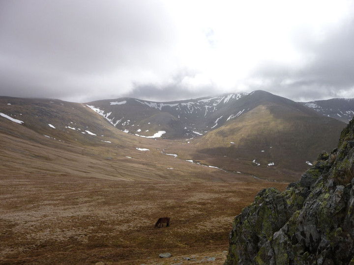


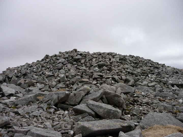


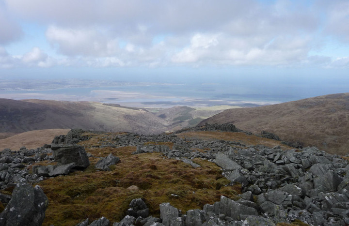

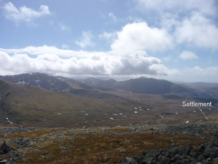
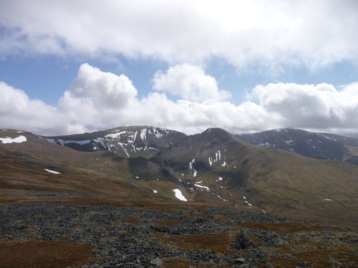
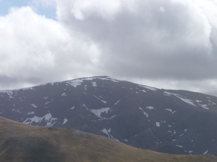

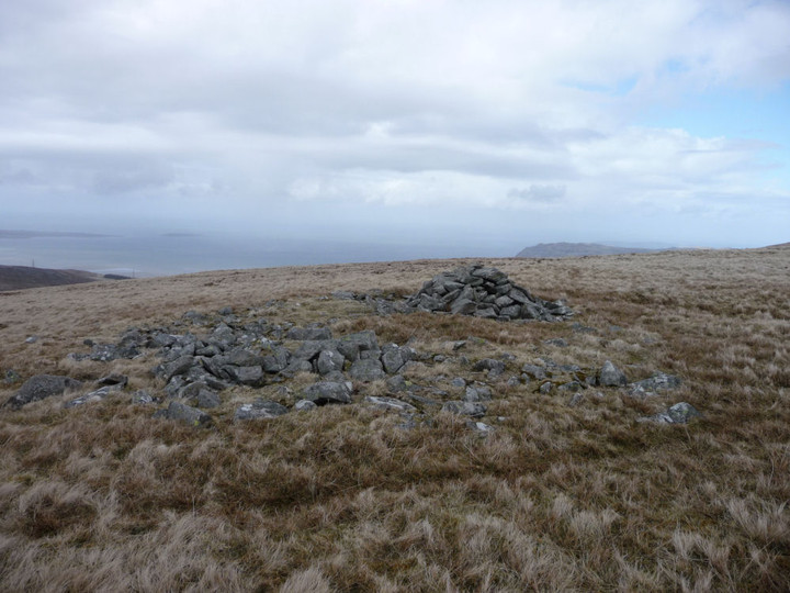
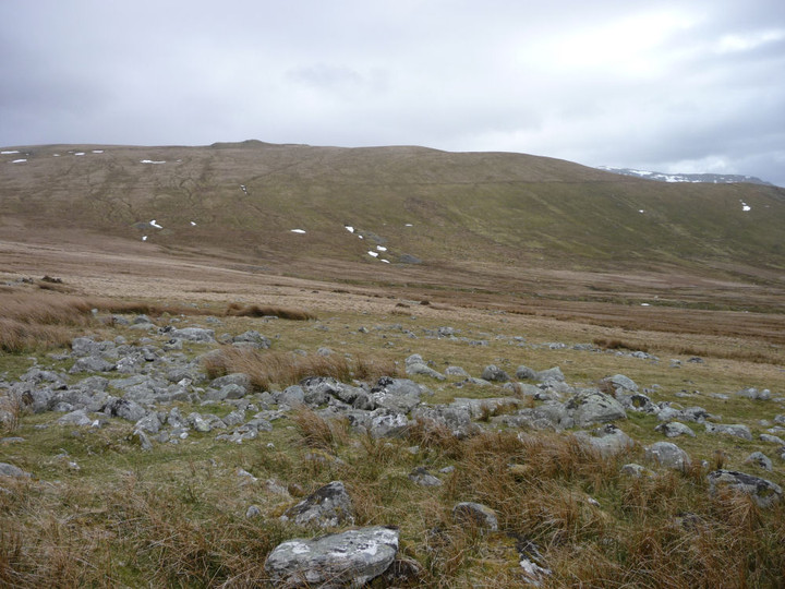
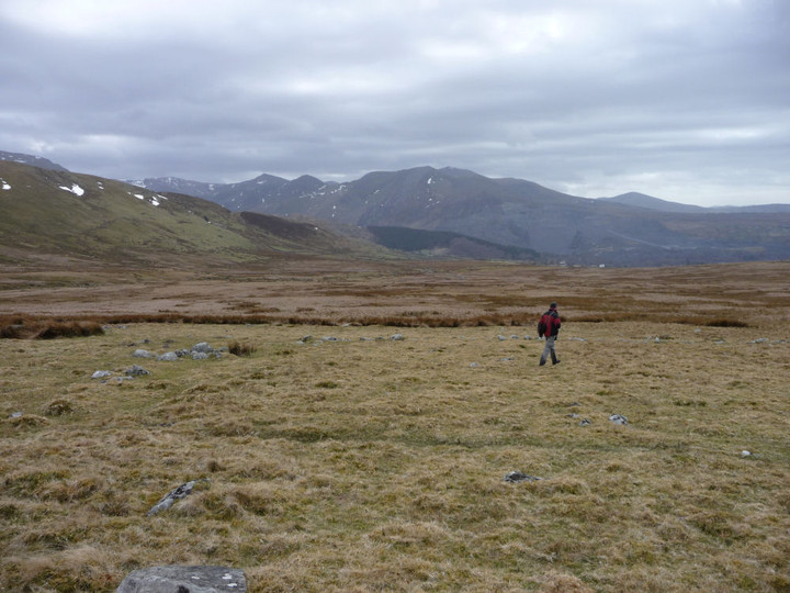
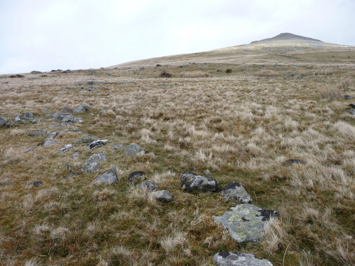
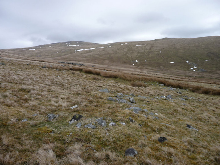
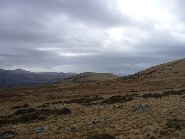
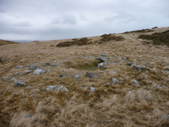
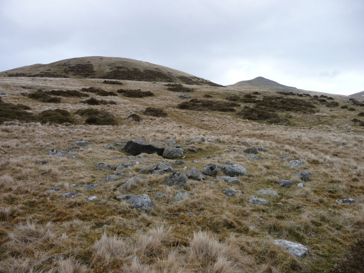
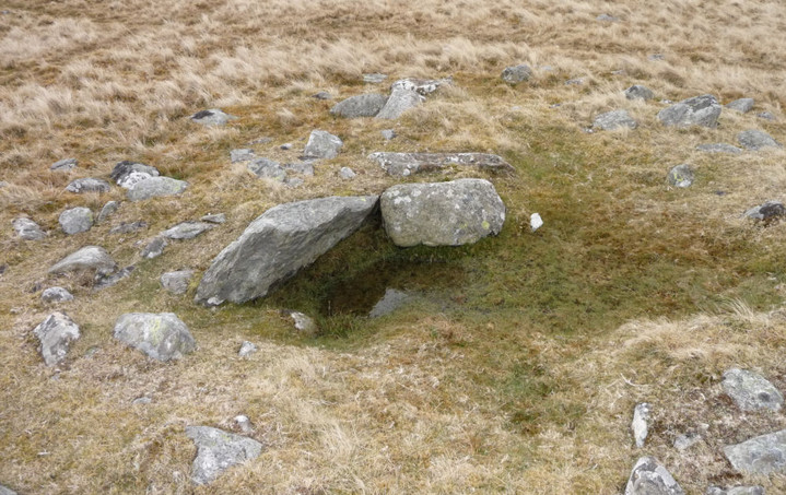
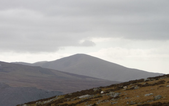
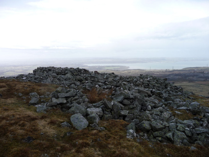
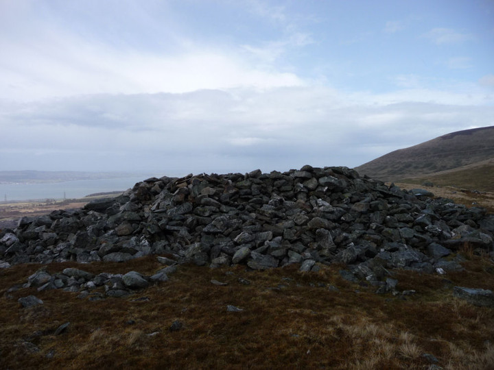
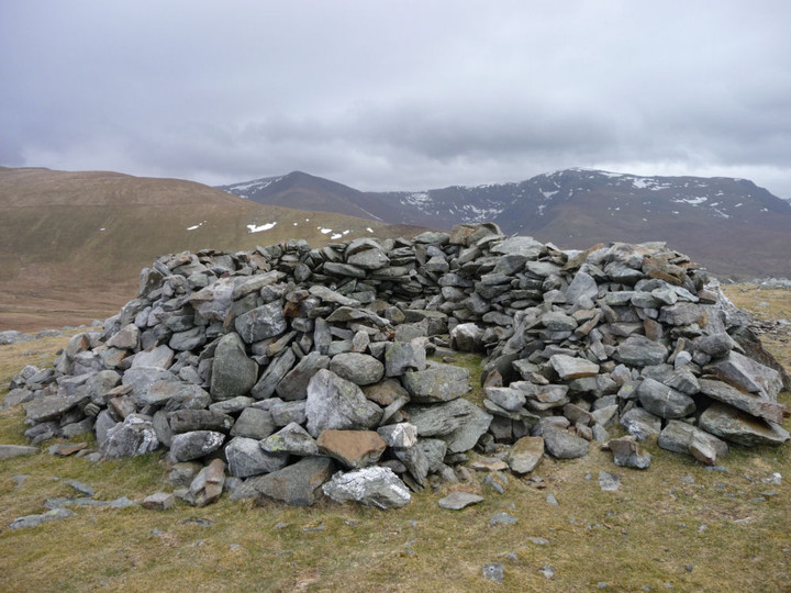
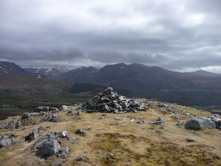
The Cotswold Way III – Winchcombe – Dowdeswell 6 April 2013 |
The Cotswold Way III – Winchcombe – Dowdeswell 6 April 2013A sunny Saturday is in the offing, but I’ve got this terrible cold coming on, so decline the charms of frozen Wales for another adventure close to home. Having been misled by on-line bus timetables into being in town with an hour to spare, I find myself in an outdoor shop succumbing, finally, to Gladman’s advice and buying some walking poles, in the hope that they might help my ongoing dodgy leg. Suitably equipped, I head off to Winchcombe, a bustling little town on this spring morning. After crossing the swift-flowing River Ishbourne, the Cotswold Way leaves the road and heads southwest. The ground is much firmer than it has been on the previous trips out, a dry week has drained much of the moisture from the mud that made walking such hard work. The biggest climb of the day is early on in this section, past disinterested horses and into the trees near Corndean Hall. Climbing up through the woods and fields towards today’s key site, I meet several pairs of walkers. This is obviously going to be a popular stretch; no lonely hills these. It’s quite a steep ascent up towards Belas Knap, a little more than 200 vertical metres above my start point in Winchcombe. Belas Knap — Fieldnotes14.04.13ceI’m excited to be coming back to Belas Knap. It’s been over three years since I last came up here, when the mound was buried under snow as deep and pristine as Christmas cake icing. In contrast, today is a proper spring day. The late winter has left some snow in the hedges and verges, but the twitter and trill of birdsong and the sunshine slanting through the trees on the approach instils a sense of renewal and rebirth. I don’t have the place entirely to myself on arrival, but the two walkers I meet are readying to leave and I’m soon alone. This is a wonderful monument; the restoration work detracts not at all from the splendour of curved forecourt, whaleback mound and welcoming chambers. What does detract however, is to be confronted with a swastika daubed on one of the stones in the NE chamber. It’s never nice to see damage of any sort at an ancient site, but the fact that some meat-headed moron has chosen to bring their far-right idiocy here is doubly upsetting. The swastika is black, it’s not clear what has been used, although it’s not paint – perhaps charcoal. Ugly, in every sense. More people arrive, but the mound is so big that it’s possible to feel alone here even when you’re not. I come across another swastika in the western chamber, which I manage to partially wash off with water from my bottle. Looking out from the chamber, I realise that the masts on the top of Cleeve Hill are visible. The last two times I came here, visibility was reduced by hillfog, so it’s great to be able to see so far. There is some temporary wooden fencing at the eastern tip of the horned forecourt, where people climbing up onto the mound have eroded the earthwork. It looks as though some repair work is underway here, from the little pile of stacked limestone pieces. I return to the NE chamber and find to my sadness two further swastikas that I hadn’t seen the first time. Awful. Emerging back into the sun, I meet three guys from Edinburgh, who turn out to be actors come down to Stratford for a play. They tell me that they usually come out to the Cotswolds for a walk on their trips down here, showing what a pull this area exerts far and wide. We chat for a bit and they head off towards Brockhampton, leaving me alone in the sunshine for a while longer. Before eventually leaving, I have a quick look at the almost-gone round barrow in the field to the WSW. Like the similarly denuded example at nearby Crippetts, it was obviously placed here in a relationship with the earlier long barrow, but is so reduced as to almost escape notice, even if you are looking for it. Although I’m considerably saddened by the neo-Nazi nonsense I’ve found here today, I’ve nevertheless enjoyed the re-visit to Belas Knap greatly. A fine example of how sympathetic restoration can really work, I’m lucky to have such a wonderful site so close to home. Adieu, for I shall surely return. Belas Knap — Images16.04.13ce
From here, my aging map shows the Cotswold Way route heading up onto the ridge of Cleeve Hill, but waymarkers indicate that it has now been re-routed down to Postlip Manor. As this involves a steep descent through woods, I opt to follow the former route, which stays on the higher ground and will offer better views. The views open out to the north and interestingly Belas Knap stays in sight for much of the way. At 330m, the top of Cleeve Hill is the highest point in Gloucestershire, today offering good updraughts for the paragliders. I’d not realised previously that Belas Knap is still visible from here. Belas Knap — Images16.04.13ce
I continue along the old Cotswold Way route, a steady descent past disused quarries alongside a beautifully clear stream running over the limestone, down to Postlip Warren. Here I rejoin the current route, as well as the first runners of some kind of long distance race. The path re-ascends steadily onto the edge of the escarpment, where great views of Langley Hill and hillforted Nottingham Hill unfold. Nottingham Hill — Images16.04.13ce
Cleeve Cloud — Fieldnotes14.04.13ceCleeve Hill has a wealth of Iron Age remains, as well as some possibly earlier monuments. Unfortunately, much of the hill has been badly damaged by limestone quarrying, to build the pretty Cotswolds villages and towns that so attract the tourists. The northwestern part is particularly badly affected, where the quarries have dug straight into the scarp face of the hill. But there is still enough to see, including a rectilinear enclosure that shows up particularly well in today’s light. The Ring is a small oval enclosure, set on steeply sloping ground. What function it served is unclear, maybe a stock pen or homestead site. The interior has been flattened into a platform for a now-vanished golf tee, but the surrounding bank and ditch are pretty well preserved and clear. An adjacent mound to the east has been tentatively identified as a hut circle, although there is also a possibility that it was a round barrow. The Cotswold Way passes right next to these two sites, so no excuse for not indulging in a brief re-visit. There is a very fine view of Nottingham Hill fort from here as well. The path then steepens to approach the northern summit of the hill, which has several separate summits, strung across its mile or so of top. Although not the highest, this one provides the best views, as reflected in a topograph. The Malverns and May Hill are clear today, but the Forest of Dean and Wales beyond are reduced to hazy smudges on the horizon. It’s busy here on such a lovely day, golfers, strollers and runners vying for position. I head south, crossing the remains of the Iron Age cross dyke that encircles this part of the hill, following the contour and largely unaffected by the quarries. The path now hugs the top of the escarpment, with artificially created cliffs dropping away vertiginously to my right. It’s quite cold up here on the edge, snow still clings to the scarps below me and the wind serves up a reminder that the late winter is only just receding. A number of the benches up here are festooned with brightly coloured ribbons, very similar to what you find at sacred wells across the country. Clearly this hilltop still represents a sacred place for locals. With the views stretching away across the vale below, to the mini-mountain range of the Malverns, it’s not difficult to understand why. The final prehistoric stop-off of the day is the once-impressive Cleeve Cloud fort. Three lines of defensive banks and ditches cut the interior off from the rest of the hill, but sadly the western half of the fort is gone, another victim of the inexorable need for building stone. To add insult to grievous injury, a golf green has been inserted into the northern ramparts of the fort. Bah. Despite all of this, it is a fine site still, the defences that remain are substantial and the views are immense. A good spot to stop off for a while and contemplate the route ahead, aided by what’s left of my lunch. The Ring, Cleeve Hill — Images16.04.13ce
Cleeve Common cross dyke — Images16.04.13ce
Cleeve Cloud — Images17.04.13ce
At some point I will have to decide whether to abandon the path above Prestbury and drop steeply down to that village, but for now I carry on along the escarpment, past the three trees (one a spindly replacement) known as the Three Sisters and down through Bill Smyllies Nature Reserve, a haven for many rare butterflies that favour the vegetation growing up from the limestone. There’s a fine retrospective view of Cleeve Cloud fort from here. Cleeve Cloud — Images17.04.13ce
I pass a beautiful sun-dappled copse of mature beach trees, sadly enmeshed in barbed wire and festooned with signs warning of CCTV and the list of possible crimes you might wish to avoid committing. Such a shame that southern England is so cursed with this need to bar and barricade, to stamp ownership and restrictions all over everything. Looking at the map, I decide to ignore the lures of Prestbury. Stopping here would make for an unnecessary climb at the start of the next walk, which I’m keen to avoid. Instead I press on, past Wood Farm round barrow (I don’t stop today, sorry). Wood Farm — Images17.04.13ce
|
Posted by thesweetcheat 14th April 2013ce Edited 14th November 2021ce |


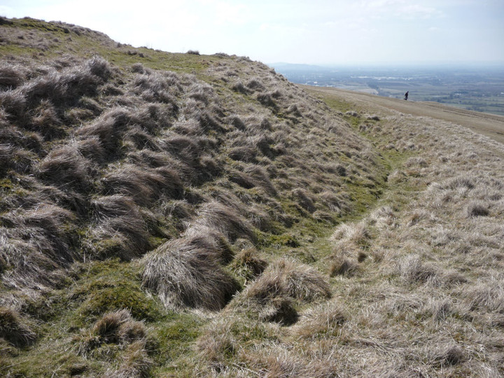
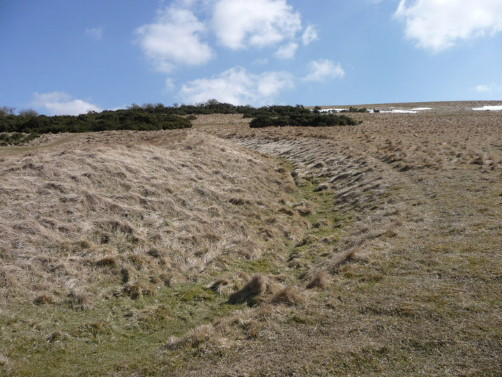
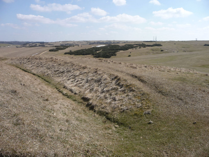

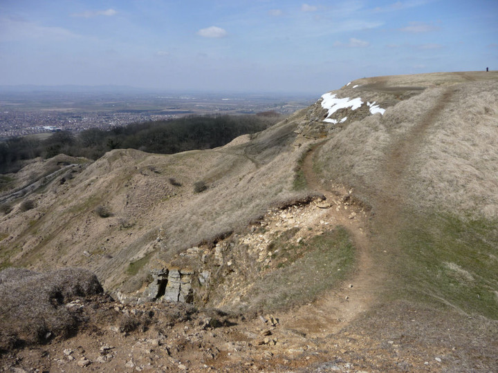


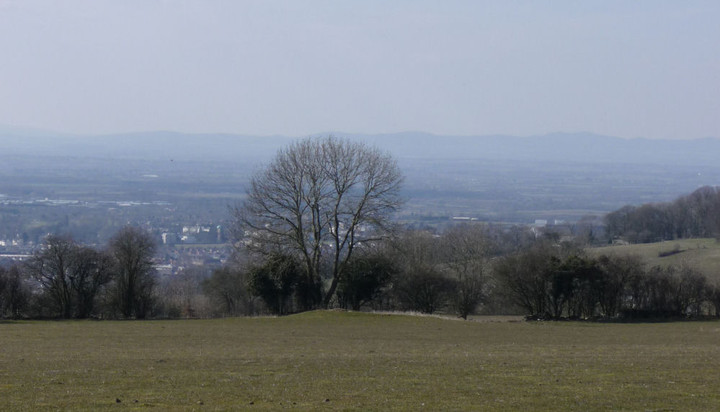
Circles, monuments, crashes, and floods. |
Circles, monuments, crashes, and floods.It's five in the morning and the day is just dawning and once more the A55 takes me to the place that an ancestor called home, a million miles from all my problems, it is where my heart lies, it is called Snowdonia. I wasn't totally sure where to go, one thought was Tre'r Cieri, but low funds and a late night made my decision for me, it was to be an Equinox sunrise at the Druids circle above Penmaenmawr. I decided to save time and take the car up the track as far as it would go, passing the twin pillars the track gets rutted and pitted, so much so that I decide this is the one and only time I shall take it up this far. Coat on, camera over the shoulder and I'm off up the path, rounding a small hill the wind hits me like a mad Yeti, cripes that's cold, for a fleeting moment I think this is far too cold I'm going back, but that's not the postal way either so I quicken my pace, keep my head down and keep moving. I pass Red Farm remnant stone circle and Maen Crwn with barely a glance, time for that on the return trip. Out of the damning cold wind I reach Brian, otherwise known as Circle 275, I say "alright Bri" and turn to check on the suns progress, bugger, it's already risen, so I run the rest of the way up to the circle of the Druids. It's as perfect a day for a sunrise as ive yet seen, and ive been watching the sun on the solstices and equinox's for over a decade. The sun rises probably not fortuitously over the highest part of the hills Cefn Maen Amor on the near horizon, this is not perfectly east, but if the land was totally flat it would be too far north of the highest point, but because the sun has had time to move through the sky a bit, it does rise above the highest point of Cefn Maen Amor. On the other side of the circle from the sun I am standing on a small mound, for a moment I wonder if it's man made, perhaps for people to stand upon whilst watching the equinox sunrise from, I look over to my left and note another mound, almost perfect for watching a winter solstice sunrise. There is no mound for the summer solstice. Was it perhaps not deemed as important as the other two ? Are they actually natural mounds, but the stone circle was placed there because of them. Between the two mounds an ancient track passes by. Ive always wondered why the circle is sited right on the edge of the land before it falls steeply down to Penmaenmawr. In between the big hills (Tal y Fan) and the steep down hill fall there is plenty of room to put a stone circle, granted most of it is pretty boggy , but why right the way over here on the edge. I feel I could be onto something, but it could be just a feeling. On the east side of the circle is another mound possibly in just the right place to see the sun set on the winter solstice, it should also be said that from the sun rise mounds the sun rises right across the middle of the circle. Oh for a central tall megalith.. This is easily the best stone circle in Wales. From there I take the short walk to the conundrum that Ive called Thora, less enthusiastic folk call it Monument 280, where are the other 279. Just to the north is Kevin, a ring cairn called Circle 278. Both of them would have brought me here on there own, but there is so much more up here. I then walk up to the top of Moelfre, a small hill with big views and a much denuded cairn, but it seems less denuded than before somehow. I sit here for a while watching clouds drift over the snow topped mountains to my south, resisting the urge to run over and climb one. That'll happen soon enough. I run down the hill, always a fun thing to do, but less fun than with Eric pulling me, urging me to go faster. Cors y Carneddau is my next port of call, a large barrow with a scooped out interior, a very decent kerb cairn , a less decent ring cairn and a fairly knackered hard to discern stone circle, the kerb cairn and the barrow are in my opinion wonderful to behold , second only to the Druids Circle, and the views of the mountains, which are almost overpowering. From Cefn Coch barrow I skirt around the base of becairned Moelfre following the path towards two cairns called Bryniau Bugeilydd. Passing the site of crashed WWII bomber " Bachelors baby " a B24 Liberator, they were probably looking for stone circles and never saw the hill coming. Coflein still isn't co-operating, so I didn't know what to expect, if anything. But I was pleasantly surprised to find the remains of a substantial kerb cairn. Half the kerbing has gone but those that remain are quite large, the interior of the cairn has a slight rise in ground level . About fifty yards up the hill back in the direction of the Druids circle, is what I presumed must be the other cairn. It is heather covered and is either situated upon a rocky knoll or the whole thing is the rocky knoll, there was nothing else in the vicinity so I clicked the camera and moved on. From there it's a second visit to Cerrig Gwynion, a cairn with a cist. Coflein state that the cairn is four meters high, it isn't, its barely one meter high My second visit, but as i'm approaching from a different direction it's as hard to find as the first time. then quickly back to the Druids, then a longer look at Brian, circle 275. It's now time to go and get out of this biting wind, but just before I do there's just one more new site to see. A mere fifty yards from Brian is this massively overlooked barrow/cairn, somewhat unfortunately named Fridd Wanc, with so many megalithic wonders here about it's almost understandable. About a meter tall and maybe five across this heather and grass covered mound melts seamlessly into it's surroundings, look for the telegraph pole uncaringly stuck right on top of it, blighters. Back at the car I'm glad to be out of the cold, which I'm glad to say didn't affect me too much. I leave the vicinity and head away. I planned on looking for and hopefully finding Porth Llwyd portal dolmen. I knew from George Nash that it may not be findable as it is now descheduled by the Office of works and described as " Presumed destroyed by flood " But I still hoped to at least locate the capstone, and one or two uprights could still be in place, but alas it was not to be, two hours of digging, scratching, going round in circles and wading through brambles all on what I supposed to be private property. I could find no trace of it, the Dolgarrog flood disaster (of which i include a photo of from the information board, not the actual flood, just a description of it) has taken it all away. Only more hours spent searching round in circles can prove its destruction. Any information about it's location would be greatly appreciated, it is not at the grid ref supplied by me here. (Taken from Nash) |
Posted by postman 13th April 2013ce Edited 14th April 2013ce |
Evie to Rousay May 30th 2012 |
Evie to Rousay May 30th 2012EVIE Set off from Orkney Blide Trust on the minibus on a lovely bright day. Arrived at Tingwall, that is thing-völlr 'thing-field'. The long mound has two peaks, the first the top of the broch that was used as the assembly place (with stonework exposed in various places top to base) and the second where a mill once stood. Walking between the houses the millstream ends in a culvert beneath a high drystane wall bridging the banks. There are various ruined buildings. At the cliff edge one of these is an old boathouse, just about distinguishable from the rest. Since this visit one of the other buildings has been renovated and dolled up as Betty's Reading Room, with an old mangle and a large mounted grinding-wheel outside. This was done by locals after the sudden death of Betty, and to commemorate her there are masses of shelves full of books - something to do whilst waiting for transport. Looking to my right towards Banks a shadowed heron could be made out on the shore in the distance. As the ferry left Tingwall I trained my binoculars on the mounds between Tingwall and Woodwick. The Knowe of Midgarth settlement (HY32SE 6 at HY39812361) is comprised of two sites - a long hillock that is a chambered mound (though thought by some to be a variation on a souterrain) adjacent to a circular mound. From the ferry at high magnification the disparity is plain to see, even clearer than from the farmroad to Tingwall. Previously I have seen similarities with the Howe of Hoxa, where a broch sits on the far end of a long mound (traditionally a Viking burial site), but if it isn't a settlement might it not be like the Head of Work where a circular cairn has been plonked on a long cairn later ?? The cairns are right at the edge of the low cliffs and from the ferry the material of the long cairn clearly extends down to the cliff base (or at least sea-level on the day). BRINIAN On arrival the first business of the day was a delivery of leaflets to the Rousay surgery, heading east and then down a steep short road to Brinian House. A fine two-storey house with pale lemon limewash walls below two pitched roofs (or a bayed roof). At least that is how the walls looked from the sea, where it resembles a rather tall kirk of the ordinary kind with a peedie pitch roofed portico centrally placed. There is an actual kirk close at hand. In fact there are two kirks, one no longer in use only a stone's throw away. You would think that the active kirk is the older one going by the arched windows but you can see from the tops that these are set into a rectangular space. Both are of the late kind, no great age to them, both with those [what I would call] porticos facing the sea [session houses ??] but with chimneys. The slightly older one has the graveyard behind it. This kirk took over the duties of the Swandro kirk when St Mary's Church became abandoned in 1815. Our first real stop is Trumland House. From May to September all of the grounds and gardens can be seen by the public, and part of the buildings. Near the entrance is an information point where you also pay for admittance, though this is unmanned and you pay how much you want to. The vista is magnificent, with a magnificent sweep of road taking you round to the grand mansion house. It is half-hidden by trees from here and there is a small woodland/copse right of the road, eventually giving way to heath and gorse at the edge of Green Hill. The next point of interest is the boundary wall, with a gateway sans gate. The gatepillars are square and of mortared stone. They are topped with concrete capped tall pyramids, the whole distinctly out of proportion. To the left is a devil's gate, three staggered slabs set into the wall. Raising your eyes there is a tomb under Historic Scotland's care on the horizon. In May 1898 workmen digging out a mound on Flag-Staff Hill, 300 yards west of Trumbland (sic) House, to make a summer seat found a 'vault' with bones etcetera (said to be similar to to a discovery near Hunclett farm described as unexcavated at the time, more than likely the Knowe of Hunclett). When the circle was almost done they came upon a well-finished wall and thin edgeset stones where the remains were found under a stone at the foot of one of these slabs along with rough pottery. Two more small 'kists' were found before they made the major discovery of the main body of the tomb under a 10" thick fallen lintel. This split-level tomb is now called Taversoe Tuick (HY42NW 2 at HY42572761). It dates to 2130~1740 BC. In the early 1990s the mid-morning sun was observed coming along the passage to the lower chamber on December 18th. Trevor Garnham thinks there may be an alignment involving the lower passage viz. burial cairn at top of Gairsay (HY42SW 15 at HY44112233) > the passage at HY42572761 > Holm of Huip cairn (HY63SW 4 at HY62823116) > Eday Church cairn (HY53SE 5 at HY56043344). At the house the first thing you see is a small museum and picture gallery attached to the side of the main building. Light and airy. What I love is the agricultural machinery, most especially the wood and metal wonder that is the ~1880 combined corn and seed-dressing machine. Actually, the first thing to greet us is the family pet, a white and light tan hound. The house has been given crow-stepped ends to the end of almost every roof. Its front is chock full of big bright windows. Of note are a bay window at ground level and two pedimented windows on the first floor on the left and on the right a narrow corner window with a curved projection a little distance above. The cluster of small buildings already mentioned make for a more cluttered east side, these entered by an 'archway' pointed on top but ogival beneath. Compared to the front the back of the house is not so imposing. Appearances deceive me as this is really the front of the house with a studded wooden door held by massive black hinges which sits inside a round arched decorative stone doorway edged with a rope effect. In an horizontal cartouche above this sits the original owner's initials in monogram form, the date 1873 and other letters. A steeped line, part of a horizontal stone one going across the whole face of the house, sits over it. Touching the top of that is the bottom of a window, and I have only just spotted that above the window is a vertical stone cartouche about the same size, with what appears to be a shield inside (sadly eroding). Centrally place in a large space on the right-hand side is the piece-de-resistance, a much larger stone cartouche containing Burrough's coat-of-arms with flourishes and a rectangular plaque with his medals in stone form. The west end is the east sans additions. Now I can see another of those corner windows, except at the actual corner of the house, and the 'cornice' above. Still cannot divine a purpose for that - all that I am reminded of is the same feature at e.g. the Clay Loan end of Victoria Street and Neukatineuks in Kirkwall, but those are (they say) designed for carriages to pass safely round and are at ground level, not two floors up !! Later, on leaving the natural wonderland behind and coming back round to the south side of the house, re-reading my photos taken from the north elucidates my former error as to the mansion house's orientation. What I like about this place is the almost unadulterated symmetry of it, not being a hostage to sterile balance. It certainly looks like the house only went as far as the two corner windows. But even within that the left is dominated by the two-storey bay window with two narrow windows below two triangles the same width topped by roses whilst the right is dominated by a twin-peaked crow-stepped roof that does not touch the upper windows. The right-hand side is what ordinarily would be a main entrance slap-bang centre. Two sets of stone steps lead from the stone path around the chief lawn up to the centre of its facade only to bring you up abruptly at the window - no sign a door had ever been intended even ! Of course the lower steps do take you to a similar path across in front of the house as if on a gallery with views down. Back to the day, and from the gallery we started for the gardens. Entry is under an arch set on pillars, the whole made from red sandstone now parti-coloured with pale lichen. Around Trumland House there are many items constructed from old ruins re-used. Whether this piece has been gathered together from scattered parts or is a (literally) monumental objet trouve I cannot tell. What first came to mind is the mediaeval St Olaf gateway sitting seulement in Kirkwall (transposed from its original setting). Yet it is nothing like, as I realised when I came back home. Oddly enough the remains of the Swandro kirk are amongst those used about the place. Secondly the arch struck me as a realisation of a whale's rib in stone. Nice curves carved along it. A few of the top stones supporting it are moulded and some with have horizontal grooves that may instead might be löwenkratzen 'lion-scratchings' similar to those att St Magnus Cathedral and at St Nicholas Chapel in Holm (kirk stone as medical treatment). There are some huge gunnera inside and a woolly-leaved plant with a gorgeous long lamb's-tail spike, flowers I assume. Another leguminous plant on steroids has rings of yellow flower at intervals up the stem. Then there's an IIRC shorter plant with pink flowers apparently composed only of overgrown pink stamens with no petals looking like a motion-stop photo of milk splashing up. Opposite the orchard where a lone gardener is working black-and-yellow liveried insects coat the flowers in a border. Amongst them are more hornets than I have ever seen, so busy that I can only mage to snap one breaking into the top of what I take to be an ornamental thistle's closed apical bud. The air hums. From here we move on to Burnside Walk to walk amidst and under shading trees. I now know that the path to Taversoe Tuick trails out of this woodland. Oh I would want to spend hours here with the dryades and naides inspiring me. One enticing spot is a shady pool. The furthest away sides have rocky faces and a streamlet trickles over in the corner, watering micro plants as it flows down them. At another more open place a wooden footbridge passes over the burn. This is comparatively modern I'm sure. It is a light brown symphony of diamond trellis and spiky posts. There are straight and smoothly curved top rails to trail the fingers behind you. This is quite a mature copse for a 'modern' creation, with long bare branches creating patterns below the sun-searching leaves. All too soon for me the time comes when our party must peradventure to pastures new - though I do take time out on my way back to join the rest to see the final side of the garden. WASBISTER Everyone gathered up again we returned whence we came and made a weodorshins circuit of the island, round below Cubbie Roo's Burden up into Sourin and the (slightly) lower slopes of Faraclett Head, then down the long steady incline of Leeon to the east end of Saviskaill Bay. We then turned down by the east side of the Loch of Wasbister for our next stop lay on the low cliffs east of Saviskaill farm. By the fieldwall are several single-storey ruins. These are the Saviskaill structures (HY43SW 40 at HY40123340) about which the NMRS relates that on the 1st 6" map attached to the wall are 3 roofless structures but only one on the 1977 1:10,000. Really they are both right, as you can tell not only from the first 25" map but also by drilling down through RCAHMS own CANMAP ! In fact there may be another shown yet or the three includes this. At present it is a bit of a jumble. The definite single structure's doorway faces the end of the road. It looks fairly obvious that though they appear seperate stuctures the three are actually compartments, as it were, of one long continuous building. I think this started off with the central piece as this has the curving walls you normally associate with Orkney's late Viking / early Mediaeval period. This would probably go well with the Saviskaill settlement (HY43SW 24 from HY40153342 to 40133358). That the head of this shingle bay is called Nousty Sand, indicating a number of nausts for drawing boats up into, makes me hazard that this used to be a hope 'sheltered bay'. Leaving the others to their repast I walked along the clifftop with a stupendous view of Faraclett Head looming up in the distance. After the sands come the hard rocks of the Riff of Wasbister. At the sea's edge large boulders shone white in the sun. These showed themselves to be seals basking in a line on the edge of a finger pointing into the waters.. It is the same on the Loch of Stenness where near the Stones of Stenness circle, where the distinction between seal and rock is so blurred visually that those not in the know will insist against you that one is the other unless movement visibly happens ! In getting a little closer I wandered over rocky plates amid pools left behind by the tide. Turning back I walked the shore the rest of the way back to rejoin the others. Where the minibus stood there is a jumble of rocks and slabs that seemed like archaeology to me. I did put it down to modern JCB activity, only realising weeks later that this must be one of the places where the Saviskaill settlement shows in the low shore banks even if it doesn't appear to be on NMRS record no. HY43SW 24 (from HY40153342 to 40133358), tentatively assigned to Norse times too. Mr Yorston of Trumland Cottage first brought it to the attention of officialdom. In 1972 Ordnance Survey noted drystane walling traces under present-day structures, along with some kitchen midden material. Came 1979 and high under the banks of the farm buildings some more walling had [?become] exposed, this time made up of very large beach stones (bringing to my mind the Lamb Holm settlement, now [IIRC] swept away). In the same year both these remains and the drystane walling are briefly described again, but with the additional info that the latter lay exposed for 28m - not sure if that stretches to the piece I saw [and I'm crap judging distances] but the SMR reports the former at the shingly bay's southern end with the farm itself on the north end ! Saviskaill 'sea-Hall' itself is a large complex of big farm buildings shining a golden yellow because the farm is almost entirely covered by lichen. It seems abandoned, or at least uninhabited, but is the kind o' place you could see being an attraction or mebbe a museum if someone threw a ton o' money at it ! Part of it at least has been a mill at one point (the one building with no lichen) because there is a sluice shown on a large-scale map by the wall nearest to me and I can see a rusty millwheel resting against the wall, a frame that I think is a bucket-type wheel (there is another such leaning against a building on the south side of the Lyde Road near Stenso). It is just such a magnificent place I would surely go into raptures if left to peruse up close for any length of time. And again a monument with no monument record as with that mansion house on Damsay. A visit to the Orkney Room comes up with no new information. Returning to the party most of them decided to take a look for themselves, and I decided I would try and see if I could complete the foursquare circuit of road around the Loch of Wasbister 'loch-farm' before they finished and decided to move on. So I set off along the eastern side. About half-way along this side of the square-ish road surrounding the loch a tongue of land points into the water. The gently mounded promontory is called Bretta Ness, by tradition the site of a kirk - the 1880 Name Book says the stones from it were removed to the loch margins. It is almost completely artificial (though this is under dispute) but to my mind the rises in water levels make it unlikely to have been an isolated crannog as the neck would have been even more prominent in prehistory. A now underwater dump of stone is overlain by a masonry platform and then the whole covered by a mound 1.7m in height and ~30mD. This site has been used since at least Pictish times, possibly metalworking from what I've read (I'm minded on the Knowe of Verron in Sandwick). Exploratory digs found an E/W line of wall-footings with building rubble and lime plaster that could be taken for chapel remains. Over at the W end the site's first use may be signified by thick circular walls (aerial photography has also revealed a weed-covered feature in the loch west of Bretta Ness). Then there were what sound like beehive cells,. Subsequent buildings left very scant remains because of frequent robbing, but due to later re-use as part of a kiln setup a flagged floor and walls built into the earlier rubble did survive. Out in the water near the far side is what is thought to be a crannog (a large artificial island settlement), The Burrian, though the 1880 Namebook confusingly also gives this as the loch's chapel site, with finds of deer remains and coins and reference to possible earlier building. In 1912 "The Orcadian" tells us that this site (HY33SE 13 at HY39493338) was still connected to the west shoreline by the remains of a bridge (then a foot underwater) with a fault half-way. Later underwater features were observed where it met the shore but these are apparently buried now. A 1972 report tells us that the stepping stones start midway along the north-west side of a ?modern wall on the island and continued visibly in that direction for some thirty metres. This wall running around the island is sub-divided into two unequal enclosures, but salmonberry hides any internal remains there might be. There may be traces of sections of an earlier wall a metre or two outside this, and just above the waterline walling has been noted. The combination of an island, The Burrian, and a promontory, Bretta Ness, is highly reminiscent of the Loch of Wasdale in Firth where these features were seen as a kirk and its burial ground [the latter also shown on some earlier maps as an island]. A little futher along the loch meets the road. On the other side of the road here a 'drain' in an E/W aligned earthwork strikes off. Near where this ends at a field boundary there is a well/wellspring immediately south and a burnt mound no much further along but immediately to the north. The latter is called Everhaud (HY43SW 3 at HY40203310). This conical mound, also aligned E/W, is some fourteen metres by twelve metres and stands to a height of 1.1m. Projecting the line of the 'drain' brings you to the traditional site of St. Colm's Kirk (HY43SW 10 at HY40553307), by the shore near the NE corner of a field bearing the number 33 on the 1:25,000 map. All that can now be seen of this is a low rise on the shoreline beneath rubble placed to combat erosion, hiding the ?paving slabs and edgeset stones still visible as recently as 1972. One cannot but wonder if the worshipper left this kirk following the E/W line until they came to the Loch of Wasbister before finally taking a boat to The Burrian. Looking over to my left above the Loch of Wasbister there is a large graveyard (now with an extension) that in 1880 was still attached to the ruins of Corse Kirk (HY33SE 14 3948 3361), all traces of which are now gone. Left again, by the main road, is the old Cogar school. North of this there is (though I didn't see it myself) on the south shore modern dumping over an irregular shaped rise covered in vegetation called The Bleaching Knowe (HY33SE 6 at HY39573316). Already in 1935 little remained of the 'burnt mound' apart from edge-set slabs in box arrangements at the water's edge. In 1972 there was little left of even these structures, and ten years later these too were out of sight. I phrase it thus because it is possible these still survive buried by trash or submerged by further loch encroachment. Second leg of the road is the main road. Not enough time to check the knowe for myself, so I forged ahead in my bid to return to the party by the sea. Above this southern side of the road there is an old complex of farm buildings alongside the burn like a much reduced stature Saviskaill but without the lichen. I am especially taken by a long building, one half slightly taller than the other, with the two roofs formed purely from long flags (in an unusually good state for their age). This is Quoys. I had hoped to visit the graveyard just in case there is still something that relates to Corse Kirk (archaeologists can get 'hung up' on searching too tightly in a set locality). Before I could turn the next corner the Blide bus came haring along. Reluctantly I hopped aboard and we set off on the last part of our circuit of Rousay, heading off around the Mansemass and Ward Hills into Westness. STANDING STONES Rushing like the wind we left a line of houses bordering the road and I only just had time to glimpse of the Long Stone (Frotoft) above the road. I know that the Langsteen (HY42NW 7 at HY 40412750) is described as close to the road but it's real close ! At some time it lay broken (or ? had been deliberately smashed like the Stone Of Odin in Stenness) but has since been 'fixed'. And so the height of this NW/SE aligned stone can only be given as nearly 7'6". Also it may be one of those where the ground is eroding or building up about the setting. There it is 2'6" broad and a foot thick, reducing a little to under two foot at the top. There is a bit of a hollow five foot up and this is likely to have been seen as a giant's fingerprint, which makes it the Cubbierow/ Kubbie Row's Stone/ Cubbie Roo's Stone thrown from Fitty Hill in Westray to Lyra. Other such on Rousay are the Clet of Westness (according to the 1884 "Anderson's Guide to Orkney" above "the little water" - Peerie Water I assume), about which I can find no more, and Finger Steen or Byasteen (which is [or was] on a cliff near Wasbister shore). Which standing stones we officially remember, and identify as such, and which we 'lose' sometimes seems potluck. BLACKHAMMER Our final stopping point before journey's end on Rousay at the roadside took us to where we went a little uphill to the Blackhammer tomb (HY42NW 3 at HY41422761), named for a farm that once stood on the terrace above - the steading can be easily made out from the air but has not survived as well (though on the ground my eyes could still trace where it once stood). It is highly likely that the farm buildings were where material from the upper part of the cairn went. Prior to excavation the chambered mound itself (a grass and heather covered oblong 78'x34'x5') had been thought merely the ruins of another peedie farmhouse. Eventually the stone cairn stood revealed as a sub-rectangle with sides incurving a little, aligned NW/SE and measuring 72'6" by 27' at its broadest. The eastern end still stood above ground to 1'8" the western end from 2' to 2'3, the northern side mostly 1'6" high (though falling to 6" at a point near the eastern end) and the southern side 2' to 2'6" rising to 3'6" by the west end. Its outer wall's foundation course formed a plinth like that of the Knowe of Yarso a kilometre west of here. For the first time antiquarians found walls fashioned to look like Unstan ware decoration, with sides built of slabs face down obliquely and set alternately slanting left-right and right-left to form hatched triangles. For the second time on Rousay they found a tomb's mouth deliberately closed, in this case blocked by well-built masonry whose outer face was flush with the cairn's outer wall. Animal bones were found throughout the debris inside the tomb, mostly with signs of burning. In the upper levels This included not only sheep, cattle and deer but also the remains of pink-footed geese and cormorant. Much of the bone lay in the first cell. In the bottom layer the birds were gannet, perhaps indicating a different season. Two very fragmented men's skeletons were found at the lowest level along with most of a carinated bowl and a splintered leaf-shaped flint knife burnt white, with only the upper face dressed. Low says one skeleton came from the passage and the other from the compartment furthest west. In cells 1 and 3 at the lowest level two scrapers and five flint splinters were found. One of the scrapers and a partly-worked splinter came from behind the walling sealing the entrance passage mouth under a step. At this same level a foot from cell 1's SW corner a fine-grained grey-green polished stone axe came to light, sealed by animal bones above and below it. Sometime after the tomb was built two large chucks of masonry were placed inside for purposes unknown. One stands in the angle between the 2nd-3rd stall partition and the chamber's north wall. The second, much cruder in appearance, makes an ogee across the chamber and starts in the south wall a little to the west of the entrance. Some folk object to the concrete capping given in 1955 to protect the tomb - perhaps we should shroud the inside with moss and lichen ;-) Really unless you filled the remains in and so kept everyone out this is the kind of compromise one has to come to. Nowadays the way into the tomb is topside, uphill, but at the front is a window that allows you to see down onto the original original [sic] entrance. Except today the sun shone straight down and all was glare. Or perhaps if I had been given a little more time… On the coast below is the Knowe of Hunclett, HY42NW 15 at HY41442722. This site or its predecessor would, I imagine, lay strong claim to being the settlement that went with the tomb. This is a ten-foot high turf-covered broch mound, apparently excavated (slight depression on summit), with extensive outbuildings to the south showing as many areas of exposed stonework. Thirty metres from the tower there is a shingle beach rather than the usual rocky Rousay shore, with further archaeology in the shore banks themselves . A rough, unploughable section of the next field west continues the five-foot high broad platform on which the broch sits. An exposed inner broch wall-section a yard long and a foot high has been extrapolated to give a diameter of 30-33' (with walls at least 10-12' thick) and its platform extends about two-hundred feet from the fieldwall. The whole broch is bounded at the west by a curving ditch 3-4m wide by 2.2m deep, on whose inner lip a possible fortification is indicated by a stone wall. And an outer wall can be read from more stonework west of the ditch itself. BRINIAN 2 Coming back to the pier I had a pootle around and the others whiled away their time outside the tearoom with refreshments. In the small harbour were two catamarans, a peedie one and a muckle one, comparatively speaking that is ! Side by side I believe they belonged to the same person. The Speedbird was large, white and modern, with a proper size cabin. Its yellow companion directly alongside looked more the original type i.e. twa small boats lashed together and definitely unpowered. I enjoyed the view over to Trumland Home Farm as I wandered over to the small museum, a cosy intimate place with enough to whet the appetite. Home Farm is a jumble of styles. With buildings of contrasting form it is as if someone had had the same idea as the fella who cobbled together the Hall of Tankerness but used a much later starting period for his design. The latest, and tallest, bit feels vaguely like a castle and also puts me in mind of an Italian hillside. Quaint. Soon enough the ferry came. On board and looking back towards Brinian Kirk my eye was caught again by Ivy Cottage to the right, a bonnie wee hoose dating back to1878 and minding me on a country cottage plonked on a hillside. There's a garden with lines of low 'bushes' and a low drystane wall. The central wooden door is a faded green, pale anyway, with a split window above the same and then the inscribed date on a shallow arched stone. It has been very sympathetically updated with small symmetrical skylights and below them twa narrow door-height windows. OTHER ISLANDS IN VIEW Took a few shots of Egilsay at maximum telephoto (520mm equivalent). Amazing how knobbly the hill's skyline looks, as if peppered with cairns or mounds. Time for a final view of Wyre. North of the pier, over at Rus Ness, there are what appear to be drystane seawalls. In a ?broken' section there are much heftier stones at the base and loose ones in an exposure behind. If they were part of structures they are definitely un-mortared. Part is now used for sewage discharge with a couple of large stone-lined tanks behind on the cliff-top. At the top of the island you can just make out the dark shape of Cubbie Roo's Castle and its surrounding banks. Though this had been built for the Viking called Kolbein Hruga the author Gregor Lamb has shown that the giant Cubbie Roo /Cuppierow must have been before the 12thC chieftain i.e. the giant assimilated the man, the Wyre man did not beget the Orkney-wide tales. As the ship passes the Bay of Whelkmulli (surely a cognate of Waulkmill Bay in Orphir - waulkr 'fuller of cloth', with Walkerhouses in both Evie and Birsay) there are no Wyre Skerries above water for the seals now as there were on the forward leg. EVIE AGAIN Trained my binoculars on the Evie coastline, around to Eynhallow [which I usually confuse with Egilsay !] and then Rousay, and took photos in a sequence in the hope that I would see more sites popping out, and idenifiably so, when I returned home. From the ferry looking north of the Woodwick woods the remains of the Ness of Woodwick broch in Evie (NMRS record no. HY42SW 9 at HY40072487) loomed large in my binoculars. Hedges notes that the rocky outcrops and sand below would be a good place to haul up a boat. This site is between the Loch of Vastray, a freshwater lochan, and the Rendall-Evie parish boundary at Woodwick's sea inlet. Though the site is called the Ness of Woodwick, after the headland, this is very obviously the Craig of Ritten. The 'crag' is an impressive mound with dimensions estimated as 50-60 feet with an inner diameter about half that - in 1946 at the seaward side to the NE about 20' of outer wall (thought to be the outer wall-face) could be observed. No midden was seen. Twenty years later most of this outer wall was overgrown like the rest of the mound. On a wider view there are two stone-walled enclosures running south of the mound that feel old, though post-broch they are in the right situation to replace outbuildings if this were a broch settlement like Gurness. I wonder if ritten could possibly be an error for pitten to give us a name Pict's Crag but a ret is an enclosure used during sheep-shearing and fits those enclosures equally well (Vikings are fond of giving placenames a double meaning too). An aerial Google image shows the broch's outer wall and others besides equally plainly. |
2nd April 2013ce |
The Cotswold Way II – Broadway – Winchcombe 23 March 2013 |
The Cotswold Way II – Broadway – Winchcombe 23 March 2013“The winter that keeps on giving”. That’s how the weatherman describes this weekend’s prospects. Last Saturday’s rain has been replaced by imminent heavy snowfall, a week before Easter. Not the weather to go too far afield, so instead I make a sooner than expected return to my new side project, the Cotswold Way. Snow is falling as I leave the house, but it’s not until the bus makes its slow way around the flanks of Cleeve Hill that I see the full scale of the winter terrain ahead. The village of Broadway is dusted lightly, with the snow falling steadily at a sufficiently shallow angle to plaster the eastern face of the war memorial’s column. I’m in some luck, as the snowfall will be hitting my back as the route mainly heads southwest along the Cotwolds escarpment. The sky is grey in all directions, with little prospect of brighter skies ahead today. Burhill Farm — Fieldnotes24.03.13ceLeaving the village, the route crosses muddy and wet fields, in what is becoming the noticeable feature of the Way so far. I’m soon climbing up more steeply, into deeper snow above the 100m mark. Broadway is disappearing into the gloom below. Once through the winter wonderland of Broadway Coppice, it’s time for my first – minor – diversion of the day. Leaving the Cotswold Way, a footpath skirts the southwestern edge of the field. The rampart of the fort comes into view once the crown of the hill has been rounded. Carl notes that there isn’t much to see here, apart from a single rampart. All true, but this is a fairly typical promontory site, with three sides defended by the natural scarp of the hill and only one rampart needed across the dip slope of the “neck”. The single rampart isn’t the most impressive you might see, topped with very mature trees and no doubt eroded from its original height. It no longer extends across the full length of the field, presumably a victim of ploughing. There is a ditch on the outer, northeastern, side. The footpath crosses the rampart at its northwestern end, and then runs directly across the featureless interior – especially featureless in the snow today! Once at the south of the fort, the ground drops away steeply and there is a good view of Buckland village below. I walk back around the southwestern and northern perimeter. There’s little evidence of any counterscarping and the site is not the most obviously defensible. However, various recorded finds of pottery, flints and a saddle quern suggest occupation over a long period, perhaps at times where defensive capability was not the primary focus. Certainly worth the minimal effort of the diversion today. Burhill Farm — Images24.03.13ce
Back on the Cotswold Way, the route follows a farm track to the muddy yard of Manor Farm. The ascent to day’s highest point ( a modest 295m) now lies ahead, a steady climb of 100 vertical metres or so, not steep but increasingly difficult in the deepening snow. My dodgy leg is starting to protest now and as I make my way past Laverton Hill Barn I’m beginning to wonder if I should consider curtailing the planned distance. I had considered a further detour to Snowshill barrows, but reluctantly decide that today isn’t the best day to see them. Instead I carry on south, along a track filled with shin deep drifts of snow, pristine and untrodden. And blooming hard work. Shenberrow Hill Camp — Fieldnotes24.03.13ceNearing the top of the hill, the northeast wind takes on an additional biting edge, driving snow in almost horizontally, over the edge of the escarpment. Shenberrow Hill Camp is another promontory fort, like its neighbour at Burhill Farm. Unlike that site though, the ramparts of Shenberrow are rather more powerful, with two banks protecting the approach from gentler slope to the north. On the west and south sides the steep scarp provides natural defences. I walk some way along a bridleway that follows the curve of the northern rampart, but the wind is doing its best to knock me over and I’m quite relieved to retrace my steps and enter the fort. The interior is crossed by the Cotswold Way itself, and an area below the west and south sides are access land, making it possible to get a good look at the earthworks without needing any permission. The southeastern section of rampart has unfortunately been destroyed by the construction of the farmhouse. As the strong wind and drifted snow attests, this is an exposed place and life here in the Iron Age must have been very tough, even snug under thatch behind the ramparts. The Way exits the fort through what appears to be an original entrance at the south, from which the ground drops steeply to a wooded valley. Rather than following the path, I head onto the access land to the west of the fort, for a look at the sloping flanks below. The deep snow has the advantage of making a fairly sharp descent over thorny shrubs back to the path easier than it would be at other times. Shenberrow Hill Camp — Images25.03.13ce
From here the route drops quickly to the village of Stanton, another of the chocolate box places that make the Cotswolds such a tourist honey trap. Here my route nearly intersects that of the almost-due bus, and for a few minutes my aching leg tells me I should call it quits here. But there’s a stupid stubbornness at work that keeps me walking, heading out of the village and onto a path crossing two of the muddiest fields it’s ever been my displeasure to have to cross. I’m below the snowline here, and the mud is deep enough to cover my boots. Squelch. As I make my way south across more muddy fields, the whistle of a steam train on the nearby Cotswolds railway echoes, ghostly, across the flatlands to my west. Not for the first time, I wish that the designers of the Way had routed it up on the edge of the escarpment, rather than down here in the mud. I can only assume a mud-loving lunatic had a hand in the choice. Reaching Stanway, the snow is falling more heavily, sending the neighbourhood rooks cawing and flapping. I take shelter in the church to rest my leg and eat some lunch. The stop does me good and I re-emerge into slackening snow feeling more up for the second part of the walk. Stumps Cross — Fieldnotes24.03.13ceAfter the hamlet of Wood Stanway, where a passing farmer greets me with laughter and a disbelieving “you must be mad”, the route reaches its steepest climb, up to Stumps Cross. I take the ascent rather gingerly, but it’s not a huge climb and I reach the bench at the top without any major problems, despite the mud at the bottom and drifted snow on the slopes. From here, there are expansive views across the vale to the west on a good day, but sadly little to be seen under the low cloud today. I visited the two round barrows a little over a year ago, but neglected to write any fieldnotes. Aside from the view from the escarpment edge, which is now obscured by trees from here, there is little recommend these barrows. They have been ploughed within an inch of their lives and unless you knew they were there, you probably wouldn’t notice them at all. However, if positioning is everything, they would have been impressive in their day and can be compared with the Saintbury Barrow a few miles away along the escarpment edge. Incidentally, Stumps Cross takes its name from the base of a now otherwise gone medieval cross alongside the road junction below the barrows. Stumps Cross — Images28.03.13ce
Beckbury — Fieldnotes24.03.13ceLeaving the junction, the Cotswold Way follows a straight track up to the top of the hill. The wind is keen, blowing the sculpted snow into flurries of spindrift. The walking is hard work, the shin-deep snow a plague for tired legs. Beckbury is another site visited last year, with overdue field notes. On that occasion, I approached from the southwest, up the steep escarpment. Today I have it easier, crossing the gentle slopes from the east. Like the other forts visited today, Beckbury is a promontory fort, with the west and northern sides relying on the escarpment for protection. Here the length of single rampart is rather longer, the curving bank on the east and south sides enclosing an area approx. 160 x 130 m. The eastern bank is rather damaged, with a gap halfway along its length that is not original but has been broken through in recent times. This has exposed some big chunks of the limestone that make up the rampart’s construction. The southern curve of the bank is topped by a drystone wall, but remains fairly well-preserved. Apart from a short section at the northern end, there is little sign of a ditch, although on today’s visit it would be filled with snow anyway! Last time I came here there were quite a few people out for a stroll. Today it’s deserted, the howling wind the only company apart from the sheep sheltering in the lee of the escarpment. The western slopes have developed cornices of snow that wouldn’t be out of place in the Cairngorms, although obviously without the life-threatening drop below. At the northwestern corner is an enigmatic limestone monument, graffiti scratched but naming no names as to whom it commemorates. Ozymandias, perhaps? Beckbury — Images28.03.13ce
It’s a steep descent over slippery roots off the ramparts, then something of a pell-mell downward hurry through startled sheep across the fields to the southwest. The path meets a track running into Hailes Wood, where the spun snow clings to the branches but all at once is gone from underfoot, as once more I’m below the snow line. I don’t pause to revisit Hailes Wood Camp this time (more AWOL fieldnotes) but carry on down to the ruins of the Abbey, a relic of Henry VII and Thomas Cromwell’s dismantling. I’d love to say it was an easy stroll from here to the finish at Winchcombe, but that would be a lie. Instead, it’s yet more saturated mud and by the time I reach the intriguingly named Puck Pit Lane, I’m caked in the stuff. Luckily a fast-flowing culvert allows me to get the worst off my boots, and I can peel the splattered waterproofs off once I reach the safety of the town. It’s been another good section, though my leg may not easily forgive me for it. The three forts seen today are all worthy of a visit and the solitude of the snowy hills never fails to lift the spirits. To the woman at Wood Stanway, mad I may be, but reminded that I’m alive as well. That’s what it’s all about, isn’t it? Now, let’s have some sunshine please. |
Posted by thesweetcheat 24th March 2013ce Edited 28th March 2013ce |


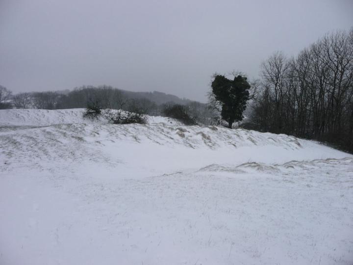

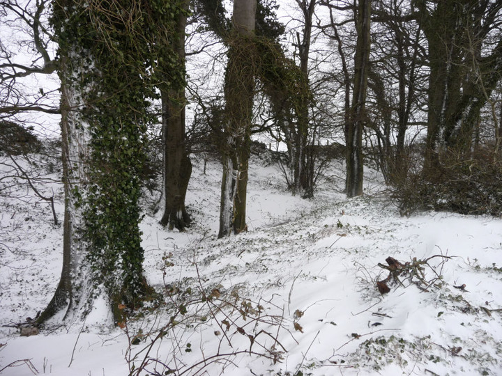
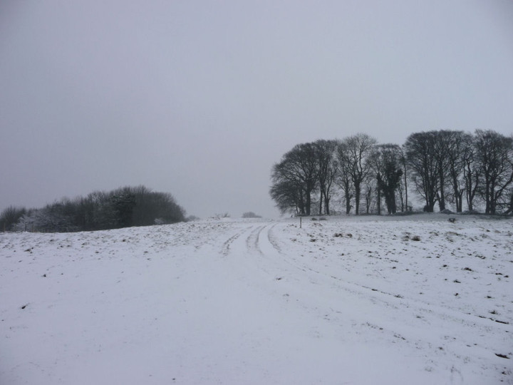

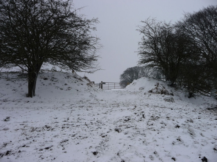

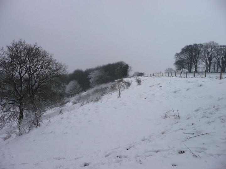

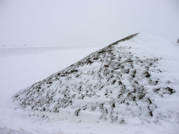

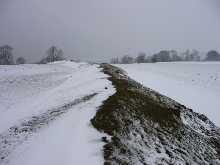
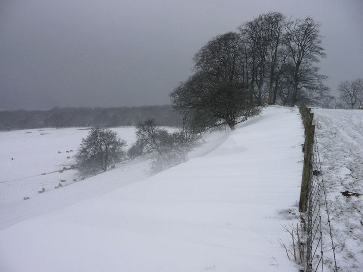
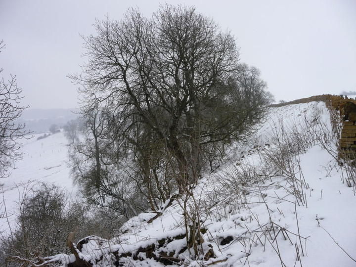
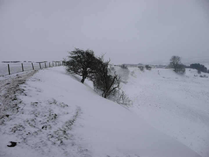
The Cotswold Way I – Chipping Campden – Broadway 16 March 2013 |
The Cotswold Way I – Chipping Campden – Broadway 16 March 2013After ending my recent trip to Meon Hill in the pretty town of Chipping Campden, I thought it about time that I made a bit more effort with the Cotswolds again. Despite living below the edge of yellow escarpment for almost 7 years now, my gaze has tended to be drawn away to the west. Part of the reason has been the constant fascination of Wales, but it’s also partly due to the effects of farming on much of the Cotswolds’ prehistory, from access difficulties to endlessly ploughed barrows and earthworks. But there is also much to enjoy and so I thought I’d have a go at the Cotswold Way, 102 miles along the Cotswold edge from Chipping Campden to Bath. The Way passes close to a large number of prehistoric sites, some familiar to me, some not. While the Wales Coast Path is the main objective for G/F and I over the next few years, this can be my experimental side project, to dabble in occasionally. Hopefully more enjoyable than a drum opera or earnest acoustic set at least. The promise of an unsettled weekend with heavy showers sounds like a good time to get on with it. Getting to the start is a bit of a faff involving two buses, and heavy rain all the way to Moreton in Marsh. By the time the second bus drops me in the centre of Chipping Campden, it’s clearing and the sun is threatening to break cover. Chipping Campden has plenty of amenities and makes for a good start (or end) point for a walk, but I don’t linger today, hoping to make the most of the good weather while it lasts. Out of the town it’s a steady climb along a rather muddy lane to Dover’s Hill. Dover’s Hill enjoyed fame in the early 17th century when the enterprising Robert Dover instituted an annual games here, called the Olimpicks, a couple of hundred years before the better-known Much Wenlock version. There’s no games going on up here today, but there is a superb view. To the northeast, the flat-topped Meon Hill, to the west the bulk of Bredon Hill, with the unmistakeable ridge of the Malverns beyond, all topped with hillforts. To the north, the Vale of Evesham stretches away as far as the eye can see on this rather gloomy morning. There’s a handy toposcope on the highest point of the hill and a cute little limestone seat that reminds me of a miniature chambered tomb. It’s nice to back in the hills, as ever. Kiftsgate Stone — Fieldnotes17.03.13ceAfter drinking in the views for a while, I carry on off the hilltop. Here the Cotswold Way follows a busier road and has been moved off the verge and slightly down the slope, out of sight of the road. But I choose to stick to the verge instead, because my first stop-off of the day beckons. I remember Carl having trouble finding this stone, and as I pass a locked and chicken-wired gate I wonder if it’s going to be particularly accessible. I’m therefore very pleased to see it from the road, through a little gap into the trees. Access is as easy as can be, the stone is only yards from the road (it’s quite a way northeast of the layby that Carl refers to). I didn’t really know what to expect from this “disputed antiquity”. It turns out to be a dinky little irregular limestone slab, heavily moss-covered and orientated with the long side SW-NE, parallel with the road. As reported, it has a (blocked) hole through it. On the NW face of the stone, the hole has the appearance of being counter-sunk, although whether this was intentional or caused by something inserted into the hole being turned and causing wear I can’t say. Apart from the hole, it’s not obviously worked, but the thick moss and the years of wear could easily mask any signs that might be there. I really like it, hidden away and passed by lots of unsuspecting drivers every day. I wouldn’t want to commit to its antiquity, but it’s worth paying your respects if you come this way. A promising start to the day, anyway. Kiftsgate Stone — Images17.03.13ce
Willersey Camp — Fieldnotes17.03.13ceLeaving Kiftsgate Stone, the Way follows the Mile Drive, a broad, grassy path that would make for easy walking if less wet underfoot. At the end there are two fields of mud to cross (lovely), after which I take my main detour of the day, heading north alongside the Roman Buckle Street. My next site is one that I am not by any means hopeful about. Despite being a very decent-sized fort, Willersey Camp has had the misfortune of having a golf course dumped onto it, the construction of which, according to Pastscape, caused “considerable damage” to the fort. Approaching from the south, any views are obstructed by a thick screen of leylandii, that well-known native Cotswold species. A bit further along the road is the Dormy Hotel, built right on the SE corner of the fort. I walk up the drive towards the reception, hoping to get a bit of rampart action. The drive cuts through the bank and I manage to get a picture in. However, the CCTV signs don’t lie and it’s barely a minute before a uniformed functionary emerges to ask me if I need any “help”. I get the impression that the response “I’d like to have a look at the hillfort” would be as well-received as “I’ve come to steal your silver teaspoons”, so decline the offer and return to the road. The road follows the old line of the eastern rampart, but apart from a bit of “rough” (in the golfing sense) there’s nothing to see here. A low mound can be seen silhouetted on the skyline in the middle of the course and I think this is probably the poor remains of the long barrow. Having been accosted once, I’m not keen to have another go, so I don’t follow Carl’s admirable example. In any case, I’m not acceptably attired for the course, wearing neither a turtleneck shirt, tailored shorts, or golf shoes. I imagine there would be a scene at such a blatant breach of the dress code. I carry on past the clubhouse. As Carl said, the wooded area alongside the road is the place to come. There is indeed quite a bit of litter (tut) but the ramparts here are very impressive. The outer rampart is several metres high, with a slighter, inner rampart that hasn’t been encroached upon by the golf course. It’s a shame the rest of the fort has been so badly treated in comparison, because it must have been a fine site. Willersey Camp — Images17.03.13ce
Willersey Long Barrow — Images17.03.13ce
Meon Hill — Images17.03.13ce
Saintbury Barrow — Fieldnotes17.03.13ceContinuing north, I take a left (west) at the crossroads. A few yards on, a metal right of way sign points south for a bridleway and north for a footpath. I take the latter, for this leads very conveniently to the Saintbury round barrow. This could easily be overlooked as just another ploughed down barrow in the Cotswolds, but Carl’s previous notes indicate that it’s worthy of attention. He climbed up from Saintbury to the north, whereas my route takes me northwards downhill to the barrow. It’s very muddy and the hill seems to teem with springs, so I’m glad to be wearing my waterproofs, even as the sun has now come out. The barrow is quite a way down the sloping field, and is not visible until I’m practically on top of it. Before it comes into view, there is the rather surreal sight of the top of the lofty (ha) spire of Saintbury church appearing below me. The barrow itself is small, but quite well preserved for these parts, with the possible remains of an infilled ditch around it. As Carl notes, the positioning is terrific. Perched just above the steeper part of the scarp, the views are wonderful indeed. To the northeast, trees block Meon Hill fort, but otherwise there is an expansive panorama, from Bredon Hill, the distant Malverns, across into Mid-Wales and at the furthest limit of my sight, Titterstone Clee and Brown Clee, maybe 60 miles away and near where I grew up. The darker, wooded hills in front of them possibly even include Croft Ambrey, the fort I used to visit on Boxing Day walks. Breathtaking. Saintbury Barrow — Images17.03.13ce
Heading back up the slippery slope, I manage to fall over as the mud takes my feet from under me. Luckily it’s all very soft and squidgy, so only my dignity is bruised. Back at the road, I cross over and take the bridleway, which runs parallel with the northern rampart of the fort. Unfortunately, a screen of vegetation and yet more golf fairways block access to this part of the fort. The bridleway is also incredibly muddy and after a while I turn back, caked in mud and feeling a bit deflated. Retracing my steps past the clubhouse, I head south again to rejoin the Cotswold Way. The trip to Saintbury barrow has provided reward enough to justify the detour, so the relative disappointment of the fort doesn’t detract too much. It’s now clouded over again, and back on the footpath across yet more mud, the rain starts again in earnest. I stop off at the Fish Hill picnic area (tables, toilets, car park, weird arrangements of upright limestone) where there is a particularly fine toposcope, carved with a relief map of the Cotswolds and I learn that aligned with Tewkesbury (15 miles away) is New York (3370 miles away). Some ley-line that. From here the path crosses the busy A44 before climbing gently up through woods towards the highest point of today’s walk, at Broadway Tower. The weather doesn’t lend my visit to the tower quite the views it deserves, but I do learn that there is a decommissioned nuclear bunker up here. Hopefully not something that will be needed again! From the tower it’s a very steep descent off the escarpment down to Broadway, with good views of the western flank of Willersey Camp to be had from the path. I’m quite wet and very muddy by the time I emerge onto the streets of Broadway, but nothing coffee and caramel shortbread can’t cure. It’s been a fine start to the Cotswold Way, with a good variety of sites for the TMA-er on the way. I’m looking forward to my next side project dabble. |
Posted by thesweetcheat 17th March 2013ce |
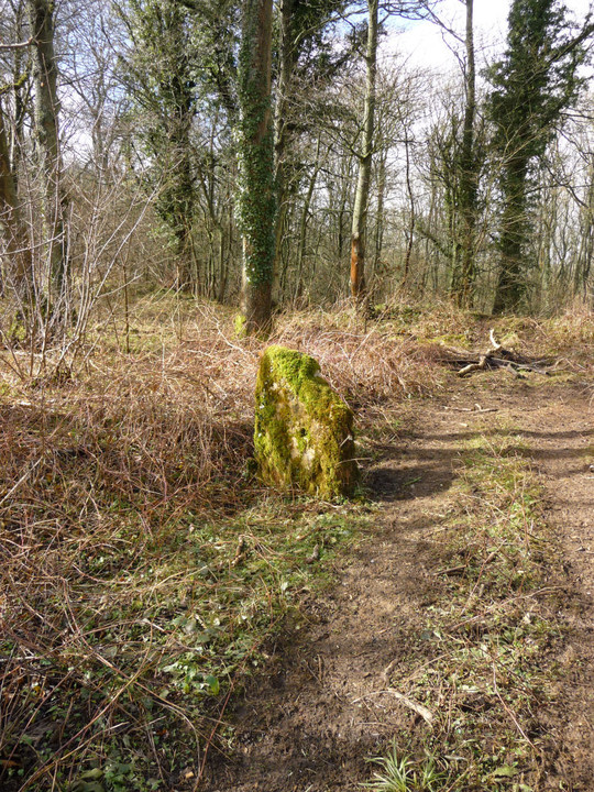
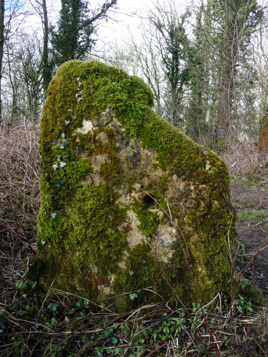
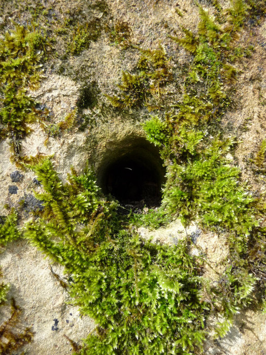
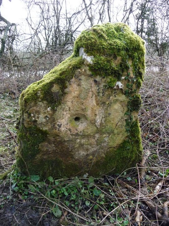
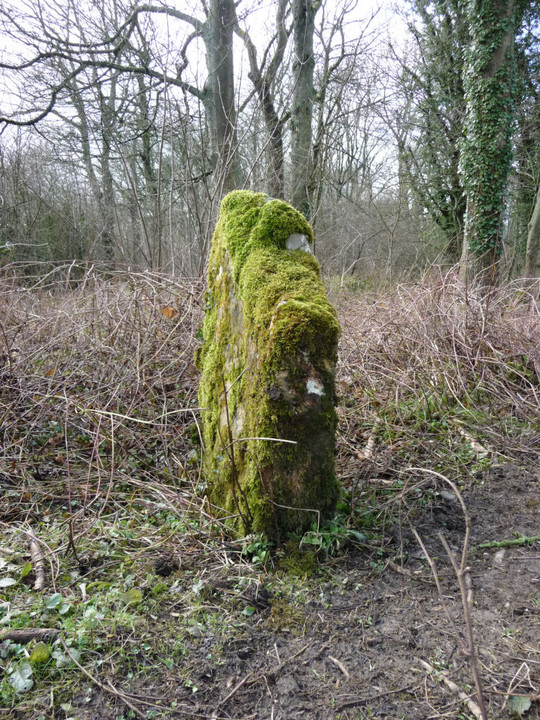
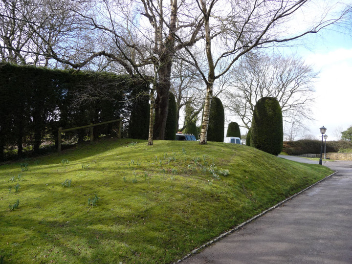
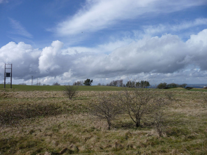
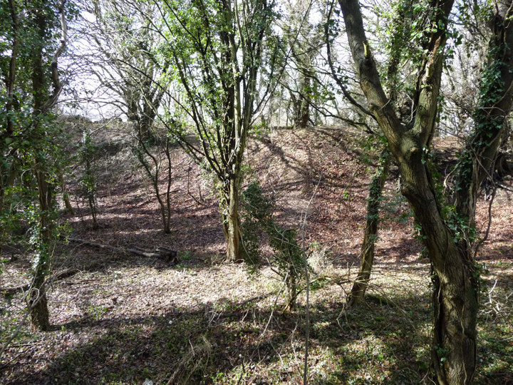
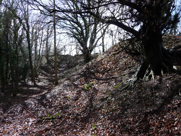
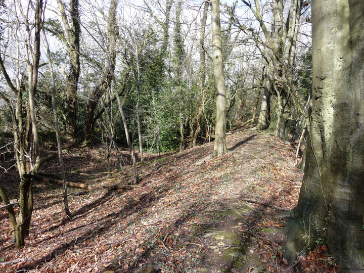
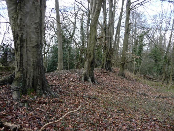
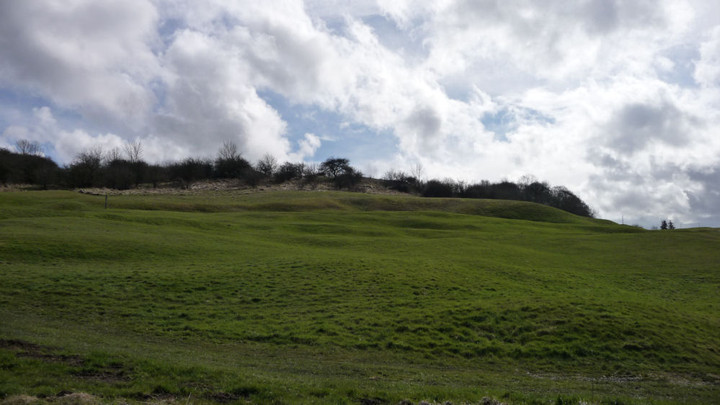
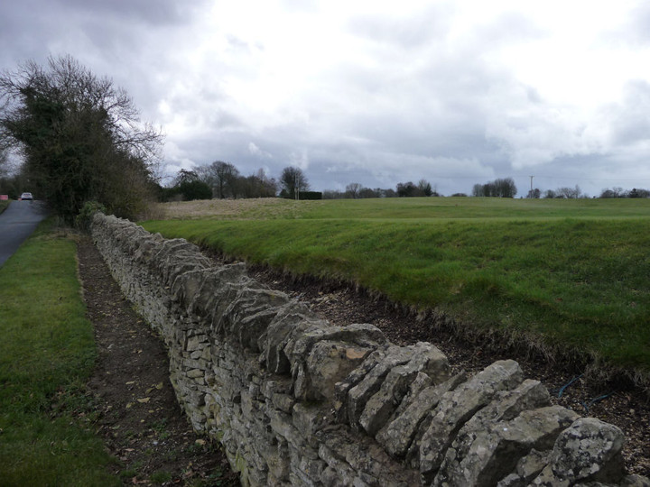
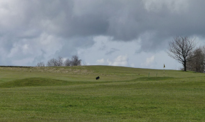
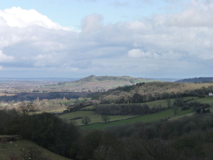
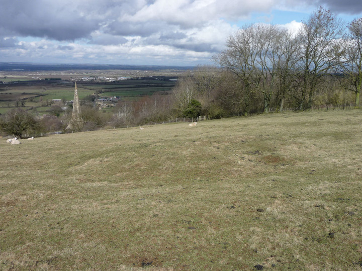
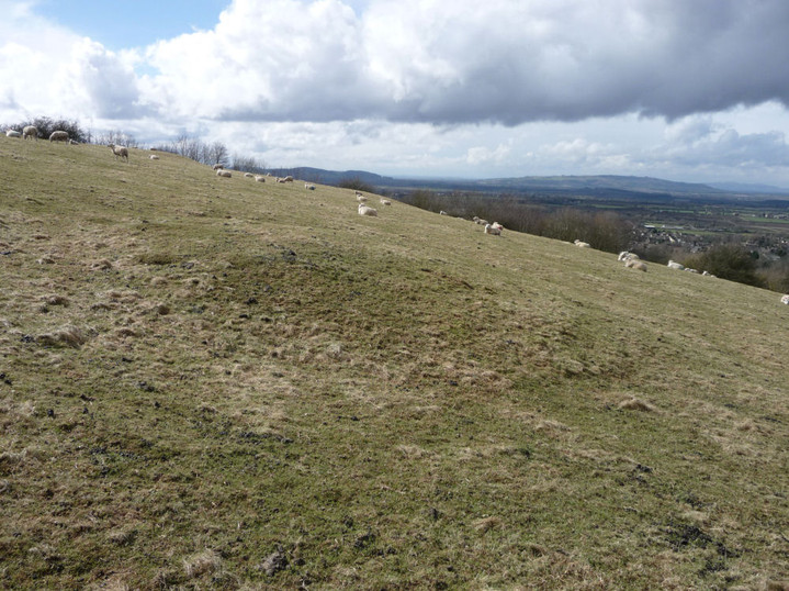
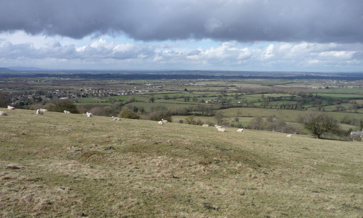
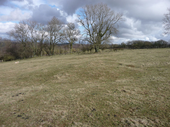
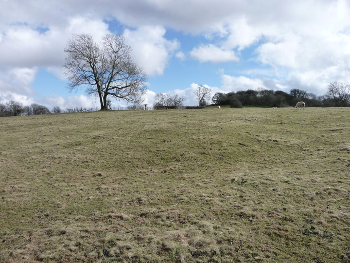
Wonders of Whimble (and Bache again) 2 March 2013 |
Wonders of Whimble (and Bache again) 2 March 2013The promise of some much-needed sunshine centred on Mid-Wales, together with tentative confidence that my leg would stand up to something of a challenge, has led me to focus my sights on a return to the Radnor Forest. Bache Hill and the Whimble — Fieldnotes03.03.13ceLike Gladman before me, my previous trip to the summits of Radnor mountains had neglected the shapely, but sub-2,000ft Whimble. In truth, my previous trip in thick, dank mist had been something of a nightmare of zero-visibility and soaking wet feet. I’m hoping for a contrast today, so I’m relieved that as the bus drops me in New Radnor, the skies are blue if rather hazy. The lack of car precludes me from following Gladman’s advice and so I have to start off with the steep “road-bashing” of his warning, taking a minor road north out of the town. In truth, the firm surface provides a nice easy way to gain some rapid height. I pass a couple of walkers on the road, as they stop to remove outer layers – despite the single-figure temperature, it’s soon warm once you get going on the uphill. At the gate where the road stops, I pause to do the same and shed my coat. The long months since I discovered that I had torn my hamstring badly on Moel Eilio last year have been seriously frustrating, even climbing a couple of flights of stairs had been a strain. As such, I feel immensely relieved to have made the first couple of hundred metres of ascent without problem. From the gate, a bridleway continues the climb, more gently now, around the western edge of the forestry that clothes the southern slopes of the Whimble. Sheep and Spring lambs are the only company and pretty soon a fine view has opened up along the steep-sided valley of Summergill Brook to the southwest. Rank after rank of hills line up to the horizon, fading gently into blue on this hazy day. I realise that the views won’t be extensive in a haze more reminiscent of a summer’s outing, but to be out in the sunshine on these hills provides more than ample pleasure. The bridleway is easy walking and after a while a flat-topped expanse appears to the northwest – this is Great Rhos, the highest part of the mountains and a top that I had to navigate across by relying on compass and contour alone. No such trouble today, it’s nice to finally see what I missed before. Directly ahead of me is Great Creigiau, the southern part of Black Mixen, underpinned by steep cliffs falling away into the valley below. It’s quiet enough to hear the tumbling water down in that narrow channel. This is what I’ve been missing these last months, away from the solitude of the lonely hillside. Then, through the thinning trees to my right, as if conjured from nowhere by powerful magic, the conical shape of the Whimble appears. The path continues northwest, but a smaller, much-used trail heads off to the foot of the hill. I’m suddenly overawed by the steepness of the climb ahead, although it’s less than 100m of vertical ascent from where I am now. I briefly weigh up how my leg feels against the steep hillside, but this is what I’ve come for and the urge to go on far outweighs any concern now. I take the climb steadily, one foot in front (above) the other. When the summit approach comes, a deep sense of joy comes too. I’ve made it! It’s not the biggest hill in the world, but after a winter wondering if I’d get up in the mountains again, the feeling of relief is overwhelming. Also overwhelming is the view from the top, even with the haze. The hill drops away steeply on all sides. Away to the southeast is Hergest Ridge and on a clearer day the Black Mountains would be visible to the south. To the west and north the higher, flat-topped summits of the range cut off the longer view, but the intervening valleys are far below and steep-sided, providing plenty of visual interest. To the northeast, Bache Hill is the focal point, topped irresistibly with a line of prominent round barrows that I will hopefully visit later. And then there’s the summit barrow, a fine, turfed-over specimen with a flat top. About half a metre below the top, the sides of the barrow are stepped-in. Coflein states this to be a later cairn placed on top of the round barrow, although it doesn’t say how much later. But for all the world, this wonderful, conical proto-Silbury seems topped with its own mini-Silbury barrow. To all those people who cause endless debate by climbing Silbury, why bother? Come here, to quiet of the Radnor Mountains and climb a proper sacred hill instead. Sky gods, earth goddess, if such beings exist, then this is the place to commune with them. No man-made vanity project striving and failing to reach up to the heavens, this beautiful, shapely hill is the real thing, the focal point of Radnor’s sleeping goddess. It has the power to remind me how small I am, a tiny speck of dust in the infinity of nature, yet so alive and ecstatic too. I live for places like this, days like this, when mundane cares are so far below and there’s only the sky, the wind, the hills. *** I stay as long as my body temperature allows, for it’s cold up here in March, even in the sunshine. My route onwards is to the east, where the hill is at its most gentle, sloping down a wide grass strip to the bwlch below. Here I meet two riders, the last people I will see in the hills today, apart from distant stick figures on Black Mixen. A bridleway heads northwards. Neatly bisecting the twin summits of Bache Hill, the path crosses the saddle between the two. To the northeast is the main summit, where I went in the mist last time I was up here, together with the low remains of an intervening barrow. But I have unfinished business with the south-western summit, above Whinyard Rocks, to get better acquainted with the two prominent barrows here. A narrow sheep track winds in the general direction, so I take that to avoid the worst of the heather that clothes this hillside. The Whimble comes into view straight ahead, a reminder of the shapeliness of its curves. But the track doesn’t head to the barrows and I’m forced to take to the heather after all. A summer visit would be tough and my dodgy leg doesn’t enjoy the motion of stepping over the vegetation very much. But the barrows are worth it, especially the fine south-western example (Winyard Rocks I), placed perfectly for views of the Whimble and of the other Bache Hill barrows to the northeast. The other barrow (Whinyard Rocks II) is smaller, or more reduced, but placed so that nearly all of the barrows in the group are visible from it. Back across the tiresome heather to the saddle. The next barrow (Bache Hill III) is visible in the grassy field beyond, it appears to have been much-reduced by erosion (ploughing?) and has no cover of heather to keep it warm. Of all the barrows in the group it is the least impressive, but still boasts a wonderful location. The Bache Hill summit barrows are not visible from it, but the Whimble and the Whinyard Rocks barrows all are. [Incidentally, this is the only barrow of the five on Bache Hill that is not on access land, although a stile gives easy entrance into the field from the bridleway to the southwest.] The final walk to the summit of Bache Hill is easy from here, and I’m elated to be back on top of a mountain after such a long absence. Previous fieldnotes extol the virtues of the summit barrow, so I’ll just add that this is one of the finest round barrows I’ve visited in Mid-Wales – if not the finest. Good spot for lunch too, with back against the trig point and Radnorshire spread out in patchwork below. After a quick revisit of the final barrow, at the eastern end of the arcing group, I bid farewell and start the long descent off the hills via Stanlo Tump. The last time I was here, I was pleased and surprised to see Titterstone Clee away to the northeast. Today the haze prevents any such revelations, but in the interim G/F and I have walked close by along Offa’s Dyke, so now I have the pleasure of recognising Castle Ring, Beggar’s Bush, the approximate position of the Cwmade Barrow and the wonderful Burfa Bank hillfort. Another bit of jigsaw slots into place. Bache Hill and the Whimble — Images03.03.13ce
At Kinnerton I pop into the lovely little church, its yard carpeted with snowdrops. I’m very taken with a fine stained glass window depicting a hare. Moving on, a quick stop reveals Kinnerton Court Stone II to be much clearer of vegetation than on my last visit, and I say hello to the lovely Kinnerton Court Stone I, with its fantastic view back to the Radnor mountains. Kinnerton Court Stone II — Images05.03.13ce
Kinnerton Court Stone I — Images05.03.13ce
Crossfield Lane barrow — Images05.03.13ce
The Four Stones — Fieldnotes03.03.13ceThen I’m back at Four Stones, in my Dad’s countryside. Last time, I was hit with a wave of emotion I hadn’t foreseen, but this time I’m prepared and enjoy the site for itself more. It would have been his birthday in two days’ time though, so it seems more than fitting to be here and raise a metaphorical toast. It is a wonderful site. The proximity of the house, road and telegraph wires perhaps just enough to keep it from the front rank of circles for the modern visitor, but otherwise the setting, and the stones themselves, are exquisite, the cupmarks on the south-western stone a little bit of icing on the cake. A site to be savoured. Time passes as it often does. The Four Stones — Images05.03.13ce
*** At length I’m off, to see about some of the other sites crammed into this little corner of Wales. Heading east from the circle, the quiet lane points directly at Burfa Bank and I toy fleetingly with a visit. But I think my legs have had enough excitement today and the approaches to the fort are very unforgiving. Instead, I make my first visit to the Hindwell Stone. Hindwell Stone — Fieldnotes03.03.13ceUnmarked on the OS map, even Coflein have a “?” after its standing stone attribution. I like it very much, in its field of lambs and with the ubiquitous great views of the mountains. It certainly seems all of a piece with the other stones of the area, both in composition and shape. Deserving of attention anyway. Hindwell Stone — Images07.03.13ce
Hindwell round barrow group — Fieldnotes03.03.13ceNot much further down the road a footpath gives access to a field boasting two round barrows, Hindwell Farm I and II. Sadly, neither is exactly well-preserved, having been ploughed to within an inch of their (considerable) lives. But when viewed in the context of the other sites nearby, they should not be overlooked. The views to Bache Hill and The Whimble are inevitably fabulous. Passing Hindwell Farm, a further barrow (Hindwell Ash) is visible in a field to the north, on the left (west) side of the round. An OS trig pillar has been inserted and the barrow proves to be in a poor state, crumbling away under the pillar on its northern flank. The fourth barrow in the group, Upper Ninepence (great name) is not visible from here. Hindwell round barrow group — Images08.03.13ce
Hindwell Pool — Images08.03.13ce
I make an aborted effort to see Knobley standing stone, but an apparently imprenetrable hedge, a quad-biking farmer and far-too-close-for-comfort shotgun soundings, together with increasing lack of energy after the efforts of the day, finally conspire to persuade me to leave it for another day. I get to see it from a distance, a similar stone to the others in the area with an apparent split in it. Knobley — Images08.03.13ce
Despite this final failure, it’s been a terrific day in this quiet part of Wales and I come away with renewed confidence after months of doubt. The little death of Winter seems over, the burgeoning life of Spring is here. |
Posted by thesweetcheat 3rd March 2013ce |


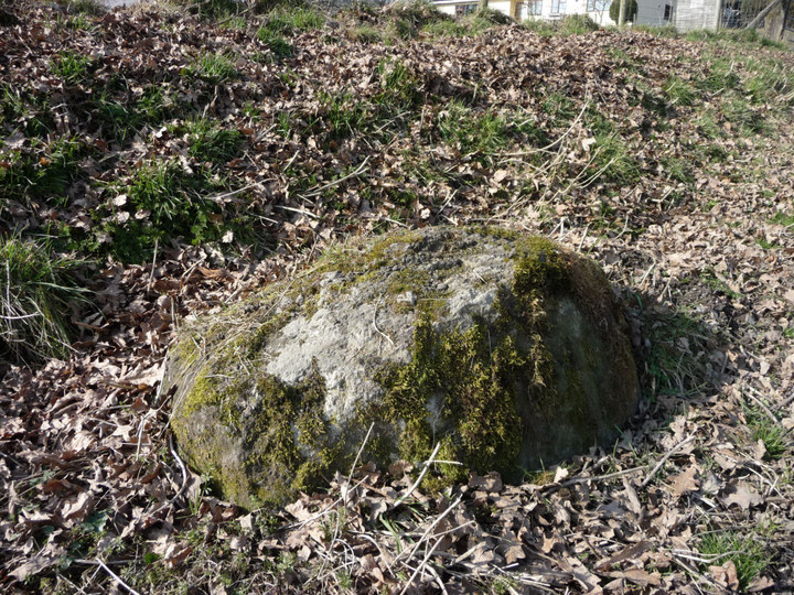
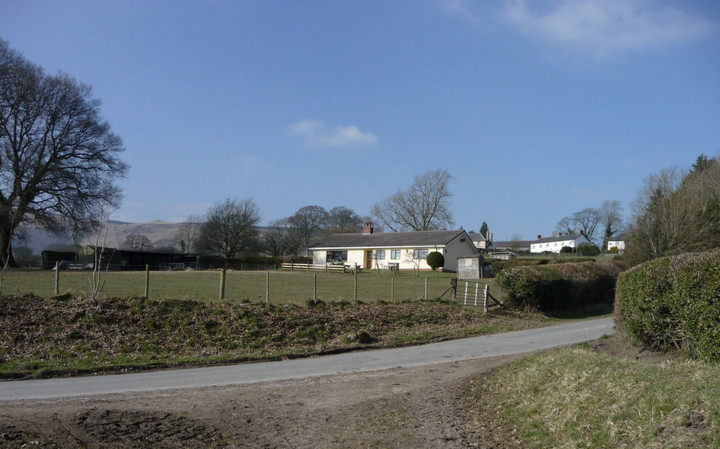


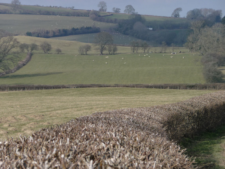


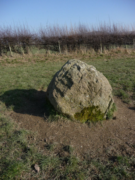
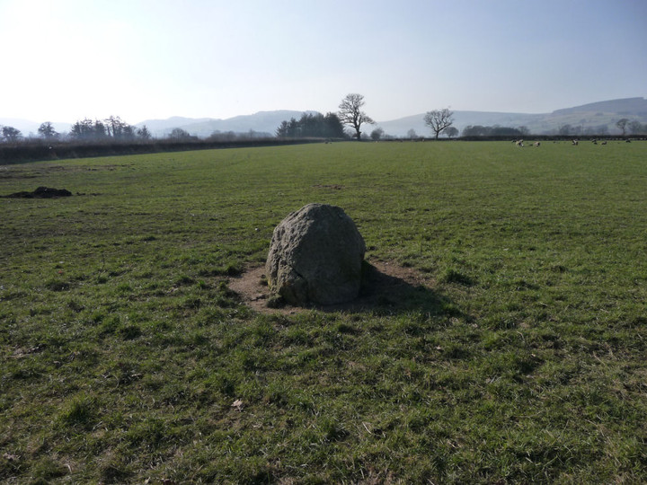
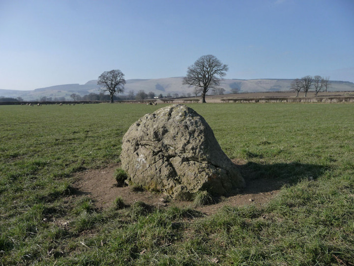
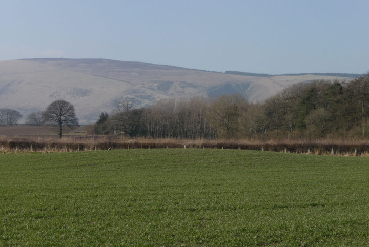
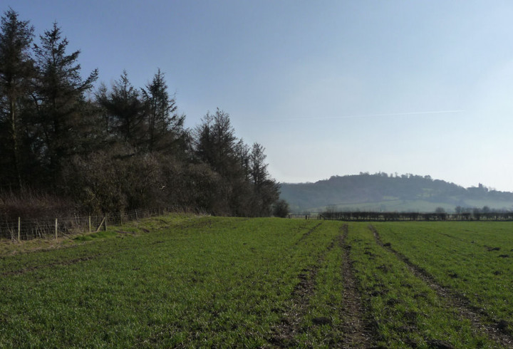
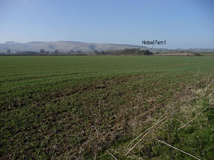
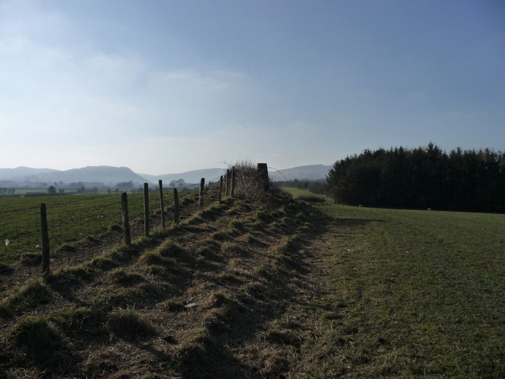
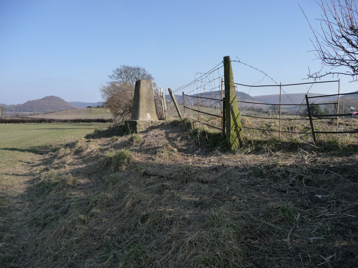
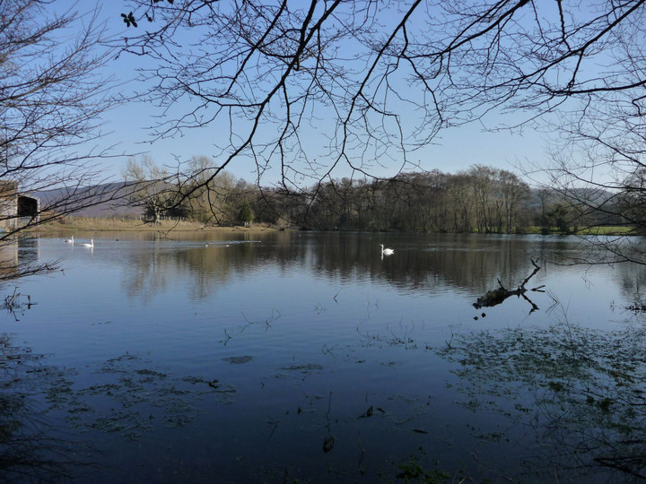
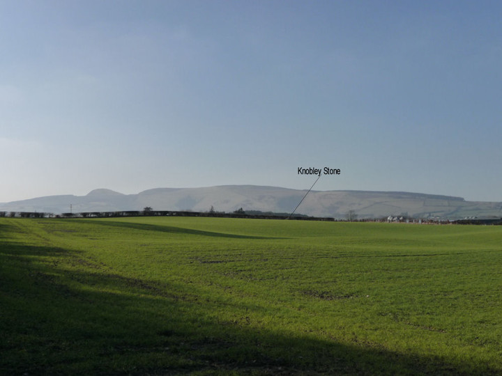
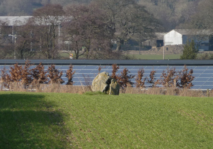
Offa’s Dyke V – Llangollen – Chirk Castle Mill 19 February 2011 |
Offa’s Dyke V – Llangollen – Chirk Castle Mill 19 February 2011We booked a weekend in Llangollen almost as soon as we got back from the previous Offa’s Dyke trip, with the consequence that the weather is out of our hands. The afternoon of our arrival is wet and cold, but we manage a stroll from the town to the ruined abbey at Valle Crucis. An intended stop-off at Eliseg’s Pillar mound is abandoned as freezing winds and rain drive us to seek shelter and teacakes at the nearby Abbey Farm tearoom instead. Castell Dinas Bran — Fieldnotes26.02.13ceSaturday dawns dry but very foggy. We finished our last walk in thick mist that enveloped the cliffs of Creigiau Eglwyseg and completely hid Castell Dinas Bran from view. Sadly, it looks like we will be picking up where we left off in almost identical conditions. The top of the hill is invisible ahead, which may be something of a blessing; as others have mentioned, it’s a steep walk up here from the town, especially the last climb up to the fort itself. As a place to assault, I think I’d be favouring the “starve ‘em out” option, rather than the direct approach. Due to the restricted visibility, we come upon the medieval ruins before really seeing anything much in the way of prehistoric ramparts. It’s an atmospheric spot, enshrouded in thick mist, where chunks of masonry loom out of the murk and just as quickly fade away again. We are missing out on the spectacular views though. There are earthworks to be “seen”, especially at the northeast of the hilltop, outside the medieval ruins. There is also a daunting rock-cut ditch, but this probably belongs to the castle, rather than the fort. Even for Iron Age builders of great fortifications, I think that would have been a challenge too far, perhaps. For all the atmosphere conjured by the mist, the lack of views makes the visit rather less than it could be. One to come back to on a clear day, with blue skies and a warm summer breeze. We make our way off the hilltop utilising the path heading northeast, and once off the top of the hill, fort, castle and all are immediately swallowed back into the pervasive gloom. Castell Dinas Bran — Images21.02.11ce
Joining the lane to the north, once again we’re back on Offa’s Dyke Path. In a roadside field a couple of hundred yards away from the fort we encounter what looks on approaching to be a decent standing stone, but on closer inspection appears to be a naturally placed wedge-shaped monolith. It wouldn’t have escaped the notice of the fort builders though, no doubt. Castell Dinas Bran — Images26.02.13ce
The road takes us below the scree slopes of Trevor Rocks and into the misty murk of Trevor Hall Woods. There is a small defended enclosure above us here (Pen-y-Gaer (Llangollen), but it is not visible from where we are and the thick mist doesn’t encourage an uphill detour. Once through the woods, it becomes a semi-urban walk through Trevor, under a disused railway line and across the Llangollen Canal via Cysyllte Bridge. From here we can see the magnificent Pont Cysyllte Aqueduct, although way out of TMA territory, an amazing piece of engineering by Thomas Telford, 206 years old and still fully functioning to carry canal boats across the Dee. This is the way we go now, not a comfortable place for those with vertigo, but worth the effort for the views of the mighty Dee, one of the major rivers we will cross on our walk along the Welsh borders. The Dee/Dyfrdwy rises in Snowdonia and by the time it reaches this point in its course it has fed into and back out of Llyn Tegid/Bala Lake, flowing onward close to the Tyfos circle and Tan-y-Coed chambered tomb. At our crossing point, it separates the northern limestone scarps of Eglwyseg Mountain to the north from the rounder shoulders of the Berwyn range to the southwest, before making its winding way through Cheshire to the sea. It seems inconceivable that such a wide waterway could have been anything other than of major significance to the prehistoric people of this area. We should probably be crossing in a coracle! Safely across, it’s a canal walk for a while, easy, boring and unfortunately it seems to be the local dog toilet. But all is not lost, as once we leave the canal at Pentre, we finally, after a little over 40 miles of walking the Path, encounter Offa’s Dyke itself. Although possible traces of the Dyke stretch as far north as The Gop, it’s pretty sporadic and the people who organised the route of the Path chose to follow the dramatic Clwydian Hills instead (good choice). It’s not the most impressive earthwork in the world at this point, not much more than a low bank under the hedge line that you wouldn’t pay much attention to generally unless you were looking for it. But for us it’s a real “Wow” moment, to at last be in contact with the thing that’s got us out on these walks. . The Dyke is now with us for the next mile or so, either right beside us or at least visible nearby, as we climb steadily out of the Dee Valley onto the hills above Chirk. The earlier mist has gone, leaving an overcast day with better views into Cheshire/north Shropshire. The walking is easy; we’ve left behind the dog walkers and have Spring lambs for company instead. Eventually the impressive bulk of Chirk Castle comes into view, before we drop down again to the Ceiriog Valley and an impeccably timed bus back to Llangollen. A nice easy section today, barely 8 miles and with scant prehistory, but we’ve crossed the mighty Dee and finally met the Dyke, so it feels like we’re firmly underway now. |
Posted by thesweetcheat 26th February 2013ce |


Lost in a Fforest – Storey Arms to Glyntawe 12 February 2011 |
Lost in a Fforest – Storey Arms to Glyntawe 12 February 2011Situated between the iconic twin peaks of Corn Du and Pen-y-Fan and the rocky scarps of Y Mynydd Du, the grassy ridges of the Fforest Fawr mountains are probably the quietest and least-frequented of the ranges that together make up the Brecon Beacons. Although the name means “Great Forest”, most of the upland area is treeless and the name derives from its medieval past as a royal hunting ground. Now you’re more likely to find grazing sheep, occasional ponies and tired soldiers on exercise than any crowned heads wielding crossbows (thankfully). The Romans also made their mark here, leaving behind marching camps and the mountain-traversing Sarn Helen road. Far older than any monarchical playground or imperial frontier, the range is also home to plentiful prehistoric remains, from the desecrated cairns of its high peaks to one of Wales’ finest standing stones in a plunging valley in between. Nature herself is prominent here, not least as two of South Wales’ most scenic rivers, the Afon Nedd and Afon Mellte, rise in this range before dropping through a series of spectacular waterfalls on their way to a confluence at Pontneddfechan and then to the sea beyond Neath. My last trip out was to the moors below Y Mynydd Du, a frozen visit to Nant Tarw and Cerrig Duon & the Maen Mawr. My start point on that occasion was the reservoir at Crai and the running of buses to that relatively remote spot, public-transport wise, planted the seed of the idea for the walk today. The intention is to get the bus to Storey Arms, best known as the start of the busy path up Pen-y-Fan, and take a linear route across several of the Fforest Fawr tops to finish at Glyntawe, not far from the Dan-yr-Ogof caves. As ever, the constraint is time – the last bus back from my destination is not late and a cold February isn’t the time to be stranded. I’m filled with the usual mix of feelings as the bus drops me at Storey Arms. Some trepidation, not helped by the fact that Corn Du is enveloped in low cloud as I arrive, but pleasurable anticipation at the sights to be seen, helped by the contrasting blue skies to the north and west. And then that wonderful feeling of freedom that a walk in empty hills always brings. Begone dull care indeed. The initial part of my route follows the Beacons Way long distance path, gaining height steadily below the watchful gaze of Fan Fawr, the highest of the range’s mountains. Once above the cliffs at Craig y Fro, a terrific view of Glyn Tarell opens up. Somewhere down there, alongside the river, is the bronze cairn of Blaen Glyn, definitely one for another day. Blaen Glyn — Images31.01.13ce
Reaching the crest of the ridge, another vista unfolds to the west, swathed In ragged cloud. To my left, the long ridge of Fan Dringarth, the start of the Fan Llia ridge heads out of sight. Beyond that, the unmistakeable scarp of Y Mynydd Du’s eastern flank can be seen, a link to my last walk and a reminder, were any needed, of the wonderful natural setting that the builders of the circles and cairns had as their backdrop. Truly awesome. Behind me, Corn Du finally emerges from the cloud cover. The blue sky is now mostly behind me, and the next few miles stretching ahead have acquired the threat of less favourable weather. It’s a long pull across the tussocky grass of Rhos Dringarth, enlivened by the continually unfolding view. A darkly shadowed Fan Nedd appears behind Fan Llia and the waters of the Ystradfellte Reservoir provide a patch of silver in the valley ahead. What from a distance appears to be a cairn turns out on closer inspection to be a modern marker built on an oblong rock outcrop. Ponies provide the only signs of mammalian life, even the sheep are absent from this lonely spot. Onto Cefn Perfedd, where a better view of Fan Nedd presages the first sight of one of the day’s objectives, Maen Llia, a speck in the valley below. Fan Llia — Fieldnotes12.02.13ceAs I make the Fan Dringarth ridge, the thick grey cloud is now right over my head and the temperature drops as I walk into an increasingly strong wind. Here I meet a group of three walkers, the only other people I will see on the whole of the walk today. At length the summit of Fan Llia comes into view ahead, a straightforward plod to the top. The summit itself, at 632m OD, turns out to be marked only with the concrete base of an otherwise vanished trig pillar, but enjoys very decent views of the surrounding peaks. The cairn is further south, off the very highest point but still on the summit ridge. Unfortunately, as I get to within 100 yards of the cairn, it starts to hail, the wind blasting the icy bullets straight into my face. Not the nicest way to make your first site of the day! Even less nice is the poor treatment that has been inflicted on the cairn itself. There is the usual turfed footprint of a large cairn, boasting excellent views to the south that are lacking from the summit and emphasise the obvious reasons for its positioning at the end of the ridge. Sadly, the mound itself has been badly “altered” by walkers. The stones are flat slabs of sandstone, heaped up into a somewhat shapeless pile. Other, larger slabs have been leant and propped up around the perimeter, giving the whole thing the air of half-built neglect. It’s difficult to respond to such a wilful lack of respect with anything but anger. All that said, the setting is terrific, even the ongoing hail doesn’t detract on that score, although it doesn’t help photography much! It’s too cold and windswept to linger here for long, body temperature quickly dropping when not I’m moving. Besides which, it looks like a cruel up-and-down to get from here to Fan Nedd, the next summit on my route and so I head westwards off the top, not following any particular path but making generally towards the visible block of Maen Llia far below me. Needless to say, the hail stops within a minute of leaving the cairn. Fan Llia — Images31.01.13ce
Rhyd Uchaf — Fieldnotes12.02.13ceIn a line between the standing stone and my route is a green mound, which will prove to be the Rhyd Uchaf cairn. To get to it, there are a couple of deceptively steep-sided streams to cross. Although ruined, the placing of the cairn is nicely judged, on a little knoll surrounded by various tributary streams of the nascent Afon Llia, the water source that may well have provided the inspiration for the siting of the little complex of monuments here and of this cairn in particular. Rhyd Uchaf — Images13.02.11ce
Maen Llia — Fieldnotes12.02.13ceThe cairn is separated from the Maen Llia monolith by the Afon Llia itself, fast-flowing and not as easy to cross as it looks, with peaty banks quick to crumble underfoot. But cross I must, as the pull of the stone, one of South Wales’ undoubted megalithic stars, is too much to avoid for long. This will be my second visit here. The last time I came with a friend by car and to be honest I had little hope of ever making it back here under my own steam. It’s a wonderful, wonderful stone, enjoying a lovely view down the valley between the two steeply rising mountains that flank its either side. The shaggy coat of moss gives it a primordial look, and even years’ old graffiti can do little to undermine its towering charm. I spend a good while here, undisturbed by any other visitors, although an empty car is parked nearby. Time stops briefly, and I recharge for the next and steepest of today’s climbs. When the time comes to bid farewell – adieu hopefully – I do so with some sadness. This is a site that rewards the effort of getting here tenfold. Maen Llia — Images13.02.11ce
Fan Nedd (Northern summit) — Fieldnotes12.02.13ceA ladder stile leads onto the tussocky lower slopes of Fan Nedd. There is no obvious path and so I’m left to pick a route that is reasonably direct to the summit. Due to time constraints after the lengthy stop at Maen Llia, I’ve decided to abandon a visit to the two cairns on the eastern slopes of the mountain and to concentrate on getting to the top of the mountain. I confess to a certain feeling of unfinished business here. A couple of years ago I came here a matter of hours after Gladman had been (small world). On that occasion the slopes were snow-covered and going was slow. My friend and I made it to the pointy cairn on the ridge in a hailstorm (what is it with these tops and hail?) and very stupidly mistook it for the summit trig point marked on the map. As such, we didn’t reach the summit and I’ve been keen to come back and rectify the error. So today I head straight up the mountain’s eastern flank. This proves to be very hard going, the slope is very steep and the vegetation is ankle-knee deep. Only the occasional stops to look back at Maen Llia, dwindling into a black dot below, and the unfolding view of Fan Llia across the valley, make the ascent anything other than a trial. But reaching the ridge, close to the trig, the views to the west make up for the aching knees. Once at the summit (663m OD), the views to Fan Gyhirych and Y Mynydd Du are magnificent and far-reaching, clear of the clouds of earlier. From the summit it’s a fairly easy stroll north along the ridge towards the “pointy” cairn. About halfway along the ridge I come across a recumbent slab, unworked but with a hole drilled in it. No-one is likely to have ever put a fence up here, so perhaps a fallen boundary stone? The pointy cairn is every bit as ludicrous looking as the last time I came here. But what’s this? It rests on a turfed over mound of much greater diameter, with stones protruding through the thin covering. Suspicions start to grow and I get the feeling that the walker-made pyramid conceals something much, much older. The positioning is typically clever, allowing the maximum panoramic view, particularly northwards, absent at the mid-ridge summit. It is certainly similar in construction to the cairn on neighbouring Fan Gyhirych. [A post-visit Coflein check suggests that the instinct was correct and that these are the remains of a bronze age cairn, positioned with the usual fine attention to detail.] Fan Nedd (Northern summit) — Images13.02.11ce
Fan Gyhirych — Images13.02.11ce
From here, it looks like I have a long way to go. Fan Fraith, my last summit of the day, appears far off and I know that the route onwards from there down to Glyntawe is a long one, albeit downhill nearly all the way. I quickly drop down to boggy Bwlch y Duwynt (“Pass of the Black Wind”) for a lovely view of Blaen Senni, before joining a better track that heads uphill again between Fan Fraith and Fan Gyhirych. The OS 1/25000 makes the approach to the summit of Fan Fraith look very easy, but maps can lie can’t they? In fact, it turns out to involve crossing a horrible area of bog, with little to recommend the summit once attained. At 668m OD, Fan Fraith is the highest point I will reach today and the last of the 2,000ft Fforest Fawr summits that I had yet to visit. However, it is flat-topped, with views rendered unimpressive by an expanse of bog in all directions and no swooping drop to valleys below. There is nothing much to mark the highest point, other than small pile of stones – certainly no ancient monument here. In some ways, this is an instructive stop-off, as it highlights the fact that a bronze age cairn is unlikely to be located in such a spot as much as the visits earlier in the day highlighted precisely why they are where they are. There’s no substitute for getting out and looking at these places on the ground. Dismissing any lingering thoughts of a return to Fan Gyhirych, I’m now up against the bus timetable. The highlight of the final section of the walk is the view of sun-dappled Cribarth across the Tawe valley. The last couple of miles, thankfully downhill, pass in a stumbling jog-trot as I realise just how close to missing the bus I’m getting. The aim is to cross the Tawe near Craig-y-Nos, where the map shows a handy “ford” a field away from the road. This turns out to be the only major mistake of the day. In my haste I plunge into the ford without really considering the depth of the water, which comes straight over the tops of my boot and soaks my foot. I retreat, but too late. So, with a waterlogged boot I take a slightly longer route to the road, where I have less than five minutes to attempt to dry off before the bus comes. Perhaps not the best end to what has been a hugely rewarding walk across some of South Wales’ best walking country. But feet dry soon enough and I can’t deny the pleasure had from my day in these remote hills, where the traces of hunting kings are long gone but remnants of a far more ancient past survive for those who are prepared to seek them. |
Posted by thesweetcheat 12th February 2013ce |
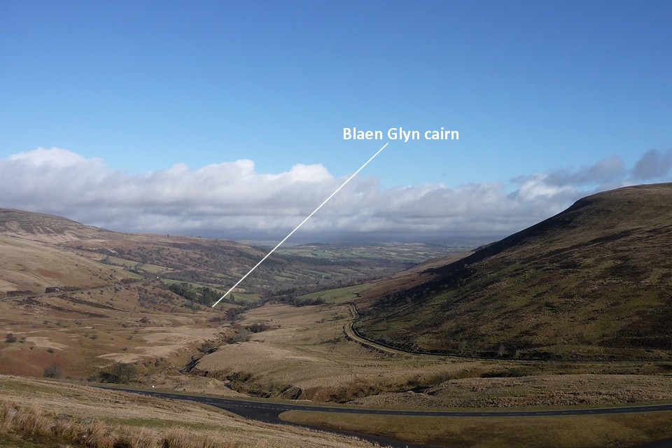
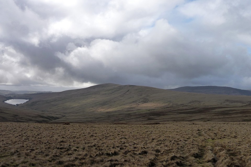
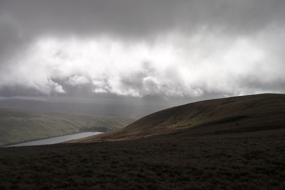

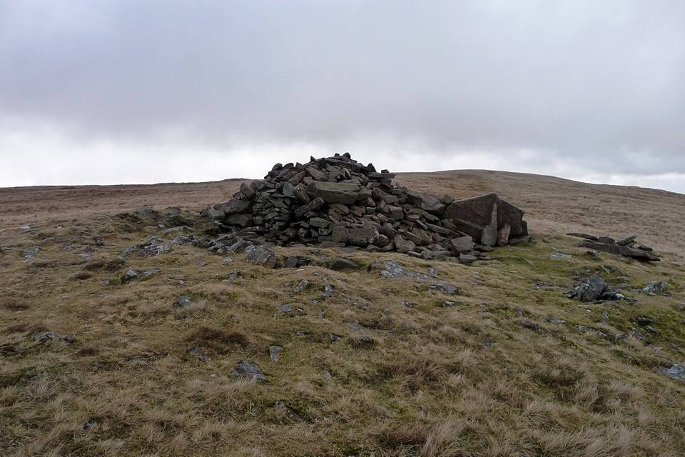
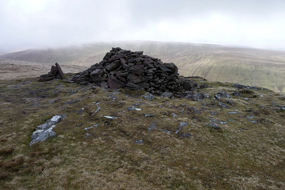
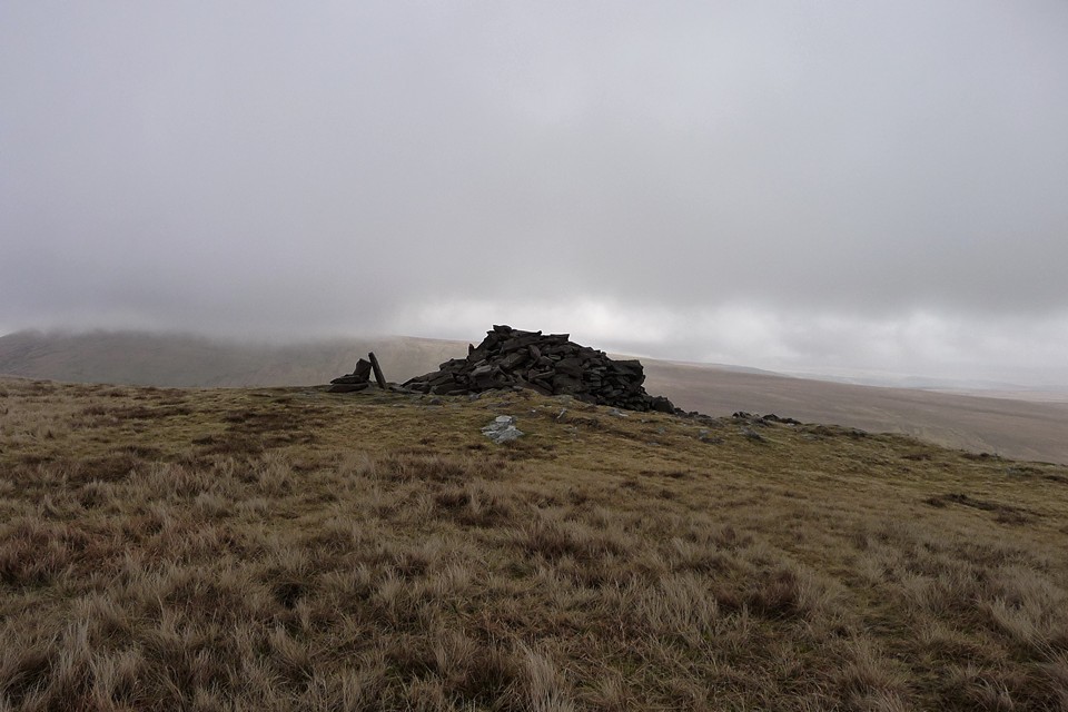
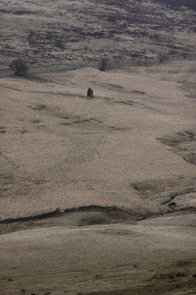
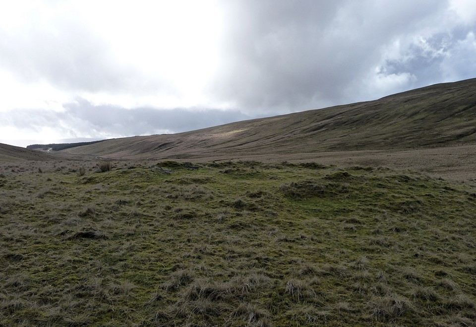
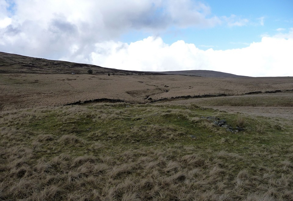
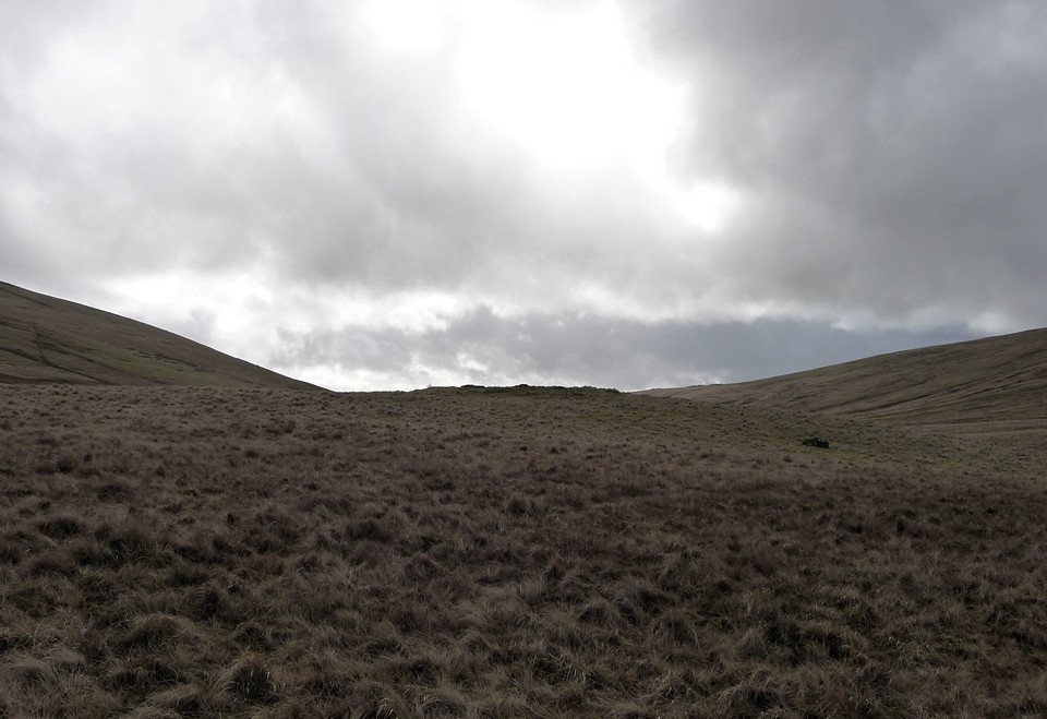
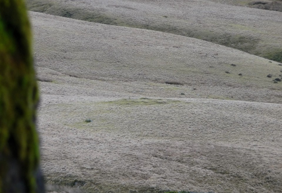


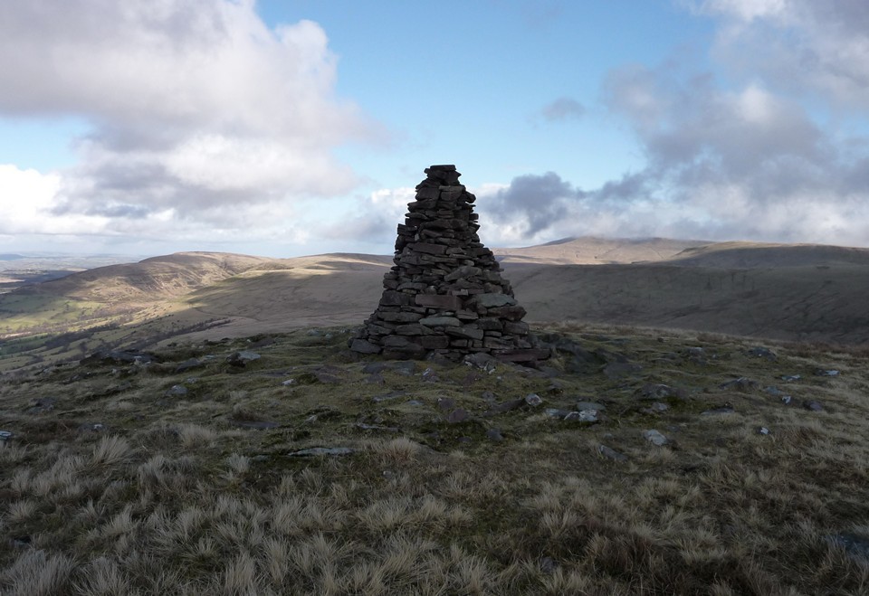
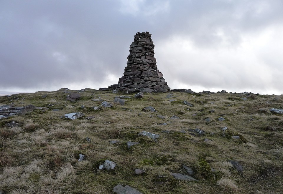
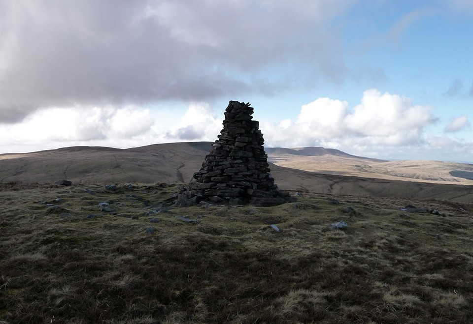
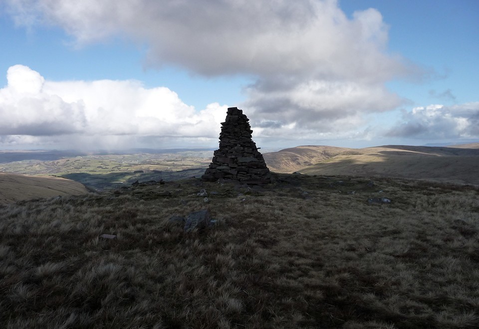
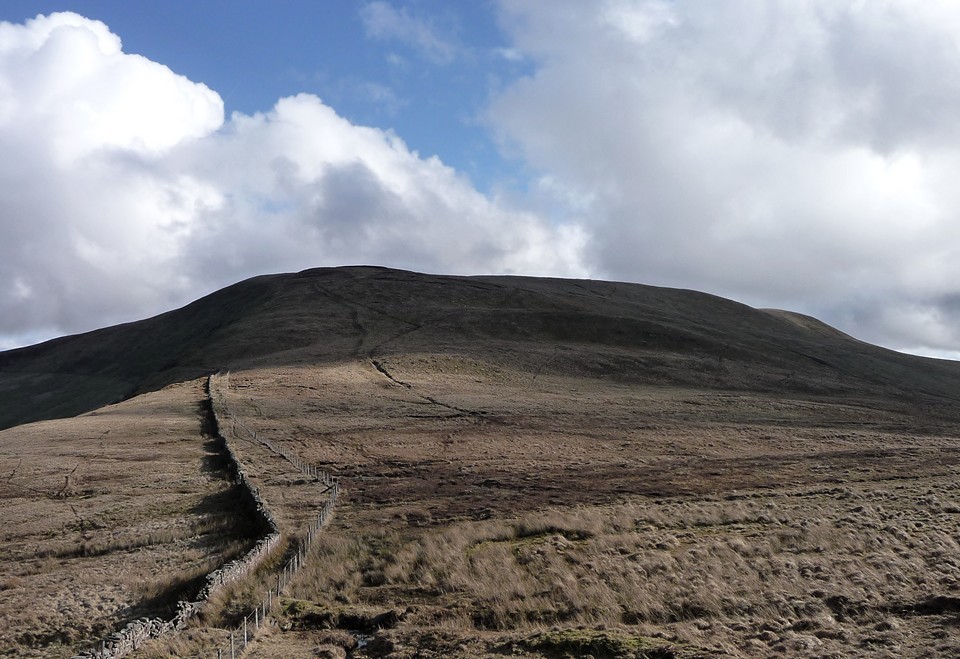
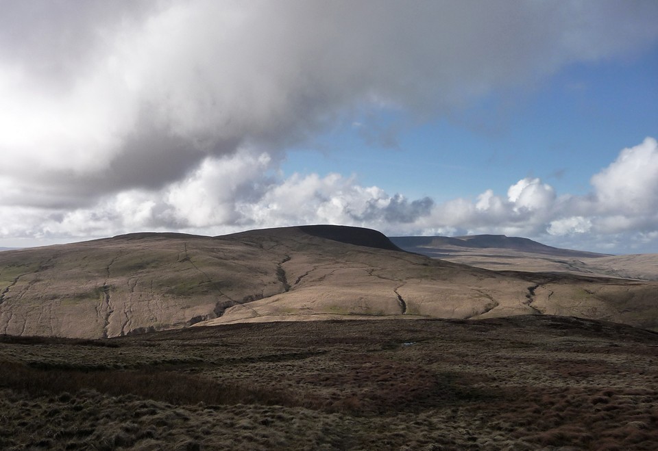
Offa’s Dyke Path IV – Clwyd Gate to Llangollen 22 January 2011 |
Offa’s Dyke Path IV – Clwyd Gate to Llangollen 22 January 2011Four long months have passed since our 2010 Offa’s Dyke Path campaign came to an end at Rhuthin last September. This year, we resolve to Try Harder and make some proper inroads into what could otherwise become a ten year odyssey. So with the harsh snows of Christmas gone, we turn our attention northwest again. This trip represents a minor watershed of sorts, being the first time that we won’t have taken the train along the North Wales coast to get to our base for the weekend. Instead, a bus from Wrexham has brought us to the charming little town of Rhuthin, one of the nicest places we will stay on our Offa’s Dyke adventures. Set in the lee of the steep Clwydian Hills, Rhuthin boasts good views of Foel Fenlli, the imposing hillfort we visited last time out. Arriving the day before our planned walk, we have a good opportunity for a mooch about. Maen Huail — Fieldnotes24.01.13ceAs well as a fine church and a decent medieval castle converted into a hotel, Rhuthun has a piece of enigmatic rock parked in its centre. Maen Huail now resides next to a bank, after it was moved to make room for a car park. It is a rough, unworked block of limestone, its age impossible to determine and its purpose less so. Arthurian enthusiasts will be impressed to know that Arthur was reputed to have used it as an executioner’s block to behead Huail (see Folklore). The setting is not the most atmospheric or inspiring, but certainly worthy of our attention. No bankers have yet been publicly executed on it, as far as I know. Maen Huail — Images24.01.11ce
Foel Fenlli — Images24.01.11ce
Saturday morning dawns very cold and the town is enveloped in a freezing fog, not really much of an enticement to the long walk on the agenda. But as the bus takes us up the steeply ascending A494, we climb up out of the gloom and into a crisp morning. At Clwyd Gate we don warm outer layers and step onto fields of crystal, crunching into a hard frost. We look down at Rhuthin far below us in the Vale of Clwyd, where the fog has lifted slightly to form a band above the town. In the far distance, the peaks of Snowdonia rise above the cloud, my first sight of these wondrous ranges, enough to set the spine tingling. Snowdon, the Glyderau and the Carneddau are particularly clear, though at this point I don’t even know these names. One day I shall get closer. But today, our objective is to finally have done with the Clwydian hills that have been our constant companion every step of the way since we first climbed out of Prestatyn, both delight and trial. Although we reached the highest part of the range, Moel Famau, last time, we still have a couple more sizeable hills to negotiate, the very up-and-down nature of the range making for a tiring start to today’s route. Foel Fenlli — Images24.01.11ce
Moel Gyw — Fieldnotes24.01.13ceThe first of the hills to be tackled is Moel Gyw, surmounted by a barrow to add incentive. Offa’s Dyke path has been re-routed to avoid the climb up to the summit, but on such a beautiful day there is no way I was going to miss out on the views. Rashly, I choose to go for a direct approach from the northwest, which turns into a mistake that can’t easily be rectified once started. The climb is extremely steep, through and over dense, deep heather. I find myself clinging to the bushes above me as the only way to gain enough purchase to carry on upwards. By the time I finally emerge on to the hilltop next to the cairn, I am knackered, my knees are aching from scrambling over the heather, the laces of my boots are festooned with bits of vegetation and under my warm winter clothes I’m boiling alive. Not the best route to choose, it would seem. But, oh boy, was it worth the effort. The views are utterly magnificent. To the south, the flat moorland expanse of Cryn y Brain that we hope to be tackling later can be seen, the shapely, Sugarloaf-esque peak of Llantisylio Mountain further to the SSW, with the start of the Berwyns range beyond. And then, rising over the temperature inversion of the valleys, the serried ranks of the ranges of Snowdonia, that I will later come to know as the Arans, Cadair Idris and the Arenigs, and the mightiest peaks of the Snowdon massif itself, the Glyderau and Carneddau. Eyes dragged away north from this vista also get a view of Foel Fenlli, illuminated briefly in the rays of the early winter sun. The sides of the cairn itself are buried in heather, but the centre is clear and an inevitable excavation scoop into the stone construction is visible. The positioning is interesting, being set back from the steep western edge of the summit, where the Ordnance Survey have built their trig pillar and a slate upright marks Offa’s Dyke Path, which no longer comes up here. For such a modest height (whatever my legs tell me), this is a spectacular place, one of the undoubted highlights of the Clwydian range. Moel Gyw — Images24.01.11ce
Aran Fawddwy — Images24.01.11ce
G/F hasn’t made the climb to the summit after me, preferring to follow the Path’s route along the western flank of the hill. As I descend to her, it is obvious that a much easier route up to the barrow can be found from this side. And from where she is, the views are still pretty damn epic. The next Clwydian, Moel Llanfair, is one we don’t have to tackle. The path skirts the western slopes, giving a great retrospective view of both Foel Fenlli and Moel Gyw. Foel Fenlli — Images21.01.13ce
The map shows a pair of barrows in the pass between Moel Llanfair and Moel y Plas (that Coflein only notes as possibles), which I had intended to have a quick look for, but as we descend to the narrow road, our ears are assailed with barking and we encounter two covered pick-ups full of snarling and growling dogs, together with a large group of men with guns, who greet us in a way that doesn’t exactly seem cordial. There is a palpable air of menace in the narrow lane and we’re more than pleased to be past the trucks and back on the footpath, where we climb to the saddle between the two tops of Moel y Plas as fast as we can, glad to be on our way. The growling, snarling and barking continues behind us and we decide that we don’t want to be anywhere near when the grilles are opened and the pack is loosed. Consequently we don’t stop to look for the barrow on the top of Moel y Plas itself. Instead we stop over on the other side of the hill, to get breath back and regain some kind of calm (best achieved by eating chocolate). From our rest spot, we have a decent view of the dark moorland expanse of Cryn y Brain, but the fog of earlier is creeping up on us from the southwest and the last of the Clwydian hills ahead are slowly being enveloped. There is no sign of Moel y Waun, the last of the range to be marked with prehistoric cairns. Moel y Plas — Images21.01.13ce
Cyrn-y-Brain — Images21.01.13ce
Equanimity restored, we make our way around the side of Moel y Gelli, from where Offa’s Dyke path finally leaves the Clwydians and turns eastwards, towards the village of Llandegla. The map and Coflein show a holy well (St Garmon’s) and a couple of ancient caves, which might be worth a look. Unfortunately, just as we approach, we encounter yet more men with guns and a dog, right near the well. We nod in passing, definitely getting the feeling that we’re interrupting something. A lithe brown shape breaks cover close by and we are rewarded with the sight of a hare streaking away. It looks like our timing may have aided his escape just nicely. We certainly hope so. After tea and sandwiches in the cold churchyard at Llandegla, we cross a couple of busy A-roads and then it’s time for the last big ascent of the day, into Llandegla Forest and the onto the open moor of Cryn y Brain. The climb through the conifers is steep and muddy in places, with little light penetrating through to the path on this gloomy afternoon. I’m not a huge fan of the Welsh conifer plantations and I’m pleased when we finally come to the edge of the woods and the moorland opens out ahead of us. We still have a long way to go today and I have to resist any temptation to go and see the cairns that cluster the moor’s highest part, around the transmitter mast and Sir Watkin’s Tower. Aber Sychnant — Fieldnotes24.01.13ceOffa’s Dyke Path has been routed across the moor on a snaking network of duckboards, making our progress across what would be tough terrain much quicker and smoother than expected. It doesn’t take us long to reach Aber Sychnant cairn, which is skirted by the Path itself – probably a little too close for comfort, but tired legs and receding daylight make me grateful for the ease of access today. The cairn is all but buried under a heather toupee, but is a good size and largely intact apart from the inevitable central scoop. The views are not that extensive, as the cairn sits in a shallow valley, with higher parts of the moor rising on all sides. Substantial enough to be worth a visit though, despite the irritation of dropping my glove and having to come back again to retrieve it. Aber Sychnant — Images24.01.11ce
From the cairn, our route follows a minor road, slowly dropping off the top of the moor. We look in vain for the cairn marked on the map above the Nant Craig y Moch, but the vegetation hides anything that might be there. There is a fine view of the next moorland “lump”, Eglwyseg Mountain, ahead of us, with one of the cairns at the highest point prominent. Eglwyseg mountain cairns I, II, III — Images23.01.13ce
The road drops steeply to a hairpin at World’s End, where stepping stones cross a stream that falls away down a series of artificial terraces. The sheer cliffs of Craig y Forwyn, a climber’s paradise, rise vertically above us, while the fine timber-framed manor house of Plas Uchaf can be seen below. From here our way takes a turn for the slightly alarming, passing under the formidable cliffs of Creigiau Eglwyseg. The path is very narrow with loose scree above and below on the steep hillside. The fog has closed right in on us again, making for a claustrophobic crossing of the seemingly shifting slopes. The cliffs are one of the natural wonders of the Offa’s Dyke Path route and above their forbidding bastions are a substantial number of cairns and round barrows. Creigiau Eglwyseg — Images24.01.11ce
Rejoining the road, we should have a view over the Dee/Dyfrdwy valley, but sadly the fog blocks out everything in that direction. Eventually we reach Tan-y-Castell, near to the evocative ruins of Castell Dinas Bran. Here we finally say our goodbyes to Offa’s Dyke Path for the day, after completing around 15 miles of it today. By now it’s late, visibility is poor and we are completely knackered, so a visit to the shrouded hillfort is postponed. Instead we stagger down winding lanes into Llangolllen, tired but happy with our efforts, the biggest chunk we’ve taken out of the Path so far. In reaching the mighty Dee, we’re at one of the major river crossings of our route and we’ve left the Clwydians far behind. Next time, we might even finally make the acquaintance of Offa’s Dyke itself. |
Posted by thesweetcheat 24th January 2013ce Edited 29th December 2022ce |


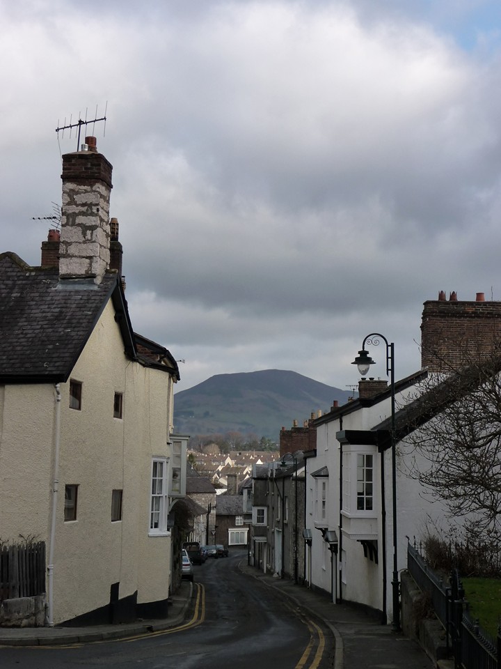
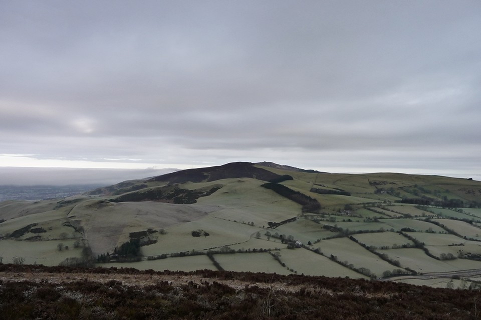
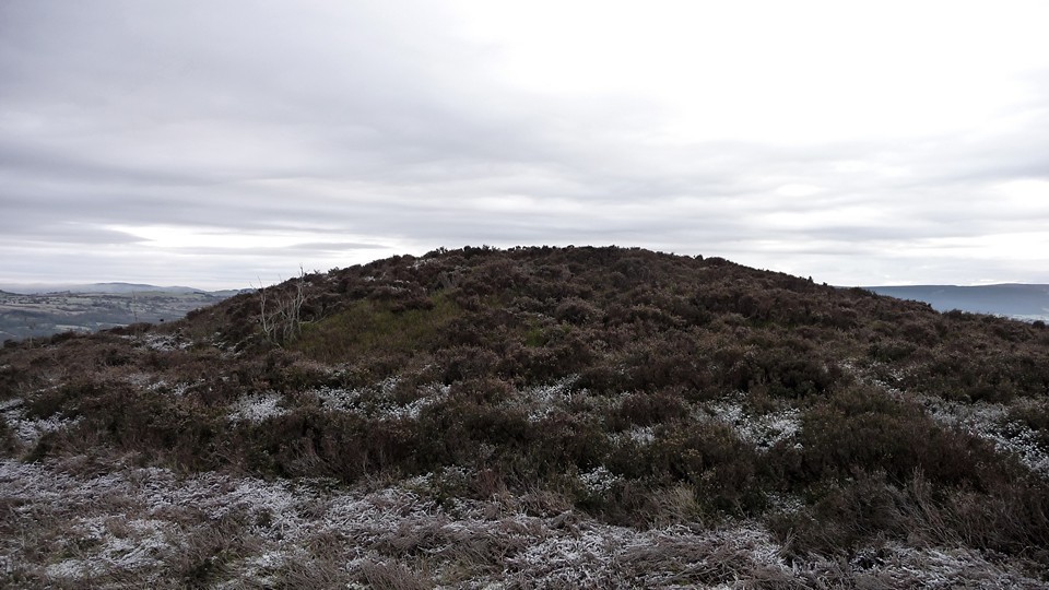
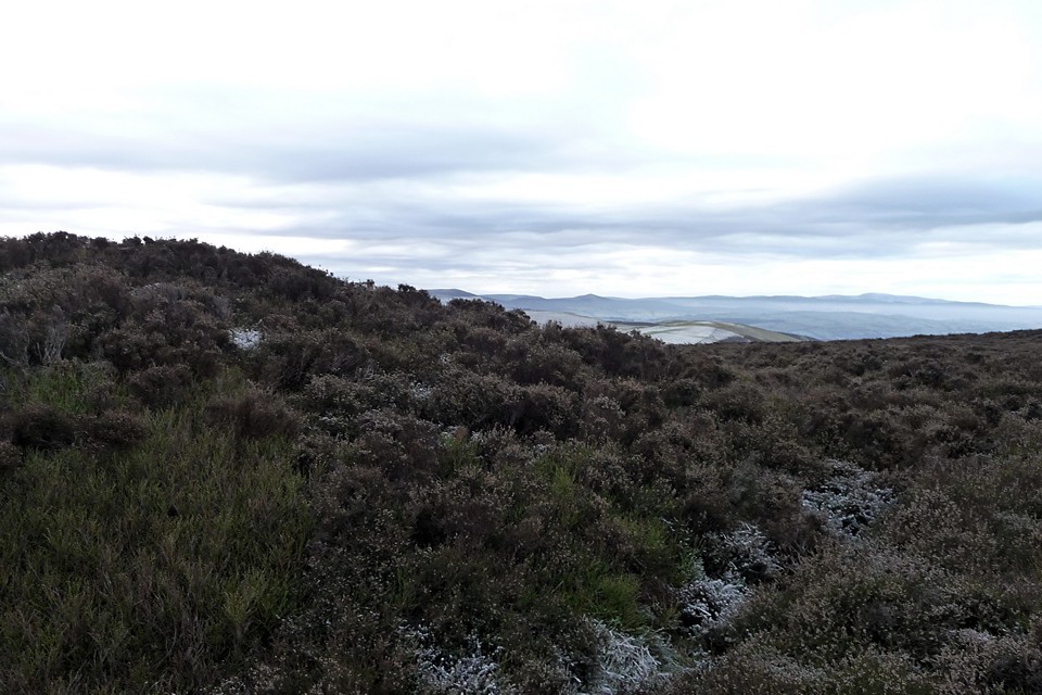
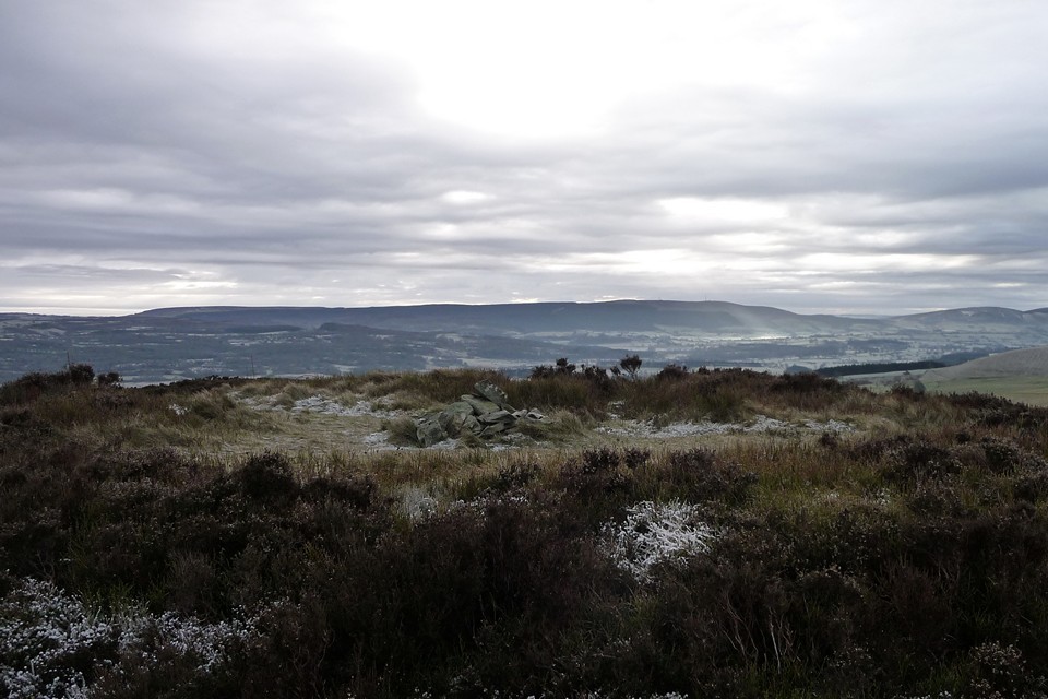
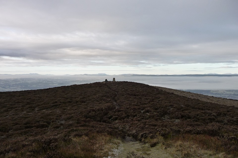
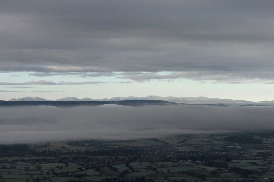
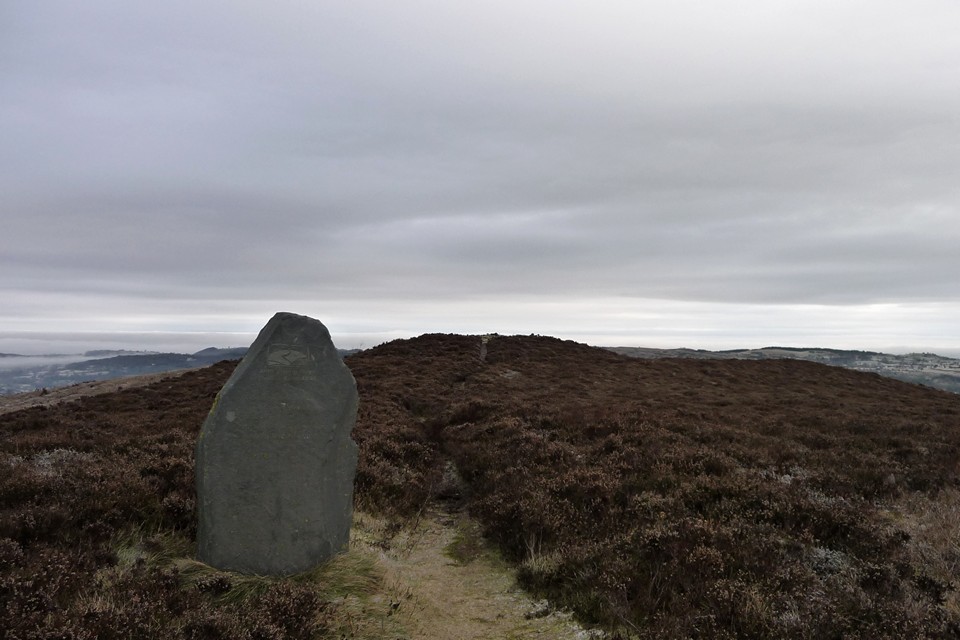

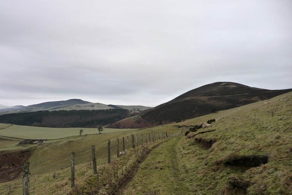
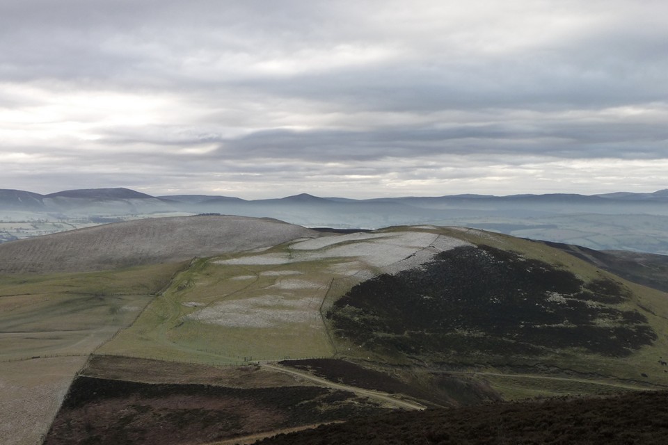
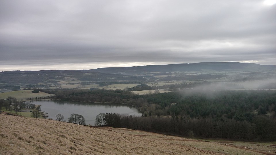
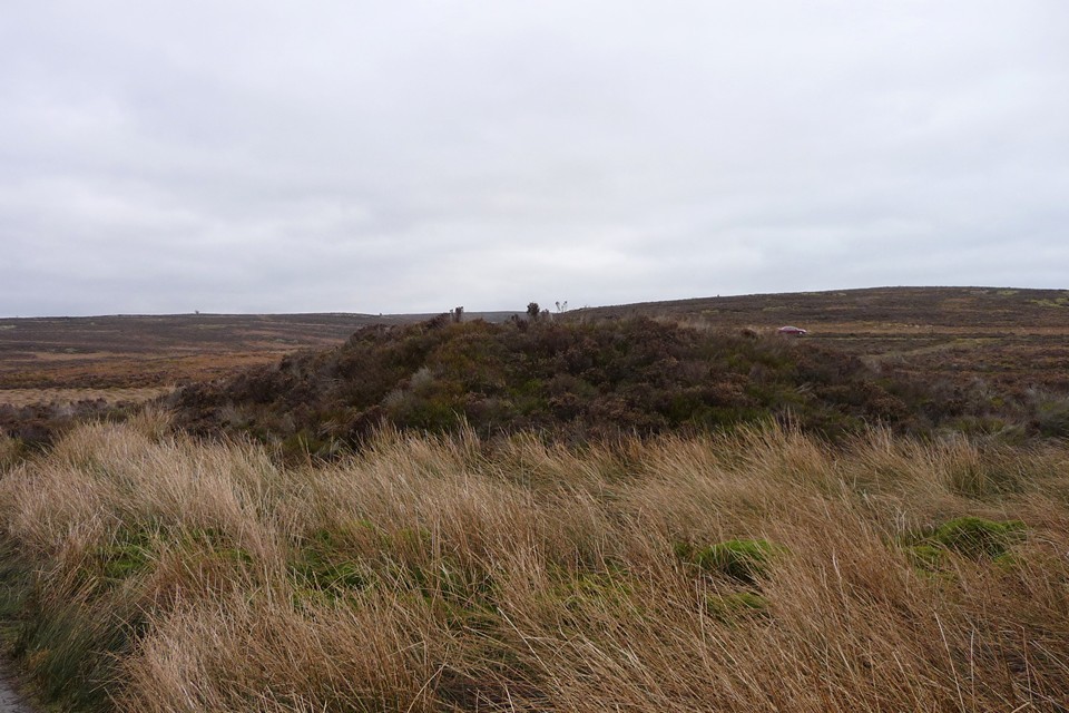
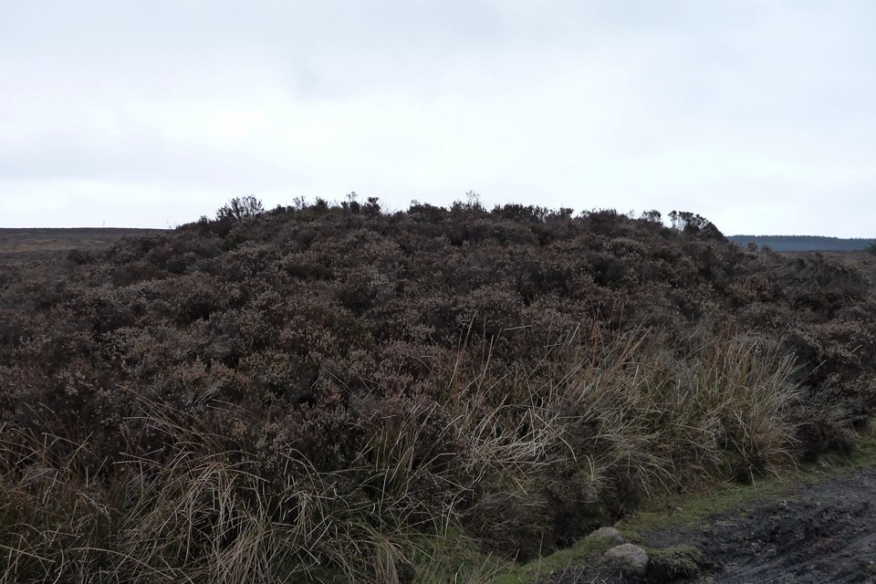
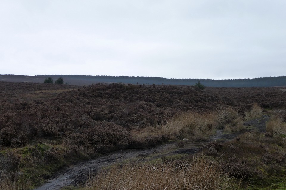
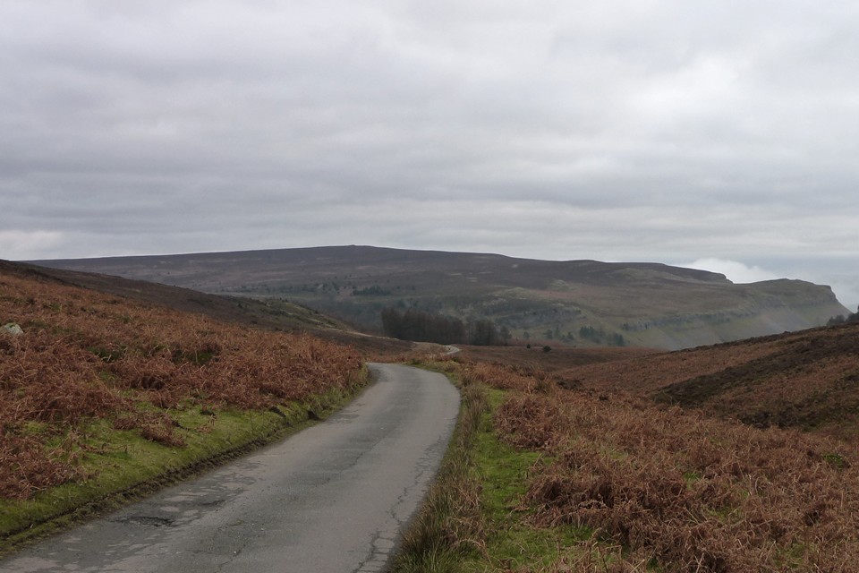
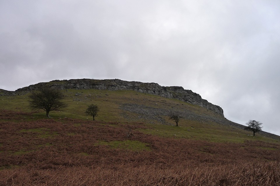
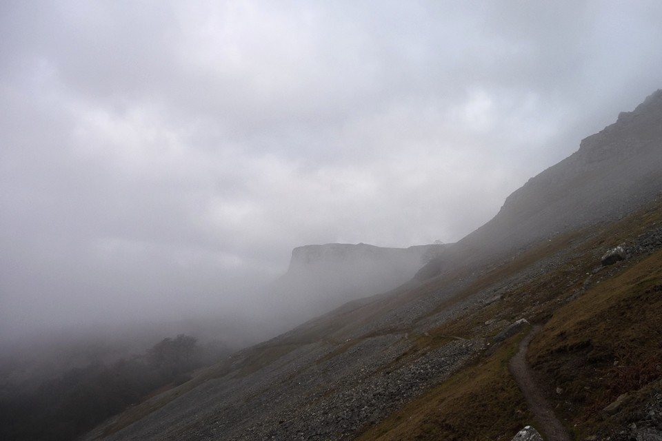
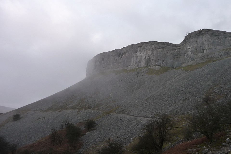
The Ridgeway - Part Three |
The Ridgeway - Part ThreeWatlington Hill to Ivinghoe Beacon Although we were leaving it a bit late in the year for all day walking my brother, sister and I decided that it needed one more tumultuous effort to conquer The Ridgeway. Things had been further complicated for Mrs Cane and myself by our having to go to a memorial service for an old friend in Manchester on the Friday before the walk. I’d only got about four hours sleep and had to get up very early to meet up with my brother and sister at the Cobham Services on the M25 before heading up to Ivinghoe to leave my car and then make the quick cross-country dash to Watlington to start the walk. As it was we didn’t begin walking till almost 9.30 with the knowledge that we had seventeen miles to cover to Wendover and only seven hours of light. That probably doesn’t sound like an excessive distance to cover in that amount of time, but if you spend too much time laughing, joking and stopping to try and photograph ancient monuments you soon begin to realise that you’ll be wondering around in the dark at the end of the day. It has to be said that the initial part of the walk from Watlington Hill is not terribly exciting. In fact you’re not even on Watlington Hill, but skirting along the bottom of it with few, if any, good views to be had. This was a similar scenario to a couple of months earlier when we were repeatedly asking ourselves why we were almost always looking south at inviting hilltops and wondering why we weren’t walking on them? Possibly this has something to do with land ownership and a lack of freedom to wander where we please, but judging by the amount of tracks and footpaths that criss-cross the landscape, perhaps not. I don’t know enough about how the route was designated earlier in the last century to understand the logic of it other than it consisted of a loose arrangement of tracks and paths which was then unified. There are parts where there are ‘alternative’ tracks, notably the section near Ogbourne St. George. All I can feel is that if I’d been walking 5,000 years ago from the Marlborough Downs to Ivinghoe Beacon I’d rather be doing it along ridges of hills than in low lying damp areas! So, lack of a good view besides, the first thing of interest, but perhaps insignificant, are two large sarcen stones which sit in the undergrowth next to a disused railway line which must have once served the gravel/chalk pits at Chinnor. Both are about three feet high, un-worked as far as I could tell and the first I’d noticed since Streatley. After passing Chinnor the route twists and turns taking you down to Lodge Hill where there are a couple of barrows (apparently), but they must have been worn away as we didn’t notice them. Again the way dips down and heads north towards Princes Risborough and the crossings of the two railway lines. You need to be a bit careful at the crossing as it’s on a bend and we were a bit surprised, having just crossed, that a train came hurtling around the bend at about 80 mph, and seemed to be on top of us before we knew it! The other crossing is thankfully some sixty feet beneath you through the Saunderton Tunnel. After this we made our way North Eastwards towards the edge of Princes Risborough and on to Whiteleaf Hill. With the low golden sunlight sweeping across the hillside we made our ascent to some of the best views we’d had all day. At the summit is a Neolithic barrow, slightly misshapen from the odd excavation and well trodden by locals for that ‘slightly more elevated’ view. A wonderful place to be buried no doubt. Maintaining our North Easterly direction we then proceeded to Pulpit Hill, an Iron Age hill fort, but at this point the Ridgeway was ‘closed’ due to tree clearance. Flimsy bits of plastic tape denied our way with the advisory notice that ‘heavy machinery’ was in the vicinity and could be a health risk if we tried to encounter it and would we kindly walk an extra mile around the edge of the hill. Reasoning that it was a Saturday and unlikely that anyone would be working there we boldly climbed the stile only to hear someone in the distance shouting “Hey, what do you think you’re doing?” As it was just another walker (peeved because they’d obviously just walked the diversion) and not anybody in authority we told them to f**k off and mind their own business. As it transpired there wasn’t even any machinery up there, but we didn’t really want to hang around to look at the hill fort in case someone turned up. Onwards, ever onwards, we next found ourselves walking past a very big house with polite notices asking not to enter the grounds on pain of sudden death. Consulting the map we were all a little surprised to find that it was Chequers, the PM’s country retreat. We really ought to do more research when we do these walks. Here you certainly don’t want to try and take a shortcut as it’s probably protected with land mines and there were certainly a lot of security cameras dotted about and we used every opportunity to wave in a friendly way to them. By now it was definitely darkening and we knew we still had a good two and a half to three miles to go till we reached Wendover. Stumbling through Fugsdon Wood we eventually found ourselves looking down on the bright lights big city landscape of Aylesbury from the Boer War Monument near Wendover. At this point we could no longer see any Ridgeway path signs, but we figured that if we followed the tarmac path from the monument it would lead to a road up from Wendover and, although we wouldn’t have strictly speaking done the whole ‘way’, it was a toss up between that and freezing to death. A few minutes later we came to a small car park where the last of the evening’s dog walkers were shoving their soggy hounds into the back of their estate cars. Asking which was the quickest route down to the mile and a half away Wendover we were given quite complicated directions when the husband of one couple said, “Actually, would you like a lift?” “I thought you’d never ask”, replied my brother! Thanking our saviours and their nice warm car we checked into the Red Lion in Wendover with only a slight feeling of guilt for not having done that final mile and a half. Having perused the football scores (Fulham 0-3 Spurs in case you were wondering, yeahhh!) and texted Vickie, a friend of mine from college days, who now lives in Wendover inviting her to join us for a drink, we headed on down to the bar for a meal leaving a trail of drying mud in our wake. The Sunday morning greeted us with bright sunshine and a very heavy frost, perfect walking conditions for this time of year in my opinion. In the courtyard of the Inn is a curious stone, sarcen I think, which has obviously been there a long time, unmoved and painted white to stop motorists and drunken guests banging into it. It also has a water-filled depression in it so may have functioned as a natural drinking trough for horses or dogs. Wending our way out of Wendover and, counter to expectations, heading south-east, the big hill fort of Boddington Hill overlooked us to our left and unfortunately the Ridgeway path doesn’t go through it, like some of the other hill forts which had been just out of reach in earlier sections of the walk. Oh well, maybe that’s another day out in the future. It’s very pleasant walking here through the sun-drenched mixed woodlands and there are all sorts of earthworks along the way some from obvious quarrying, others maybe ancient boundary markers and possibly linked to our old friend The Grim’s Ditch which was meandering to the south of us and that we’d meet up with again closer to the end. Having made our way past the A41, Grand Union Canal and railway main line at Tring the path once more ascends towards Pitstone Hill. As you come towards the top of Pitstone Hill there is what appears to be a barrow cemetery, but on closer inspection the ‘barrows’ turn out to be the spoil heaps of a quarry, hence the name Pitstone Hill (durrrr!) On this particular day we were also the guests of some spectacularly shaggy and incredibly docile ‘Belted Galloway’ cattle that were grazing at the top of the hill. It’s at this point that you find yourself once more in the company of The Grim’s Ditch and you follow it right across the hill until you spot on the horizon your final destination, Ivinghoe Beacon shining in the afternoon sun like a…. well, like a beacon! Although in some ways it looks tantalisingly close, it’s still almost two miles away and we think back to the start of our walk some eighty-five miles ago in the Spring realising that it’s all about to end. I think the main thing that comes to mind is the shear variability of this walk compared to, say, the South Downs Way that is almost exclusively along hill ridges and definitely a more defined and logical path. Perhaps it would be an interesting exercise for walkers to go over the maps and plan their own Ridgeway path. Only this very last section of The Ridgeway feels remotely like our beginning at The Sanctuary on the Marlborough Downs, high chalk hills overlooking flat plains below with the occasional barrow or hill fort dotted along the path. Dropping down for almost the last time we pass the end of the Grim’s Ditch as it curves around the base of the hill, cross a minor road and a field and then begin to climb Steps Hill. Almost at the top of here is a dramatic view down a dry valley, Incombe Hole, looking southwest back across the way we’ve come. Then comes a succession of boundary markers or cross dykes and a couple of barrows atop the knoll directly south of the beacon indicating just how important and populace a place this once was. We can make out the other Sunday afternoon strollers on the beacon and with a slight tinge of smugness we know that they probably haven’t done the whole walk, but we have (well almost)! With the end now in full sight, we walk the final few yards and on the count of three we all put our feet onto the lip of the hill-top map and congratulate ourselves. We spend a few minutes admiring the spectacular view and then it occurs to us, with a slight feeling of panic, that we can’t remember whether we left my car in Ivinghoe or Ivinghoe Aston? We plump for Ivinghoe and decide to go the direct route down the steep slope before it can get dark. Halfway down I almost trip when I see something out of the corner of my eye. It’s a coin, but sadly nothing really old just a 1919 George V penny. Maybe it was dropped by someone doing exactly what we’d done, but ninety years earlier. For me today it’s a nice reminder of our year’s walk. The Ridgeway — Images31.12.12ce
|
 Posted by A R Cane
31st December 2012ce |

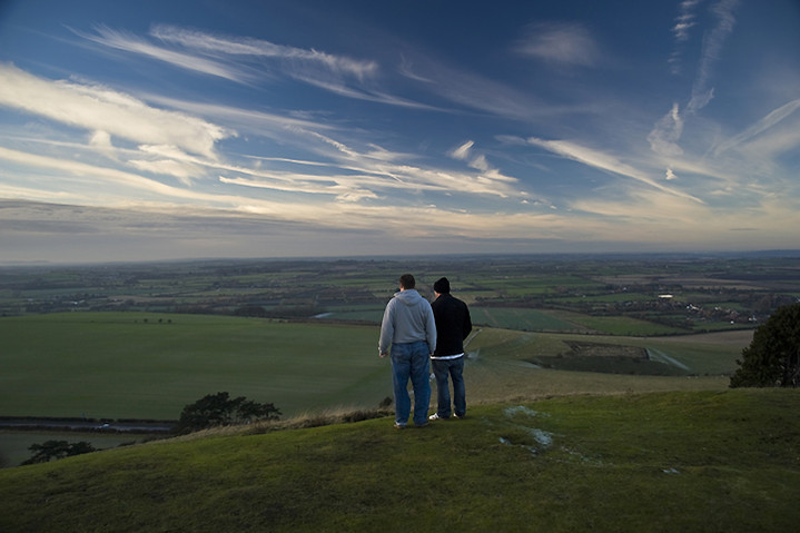

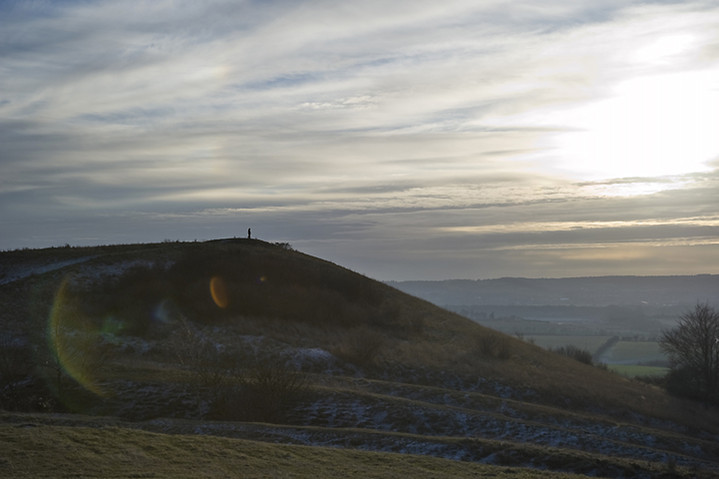
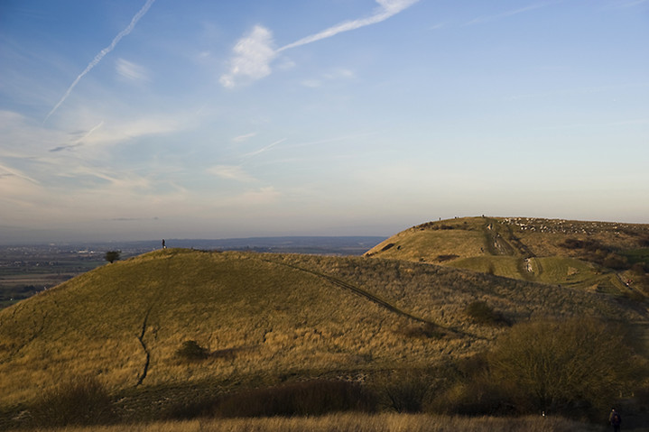

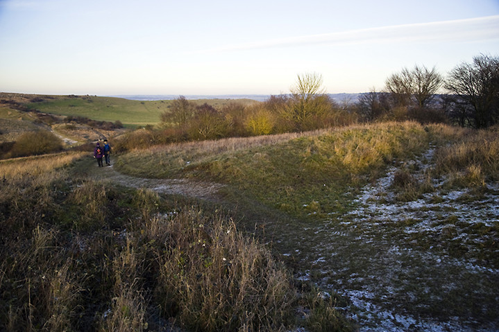


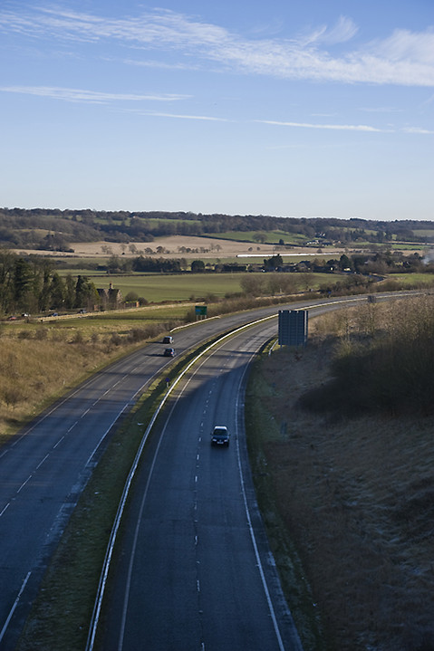


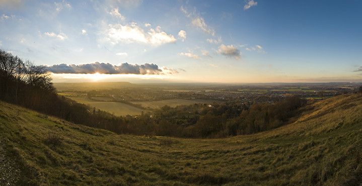


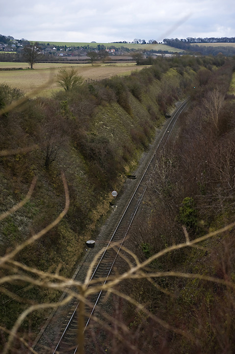
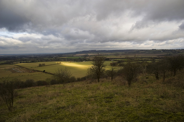

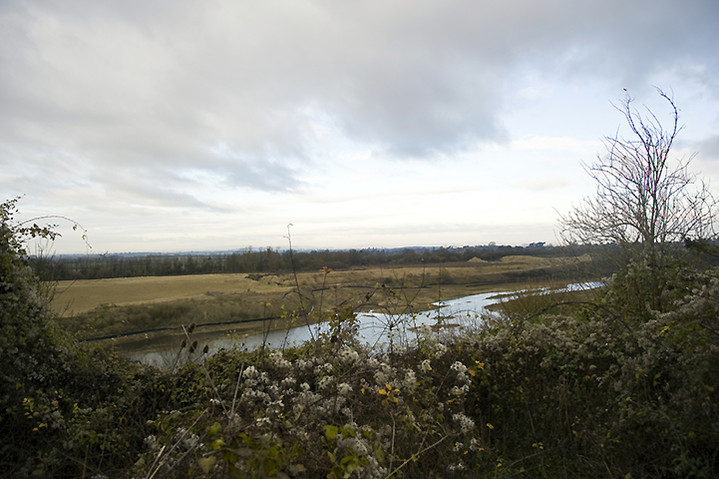

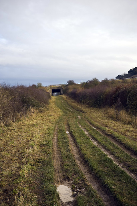
On The Hollow Hills – Twr Pen-cyrn 8 January 2011 |
On The Hollow Hills – Twr Pen-cyrn 8 January 2011One of things I love about this obsession is how one thing leads to another. I had a winter wonderland walk through deep snow up to Crug Hywel on Christmas Eve, which afforded an excellent high-level view of the shapely peak of the Sugarloaf/Pen-y-Fal. So for our first walk of 2011, girlfriend and I climbed up there on a freezing cold and somewhat gloomy day, which included a rather frustratingly unsuccessful attempt to find the Mynydd Pen-y-Fal cairns. Whilst on our way up from Abergavenny, a good view across the Usk valley to the flat mass of Mynydd Llangatwg revealed a couple of cairns, big enough to be visible to the naked eye and thus worthy of a visit sooner rather than later. Once home, a scoot across Coflein’s blue dots revealed a bewildering array of cairns, some of which appear to be the result of duplications on separate surveys. One of the blue dots, completely unexpectedly, revealed a putative stone circle. So with this background in mind and the prospect of reasonable weather, less than a week later I’m on the bus to Brynmawr. First though, a quick note about the landscape either side of the River Usk/Afon Wsyg. The Black Mountains, to the north of the river, are principally composed of Old Red Sandstone. They rise above the 2,000ft mark, putting them firmly on the mountain-bagger lists. The ridges remain largely untouched by industry, keeping to sheep farming and low-intensity agriculture. The towns and villages at their feet along the Usk and Rhiangoll valleys, like Crickhowell, Llangattock, Llanbedr and Tal-y-bont, are attractive and well-kept, with their economies boosted by tourists either coming to stay or passing through on their way to Brecon and the Beacons. The story is somewhat different to the south of the river. The northern scarps of Mynydd Llangatwg are composed of limestone, riddled with caves and shake holes. The terrain makes for hard walking, rough and boggy, with little in the way of fertile vegetation. At its highest point, the flat top reaches the 530m mark, keeping it below magical “mountain” height and thus off many a hill walker’s radar. It has also been washed by the tides of South Wales’ industrial past, where mining and quarrying scarred the landscape and where, sadly, the economy has been hit hard over the last few decades. Even the oddly named Cairn Mound Impounding Reservoir, on the southern slopes of the hill, has been abandoned and is slowly filling itself in. Brynmawr, my start point for the day, sits beside the Clydach gorge and has the feel of a town in decline. Yet this is an area rich in prehistory and deserving of more attention. Evidence of Palaeolithic occupation has been found in the extensive cave systems hollow beneath the hill and there are Bronze Age cairns by the bucketful. I leave Brynmawr via a bridge over the busy A465, passing a sports field before finding a well-defined metalled footpath running alongside one of the fast-running streams that feed the Clydach. I’m glad of the overnight freeze, which has rendered what would be quite a muddy route into something firmer. As the path climbs steadily, a decent retrospective view of the steep slopes of Cefn Coch, Mulfran and Mynydd Carn-y-cefn opens out to the south. These are some of the hills that separate the industrial heartland of the Valleys, crowned in the last case with a further Bronze Age monument. As I continue, the squat bulk of Blorenge appears to the east, then Ysgyryd Fawr beyond Abergavenny. By the time I reach the Reservoir, the top of the hill, flecked with lingering patches of snow, is in sight. Twr Pen-cyrn cairns — Fieldnotes30.12.12ceThe very top of the hill slopes more steeply in a little crest. Once onto this, the wind increases dramatically and the chill becomes noticeable, even after the heat generated by the steady climb. Views open to the west, to Waun Rydd and the cloud-shrouded central Brecon Beacons. Of more immediate interest is the collection of cairns on the hilltop, hidden from view until now. The name of the top, Twr Pen-cyrn (pronounced too-er pen keern) defies my translation efforts, settling on either “Tower [of the] head of the peak”, or “Peak-head Tower”, which seems too clumsy to be right. I have a little hand-drawn plan and notes taken from Coflein, but the numbering (and indeed the number) of cairns on Coflein doesn’t readily associate itself with what I’m seeing. The entire summit area is liberally scattered with limestone blocks, making for plentiful cairn-building material. The first cairn I reach is small and to the southwest of the main summit group. I think, if it follows the Coflein numbering and descriptions, that it’s Cairn VII. Beyond it, framed by an impressive backdrop of the Sugarloaf, Ysgyryd Fawr and Blorenge, is the southeastern cairn in the group. This is a monster, about 15 metres across and a couple of metres high. It has been messed about, inevitably, but remains a truly impressive monument. The ground falls away from the cairn to the east, leaving a fine, unobstructed view across Monmouthshire. To the north, the Black Mountains ridges, centred on Pen Cerrig-calch from here, glower darkly. I wonder whether the geographical and geological divide between the limestone plateau of this hill and the sandstone ridges of the mountains across the river were reflected in tribal divisions when these monuments and the comparable cairns of Pen Cerrig-calch were constructed? The other big cairn of the group is right on the summit, next to the trig pillar that itself surmounts a further, smaller, cairn. The summit cairn is a match for the southeastern neighbour. The be-trigged smaller cairn rejoices in the name of “Hen Dy-aderyn” (Old House of the Birds), which Coflein suggests might be linked to use as a shooting hide. The group certainly make for a great – if windy – spot for a cup of tea and contemplation. The clouds to the west briefly part to reveal the sawn-off tops of Corn Du and Pen y Fan, 15 miles or so distant. These four cairns are the only apparent cairns here, so I can only conclude that the Coflein records include a degree of duplication. Twr Pen-cyrn cairns — Images09.01.11ce
Twr Pen-cyrn Circle — Fieldnotes30.12.12ceHowever, there is also the small matter of the “stone circle”, one of the main reasons for coming here today. This proves a rather harder task to find. As mentioned, the whole hilltop is covered in scatters of limestone blocks, a crazy jumble of swirls and fans. I wander about for a while in the area where Coflein suggests the “circle” is to be found (slightly north and west of the main cairn group). Eventually I find a circular feature that pretty-much matches the description and location. I would never have described this as a “stone circle” though. I looks more like a ring cairn of some sort. More visits by more knowledgeable people might help decide. It’s somewhat churlish to complain anyway, as the location and the main cairn group make this place more than worthwhile for a visit. Twr Pen-cyrn Circle — Images09.01.11ce
Mynydd Pen-cyrn — Fieldnotes30.12.12ceAt length I head off west, following a narrow track through the tussocks of reedy grass and whin. Although the top of the hill is pretty flat, the terrain is still quite hard going, with boggy areas to traverse and ankle-sapping vegetation as soon as you step off the “path”. Luckily the next cairn, a little less than half a mile from the summit group, is right beside the path and it’s another biggie. Slightly smaller than the two main summit cairns, with a scooped-out centre now filling with vegetation, Mynydd Pen-cyrn cairn sits on the saddle between the Twr Pen-cyrn cairn group and the solitary Mynydd Llangatwg cairn. It’s an easy stop-off between the two, serving to liven up what would otherwise be a bit of a slog, truth be told. Mynydd Pen-cyrn — Images09.01.11ce
Mynydd Llangatwg — Fieldnotes30.12.12ceThe most westerly of today’s cairns, Mynydd Llangatwg is a wreck. What would have been a fine cairn, comparable with the larger monuments already visited, this has been properly buggered about with. Instead of a smoothly curving dome, the top of the cairn has been sculpted into two ridiculous horns, while sheep shelters eat into the sides below. What a shame. The location is excellent, with a great view of Waun Rydd, the Brecon Beacons, Mynydd Troed, the Black Mountains and the Sugarloaf. There is an enormous limestone scatter immediately to the west of the cairn, once again providing plentiful material. The ground drops away in every direction but east. Yeah, a great spot for a cairn, shame about the idiocy that has so distorted its shape. Mynydd Llangatwg — Images09.01.11ce
Eglwys Faen — Fieldnotes30.12.12ceI head north, as I have one further cairn to visit on this inhospitable hilltop. Again, the going is surprisingly tough, the paths are faint and before long I’ve stumbled into a much boggier area, where clumsily leaping from tussock to tussock is the only hope of keeping dry feet. Eventually I get towards the edge of the scarp, and the cairn comes into sight, another weirdly rebuilt shape, apparently hanging right on the edge of the void. There’s a small stream to negotiate first, narrow but fast-flowing, swollen by the melt from the heavy snows before Christmas. Here I meet the only people I’ve seen for hours, but as I follow the top edge of the scarp, the views become superlative and breathe is taken away. Whereas the view from the other cairns was of a gently receding slope in front of a long-range mountain backdrop, from here the drop is steep and the Usk valley appears, dizzyingly far below. Crickhowell is a toy-town, white against the fertile farmland of the valley. Crug Hywel fort is now in view, very different to the snow-covered vista of my recent visit. The cairn, Eglwys Faen (“stone church”, pronounced egg-lewis vine) is indeed perched above the drop. The stones have been fashioned into an odd pyramid, belying the larger footprint below. That said, for some reason this seems less appalling than the damage inflicted upon Mynydd Llangatwg cairn. Perhaps the wonderful placement makes up for any damage, perhaps in truth the landscape really is the thing and the cairn is merely intended to be the draw, the bait. If this is indeed a stone church, the beautiful, epic vista across the valley is worthy of worship, whatever your views about gods. Crug Hywel Camp — Images09.01.11ce
Eglwys Faen — Images09.01.11ce
Sermon over, I follow the scarp face round to the west, passing enormous shake holes that no doubt lead through labyrinthine passages into the vast cave system beneath the hill. Eglwys Faen — Images01.01.13ce
Mynydd Pen-y-Fal — Images10.01.11ce
Eventually I reach Llangattock village, where I stop by for a quick re-visit to the Garn Goch chambered tomb in its incongruous play-park setting, before wending my weary way across the river to Crickhowell. Garn Goch (Llangatwg) — Images10.01.11ce
There is much indeed to draw the stone-head visitor to the hills south of the Usk. Come prepared for a fairly arduous walk across unforgiving countryside, but the fine upland cairns are ample reward, especially if you pay your respects at the altar of the stone church, hanging high on the edge of these hollow hills. |
Posted by thesweetcheat 30th December 2012ce Edited 28th December 2022ce |
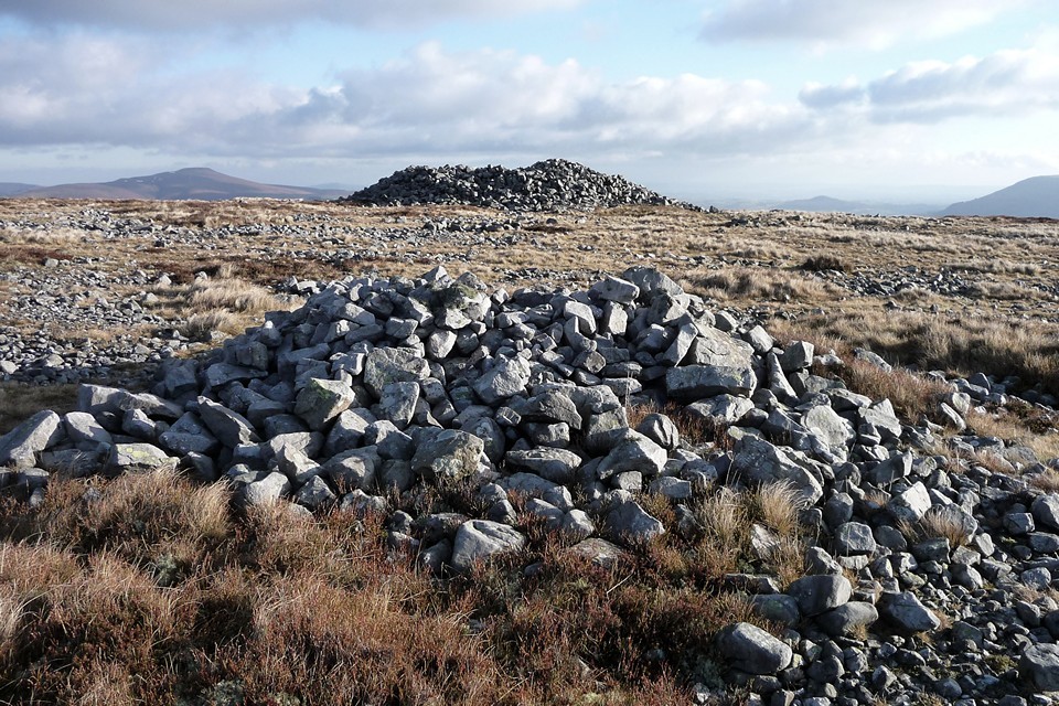
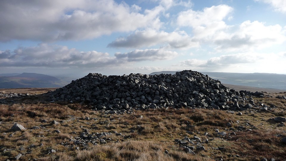
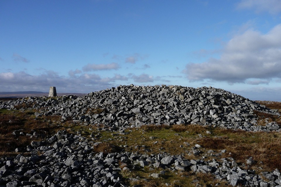
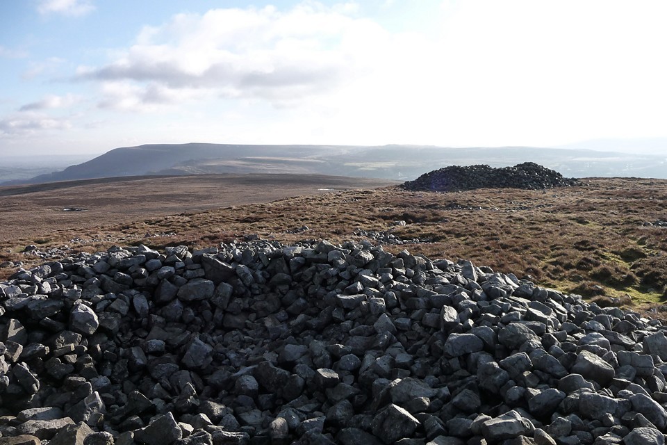
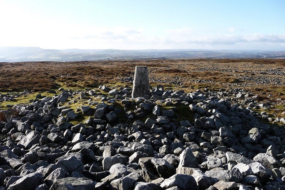
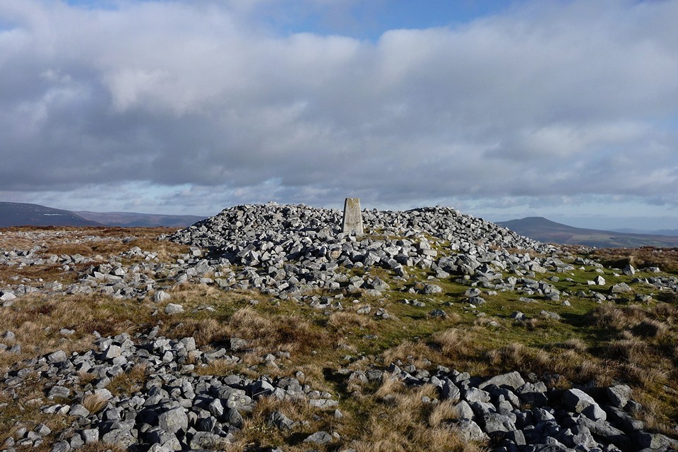
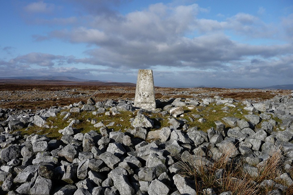
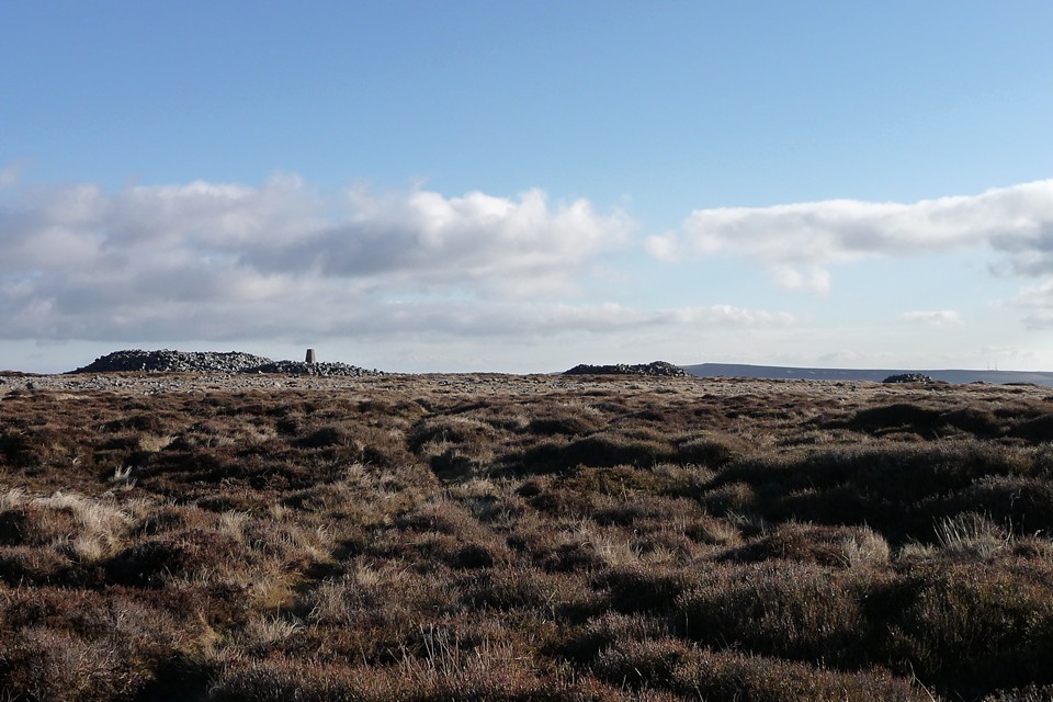
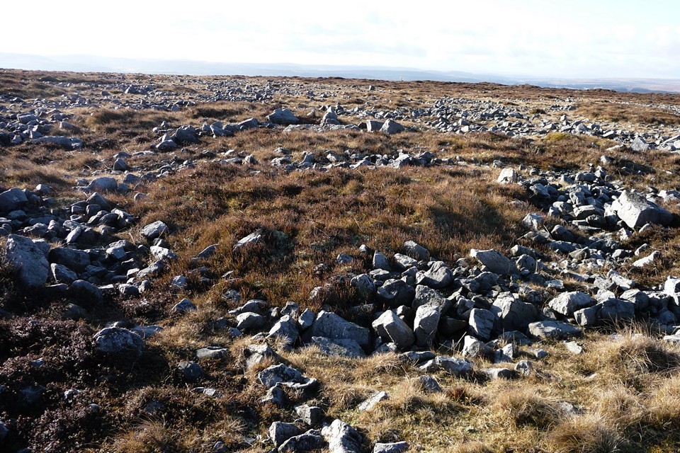
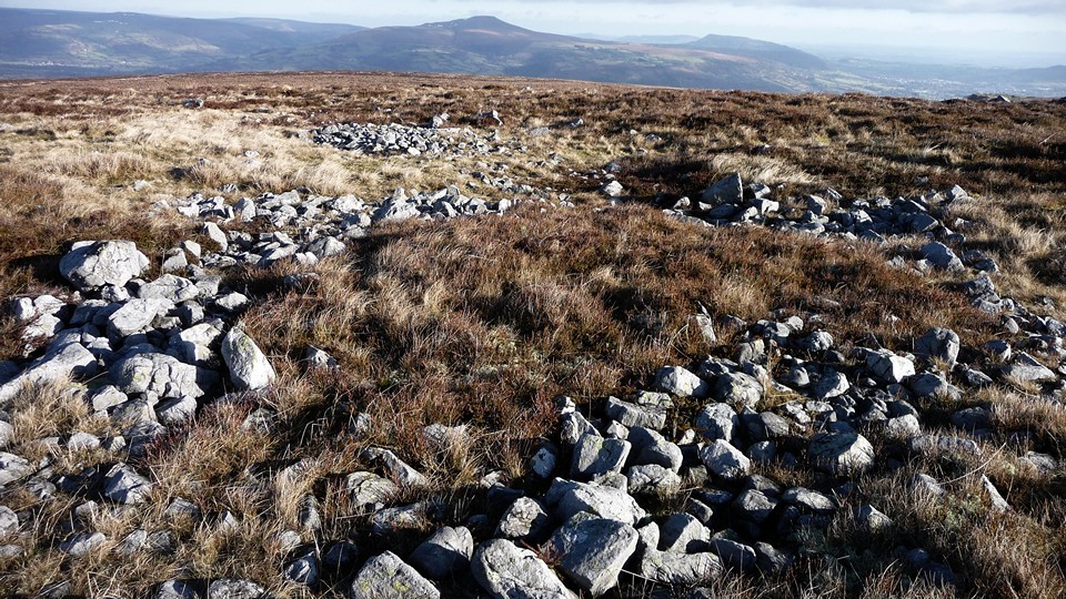
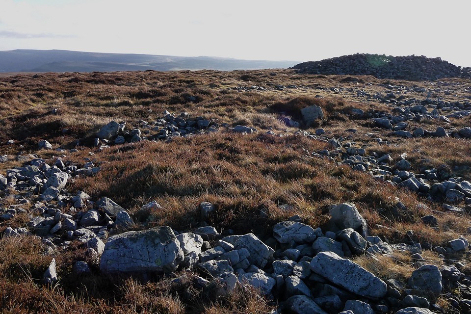

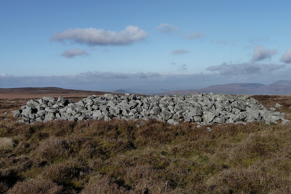


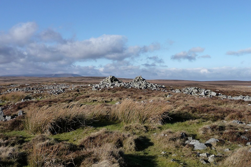
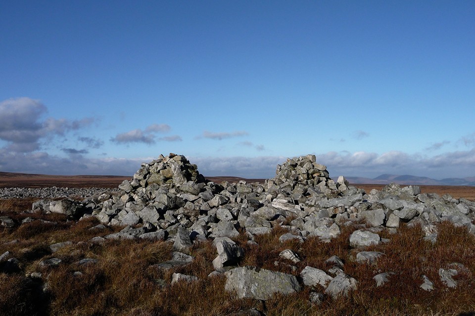
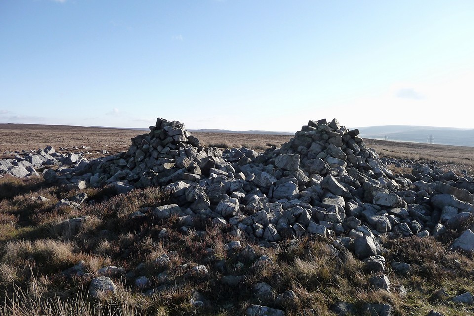
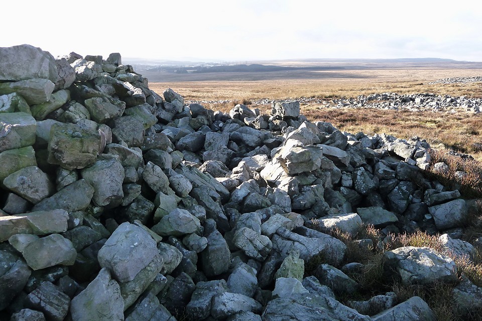
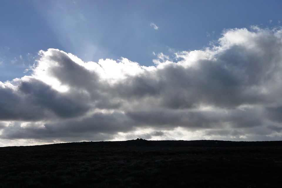
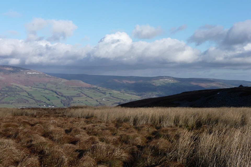
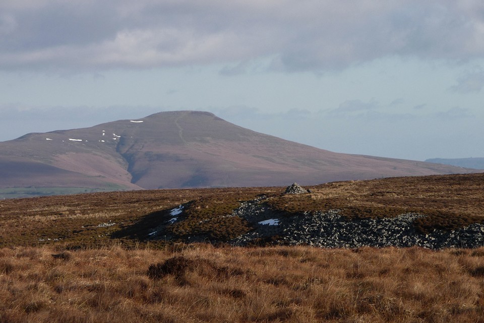
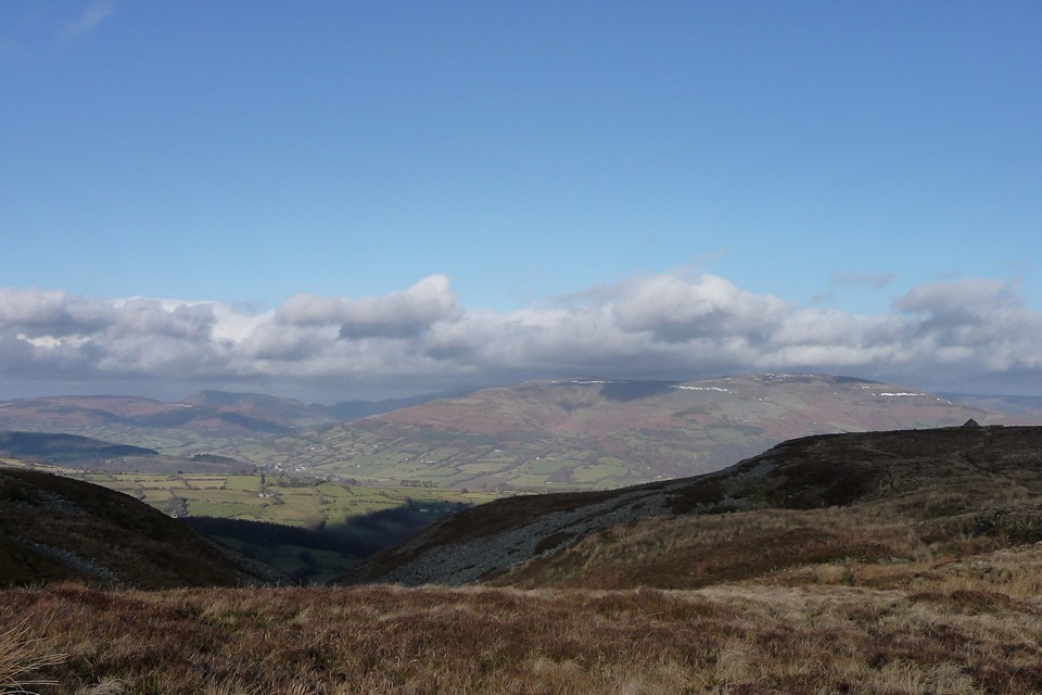
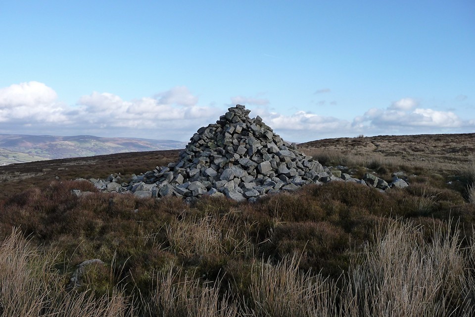

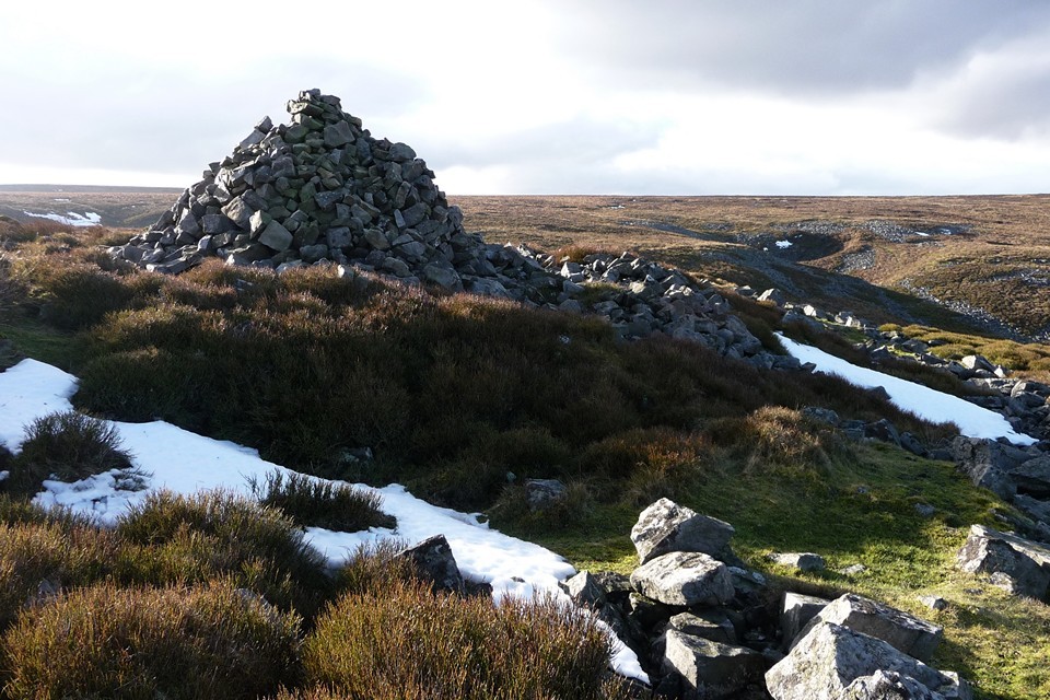
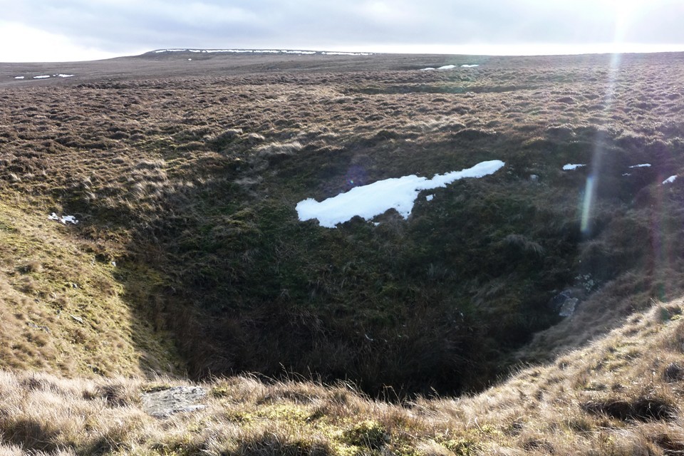
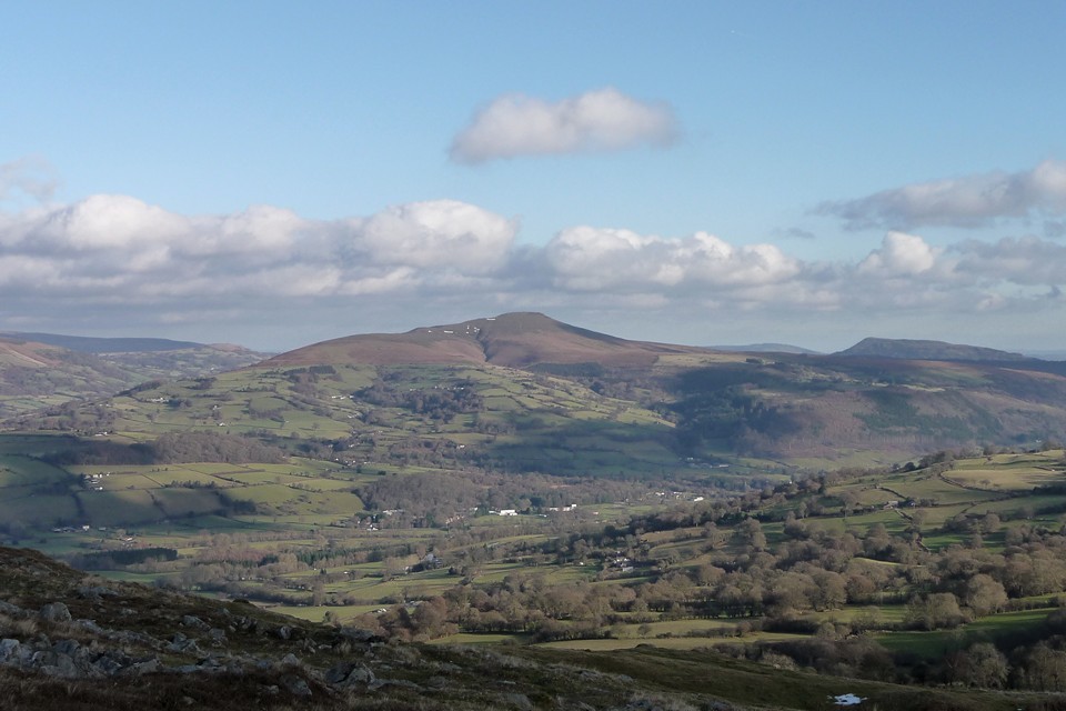
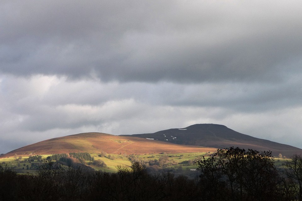
Reverend John Skinner |
Reverend John SkinnerA few years back I wrote about the Reverend Skinner, not in particularly gushing terms, but his personality fascinated me, his Antiquarianism is what drew me, then today the vast list of his drawings and sketches at the British Museum has finally been set out in an index. All this along with his many journals was undertaken by foot and horseback, no TMA or computer to record his obsession, so though he may have been a miserable old git to live with he gets my full admiration for effort...... "years ago I read extracts from the Journal of a Somerset Rector 1803-1834 by John Skinner and came away with the impression that he was a miserable bad tempered creature. Reading his diary again does little to alter my first understanding of him, but on reading the book again, I have at least come to see why he was so miserable. He was vicar of Camerton from 1800 to 1839 during this period he wrote his journals and during this time had to face a great deal of personal sorrow through the deaths of his immediate family and also as vicar at Camerton the deaths of his parishioners. The village of Camerton is also famed in the archaeology record as being the site of a Roman settlement, and also having been mined for coal since Roman times, in fact the 'everlasting flame' on the altar of Sulis at Bath was said to have been fuelled by coal from here. Skinner also had a theory that Camerton was Camulondinum as well. Yes, Skinner was an antiquarian, like Dean Merewether he would saunter out in summer, and with a few miners lay waste to any barrow that took his fancy. We decry this vandalism nowadays, but these 'heathen savages' whose bones occupied these barrows were to our nineteenth century religious zealots a great curiosity, perhaps at the back of their minds, a trickle of uncertainity had begun to emerge at their own faith in an invisible god... . At least their imagination ran riot as to thoughts of white robed Druids performing unspeakable ritual acts in the stone circles and they were fascinated by this 'other' world - like the later writers who were to collect folklore of the British scene, or to put it more simply the naive superstitious stories of giants and fairies that roamed England - our vicars were also absorbed by the paganism of earlier history, which in turn had drifted down through the centuries. Paganism was still rife in the countryside. Skinner was sensitive, nervous and irritable.. a cantankerous individual tormented by the social upheavals that were happening in the early nineteenth century. He had to contend with drunken miners in his own parish, 'fallen' women, and a poverty that we can scarcely comprehend today. This was no pretty quaint village with thatched cottages as depicted by later sentimental Victorians such as Allingham, this was life in the raw. To put it in the words of Virginia Woolf who wrote an essay on the man, "Behind him lay order and discipline and all the virtues of the heroic past, but directly he left his study he was faced with drunkenness and immorality; with indiscipline and irreligion; with Methodism and Roman Catholicism; with the Reform Bill and the Catholic Emancipation Act, with a mob clamouring for freedom, with the overthrow of all that was decent and established and right...." Skinner's archaelogical exploits have drifted across my path the last few years, the most famous of course being Stoney Littleton Barrow, but also nearer to my home the Charmy Downs Bronze Age Barrows, now destroyed by a first World War airfield, the barrows followed a linear path on top of the Downs. Also Skinner excavated (or dug down to) the Ashen Hill barrows, a linear group of 8 barrows, very near to the group of the Priddy Nine Barrows, in fact these two groups make up a bronze age cemetery, not too far from the famous Priddy Circles. All these eight barrows were investigated by the Reverend John Skinner in 1815, and all barrows produced one or more cremations. Some of these contained Early Bronze age urns and were covered with stone slabs (similar to Lansdown barrows cemetery). Three barrows had bronze daggers, one in a wooden sheaf. One barrow contained a rich burial which included beads and other objects of amber (maybe faience) and a miniature incense cup. (from Ann Woodward - British Barrows)........ http://www.themodernantiquarian.com/post/50742/images/ashen_hill_barrows.html There is a poignant passage in his journals regarding the Mendips, and it has to do with the death of his favourite daughter Laura at fourteen years old in May 1820. A few months later after her death he had ridden up to the Mendips in a solitary manner, and in his diary had written the following passage; "I could not help thinking how differently this morning was to be spent by myself, an obscure imdividual, on the desolate heights of Mendip, and the Queen of these realms in the midst of her judges in the most splendid metropolis in the world. Yet when half the number of years have rolled away which these tumuli have witnessed how will every memorial, every trace, be forgotten of the agitation which now fills every breast; all the busy heads and aching hearts will be as quiet as those of the savage chieftains which have so long occupied these hillocks" But there were happier times in his life, and in 1822 he describes riding out with a party of friends to Stanton Drew Circles;... "When the country in the vicinity was covered with wood, and the white robed Druid stood in solemn silence, each one by his stone of power in the centre of this gloomy recess, the scene of course was more impressive" ---------------------- The full horrors of death was an experience that he had to contend with as a vicar, as mentioned earlier. He lost his brother and two sisters to consumption in 1810, his wife must have also caught the infection for she was to become ill as well, in 1811 she gave birth to a daughter who died three months later of consumption. Then in 1812 his wife died. All this happened in a matter of short time, later on in life, after the death of Laura again to consumption, his son Joseph was also to die of the same illness. In the village itself, death was commonplace, the coal mines were dangerous, men and children were occasionally killed by falling rock. Drunkeness was also a killer, a woman died horribly by falling on the fire in her home. Men fell down shafts inebriated, and on one occasion a man walking through a hedge into what he thought of as a field, in actual fact plunged down into a quarry. Age and poverty were also great killers, the two linking together, no social service to put food on the table or clothes on their backs of the poor, they must in the end succumb to a miserable death, sometimes in the poor house, sometime under a hedge or a barn. Skinner mental health seemed to deteriorate after 1839, his journals became less interesting, and one day in October, armed with a pistol he strode out of his house and shot himself in a nearby beech wood. The Coroner's verdict gives some idea of the state of his mind; According to one source Skinner seems to have shot himself in despair of his son's illness, again consumption, perhaps he could not face this death of his third child. "The Rev. gentleman's health had been declining for sometime and his mind had latterly been very much affected. On Friday morning, in a state of derangement, he shot himself through the head with a pistol, and was dead in an instant." http://chert.org.uk/CHERT-Skinner%20Index%20to%20drawings.pdf |
 Posted by moss
18th December 2012ce |
Entrances uncovered, courtesy Winter – Leckhampton 18 December 2010 |
Entrances uncovered, courtesy Winter – Leckhampton 18 December 2010Snow. I love it. Not the dull grey sprinkle on urban streets that turns to brown in hours, but the deep, blanketing snow of a proper fall. Familiar landscapes are unmade, rendered new and strange and pristine. And so it is, a week before Christmas, that a Saturday comes full of winter promise, uncovering an entrance into another world of stark black and white, drained of colour but brimming with fresh possibilities. Christmas card perfect, Leckhampton church spire points into a sky of heavy grey nothingness, with lazy flakes of snow fluttering down. My route wends through white lanes, before starting its ascent via The Crippetts. Off the main road the snow is deep and undisturbed, both a guilty pleasure to deface with my passage and a hindrance to movement as the way steadily steepens. Cold though the day is, I soon find myself overheating under fleece and coat. The Crippetts is a somewhat fitting place to pass in deep snow. It was here that Edward “Bill” Wilson grew up, Chief Scientist on both of Scott’s Antarctic expeditions and one of the men who tragically perished alongside Scott on their return from the Pole. I emerge onto the hillside above The Crippetts, where a fine view of the quarry-ravaged western slopes of Leckhampton Hill can be had, today blanketed in snow with all the rest. The view extends gloomily towards Cleeve Hill to the north, but visibility is too poor to show details today. Leckhampton Hill — Images27.12.10ce
Crippets Long Barrow — Fieldnotes19.11.12ceThe path climbs up towards the edge of the escarpment, joining the Cotswold Way as it enters Barrow Piece Plantation. This name records no dredged memory of a forgotten barrow, for here is one of the finest of the long barrows of the western Cotswolds. Tree-covered, even with mound mutilated and chamber wrecked, this remains a fine, upstanding monument, every bit deserving of its “long” classification. Stark, black-limbed trees tower protectively over the white-shrouded mound laid out beneath their feet. There is deep peace here, in this quiet place. The only sound is the crunch of my footfalls breaking the crust of snow. I came here in winter once before, when a bone-deep cold threatened to strip the skin from any hand left ungloved for more than a few moments. Today, despite the snow, the cold is much less, almost an abstraction. How easy it would be to lie down in its warm blanket, nestled here amongst the sentinel trees. But that way lies the fate of Dr Wilson and I depart, spotting for the first time the ghost of the nearby round barrow, its very slight existence revealed by the snow. Crippets Long Barrow — Images27.12.10ce
Crickley Hill — Fieldnotes19.11.12ceI continue along the Cotswold Way to Crickley Hill. By now the snow has started to fall again and as I sit at a bench in the picnic area for a welcome cup of metallic tea I’m joined by a magpie, appropriately enough on such a monochrome day. I salute and wish him a good afternoon, after which he departs, apparently satisfied that the necessary dues have been paid. By the time I enter the fort itself, through the entrance in the northeastern rampart, the snow is threatening to turn heavy. Freezing mist reduces visibility and photos start to become splodged. Needless to say, I am alone here today. After a circuit of the rampart, I make my excuses and leave through the woods to the east. Crickley Hill — Images28.12.10ce
The horribly busy junction at The Air Balloon has less traffic than usual, but the road surface is icy and it becomes a slow ballet of near-death, me gingerly crossing the road while cars skid and slide towards me at three miles an hour. Emma's Grove — Fieldnotes19.11.12ceSafely across and into the trees, the next barrows of the day are before me. Mutilated in the usual way, the largest of the Emma’s Grove round barrows is still an excellent example. I remain surprised that I seem to be only TMAer who has visited. Unfortunately this visit is hampered by snow that has turned heavier still, and I’m nearing my furthest point from home. But I’ve one more site to visit today, and as Macbeth would have it, I’m stepped in so far that should I wade no more, returning were as tedious as go o’er. Besides which, I never really like to retrace my steps, there’s always something new to see up ahead. Except today, when there’s precious little to see in any direction. Emma's Grove — Images28.12.10ce
The mile or so from Emma’s Grove to Coberley is not the easiest I’ve ever walked. The paths have been largely untrodden since the snowfall, so I’m forging a way through knee-deep snow by now, while more falls from above for a bit of a top-up. At one gate I manage to fall over, but luckily the snow provides a welcome cushion. Finally reaching the wrecked long barrow, visibility dwindles still further. I could be alone in the world for all I know. I decide not to enter the field, the barrow is easily seen over the fence and I’m really starting to feel the cold now. Instead I carry on east to the road junction, where turning northwest I’m finally heading for home. Unfortunately I’m also heading directly into the snowfall and a fierce wind. It seems a very long walk home now, three miles of deteriorating weather and unsure footing where snow on the road conceals polished ice beneath. Coberley — Images28.12.10ce
But what’s to complain about? I’m not stranded in a Polar blizzard, unable to reach the next food depot. Home is close and cosy. I’ve seen some of my local sites made anew, strange and pristine. Entrances uncovered, courtesy of Winter. |
Posted by thesweetcheat 19th November 2012ce |