Fyn finds
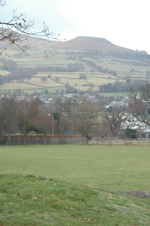
Fyn is the Danish island which lies directly east of Jutland and has a gently rolling landscape punctuated by neat little villages and farms of remarkable cuteness and character. It reminded me very much of Drenthe in the Netherlands, only not flat.
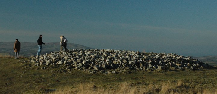
Glavendrup
Among this scene of bucolic charm is Glavendrup (featured in The Megalithic European [TME] page 156).

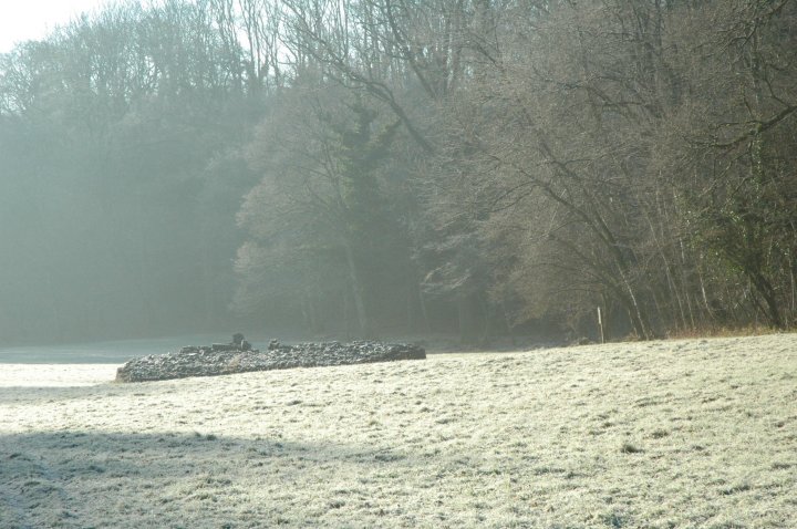
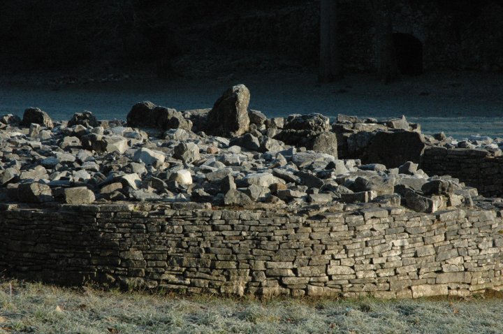
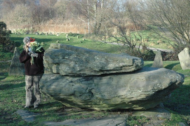
It's a bit like Klæbek Høje, that we saw the day before, in that it started as a Bronze Age barrow to which the Vikings added a whole bunch of girly pink stones. First a large runestone was mounted on top of the barrow, and they also built a skibssætning megalithic longship, of the same pink sparkly Barbara Cartland type stones, with stripes and waves of quartz running through.

The wooded area had also been added to by modern stones, inscribed with the names of 20th century archaeologists who worked here. They looked OK, but reminded me too much of the stone memorials in the woods at Bergen-Belsen to thrill me. The wind chilled me and there was no chance of sketching here.
Magic at Marhøj
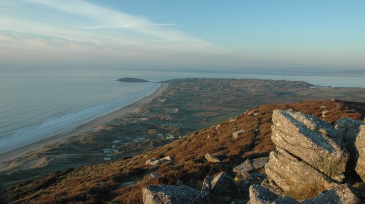
At the north east tip of Fyn is a little promentary on which can be found Marhøj (TME page 158), a particularly thrilling giant barrow. In a landscape shared by other fat, high, humpy høj, Marhøj is Queen.

Wading through the dark earth of the field littered with flints, we reached the monument and found the entrance to the passageway leading in is half way up the mound, rather than at ground level. Stooping very low (if you're tall this is almost a hands-and-knees-job) I squeezed down the 5 metre passage flanked with big flat stones to reach the main chamber which runs perpendicular to it.
The main passage was darker the dark. I got out the torch but it was unable to penetrate the blackness at all. I found a bit of candle and lit it. Then I found a tealight and lit that. And another and another and another until the whole chamber, 10ms long was illuminated by 26 tealights. It looked very hygge.

I sat down on the damp earth to inspect the chamber, smoke a cig and have a cuppa. It was vast: seven massive capstones formed the roof, all glistening in with wet in the candlelight making it as cosy as a fairy grotto. Moth scampered around with the tripod taking pictures and collecting more than 25 used tealights. It was cold in there – my breath was condensing - but it was out of the rain and the icy wind. It was fab.
We headed south from Marhøj (there is no other direction you can go on Fyn) to the east side of the island to see Lindeskov which is only given a tiny entry on page 157 of TME.
A complex at Lindeskov
We'd spotted another thing in James Dyer around Lindeskov and sought it out first: Lindeskov langdysser at 168ms (yes, metres!) the longest barrow in Denmark, and certainly the longest I've ever seen. It was never more than a metre high or 5ms wide and had regular kerbstones, giving it a visual rhythm not dissimilar to a millipede. That sounds a bit wanky but it was really like that.

While Moth fluttered around with the camera, I inspected the handy visitors' information board. To my surprise and delight, it showed a map with another six monuments nearby. I looked up in the direction indicted on the board towards a dolmen which I could just see through a hedge. I made a mental note of the map and we set out in search of what turned out to be the Lindeskov Complex: for this was indeed a complex: a series of interconnected monuments, each with clear sightlines to the next and no more than 400ms away at maximum from each other.

I drove up a muddy farm track marked 'Privat Vej' but we went on anyway, as on the map I'd seen it clearly stated public access.

We passed the dolmen standing alone in the field in the same lonely manner as Devil's Den and left the car at the copse at the top of the track and set off into the woodland, first coming across a trashed barrow with a couple of capstones in the middle. Just beyond the trees in a clearing lay two mighty monsters, Lindeskov 2 and Lindeskov 3 a couple of twin sister langdyssers lying directly next to each other and about the same length and width. Each of them had good kerbstones. L2 had a single stone cist and L3 had three good exposed chambers with capstones – looking very like Schimeres at Emmen in Drenthe.

Just 20 ms from the top end of L2 was L5 a rungdysse (round barrow) with kerbstones and an exposed central cist which would not have looked out of place in Scilly.
We felt quite chuffed with our 'discoveries'.
Finally we drove to Lindeskov as featured in TME, a langdysser right at the roadside.

It's a main road but as Denmark has so little traffic it didn't matter. The monument is correctly referred to as Lindeskov 6 and is dribblingly tasty. It's not particularly long, but has five chambers exposed on the top, four of which still have capstones. With its regular pink kerbstones and high, pointy supporting stones holding the capstones aloft it seems all dainty and floaty.
Glossary
Hygge - cosy
Høj – hill or mound
Jættestue – literally 'giant's stones'
Skibssætning – megalithic longship
Ringdysser – mound or barrow with stones or burial chamber
Dyssekammer – dolmen or burial chamber, I think!
Langdysser – long barrow with stones and/or burial chamber
Photos: Moth Clark
|
Wet west Jutland
1 April 2006
Forty minutes after the boat docked at Esbjerg in Denmark, Moth and I were at our first Danish monument, the Jættestue ved Mejls in west Jutland. Spookily the MP3 player randomly selected a track from Julian's Rite 2, a favourite on our megalithing trips.

As we drove through the almost flat sandy landscape we kept spotting large, tall round barrows – not the flattened shadows of their former selves you get in the UK - these are big, fat and pert. Effectively the jættestue were two very large barrows, one of which had been opened up to reveal two small stone chambers inside, looking all the world like little dolmens. Very nice. The weather was evil – cold, windy, wet. Grim, in fact…which interestingly is the Danish word for ugly. I didn't know it yet, but I would have to get used to this…
Further north, up the west coast of Jutland, we headed for Ølustrup to see what is billed as 'three long dolmens and a long barrow' in James Dyer's 1972 book Discovering Archaeology in Denmark.
 http://www.janetomlinson.com/images/photographs/denmark/olstrup.jpg"/> http://www.janetomlinson.com/images/photographs/denmark/olstrup.jpg"/>
It was peeing with rain, visibility was very poor and the air hung heavy with the smell of pigshit from a nearby farm. One of the long barrows had some nice exposed chambers, but the site was not particularly whelming. We were pushed for time so headed off towards our cottage near Middelfart* in the island of Fyn.
[*yes, we tittered everytime, too!]
Directly en route was Klæbek Høje (featured in The Megalithic European [TME] page 164).

Also known as Bække, Klæbek Høje is a couple of huge verdant round barrows from the Bronze Age with a much later addition by the Vikings.

They constructed a skibssætning, a megalithic longship between the barrows. The stones at each end of the 'boat' were bigger, implying prows. We liked it a lot. Dyer's book said that the depressions of tracks running through the middle were the remnants of a prehistoric military road or trackway, but neither Moth nor me bought this idea.
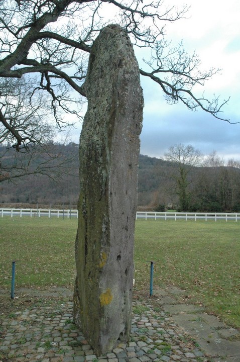
Just down the lane from Klæbek Høje stands the mighty Hamborggårdsten, an oath stone.

Hygge is a Danish characteristic meaning 'cosy' or the pursuit of cosiness and is very important to our Danish brothers and sisters. There is no higher compliment than to say to your host: 'what a hygge evening'. For novice hygge-pursuers, light a few candles and you get the idea. When we reached our cottage near Båring we found it was not at all hygge. Within a hour our friends arrived, we lit some tealights, put the kettle on and things got more hygge as the rain pelted down on the thatch. Nevertheless we were to become rather fed up with rain….
Glossary
Høj – hill or mound
Jættestue – literally 'giant's stones'
Skibssætning – megalithic longship
Ringdysser – mound or barrow with stones or burial chamber
Dyssekammer – dolmen or burial chamber, I think!
Langdysser – long barrow with stones and/or burial chamber
Photos: Moth Clark
|
Gower power
The Gower is a rather beautiful sandy, limestoney peninsula sticking out westwards from South Wales right on Swansea's doorstep.
We were very lucky with the weather. It was incredibly cold, but there was no breeze at all, the sky was cloudless and blue and the sun's weak rays poured out lemon light. There are some really rather lovely sites down here and lots of variety, too. We easily did this lot on a short winter's day!
This is a well tended and large restored Severn-Cotswold type cairn. We got there early and the light was streaming through the frosty trees. The cairn has a central passage with two pairs of transepted chambers. The cairn is now roofless so the internal structures are all exposed. It was fabulous just lying there surrounded by woodland in a bright yellow crisp winter valley. We loved it.
You can park very close by and the approach to it is flat so it'd be great for those using wheelchairs or buggies to visit.   |
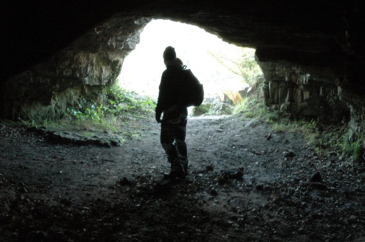
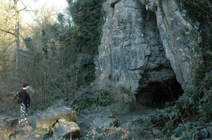
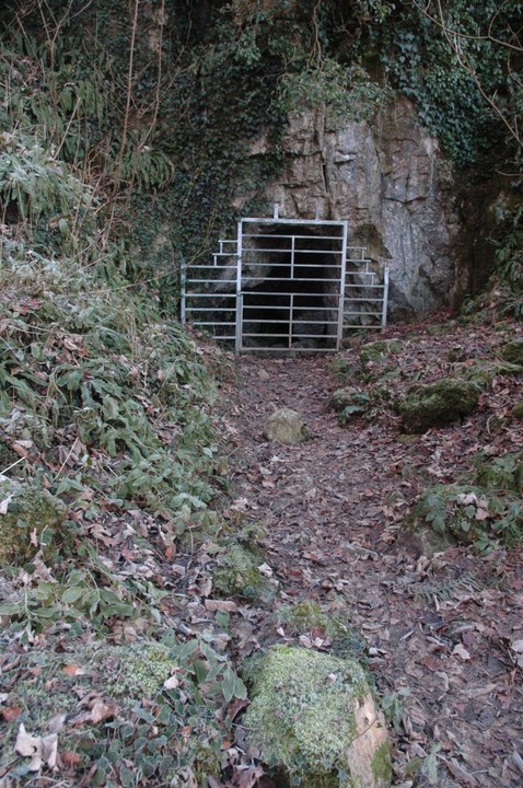
Just 200ms away from Parc le Breos hidden in the wooded cliffs on the right as you approach is this lovely cave which is certainly worth a shufti. It has two entrances, one closed up with railings. The larger entrance, of a tall triangular shape, leads to a huge interior. It goes back a long way into the rock and has a number of chambers within it. I was thrilled and delighted at how cosy and warm it was at the back of the cave away from the frosty winter morning. When it was excavated in the 1960s very ancient human remains were found. Lurking in the dunes on a promontory close to Penmaen village is a small burial chamber.
We parked at SS527885 by the bus stop and post box and walk down the path marked 'Tor Bay 0.8kms'.
Once on the promontory be prepared for a stomp about! We scoured the hillside on the left of the path where the dunes dip down sharply to the dramatic beach below. It wasn't there. We searched the tip of the promontory, but no cigar. Finally as we were about to give up, I spotted it 20 metres from the end of main path as it breaks up into many tracks through the dunes, on the right of the 'mainest' path.
It has a good sized solid capstone, now fallen on one side, and a few stones making up a short passageway. Surrounded by dead bracken, half buried in a dune, it's not a burial chamber to write home about, but I loved it anyway. The views down to Threecliff Bay are breathtaking!
Up here on top of the dunes reminded me of Porth Hellick Downs on Scilly's St Mary's.   |
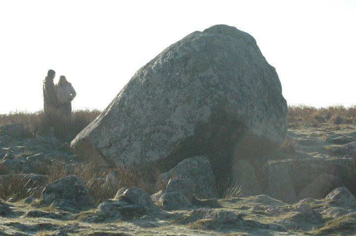
The site is found up on high open moorland with amazing views back over to Llanelli to the north. The moor was crawling with shaggy frozen ponies. As you approach it you can see it's big but then - woooo!!! This is so much bigger and more impressive than I had ever imagined up close. The capstone is less of a cap and more of a mighty concrete helmet – perhaps weighing 40 or 50 tons (I kid you not!) - supported by really small uprights which look as if they have been driven into the earth under the vast weight of the elephantine lump above. The whole construction sits in a concave rubble cairn, so it's easy to imagine the original size of this place.
As we drove around, we kept getting sights of the monument perched up there on that chilly heath from miles away. Cefn Bryn Great Cairn is just 25ms away from Maen Cetty and is little more than a huge mound of large stones. But it all adds to the atmosphere up there on that amazing ridge of moorland with those staggering views. Sampson's Jack is a pointy menhir of white stone which soars out of its hedgerow setting! It is the texture and colour of rice pudding. What a shame you can't see the whole stone – it must be 12 feet tall, but the bottom six feet are hidden in the hawthorn. Without modern buildings it is only maybe 300 metres away from the standing stone at Ty'r Coed farm and certainly on a sight line.
Note for pedants: On the map, the spelling of Sampson has a 'p' in it. Park at the top of the lane by the farm entrance and ask at the farm to see it, because this is on private land.
The farm building is only inches away from this menhir which is made of the same rice pudding stone of Sampson's Jack. Because it stands in a rise of land its size is deceptive. It must be at least seven feet tall. From here you get a very clear view of Maen Cetty on the ridge to the south about a mile and half away.
The stone is kept in a small enclosure with three dogs so mind where you tread - it's very shitty!  |
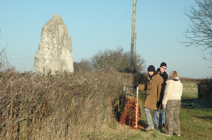
We drove along to Llanrhidian village where a number of standing stones were marked on the map. We had a look for the one at Oldwall at SS484919, but it wasn't there. Perhaps it has been removed?
We drove into the village of Llanrhidian. Two menhirs stand guarding each side of the path up to the tiny old church.
The stones are curious. The 'lower' one is undoubtedly ancient. The size, weathering patterns and position all felt genuine. The 'upper' one was highly suspicious. It looked as if it were a more recent stone – which for sure had once been used as a gatepost – which had been plonked on top of a larger stone. The larger stone now lies down on the slope, but the size, type and weathering all matched the standing stone still up.
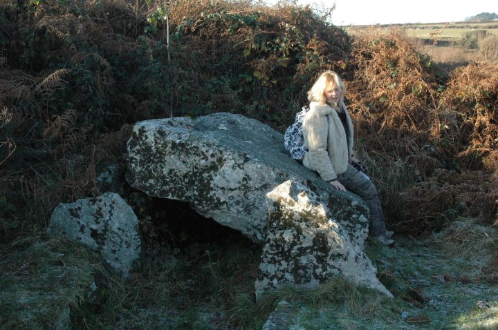
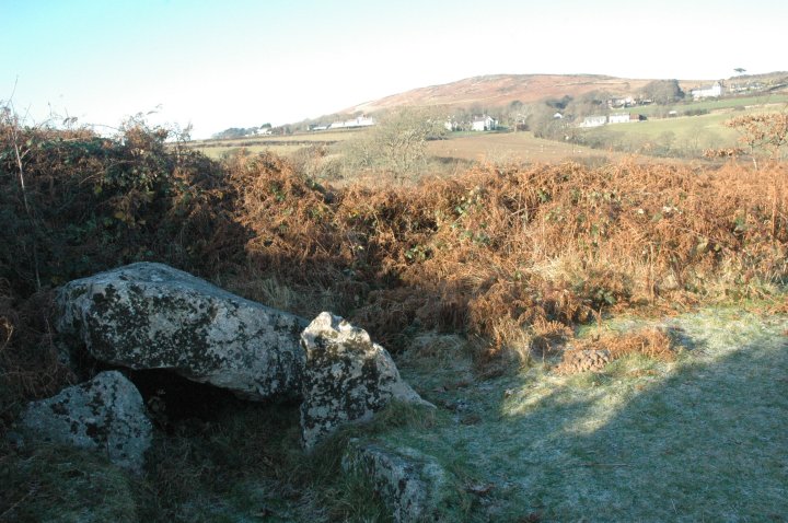
I wondered if they had once been part of an alignment as they followed the dip in the road which looked as if it had once been an old trackway down to the marsh just half a mile or so to the north At the far western end of the Gower peninsula is the most lovely beach – four miles long backed by extensive hummocky dunes. Rising sharply to 185 feet above sea level immediately behind this is Rhossili Down, a great dramatic hill facing directly west. Right on the top of this are some cairns, burnt mounds and the Sweyne Howes chambered tombs.
I can't resist a chambered tomb, so I foolishly persuaded myself that shuffling up the near vertical (OK, I'm exaggerating, but it was really steep) hillside would be worth it. Grumbling with displeasure, I made it to the very top, but when I couldn't immediately see the tombs I turned back, knowing it would take me a long time and a great deal of pain in my knees to get off this particular Everest. The view from the top was lovely, but certainly not worth pain. Moth made it up to the tombs and took lots of lovely photos for me to see later. I returned to the beach to sit in the dunes and watch the crazy surfers – one of who I observed scraping ice from his board before waxing it down. Nutter! I hope he had a thermal vest on underneath his drysuit!
The Gower really is very beautiful. For megalithomaniacs needing to take a holiday with their family, I can highly recommend it. Amazing beaches, lovely walks (I imagine, for those who like walking), delightful hostries, views, surfing, horseriding, pottering about and for the stone-huggers lots of different kinds of monument to seek out.
|
South Wales Getaway
Perhaps if I was a drinker, a Christian, a capitalist or not a woman I might like Christmas. But I'm not, so I like to flee it if possible. This year Moth and I escaped immediately after the 'festivities' were over to visit friends in South Wales who also don't like Christmas. I wanted in particular to visit the Gower peninsula. But we thought we'd have a look at some stuff en route to the kingdom of Swansea.
What a strange place! In a wonderful position on common land near Pontypridd hospital are some natural rocky outcrops, one of which is known as the Pontypridd rocking stone. It is very large – about 5 and half feet tall and round, roughly in two pieces like a cottage loaf. I gave it a push. It doesn't rock. In recent times a very nice small stone circle has been built round it. The whole place seems rather peculiar though. Around Crickhowell
From Pontypridd we drove up into the valleys, singing 'Bread of Heaven' as we went, towards Crickhowell. Around Crickhowell there are quite a number of sites worth seeing, though I would argue none of them are A-list Hollywood sites, (although Moth thinks the Fish stone is.)The growing stone is a very tall, slender menhir, standing sentinel by the roadside about 12 feet high and provides a certain surprising quirkiness at the entrance of a military training establishment. It didn't need medals or stripes or pips to give it authority. In the village of Llangenny, very close to Crickhowell two standing stones are marked on the map. One stands very small and looking rather forlorn and alone at the bottom of the valley. It's nice though, and I'd like it in my orchard!
Llangenny is a small picturesque village, tumbling down a steep hillside so we drove through in an attempt to find the second stone on the map at SO237188. In thick impenetrable woodland, overgrown with brambles and dry bracken we didn't stand a cat in hell's chance of finding it, so we moved on. Out on the other side of Crickhowell on the edge of a village recreation ground is Carn Coch burial chamber. There's not much left to see here, but I liked it. A grassy mound with a bit of rubble poking through here and there and a single flat capstone is all that remains. It's been disturbed a bit too, as its outline is not smooth or distinct.
It has as tremendous view of the very unusually shaped Sugar Loaf hill on the other side of the valley. Half a mile out of Crickhowell right by the busy A40 is all that remains of Gwernvale burial chamber. It is scarily close to the road! It now signals the entrance to a posh hotel. The stones, all about 2 feet tall and 2 feet across, clearly mark out a main chamber and entrance passageway, but the rest of the tomb is long gone. No mound, no rubble, no nothing. The only thing to indicate the tomb's original size and scale is a number of marker stones. Once, it might have been as big and impressive as Belas Knap or Stoney Littleton. My guess is that much of the cairn material was used to build and repair the road.  |
A short walk through the woods following the line of the river Usk brings you to the Fish stone... in theory! Actually the path through woods is 30 feet up a steep slope and the stone stands in the grassy inaccessible valley below. Being a confident walker, Moth decided to head off down the slope and seek it out, trespassing merrily. I didn't! I could see the stone tantalisingly close below, but there was no way I was going to be able to reach it. It's crackingly tall – perhaps 18 feet or more and intriguingly fish shaped, with distinct fins projecting from its narrowest sides. We continued on to Swansea where we met up with our Christmas-hating friends.
|
'Seek and ye shall find' Jordan Valley dolmens
Warning: This is quite a long weblog. However it is lavishly illustrated (a bit further down) for your viewing pleasure. All photos by Moth Clark.The River Jordan flows south out of Lake Tiberias 320kms to the Dead Sea, the lowest place on the surface of the earth. The river follows the line of the Great Rift Valley, a meeting of two massive geological tectonic plates which runs north to south for more than 5,000kms from Syria to Mozambique.
The River Jordan now forms the frontier between Israel and the Kingdom of Jordan. At some point along the banks of the River Jordan 2,000 years ago, a Jewish social reformer underwent a watery ritual with his cousin called John in a cleansing ceremony known as 'baptism'.

Piero della Francesca's 'Baptism of Christ'
But human activity in the Jordan valley goes back far, far further than this. With rich alluvial soils, a regular water supply and a good climate it was an obvious choice for humankind to settle and begin farming. And so it came to pass.
Both Israel and Jordan claim to have found the exact place where the baptism occurred. Tourists in any doubt can visit both. We visited neither. We did find something very interesting indeed though. Not far from the more likely baptism site near Bethany-Beyond-The-Jordan on the Jordanian side of the frontier - fields of dolmens.

'Seek and ye shall find' (Matthew 7:7)
You won't find them in any guide books. I only found out about them while flicking through the worthy but spectacularly dull 'Dolmens for the Dead' by Roger Joussaume in which the writer virtually overlooks them. A bit of desk research lead me to a small amount of information on the megalithic portal (http://www.megalithic.co.uk) which in turn directed me to HG Scheltema, a kind Dutchman, who sent me a little more information.
We were on an organised tour of Jordan which allowed no free time. Happily, a cock up by Bastard Airways had resulted in a spare day at the end of the trip. Our tour leader, Carole, an old friend of mine, knew how keen Moth and I were to see some/any Jordanian dolmens, so she phoned Ismael, her local agent in Amman, who she remembered had done an archaeology degree. Ismael didn't really know where they were exactly but felt pretty sure that armed with our sketchy notes and a bit of luck asking around locally we might find some. He arranged a car for us and an English speaking driver. It was pretty expensive but we'd come all this way. We had to take the chance and cough up the dinars.
Next morning, our driver arrived on time. But it appeared as if he could hardly speak any English and we weren't confident he knew what we were actually looking for! Dolmens. Yes. He kept saying 'donads' (rhyming with 'gonads') as if it were the only English word he knew. Or it might've been 'donuts'. Mmmm. We drove off.
Luckily my rough knowledge of Jordanian geography combined with my woefully inadequate notes (one side of A4) indicated that at least we were going in the right direction. We cleared the suburbs of Amman, and passed once again, the Holy Land Shopping Mall (a more loathsome collection of biblical tat you could not wish to find - 'best buys' included a model of the Dome of the Rock in mother-of-pearl and a nativity scene made of fimo with a lovingly crafted figure of a man slaughtering a lamb included) and south west onto the Dead Sea Highway.
Stopped at a random roadside checkpoint, we smiled benignly at the man in khaki with a big gun and bushy moustache. The driver showed him my woefully inadequate notes on which was a small picture of some dolmens. 'OK!' he smiled and waved us through. A sign at the side of the road showed sea level. The road descended steadily.

Hallelujah!
I turned my megalithing antenna into 'maximum search' mode and scanned the landscape. I knew there were dolmens fields somewhere round here but the likelihood of seeing them from the road was slim. But just a kilometre down the highway from the sea level sign, I spotted something on the barren rocky hillside. Dolmens!!! The more I looked, the more I could see! The driver obviously had no idea they were there. 'Stop the car!' we yelled.

We scrambled excitedly up the hot, dusty hillside, crunching limestone rubble underfoot to reach the dolmens.

Just in this tiny area of hillside I counted three still with capstones on and at least six more wrecked ones and traces of several more. It also seemed obvious that a nearby quarry (limestone is second favourite building material only to concrete 'round here) may have destroyed numerous others.
Made of now badly weathered limestone slabs they were mostly the same size - about 1.3ms tall and 2-3metres wide and deep. This was to be the pattern for practically all the dolmens we would see.

I wasn't exactly sure where we were; the Moab mountains, I thought. 'Kafrein' said the driver. I was none the wiser. The Lonely Planet guide maps were too general for our needs. This may have been the Rawdah site according to my notes, but I'm not really sure. The roadsigns showed we were 12kms from the Dead Sea and 6kms from the baptism site. Does anyone know for sure what they are called? The photo above shows their position close the the main road, with the large newly built blue golden-domed mosque on the slopes opposite. Whatever they are called, we were very, very excited about them.
Baptism of fire
'More donads!?' said the driver enthusiastically. We managed to work out that he had instructions to take us to see the Damiyah field of dolmens, which according to my note are the biggest and best known. He'd obviously never seen a dolmen before and our passion for them seemed to have rubbed off on him a bit.
Very soon, as the road dropped deeper below sea level, the Dead Sea and the lush flat green plain of the Jordan Valley came into view. And suddenly, right by the roadside - more dolmens! We stopped the car to take a look.

Perhaps six or seven here were clearly visible. There seemed as if there may be more further up the hillside, but it was 10.30 and already screamingly hot with no shade around at all, so we saved our energy for the big prize.

Back into the mercifully air-conditioned car we continued towards our Holy Grail - the Damiyah field. As we approached the area the driver stopped and asked various local people who seemed not to know anything.
We tried a smaller road to the west - but were not confident and were stopped by a checkpoint anyway - we were getting too close to the Israeli border. Back onto the main(ish) road, I spied a ridge on our right and my megalith antenna registered 'getting warmer'. We drove up a farm track to the right (east). My antenna went into 'hot' mode. Suddenly we spotted them! LOADS of them! As we got closer, distinctive shapes broke the skyline! WOW! How the hell we were going to get up that steep ridge I had no idea, but get up there we would.

Armed with sunhats, water bottles and determination we got up the first ridge OK, beyond which was a fast flowing canal. On the other side, the land rose steeply and our dolmens stood near the top.
Scrambling up the red hot ridge we were soon passing dolmen after dolmen not knowing where to start looking; there were just TOO MANY dolmens to investigate!!!

I was aware that the searing heat and the total lack of shade would limit the time we could spend up here and sadly realised that painting would be out of the question.

I reckon there are still maybe 50 or even 60 clearly visible up here stretching along the ridge, dotted around randomly, with some only a few metres from each other.

All wonderful, all unique, and an absolute head-f*ck! Within one square kilometre up here, there may even be more dolmens than exist in the whole of the England, Wales and Scotland! I'm sure someone will correct me if I'm wrong. Please do!

The dolmens themselves follow a pretty regular buiding style and are similar sizes. I'll let the photos speak for themselves.

Many have a square cut entrance hole in the 'front' (facing roughly north) giving them a unique character.

They are in various states of disrepair.

This one (below) still had cairn material littered about it:

We scampered about the hillside: happy, dusty and with the sweat rolling off. I stood on the capstone of the highest one I could find and surveyed the the Holy Land below:
-Over there is the baptism site.
-Over there is Jericho.
-Over there Mount Nebo, from where Moses saw the Promised Land and subsequently died.
-And right here I was standing in the midst of a necropolis built by civilised, farming people who lived probably 4,000 years before Jesus. Their beautiful tombs are ignored by coach parties of tourists, their magnificent pioneering achievements almost forgotten, overshadowed by the life of a rebellious son of carpenter. They even seem virtually unknown in Jordan itself, and this seems to be the case for dolmens in the other countries that the Jordan Valley runs through.

Disasterously for Damiyah, a quarry just to the north is eating up the slopes of the valley. Many may have already been lost. What chance those that remain have seems uncertain.

Thanks to my gorgeous friend Carole, Ismael in Amman, HG Scheltema and our driver for helping us make this day happen.
|
|
Habitat: Commonly sighted in fields round Oxfordshire and Wiltshire.
Distribution: Widespread; occasional migrations to overwinter in Africa or other hot climes.
Characteristics: A tall, blonde, opinionated bird with feisty temper when provoked. Prone to spells of gloom during winter months. Usually sporting dark plumage, except for golden head, can often spotted with sketchbook and brushes near megalithic sites.
Feeding habits: Easily tempted with cheese (any variety) or a nice cup of tea. Unfeasibly fond of curry.
Behaviour: Unpredictable, approach cautiously. Responds very favourably to flattery.
Abhors: slugs, invisible sky gods, Tories, the Daily Mail, bigots, eggs, the cold, walking and timewasting.
Adores: a man called Moth, painting, live music, furry creatures, tea administered frequently, hot places, cheese, writing crap poetry, David Attenborough, Ernest Shackleton, Vincent van Gogh and the English language.
Want more?: see her website.
Big old rocks I find appealling
Their secrets they are not revealing
Some are chambers, some are tombs
Hidden in valleys and in combes
Some are said to act like clocks
With shadows cast out from their rocks
I like the way they just survive
When I visit, I feel alive
So I chase my rocks around the maps
Round England, Ireland and France, perhaps
But there ain't nothin' that I liked so much
As to see the Hunebedden, dem is Dutch.
|