The Modern Antiquarian
Log in
|
Register
Home
Latest Posts
Forums
Maps
Help
Browse Sites
News
Blog
Contributors
The Books
Select
-
Belgium
Denmark
Eire
France
Germany
Greece
Italy
The Netherlands
Norway
Portugal
Republic of Malta
Spain
Sweden
Switzerland
United Kingdom
County Limerick
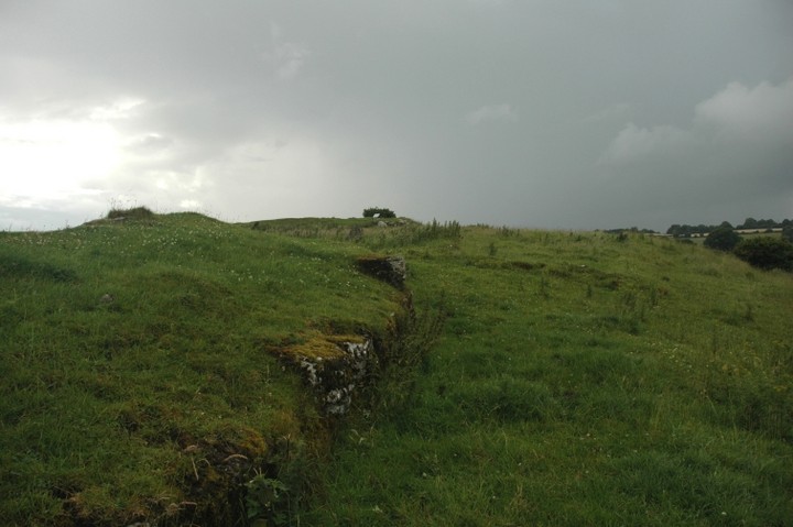
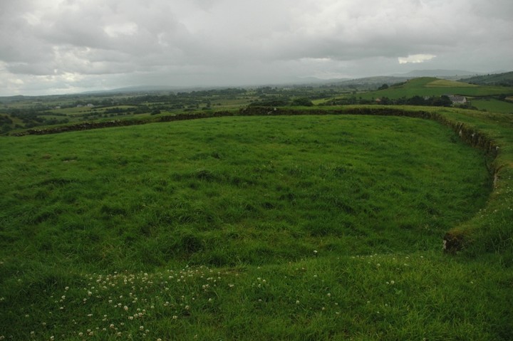
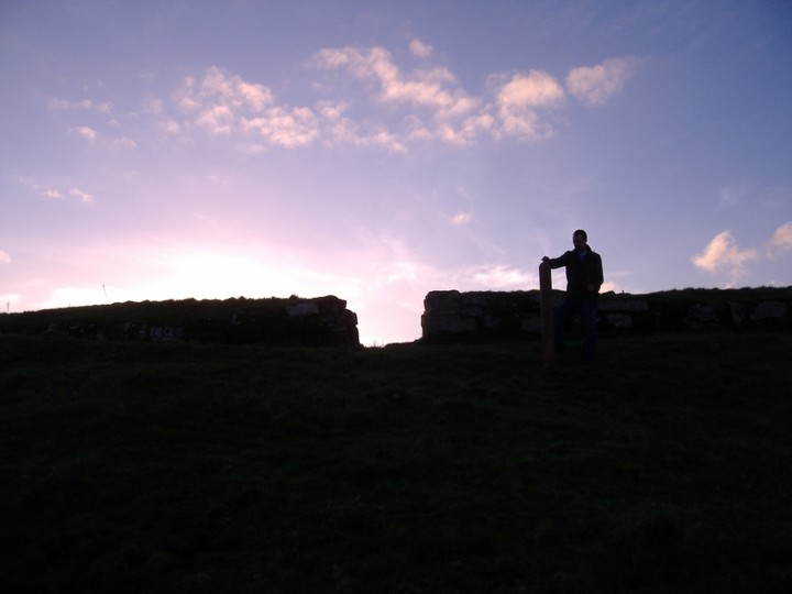
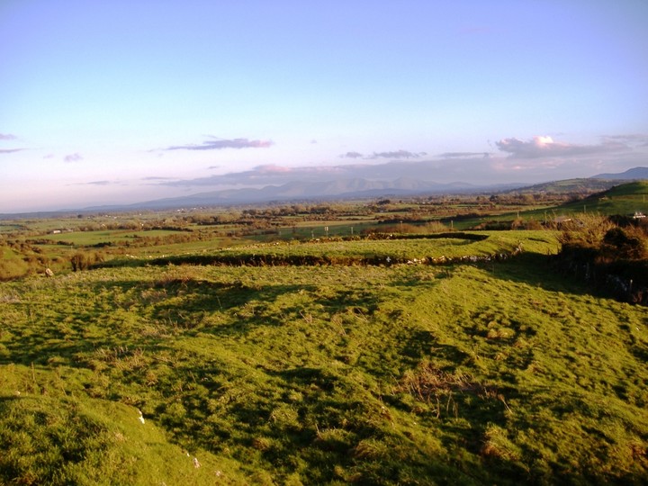
Carraig Aille
Carraig Aille
Rath
Carraig Aille (Rath) on The Modern Antiquarian, the UK & Ireland's most popular megalithic community website. 4 images, plus information on many more ancient sites nearby and across the UK & Ireland.
Image © ryaner
Nearest Town:
Bruff (5km SSW)
OS Ref (IE):
R653408 /
Sheet: 65
Latitude:
52° 31' 3.27" N
Longitude:
8° 30' 40.41" W
Added by
bawn79
Images (4)
0 discussions
Start a topic
Show |
Hide
Web searches for Carraig Aille
Flickr
Google
Google Images
The Megalithic Portal
Bing
Stone Pages
Wikipedia
Show map
(inline Google Map)
- Sites within 20 km -
-
Carraig Aille (0km N) (7 posts)
Lough Gur P (0.4km N) (1 post)
Lough Gur O (0.44km N) (8 posts)
Loughgur (0.45km SE) (0 posts)
Knockadoon (0.8km WSW) (1 post)
Entrance to Tir Na Og (0.89km W) (3 posts)
Knockadoon Circles A + B (0.92km WSW) (1 post)
Old Hags Chair (1km WSW) (2 posts)
Knockadoon Circle K (1km WSW) (5 posts)
Knockfennel (1.28km WNW) (3 posts)
Lough Gur Wedge Tomb (1.31km W) (26 posts)
Grange / Lios, Lough Gur (1.31km W) (87 posts)
Lough Gur D (1.33km W) (6 posts)
Lough Gur C (1.33km W) (17 posts)
Knockfennel North (1.52km W) (4 posts)
Knockfennel (1.55km W) (2 posts)
Moohane (1.61km ENE) (4 posts)
Knockfennel (1.64km W) (4 posts)
Knockroe (1.65km ENE) (3 posts)
Black Sow’s Bed (1.72km SW) (6 posts)
The Pillar Stone (1.89km WSW) (8 posts)
The Stone Of The Tree (2.03km WSW) (6 posts)
Ballingoola A (2.1km NW) (2 posts)
Grange Lios (2.11km WSW) (9 posts)
Ballingoola B (2.23km NW) (1 post)
Ballingoola (2.37km NW) (1 post)
Ballingoola C (2.41km NW) (1 post)
Ballingoola D (2.69km NW) (0 posts)
Ballingoola E (2.87km NW) (1 post)
Grillagh (3.29km S) (0 posts)
Rockbarton (3.6km WSW) (3 posts)
Rootiagh (3.7km ENE) (3 posts)
Cloghaunainey (3.97km ESE) (1 post)
Rootiagh (4.06km ENE) (1 post)
Cnoc Aine (4.51km SE) (2 posts)
Cnoc Aine (4.71km SE) (3 posts)
Ballynamona (4.77km E) (4 posts)
Cnoc Aine (4.86km SE) (1 post)
Cnoc Aine (4.87km SE) (7 posts)
Cnoc Aine (4.91km SE) (6 posts)
Castlefarm (5.42km ESE) (4 posts)
Bruff (5.54km SSW) (3 posts)
Ballybricken West (5.7km NNW) (3 posts)
Ballybricken East (6.09km N) (2 posts)
Ballybricken East (6.29km N) (3 posts)
Ballybricken East (6.3km N) (4 posts)
Gorteennacreeagh (6.54km ESE) (2 posts)
Lodge (6.6km E) (4 posts)
Brufea (6.79km N) (3 posts)
Knockroe (6.89km N) (2 posts)
Luddenmore (6.95km NNW) (5 posts)
Luddenmore (6.95km NNW) (3 posts)
Tynacocka (6.97km SSW) (2 posts)
Knockroe (7km N) (2 posts)
Knockroe (7.01km N) (7 posts)
Stonepark (7.12km NW) (2 posts)
Rathanny (7.58km ESE) (7 posts)
Inch (7.69km N) (5 posts)
Gotoon (7.7km ESE) (2 posts)
Hospital (7.77km E) (2 posts)
Coolalough (7.85km ESE) (2 posts)
Cromwell Hill (7.9km E) (7 posts)
Inch St. Lawrence (8.01km N) (7 posts)
Coolalough (8.19km ESE) (2 posts)
Longstone (8.41km NE) (2 posts)
Rathmore South (8.47km WSW) (3 posts)
Coolalough (8.82km ESE) (5 posts)
Knockroe (8.97km E) (1 post)
Skahard (9.26km N) (3 posts)
Knocktwo (9.45km SW) (3 posts)
Highpark (9.65km N) (3 posts)
Highpark (9.66km NNW) (4 posts)
Highpark (9.75km N) (1 post)
Highpark (9.81km N) (2 posts)
Bulgadenhall (9.82km S) (1 post)
Bawnacouma (10.37km WNW) (1 post)
Knockeen (10.42km NNE) (1 post)
Elton (10.42km SE) (6 posts)
Cnoc Greine (10.57km ENE) (3 posts)
Ballinscaula (10.61km SSE) (2 posts)
Ballinscaula (10.61km SSE) (6 posts)
Friarstown (10.63km WNW) (6 posts)
Ballinvana (10.71km SE) (2 posts)
Ballinculloo (10.75km SW) (4 posts)
Knocsefin (10.8km ENE) (3 posts)
Knocksefin (12.05km ENE) (1 post)
Tory Hill (12.12km W) (2 posts)
Cloonyconry More (12.12km E) (4 posts)
Liseen (12.44km ENE) (3 posts)
Sarsfields Rock (12.75km E) (3 posts)
Clogher Hill (13.13km ESE) (2 posts)
Tuogh (14.39km NE) (0 posts)
Longstone (14.43km E) (3 posts)
Longstone (14.43km E) (8 posts)
Longstone (14.43km E) (1 post)
Glenbane (14.63km E) (1 post)
Carrignacaubeen (15.31km SE) (2 posts)
Knocksouna (15.5km SW) (1 post)
Cush (15.73km SE) (5 posts)
Cush (16.01km SE) (1 post)
Lissard (16.58km ESE) (10 posts)
Lissard (16.86km ESE) (3 posts)
Ballyfroota (16.87km ESE) (3 posts)
Lattin (16.9km E) (3 posts)
Ballyriggin (16.94km SE) (2 posts)
Cloghast (17.13km SE) (5 posts)
Kilfinnane (17.14km SSE) (4 posts)
Lattin (17.24km E) (3 posts)
Doonglara (Glenbrohane) (17.27km NNE) (1 post)
Ballyriggin (17.29km SE) (3 posts)
Ballingarry (17.46km SE) (1 post)
Duntryleague Cairn (17.63km ESE) (1 post)
Duntryleague (17.63km ESE) (32 posts)
Ballingarry (17.74km ESE) (3 posts)
Ballyconry (18.02km E) (6 posts)
Ballyconry (18.09km E) (2 posts)
Ballygeagoge (18.15km SSE) (1 post)
Kilfinnane (18.21km SSE) (2 posts)
Carraigapuckaun (18.31km SE) (2 posts)
Ballygeagoge (18.5km SSE) (0 posts)
Adare Manor (18.64km W) (8 posts)
Ladys Well (18.8km SSE) (3 posts)
Ballygeagoge (18.91km SSE) (1 post)
Mortlestown Hill (19.01km SSE) (5 posts)
Garranbane (19.05km NNE) (5 posts)
Ballinlyna Lower (19.39km SSE) (1 post)
- Add -
-
Add news
Add an image
Add fieldnotes
Add folklore
Add miscellaneous
Add a link
-
Add a site
Add a nearby facility
Add an alternative name/spelling
Images
(click to view fullsize)
Add an image
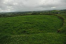 Image © ryaner