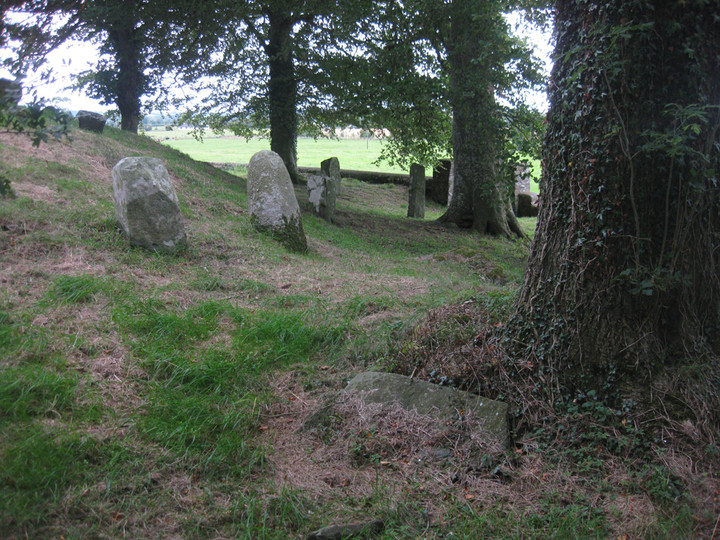
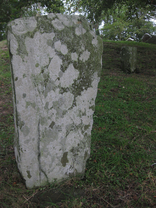
It has been suggested that Killeen Cormac was in the pre-Christian period used as a place of pagan sepulchre. Its very peculiar construction and the indications of a sepulchral chamber within the moat, with passages to the terraces such are to be found in similar structures at New Grange on the Boyne, and in other localities, give an air of certainty to the suggestion, which is well sustained by the appearance of a stone on the south side of the mound about three feet high, fixed in the wall of the middle terrace.
It seems to be one of the jambs of a door to the entrance leading from the central cave. The side of this stone is grooved, the opposite jamb was likely hollowed in the same manner to receive a thinner flag to close the exterior entrance.
Killeen Cormac has the reputation of being full of rats, as well as of being the oldest cemetery in the whole country. These animals are up to this time the only explorers of the subterranean galleries under the mound, since they were closed up to preserve the remains of some pagan hero of the earliest dawn of history.
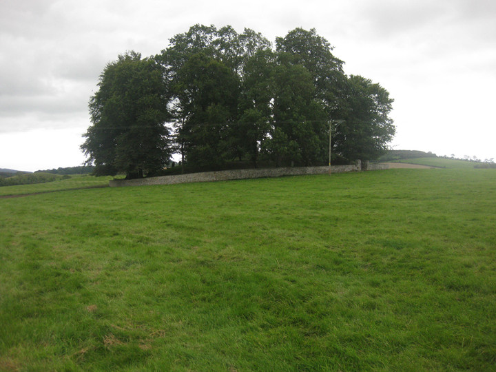
The most recent fact connected with this cemetery is, that about the year 1830 a stone wall was built around its area, some trees were then planted which add a phase of beauty peculiarly their own, while their shadows give a dim religious light in harmony with the venerable relics of antiquity of which they are the guardians.
Within the enclosure, and on the sides of the ruined terraces, are some inscribed pillar stones, with Latin and Ogham inscriptions, and some very curious incised figures, the description of which is reserved for notice at the close of this paper.
At the side of the mound, some paces from the entrance, is one pillar stone, now about three feet above the surface, on the top of which is an indentation resembling the trace of a hound's paw, as if impressed on a soft surface. Excavations made around it did not reveal any features worth describing.
A very curious legend, founded indeed on historical facts, is told concerning this stone, with a view, perhaps, to account for the name Cormac being affixed to the locality. The tradition of the neighbourhood says that the pillar stone marks the grave of a Cormac, king of Munster. It states that he was carried to this cemetery for sepulture by a team of bullocks, which were allowed to follow their own instincts, a mode of settling disputes regarding sepulture not uncommon among the ancient Irish. [This tradition...] avers that he was carried from a long distance through Ballynure from Timolin, in the county of Kildare, and when the team reached that part of Ballymore now known as "the Doon" the exhausted bullocks, in the eagerness of their thirst, pawed the earth, and that a stream of water issued forth. Another version states that the teamster stuck his goad into the ground, whereupon gushed up a bubbling fountain, which is still to be found near the roadside, and is used as a watering-place for the kine pasturing on the fertile heights at the Doon of Ballynure.
The bullocks having satisfied their thirst, journeyed on till they came to the elevation now called Bullock Hill, beside the Griese, opposite to Killeen Cormac. Here they halted, and refused to proceed farther, from which it appeared that Killeen was to be the last resting place of the king. The bullocks having done their part, returned homewards across the marsh, and were engulphed in the waters of the Griese.
[...] Another version of this legend, but more confused, places a hound on the team, which, when it stopped at Bullock Hill, jumped over to the cemetery, and left the impression of its paw on the pillar stone, thus marking the grave of Cormac; while another story represents this hound as jumping from the summit of Knockadhow, still more remote from the cemetery.

 Posted by Rhiannon