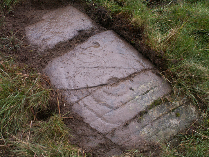
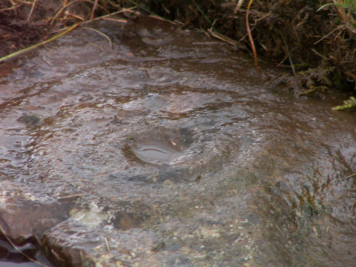
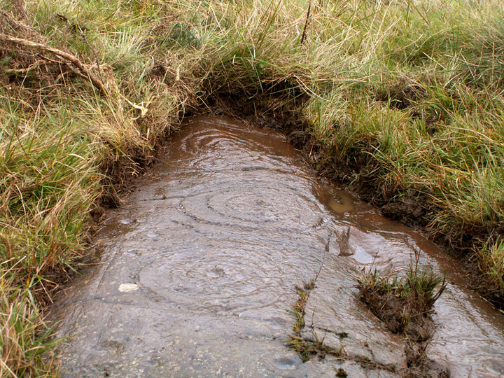
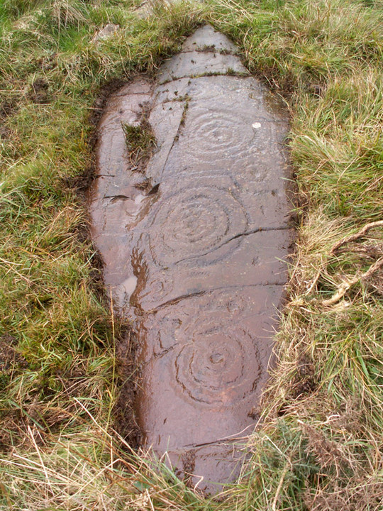
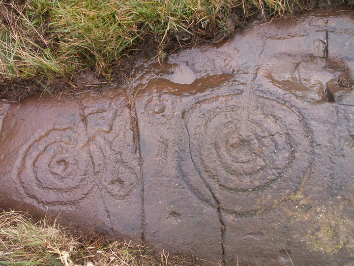
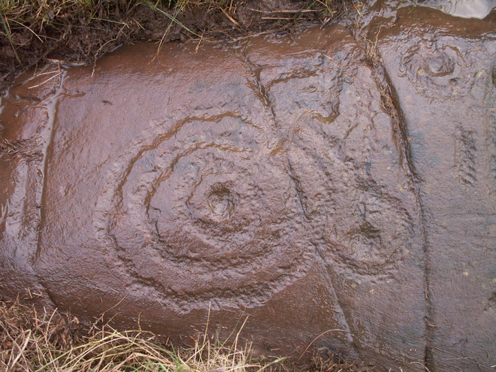
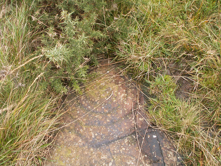
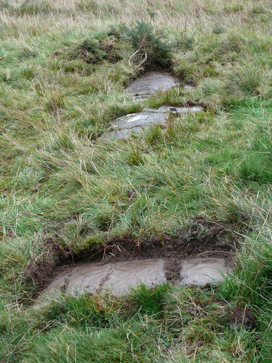
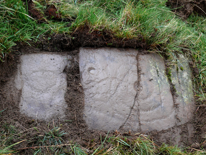
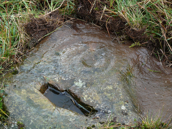
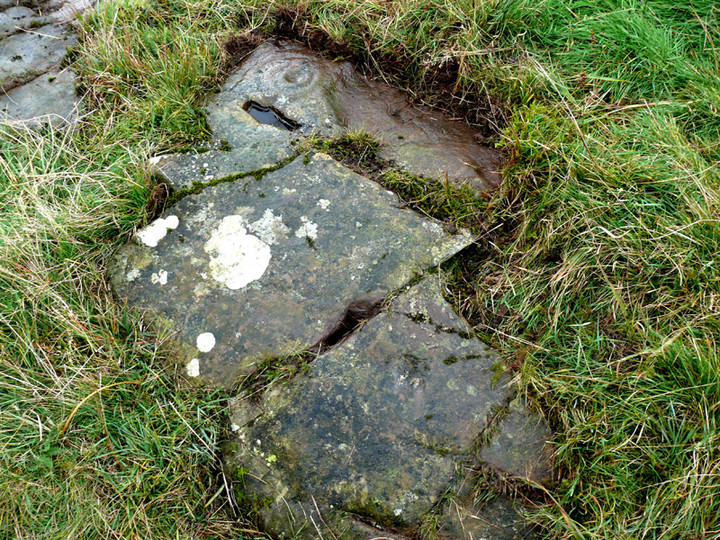
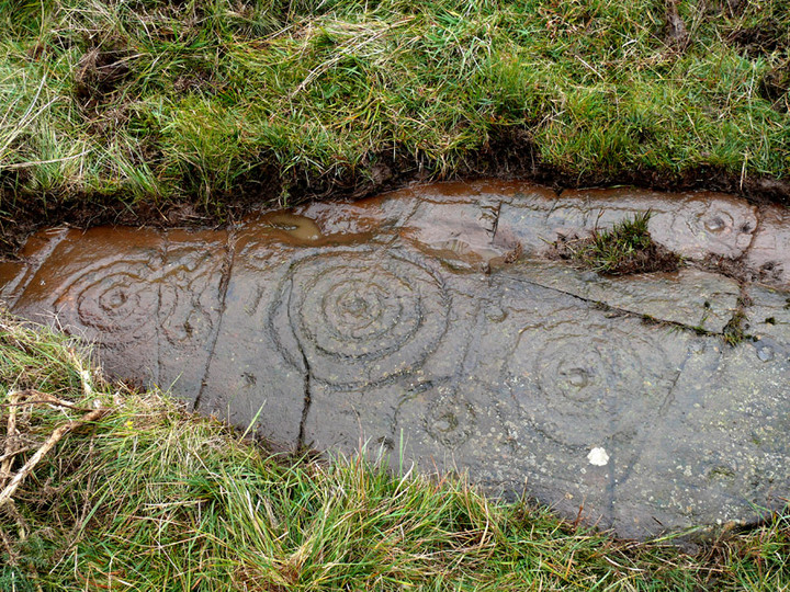
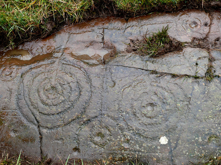
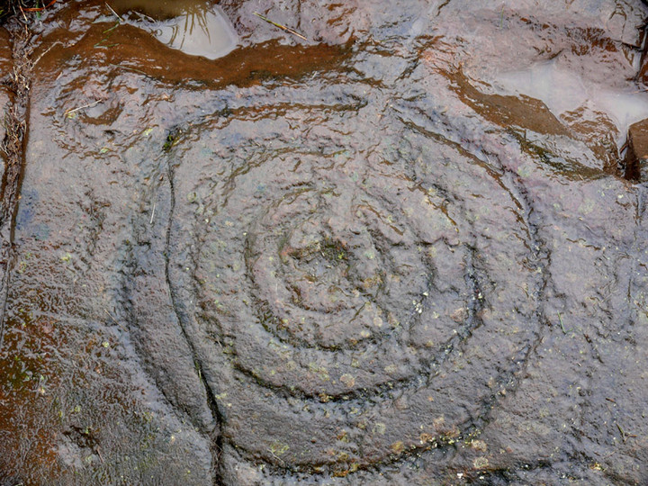
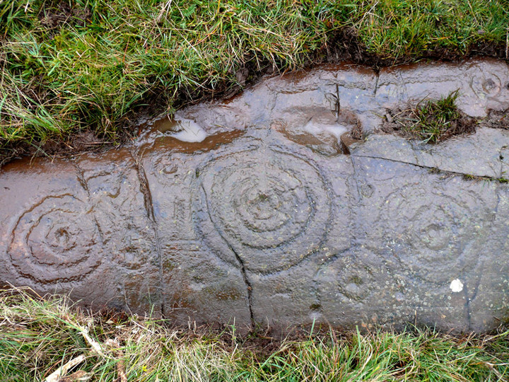
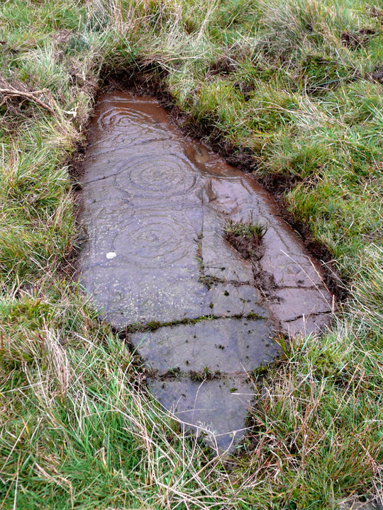
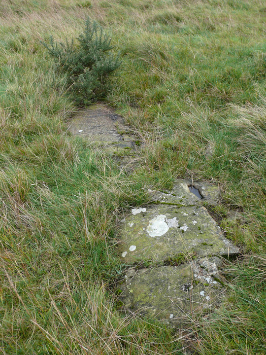
Log in
|
Register
Home
Latest Posts
Forums
Maps
Help
Browse Sites
News
Blog
Contributors
The Books
Select
-
Belgium
Denmark
Eire
France
Greece
Italy
The Netherlands
Norway
Portugal
Republic of Malta
Spain
Sweden
Switzerland
United Kingdom
Scotland
Dumfries and Galloway
Newlaw Hill 3
Cup and Ring Marks / Rock Art
Newlaw Hill 3 (Cup and Ring Marks / Rock Art) on The Modern Antiquarian, the UK & Ireland's most popular megalithic community website. 17 images, 1 weblink, plus information on many more ancient sites nearby and across the UK & Ireland.
Image © pebblewolf
Nearest Town:
Kirkcudbright (6km W)
OS Ref (GB):
NX734489 /
Sheets: 83, 84
Latitude:
54° 49' 7.41" N
Longitude:
3° 58' 13.97" W
Added by
rockartwolf
Images (17)
Links (1)
0 discussions
Start a topic
Show |
Hide
Web searches for Newlaw Hill 3
Flash Earth
Flickr
Google
Google Images
MAGIC
The Megalithic Portal
Multimap 1:25000
Stone Pages
Streetmap.co.uk
Wikipedia
Show map
(inline Google Map)
- Sites within 20 km -
-
Newlaw Hill 1 (0.1km WSW) (15 posts)
Newlaw Hill 2 (0.1km WSW) (3 posts)
Castlecreavie Dun (0.8km W) (5 posts)
Castlecreavie (0.8km W) (15 posts)
Castlecreavie (1.04km W) (1 post)
Bombie 4 (1.13km WNW) (3 posts)
Bombie (1.2km WNW) (2 posts)
Bombie 3 (1.27km WNW) (9 posts)
Bombie 5 (1.42km WNW) (0 posts)
Bombie 1 (1.48km WNW) (5 posts)
Bombie 2 (1.55km WNW) (18 posts)
Galtway 5 (2.19km WSW) (6 posts)
Galtway 7 (2.41km WSW) (2 posts)
High Banks (2.49km WSW) (39 posts)
Galtway (2.7km WSW) (2 posts)
Galtway 18 (2.76km WSW) (6 posts)
Milton (3.54km WSW) (88 posts)
High Grange 1 (3.66km WSW) (13 posts)
High Grange 2 (3.8km WSW) (0 posts)
Townhead (4.1km WSW) (45 posts)
Culdoach (4.43km WNW) (21 posts)
Blackhill Cottage (4.69km WSW) (4 posts)
Dunrod (4.75km SW) (2 posts)
Grange 3 (4.79km WSW) (11 posts)
Grange 1 (4.92km WSW) (3 posts)
Grange 2 (5.08km WSW) (3 posts)
Drummore (5.48km WSW) (3 posts)
Drummore Castle (5.6km SW) (0 posts)
Nether Linkens (5.94km NNE) (9 posts)
Knockshinnie (6.03km SW) (10 posts)
Torrs 1 & 2 (6.07km WSW) (12 posts)
Knockshinnie 2 (6.28km SW) (8 posts)
Torrs 7 (6.39km SW) (2 posts)
Torrs 4 (6.44km SW) (7 posts)
Torrs 3b (6.53km SW) (1 post)
Torrs (6.56km SW) (7 posts)
Balmae 35 (6.57km SW) (2 posts)
Torrs 3 (6.61km WSW) (11 posts)
Torrs 10 (6.89km SW) (2 posts)
Park of Tongland (7.9km NW) (7 posts)
Big Airds Hill (8.04km E) (0 posts)
Park of Tongland (8.4km NW) (1 post)
Little Airds Hill (8.64km ENE) (0 posts)
Senwick 1 (8.94km WSW) (5 posts)
Clauchendolly (9.22km WSW) (53 posts)
Clash (9.27km WSW) (10 posts)
Senwick 4 (9.52km WSW) (8 posts)
Borgue (9.78km WSW) (6 posts)
Slagnaw (9.88km N) (3 posts)
Brighouse Standing Stone (9.93km WSW) (3 posts)
Auchenhay (10.15km W) (2 posts)
Lodge Of Kelton Farm (12.12km N) (9 posts)
Tongue Croft (13.06km WSW) (18 posts)
Glengap House (13.13km WNW) (1 post)
Fir Island and Ash Island (13.25km N) (1 post)
Torrs Hill (13.3km NNE) (1 post)
Castle Haven (14.02km WSW) (5 posts)
Ernespie Standing Stones (14.85km NNE) (8 posts)
Newbarns South (15.92km ENE) (13 posts)
Newbarns North (15.92km ENE) (15 posts)
Colvend (15.92km ENE) (1 post)
Harper's Hill (16.02km W) (10 posts)
Trusty's Hill (16.1km W) (11 posts)
Rutherford's Witnesses (17.47km W) (1 post)
Lagganmullan 9 (17.9km W) (6 posts)
Lagganmullan 10 (17.9km W) (3 posts)
Lagganmullan 8 (17.9km W) (5 posts)
Lagganmullan 1 (17.97km W) (0 posts)
Lagganmullan House (18.01km W) (2 posts)
Lagganmullan 2 (18.16km W) (6 posts)
Newton Farm (18.34km W) (1 post)
Lagganmullan 4 (18.35km W) (7 posts)
Lagganmullan 7d (18.37km W) (5 posts)
Lagganmullan 7c (18.37km W) (2 posts)
Lagganmullan 7b (18.37km W) (3 posts)
Lagganmullan 7a (18.37km W) (5 posts)
Lagganmullan 6 (18.37km W) (0 posts)
Lagganmullan 7 (18.37km W) (2 posts)
Lagganmullan 3 (18.38km W) (4 posts)
Lagganmullan 5 (18.5km W) (2 posts)
Newton Farm (18.54km W) (3 posts)
Newton Farm Burial Chamber (18.58km W) (8 posts)
Redcastle (18.67km NNE) (0 posts)
Upper Newton 3 (18.88km W) (4 posts)
Upper Newton 2 (18.92km W) (5 posts)
Mossyard (18.99km W) (17 posts)
Laggan Farm (19.17km W) (3 posts)
Whiteside (19.25km W) (3 posts)
Upper Newton 1 (19.38km W) (3 posts)
Upper Newton 4 (19.48km W) (0 posts)
Kirkclaugh (19.93km W) (2 posts)
- Facilities within 20 km -
-
Newton Farm (Camping Site: 18.4 km W)
- Add -
-
Add news
Add an image
Add fieldnotes
Add folklore
Add miscellaneous
Add a link
-
Add a site
Add a nearby facility
Add an alternative name/spelling
Images
(click to view fullsize)
Add an image
Links
Add a link
Newlaw Hill on BRAC
Comments (0)
|
Add a comment
|
Permalink
Posted by
rockartuk
14th October 2009ce