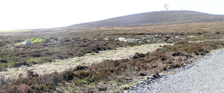
Climbed all the way to the top of Wideford Hill and followed a path down in the direction of the reservoir. Path became a narrow dried up burn then living burn criss-crossing 'path'. Rather spongy, in places very springy. Then coming near the bright wall above Yairsay which is the east side of the sharp triangle of the field-top above the old tunship I spotted a likely looking cairn shape amidst the heather. A little further yomping showed it to be earth with a few middling stones showing. When I turned back the way I saw several more such mounds the other side of the burn/track and then took in a few more about me. Despite my previous misgivings this has to be the circle of cairns amongst whom Petrie dug, too much for a coincidence. Snapped two in one shot. Naturally the camera then gave up.
Despite being practically drystane the bright wall is surely fairly modern. Walking alongside it there are two 'ruts' in parallel, a path and a shallow burn. Then I noticed a broad deep trench the other side of me. I figured it for an exposed 'drain' to feed the reservoir. Next, though, on its far side there was a whole rue of large white stones as if something had been excavated there (I briefly thought of a 'standing stone fence', but way too many for that). In the bottom of the trench I then saw a few
prostrate 'standing stones' dull in colour. Is this more of Petrie's doing, a linear spoil heap, or something arising from the construction of the reservoir - perhaps a little of both ? Man, nature, mix ? Approaching the water board's boundary fence the trench cornered away. I did not follow it further - if it were heading for the reservoir it was going a funny way about it.
Siting the cairns here means they overlook settlement this way (Pickaquoy, Grainshore ?) in like manner to Quanterness and old man Wideford Hill, a lack that has been a puzzle before now.
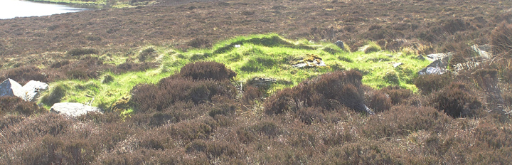
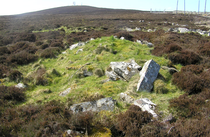
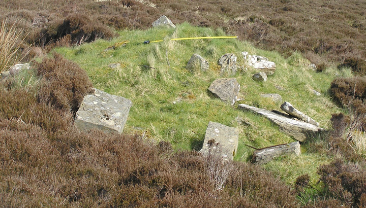
The 'trench' at about HY423121 has now been filled in as a result of works outwith the reservoir fence. So, no images of the trench. On the other hand the operations rendered more obvious the grass-covered mound, some of whose stone blocks appear squared off. Taken by itself it might simply be a clearance cairn, perhaps in connection with the possible gairsty dyke, but there are further arrays of big stones ahead that appear only as scatter. The visible portion of this cairn measures 8.5m by 4.8m by 0.9m, with the long axis going uphill, in the direction of the Wideford Hill tomb over the other side of the hill.
The wooded area below is Yairsay 'mound by the hill/dyke'. Marwick believed this to refer to a prehistoric gairsty. This would most likely be the area covered by the white wall and trench, and such boundary features often featured mounds at or by turning points. Whether this refers to these Wideford mounds or one now (presumably) lost we do not know.
RCAHMS NMRS record no. HY41SW 21.
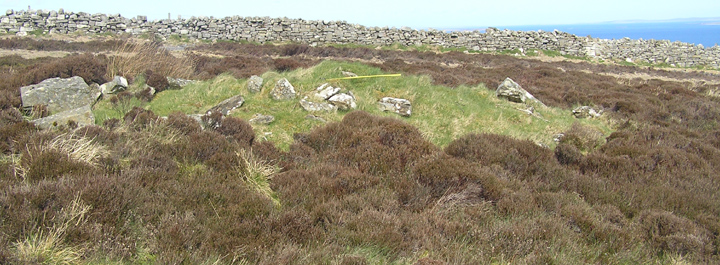
From Petrie's notes we find that of the circular group of ten mounds three of these were large (no size given). The smaller ones were 10-12' across and three feet high at most, and he chose to excavate three of these. All contained short stone cists.
The first contained burnt bone and ashes. By comparison to the first the second, the one that produced a stone pestle or corn crusher, was not so carefully formed. The last was of a similar size to the second but badly constructed of large lumps of stone jammed together. Both the latter contained burnt bones.