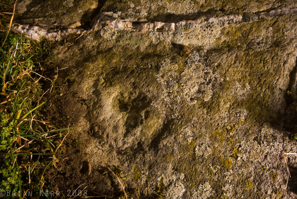
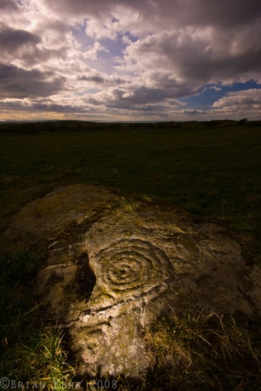
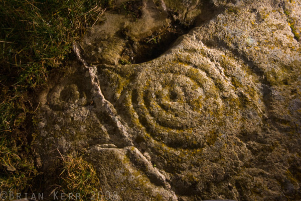
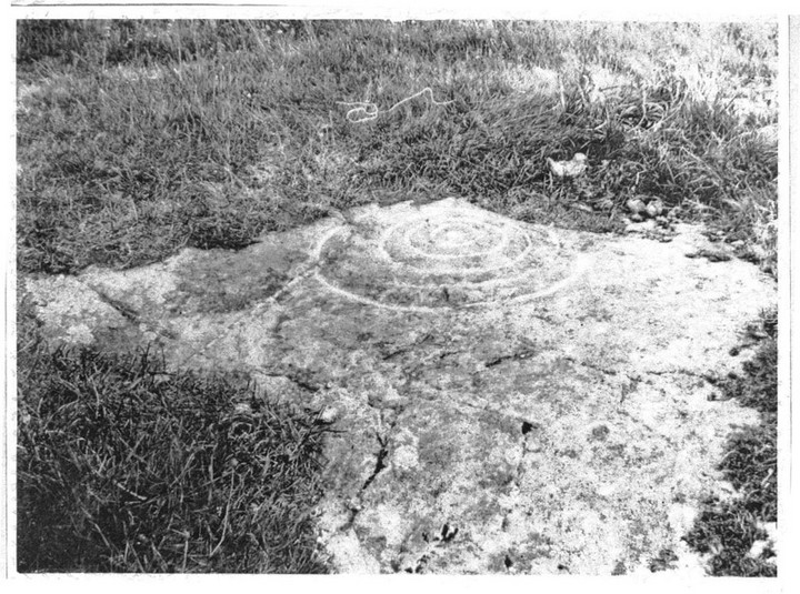
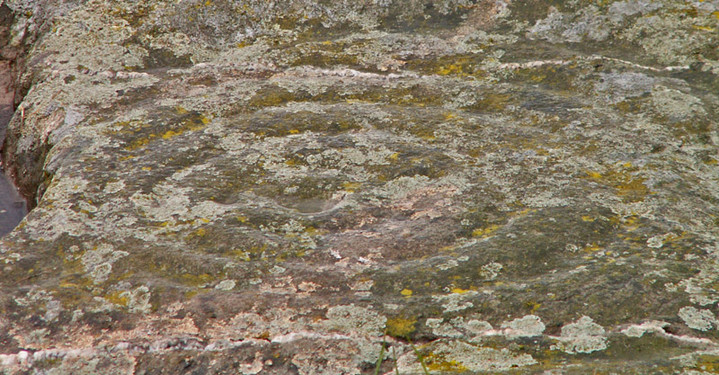
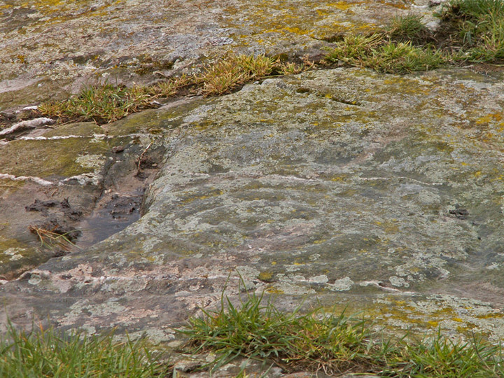
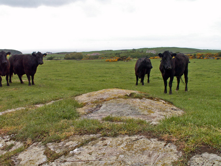
Log in
|
Register
Home
Latest Posts
Forums
Maps
Help
Browse Sites
News
Blog
Contributors
The Books
Select
-
Belgium
Denmark
Eire
France
Greece
Italy
The Netherlands
Norway
Portugal
Republic of Malta
Spain
Sweden
Switzerland
United Kingdom
Scotland
Dumfries and Galloway
Blairbuy Farm
Blairbuy 1
Cup and Ring Marks / Rock Art
Blairbuy 1 (Cup and Ring Marks / Rock Art) on The Modern Antiquarian, the UK & Ireland's most popular megalithic community website. 7 images, plus information on many more ancient sites nearby and across the UK & Ireland.
Image © Brian Kerr 2008
Nearest Town:
Whithorn (7km E)
OS Ref (GB):
NX372414 /
Sheet: 83
Latitude:
54° 44' 27.37" N
Longitude:
4° 31' 45.31" W
Added by
rockartwolf
Images (7)
0 discussions
Start a topic
Show |
Hide
Web searches for Blairbuy 1
Flash Earth
Flickr
Google
Google Images
MAGIC
The Megalithic Portal
Multimap 1:25000
Stone Pages
Streetmap.co.uk
Wikipedia
Show map
(inline Google Map)
- Sites within 20 km -
-
Blairbuy - 10 (0.14km NE) (2 posts)
Blairbuy 2 (0.22km SE) (3 posts)
Blairbuy 5 (0.56km NE) (2 posts)
Blairbuy 4 (0.72km WNW) (4 posts)
Blairbuy 3 (0.95km NNE) (4 posts)
Blairbuy Farm (0.98km W) (1 post)
Blairbuy Standing Stones (1.02km W) (0 posts)
Blairbuy 6 (1.12km NW) (8 posts)
Fell of Barhullion (1.2km W) (1 post)
The Wren's Egg & Nest (1.2km W) (8 posts)
Knock (1.47km SSW) (40 posts)
Barsalloch Point (2.48km WSW) (4 posts)
Big Balcraig (2.94km N) (6 posts)
Drumtroddan Standing Stones (2.99km NW) (14 posts)
Drumtroddan Carved Rocks (3.41km NW) (32 posts)
Glasserton Mains (5.23km ESE) (18 posts)
Culgarie (6.76km N) (4 posts)
Culnoag (7.09km NE) (7 posts)
Gallows Outon 1 (7.6km ENE) (3 posts)
Gallows Outon 2 (7.79km ENE) (3 posts)
Claunch (8.72km NE) (15 posts)
Broughton Mains (9.54km ENE) (20 posts)
Little Balsmith (9.6km E) (4 posts)
House of Elrig (10.19km WNW) (0 posts)
Boyach (11.05km E) (2 posts)
North Balfern (11.4km NE) (5 posts)
North Balfern HillFort (11.57km NE) (2 posts)
Culscadden (12.15km NE) (7 posts)
Penkiln (12.64km ENE) (31 posts)
Bladnoch (13.85km NNE) (3 posts)
Hole Stone (14.29km NNW) (12 posts)
Redbrae (14.51km N) (3 posts)
Torhousekie (15.02km N) (48 posts)
Torhousekie Stone Row (15.02km N) (8 posts)
Boreland (16.79km NNW) (3 posts)
Mull of Sinniness (17.72km W) (2 posts)
Machermore (17.98km WNW) (1 post)
Doon of Carsluith (18.08km NE) (8 posts)
Knock Fell (18.49km WNW) (2 posts)
Kirkmabreck (18.52km NE) (14 posts)
Barholm 1 (18.55km NE) (1 post)
Kirkdale House (18.55km NE) (2 posts)
Kirkdale Mains Stone (18.65km NE) (1 post)
Kirkmuir (18.78km NE) (2 posts)
Barholm 2 (18.83km NE) (1 post)
Kirkmuir 1a & 1b (18.93km NE) (1 post)
Kirkmuir 2 (18.93km NE) (1 post)
Kirkmuir 4 (18.99km NE) (1 post)
Kirkmuir 3 (19km NE) (1 post)
Whitefield Loch (19.11km WNW) (1 post)
Cairnholy (19.17km NE) (77 posts)
Cairnholy 01 & 02 (19.17km NE) (7 posts)
Kirkclaugh (19.28km NE) (1 post)
Bagbie Stone (19.39km NE) (8 posts)
Cairnholy 09 (19.41km NE) (4 posts)
Cairnholy 04 (19.48km NE) (1 post)
Bagbie Four Poster (19.54km NE) (7 posts)
Bagbie Cairn (19.54km NE) (7 posts)
Bardristane 1 (19.55km NE) (5 posts)
Cairnholy 08 (19.55km NE) (1 post)
Cairnholy 03 (19.58km NE) (0 posts)
Cairnholy 05 (19.62km NE) (1 post)
Cairnholy 07 (19.68km NE) (0 posts)
Bardristane 4 (19.76km NE) (6 posts)
Kirkclaugh (19.77km NE) (2 posts)
Bardristane 3 (19.84km NE) (3 posts)
Barholm 3 (19.9km NE) (2 posts)
Mossyard (19.92km ENE) (17 posts)
Blackmyre Farm (19.94km NE) (2 posts)
Cairnholy 06 (19.97km NE) (1 post)
- Facilities within 20 km -
-
Cairnholy Old Farmhouse (Bed & Breakfast: 19.3 km NE)
- Add -
-
Add news
Add an image
Add fieldnotes
Add folklore
Add miscellaneous
Add a link
-
Add a site
Add a nearby facility
Add an alternative name/spelling
Images
(click to view fullsize)
Add an image