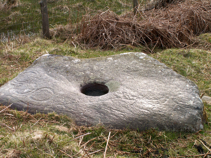
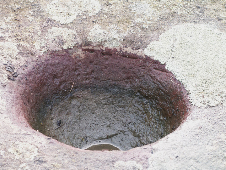
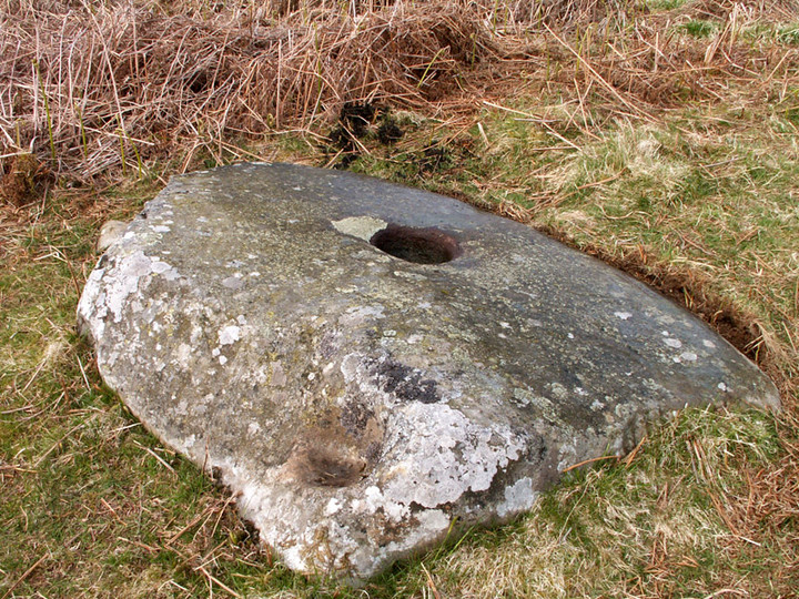
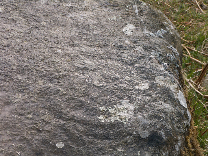
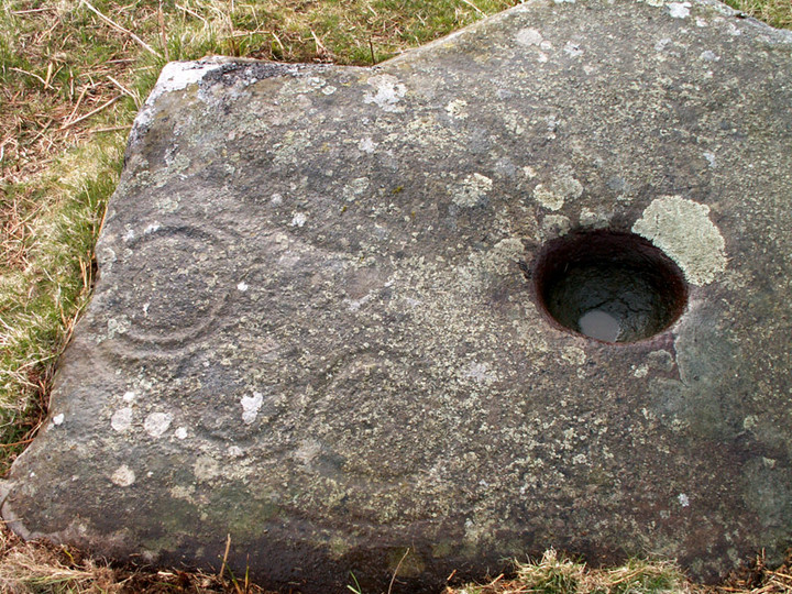
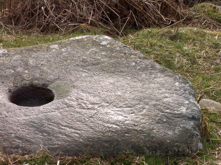
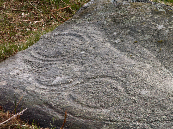
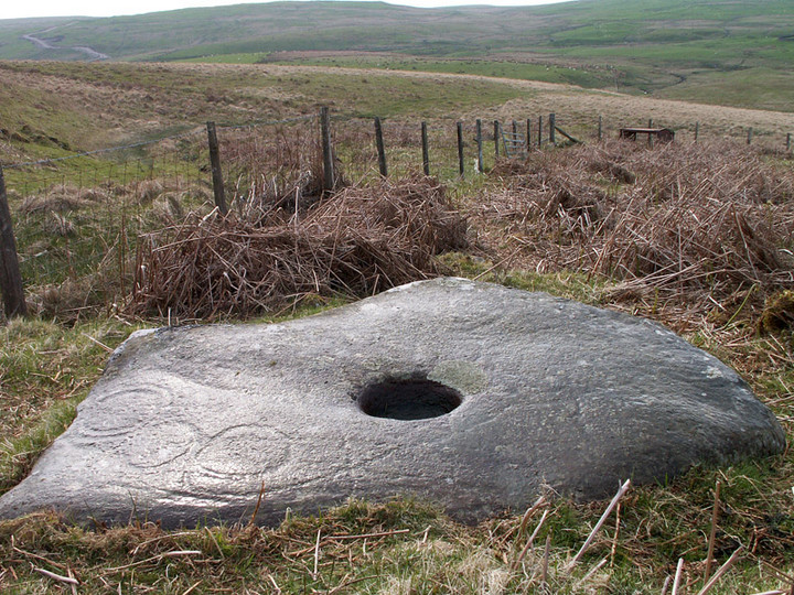
The Modern Antiquarian
Log in
|
Register
Home
Latest Posts
Forums
Maps
Help
Browse Sites
News
Blog
Contributors
The Books
Select
-
Belgium
Denmark
Eire
France
Germany
Greece
Italy
The Netherlands
Norway
Portugal
Republic of Malta
Spain
Sweden
Switzerland
United Kingdom
Scotland
Dumfries and Galloway
Milnmark Hill
Cup and Ring Marks / Rock Art
Milnmark Hill (Duchrae) (Cup and Ring Marks / Rock Art) on The Modern Antiquarian, the UK & Ireland's most popular megalithic community website. 8 images, 1 weblink, plus information on many more ancient sites nearby and across the UK & Ireland.
Image © pebblewolf
Also known as:
Duchrae
Nearest Town:
New Galloway (7km SSW)
OS Ref (GB):
NX661837 /
Sheet: 77
Latitude:
55° 7' 45.73" N
Longitude:
4° 6' 1.24" W
Added by
rockartwolf
Images (8)
Links (1)
1 discussion topic
Start a topic
Show |
Hide
Web searches for Milnmark Hill
Flickr
Google
Google Images
MAGIC
The Megalithic Portal
Bing
Stone Pages
Streetmap.co.uk
Wikipedia
Show map
(inline Google Map)
- Sites within 20 km -
-
Corriedoo White Cairn (2.03km E) (6 posts)
Dalarran Holm (5km SSW) (5 posts)
Mackilston S (5.15km W) (8 posts)
Mackilston N (5.17km W) (6 posts)
Waterside Hill (5.61km WSW) (1 post)
Lochrennie Hole Stone (7.21km ENE) (5 posts)
Stroanfreggan (7.97km NW) (26 posts)
Smittons Bridge (8.6km NW) (9 posts)
Stroanfreggan Craig (8.69km NW) (15 posts)
Stellhead S (9.14km NNW) (12 posts)
Stellhead N (9.26km NNW) (9 posts)
Round Craigs (9.97km NNW) (10 posts)
The Cow Cloot Stone (10.36km SSE) (1 post)
Braidenoch Cross Slabs (11.45km WNW) (7 posts)
Bardennoch (11.88km WNW) (7 posts)
Bruce's Stone (Clatteringshaws) (12.86km WSW) (5 posts)
Clatteringshaws (13.02km WSW) (2 posts)
Cairn Avel (13.37km WNW) (5 posts)
Holm of Daltallochan (14.95km WNW) (10 posts)
Holm of Daltallochan (14.95km WNW) (4 posts)
White Cairn, Clatteringshaws (16.02km SW) (4 posts)
White Cairn, West Skelston (16.29km ENE) (5 posts)
Carlins Cairn (17km W) (1 post)
Glenesslin Schoolhouse (17.33km ENE) (5 posts)
Tynron Doon (18.82km ENE) (13 posts)
Fleuchlarg (19.56km ENE) (15 posts)
Capenoch Loch (19.75km ENE) (13 posts)
Grennan Hill (19.86km NE) (5 posts)
Lamford Hill (19.87km WNW) (16 posts)
- Add -
-
Add news
Add an image
Add fieldnotes
Add folklore
Add miscellaneous
Add a link
-
Add a site
Add a nearby facility
Add an alternative name/spelling
Images
(click to view fullsize)
Add an image
Links
Add a link
Milnmark Hill / Duchrae on BRAC
For more information on Milnmark Hill please contact me
[email protected]
Comments (0)
|
Add a comment
|
Permalink
Posted by
rockartwolf
13th May 2006ce
Edited 24th August 2007ce