This site is of disputed antiquity. If you have any information that could help clarify this site's authenticity, please post below or leave a post in the forum.
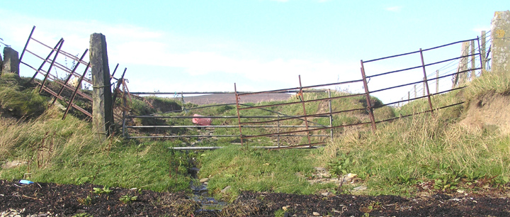
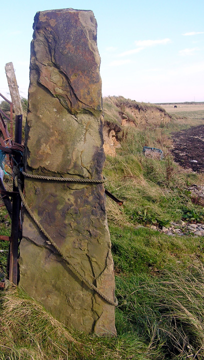
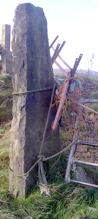
Harproo is a stream-name, and at the time of my visit a shallow stream proceeded over the present farmtrack down to the beach from the Bu road. This was an old hill dyke similar in dimensions to that close by Kongarsknowe, being just over a metre deep and approximately 6m across where it meets the shore. Actually I took the Breck footpath from the kirkyard then rushed across the shallowest bit of the Bu burn. On the cliff-top either side the drystone wall is terminated in lichen-covered stones on the order of a metre high. Fairly standard. But sitting on the base of the 'trench' is a stone of a very different character (HY33190413). It is a head higher than any other stones in Orphir. It differs from the other stones in being completely devoid of lichen and having the colouration typical of stones that have been in the vicinity of a farmyard all the time. I am firmly of the opinion that this is HY30SW 11, the Bu of Orphir standing stone, transplanted. With the other stones it has several 'loose' modern gates roped across. This stone is 1.9m high and 0.2m thick, is 0.6m across the base (which appears to be stone-packed) tapering to 0.3m at the top.
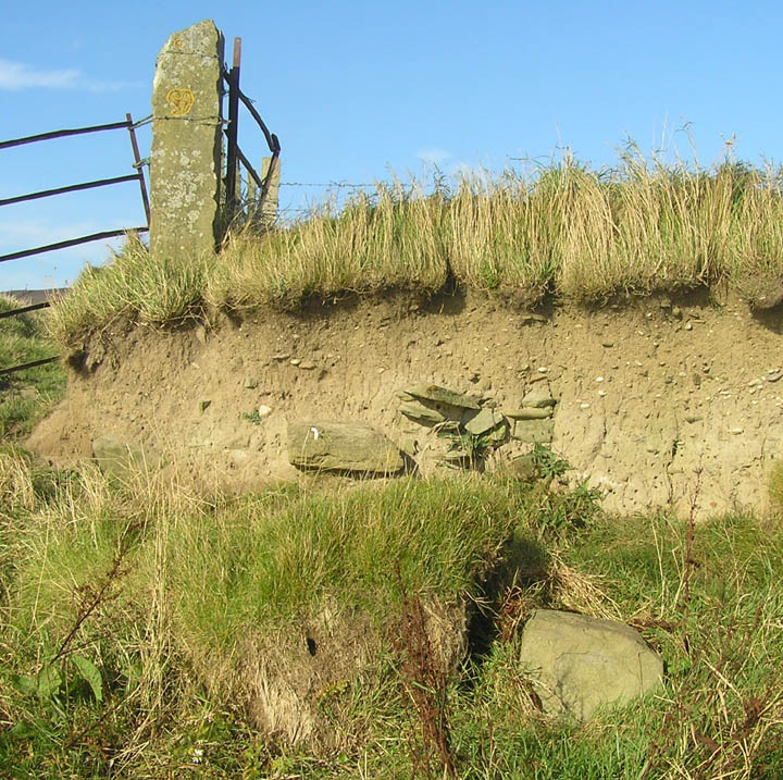
The site of HY30SW 16 is in the area shown by by Johnston on the two maps between p.12-3 & 14-15 of his private printing, to both of which he has added the name Harproo in the relevant position - it is depicted as a square structure/foundations on the second of these. Though I was ignorant of it at the time my photos reveal I may have Yarproo (HY332042), in the cliff close to the E terminal stone, as several stones about half a metre below the cliff-top in an area about a metre across and ?under half deep.
It is simpler to come down the farmtrack. At the road end is a similar arrangement of two stones aligned plus a third slightly away. As all these are similar it is my guess that the farm stone could have been a replacement for one swept out to sea. My impression is that the W margin of the track is more like the original bank would have been, but I have not yet walked the track.
Johnston reports that this shore site has turned up large stones and bones, and was believed the site of of a chapel and graveyard. Odd to have one so close to the Round Church (diagonally opposite) and those that followed on from it. The name Harproo 'stream of the heap' reminds me that another proposed chapel site, below Gyre over from the Hillock of Breckna broch, is named the Cairns of Piggar.
The Bu of Orphir standing stone HY30SW 11 was on the farm near to the church, and in 1863 a freestone ball and a stone celt (axe) were found at it. It is presently unlocated.
By the field border of the Bu boundary in the 1980's were found N/S aligned rectangular foundations HY30SW 16, with cross-wall, near the shoreline. This is being eroded where it meets high tide.