The Modern Antiquarian
Log in
|
Register
Home
Latest Posts
Forums
Maps
Help
Browse Sites
News
Blog
Contributors
The Books
Select
-
Belgium
Denmark
Eire
France
Germany
Greece
Italy
The Netherlands
Norway
Portugal
Republic of Malta
Spain
Sweden
Switzerland
United Kingdom
County Cork
Glanbrack
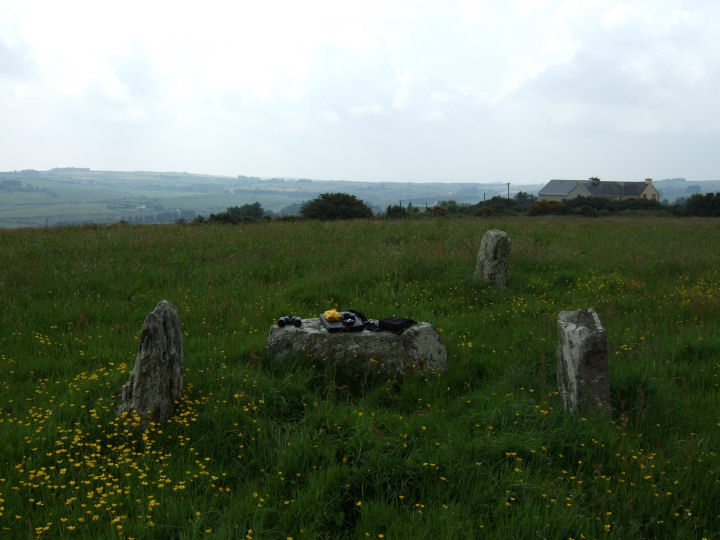
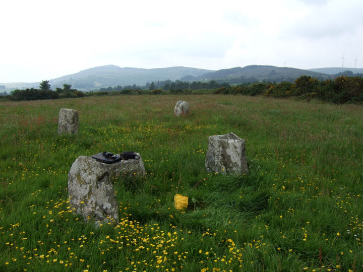
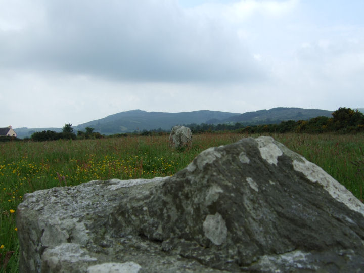
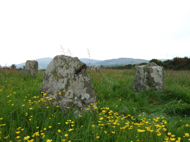
Stone Circle
Glanbrack (Stone Circle) on The Modern Antiquarian, the UK & Ireland's most popular megalithic community website. 15 images, plus information on many more ancient sites nearby and across the UK & Ireland.
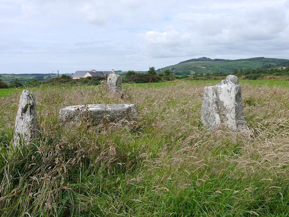
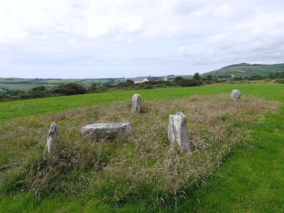
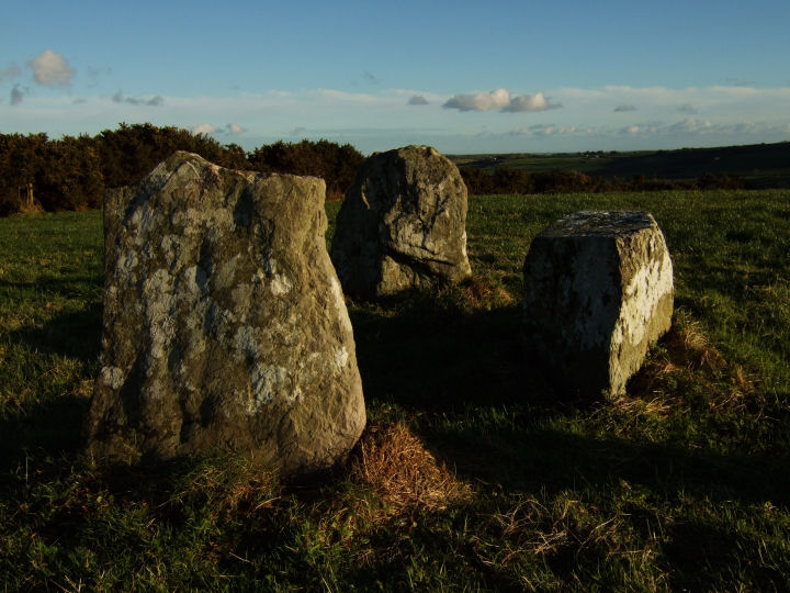
Image © Michael Mitchell
Nearest Town:
Ross Carbery (8km SSE)
OS Ref (IE):
W272445 /
Sheets: 86, 89
Latitude:
51° 38' 54.38" N
Longitude:
9° 3' 6.9" W
Added by
FourWinds
Images (15)
0 discussions
Start a topic
Show |
Hide
Web searches for Glanbrack
Flickr
Google
Google Images
The Megalithic Portal
Bing
Stone Pages
Wikipedia
Show map
(inline Google Map)
- Sites within 20 km -
-
Maulatanavally (0.91km WSW) (26 posts)
Maulatanvally (1.14km WSW) (8 posts)
Knockawaddra E (1.43km NNW) (15 posts)
Knockawaddra W (1.48km NNW) (17 posts)
Carrigagrenane NE (1.51km WSW) (7 posts)
Inchinattin (2.03km ENE) (2 posts)
Sarue (2.06km ESE) (7 posts)
Carrigagrenane SW (2.2km SW) (9 posts)
Knocks (2.79km ENE) (2 posts)
Lettergorman (North) (2.84km NNW) (25 posts)
Knocks N (2.95km ENE) (20 posts)
Milleennagun (2.96km N) (3 posts)
Milleennagun (2.97km N) (12 posts)
Knocks S (3km E) (18 posts)
Knocks (3.19km ENE) (13 posts)
Reanascreena (3.56km S) (46 posts)
Coolnaconarty (3.61km ENE) (9 posts)
Freahanes (4.71km SE) (7 posts)
Tullig Stone (4.82km SW) (3 posts)
Knockatlowig (4.9km E) (10 posts)
Garrygalss (4.93km W) (0 posts)
Garryglass (4.95km W) (3 posts)
Caherkirky (5.32km NE) (11 posts)
Ahaghilla (6.24km E) (13 posts)
Tinneel (6.68km SE) (8 posts)
Ballyroe (7.04km SW) (8 posts)
Derryduff (7.13km ESE) (4 posts)
Reavouler (7.14km WSW) (14 posts)
Killinga (7.39km WSW) (6 posts)
Ballyvackey (7.42km E) (30 posts)
Ballyhalwick (7.85km NW) (3 posts)
Nedinagh West (7.93km NNW) (3 posts)
Letter (site E) (8.03km ENE) (11 posts)
Cashelisky (8.08km E) (9 posts)
Gurteenaduige (8.4km SW) (8 posts)
Burgatia (8.41km SE) (5 posts)
Bohonagh (8.49km SE) (45 posts)
Curraheen (8.69km SSE) (3 posts)
Rosscarbery (8.7km SE) (4 posts)
Ahaglaslin (8.9km SE) (3 posts)
Lettergorman (South) (8.93km S) (39 posts)
Knocks (East) (9.28km ENE) (7 posts)
Dunmanway North (9.51km NW) (5 posts)
Killacoosane (9.61km SSW) (6 posts)
Drombeg (9.62km S) (70 posts)
Coorleigh South (10.32km ESE) (9 posts)
Derrynasafagh (10.68km NW) (3 posts)
Toom (10.86km N) (4 posts)
Templebryan (11.47km E) (0 posts)
Templebryan (11.68km E) (23 posts)
Kinneigh (11.78km NNE) (5 posts)
Behagullane (12.18km N) (1 post)
Shronacarton (12.64km W) (6 posts)
Clodagh Row (13.02km W) (12 posts)
Clodagh (13.11km W) (19 posts)
Baurnahulla (13.39km W) (3 posts)
Carrigillihy (13.42km SSW) (6 posts)
Kinneigh (13.46km NNE) (4 posts)
Carrigillihy (13.48km SSW) (9 posts)
Cullenagh (13.78km WNW) (9 posts)
Derrynacaheragh (13.83km WNW) (2 posts)
Cullenagh (14.14km W) (11 posts)
Inchireagh (14.42km WNW) (11 posts)
Galley Head (14.64km SE) (3 posts)
Darrary (14.68km E) (4 posts)
Lisnagun (14.69km E) (7 posts)
Farnanes (15.02km WNW) (9 posts)
Garranes North (15.66km W) (6 posts)
Inchincurka (15.67km NW) (15 posts)
Gurranes (16.19km SW) (25 posts)
Moneygaff West (16.47km N) (5 posts)
Goulacullin (16.59km W) (4 posts)
Lissangle (16.67km WSW) (5 posts)
Laravoolta 1 (16.76km NE) (2 posts)
Knockdrum (16.76km SW) (12 posts)
Laravoolta 2 (16.78km NE) (3 posts)
Coolnagarrane (16.91km WSW) (2 posts)
Killaneer (17.14km NE) (3 posts)
Farrannahineeny (17.18km NW) (16 posts)
Lackanashinagh (17.32km NNE) (0 posts)
Knockanereagh (17.89km N) (8 posts)
Coolmountain (18.12km NW) (7 posts)
Bawnishall (18.43km WSW) (3 posts)
Reanacaheragh (18.75km N) (0 posts)
Ahidelake (18.93km ESE) (3 posts)
Cousane (19.05km WNW) (4 posts)
Barryshall (19.1km E) (7 posts)
Abbeystrowry (19.15km WSW) (5 posts)
Knockaunnagorp (19.23km N) (0 posts)
Coolaclevane (19.24km N) (3 posts)
Bengour West (19.41km NE) (6 posts)
Coolaclevane (19.44km N) (3 posts)
Toughraheen (19.54km W) (1 post)
Burrane (19.54km ENE) (4 posts)
Cloghboola (19.84km WSW) (5 posts)
Garranereagh (19.87km NNE) (4 posts)
- Add -
-
Add news
Add an image
Add fieldnotes
Add folklore
Add miscellaneous
Add a link
-
Add a site
Add a nearby facility
Add an alternative name/spelling
Images
(click to view fullsize)
Add an image
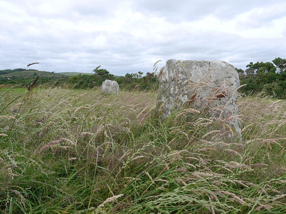
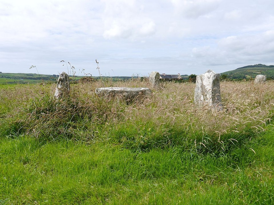
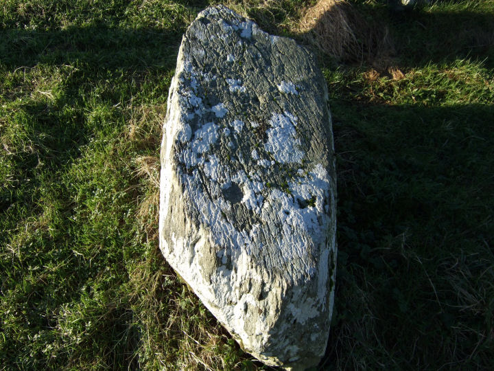
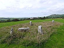 Image © Michael Mitchell
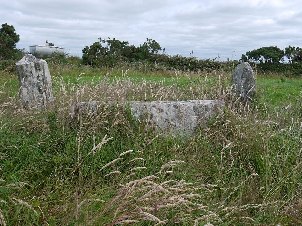
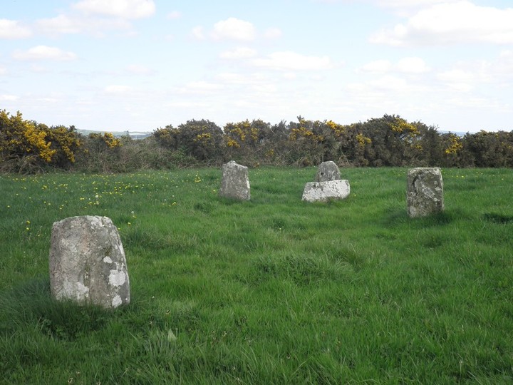
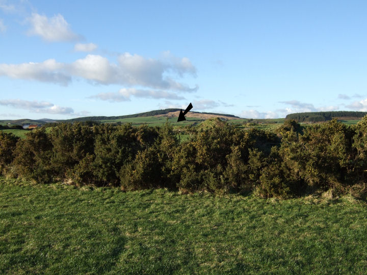