|
|

|
|
LeafeaStanding Stones
|
||||||||||||||||||||||||
|
|
|
Images (click to view fullsize) |
|
|
Fieldnotes |
|
|
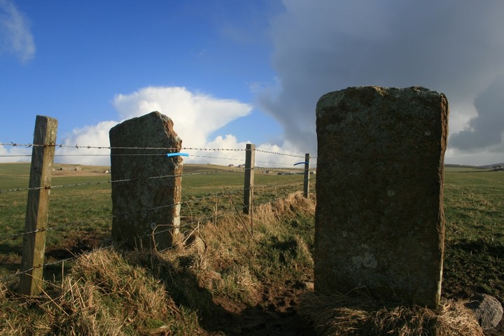
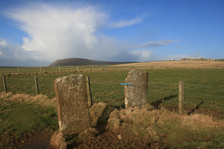
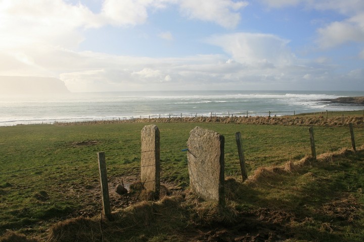
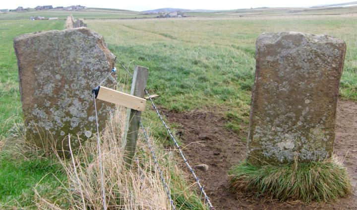
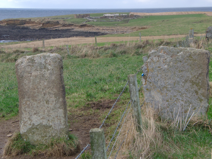
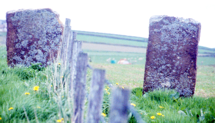
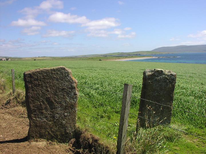
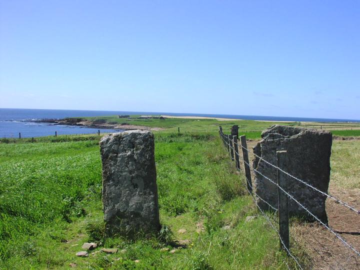
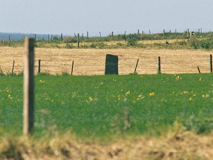
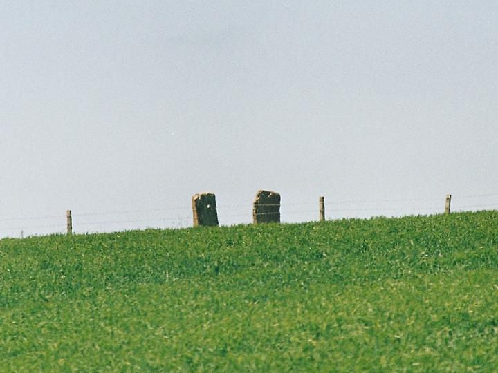
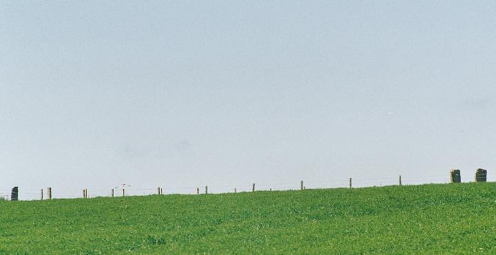
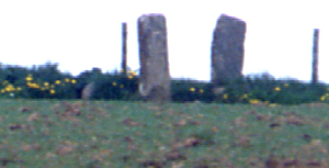
Visited 5th February 2013 Access to these stones proved easier than in Moth's old fieldnotes. As you come into Stromness on the main road from Kirkwall take a right at the mini-roundabout onto North End Road, soon, bear right again onto Back Road, which wends its way up the brea at the back of the town. At the next mini-roundabout head right again on the Outertown Road, from which you you soon see a brown signpost directing you to turn left to Warebeth beach. We parked down near the graveyard on the coast, not risking the bumpy narrow road which gives access to the small parking area overlooking the beach. From here follow the coastal path, and you will soon see the profile of the stones on the horizon. After crossing a small burn the path takes a sharp turn right and heads inland. Just a short ways up this path you will see a lane to your left which leads straight into the field containing the stones. Today (as with my last visit) this heavily rutted lane is full of pools of water, but a handy ridge between the deep tyre ruts acts like a causeway to keep our feet dry. At the stones, both solid blocks around 4' high, you get great views out over the bay. It is still windy today, but nowhere near the storm force winds of the last couple of days which had shut down the ferries, and from our vantage point at the stones we watch the MV Hamnavoe labour its way through the heavy seas on its crossing to Scrabster. The sun is out, but on the way up we were pelted by a quick rain/hail storm, such is the capriciousness of the Orcadian weather, and now a rainbow is visible over toward Stromness. As we stand at the stones the raw elemental power of Orkney is tangible, as huge waves break at the beach, and snow is still visible on the high hills of Hoy across the water. I take a look at the other nearby stone mentioned in the fieldnotes, but again am not sure whether it was ever part of an alignment, somehow it feels more perhaps like an ancient boundary stone. Regardless it's a fine place here, a pleasent walk, wonderful views and a pair of megalithic stones, what more could you ask for! |
10th February 2013ce |
|
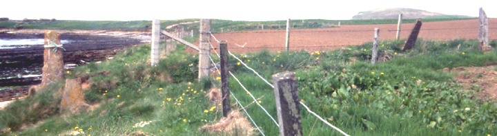
Access I walked along the coastal path from Warebeth beach towards Breckness. I'd guess it's a mile or so on a reasonably good path, but it's probably only good if you're OK on your feet - it undulates and has been damaged by subsidence in a few places. The stones are easily visible from the path but a real struggle to reach. I ended up being a bit naughty and nipping through the barbed wire and walking up the field margin - you'd have to get through the fence to reach them anyway.... Friday 25 June 2004 As Wideford has said, Orkney is littered with stones, often in pairs, some of which seem to be acknowledged as 'bona fide' standing stones, and some that don't. These are in a lovely spot and it's a really nice walk from Warebeth beach, round the 'corner' from Stromness. The nearby stone that Wideford has mentioned looks every bit as much a 'real' standing stone as these, though many others seem maybe less convincing. Bottom line is that unless proved otherwise, many could be ancient boundary markers, and many might not be. I passed a big pile of at least 5 or 6 similar stones stacked by the coastal path on the way up from the beach. Were they 'old ones' taken down & stacked by a farmer, or 'new ones' ready for use? Or both? |
28th August 2004ce |
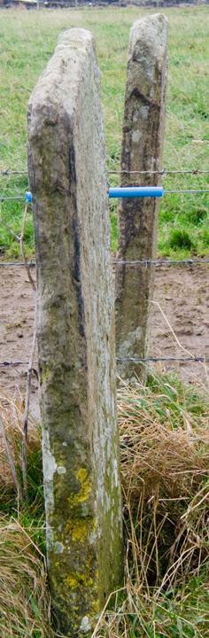
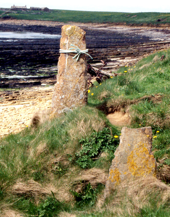
| It was by going up a wide ditch, presently dry, knee-deep in vegatation that I reached the end of the field with the Leafea stones. From here I could fill my camera with their image. After getting back I realised that the way chosen was the worst of several to reach Leafea and Brockan (it strikes me with hindsight that the best way is likely to be not to go down the turnoff to Warebeth but instead continue along to where the Outertown road takes a sharp turn and go around the field edges at that point). The two standing stones (1 & 1.2m high) are at right angles to the coast, earthfast. Not part of the arrangement were a couple of natural boulders of which one filled the gap.The story goes that a dog unearthed human bones at the stones' base. Now the uppermost stone is part of the barb-wire fence. It is often difficult to fathom why some stones are chosen and loads of others aren't. Just behind where I stood (HY23040928) is one of decent height, either side of where ditch meets coast are another two (HY22980917,HY22990917) and I think I remember another on the way up. All these ones differ from Leafea by being the usual taller than they are broad. |
17th May 2004ce |
Miscellaneous |
|
| When Stromness was planked in 1765 Innertoun was divided from Outertoun by "a line from the March Stone at the goe of Stinnigar and upwards to the March Stone at the west corner of Pressquoy, and from that in a crook eastward to the top of the Green Hillock, and from thence upwards through the middle of the Green Gate leading up to John Stout's house called Gentle June [Gentlejohnshouse a.k.a. Castle (near Hillcrest) croft now abandoned HY236101]." At first I though the Green Hillock must be Brockan chambered mound, but that is westward. Another possibility is a mound S of Wester Leafea. But this is a "natural sandy knoll" rather (site of the Innertown cist HY20NW 3. Which leaves the Leafea standing stone pair as the only candidate for Green Hillock, the march stones those I saw coming up. |
26th November 2011ce Edited 26th November 2011ce |
| Though now given the name of a place in the hill above this was the original site of Stenigar 'stones-farm', which might be including stones other than this pair. |
3rd June 2005ce |
| Looked this up again, RCAHMS NMRS no. HY20NW 4 lists it as 3 stones that may have been from something bigger but not a stone circle. After Friday I'm thinking Stones of Via ?? Will see. |
26th April 2004ce |