The Modern Antiquarian
Log in
|
Register
Home
Latest Posts
Forums
Maps
Help
Browse Sites
News
Blog
Contributors
The Books
Select
-
Belgium
Denmark
Eire
France
Germany
Greece
Italy
The Netherlands
Norway
Portugal
Republic of Malta
Spain
Sweden
Switzerland
United Kingdom
County Cork
Cools
Standing Stones
Cools (Standing Stones) on The Modern Antiquarian, the UK & Ireland's most popular megalithic community website. 3 images, plus information on many more ancient sites nearby and across the UK & Ireland.
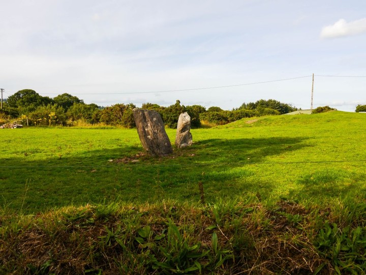
Image © Michael Mitchell
Nearest Town:
Cookstown (19km E)
OS Ref (IE):
W247731 /
Sheet: 79
Latitude:
51° 54' 18.47" N
Longitude:
9° 5' 39.23" W
Added by
FourWinds
Images (3)
0 discussions
Start a topic
Show |
Hide
Web searches for Cools
Flickr
Google
Google Images
The Megalithic Portal
Bing
Stone Pages
Wikipedia
Show map
(inline Google Map)
- Sites within 20 km -
-
Ballyvoge 1 (1.7km ESE) (6 posts)
Kylefinchin (2.46km E) (1 post)
Kylefinchin 2 (2.94km E) (5 posts)
Lissacresig (3.1km NE) (3 posts)
Inchinlinane (3.11km ENE) (5 posts)
Lissacresig 2 (3.46km NE) (5 posts)
Lissacresig 3 (3.46km NE) (4 posts)
Lissacresig 1 (3.54km ENE) (4 posts)
Gortanimill (4.01km W) (16 posts)
Reananarree (4.29km WSW) (3 posts)
Reananerree (4.39km WSW) (11 posts)
Carrigaphooca (4.7km ENE) (7 posts)
Ballymakeery (4.73km WNW) (5 posts)
St Abban's Grave (5.17km WNW) (1 post)
St Abban's Grave (5.17km WNW) (4 posts)
Shanacloon (5.17km WNW) (5 posts)
Gortnalicky (5.36km NE) (1 post)
Lack More (5.52km WSW) (9 posts)
Clashmaguire (5.61km NE) (1 post)
Derryfineen (5.65km WSW) (6 posts)
Derryfineen (5.67km WSW) (5 posts)
Teergay (5.76km ESE) (8 posts)
Gortnatubbrid (6.06km W) (13 posts)
Gortnatubbrid (6.06km W) (4 posts)
Clashmaguire (6.32km NNE) (2 posts)
Cabragh (6.96km NNE) (4 posts)
Carrigonirtane (7.16km NNE) (4 posts)
Cabragh (7.37km NNE) (4 posts)
Cabragh N (7.37km NNE) (6 posts)
Gortyleahy (7.47km E) (4 posts)
Kilboultragh (7.82km ENE) (1 post)
Carrigonirtane (8.39km NNE) (6 posts)
Turnaspidogy (8.69km SW) (8 posts)
Knocknakilla (8.89km NE) (0 posts)
Scrahanard (8.91km NE) (15 posts)
Knockraheen (9.02km NE) (19 posts)
Lackaduv (9.17km NE) (5 posts)
Coolaclevane (10.05km SE) (3 posts)
Knockaunnagorp (10.2km SE) (0 posts)
Coolaclevane (10.24km SE) (3 posts)
Bealick (10.26km E) (3 posts)
Glantane South (10.36km NNE) (8 posts)
Carriganimmy (10.63km NNE) (15 posts)
Rossnakilla (10.65km ESE) (0 posts)
Rossnakilla (10.65km ESE) (9 posts)
Currahy (10.67km SW) (4 posts)
Lumnagh More (10.68km W) (0 posts)
Glantane East S (10.83km NNE) (16 posts)
Gorteennakilla (11.03km WSW) (6 posts)
Knockanereagh (11.18km SE) (8 posts)
Bealick (11.38km ENE) (0 posts)
Glantane East N (11.46km NNE) (14 posts)
Glantane East N (11.46km NNE) (5 posts)
Glantane East (11.77km NNE) (7 posts)
Knockane (11.85km ESE) (8 posts)
Keamcorravooly (12.17km WSW) (4 posts)
Keamcorravooly (12.21km WSW) (11 posts)
Knocknakilla (12.24km NNE) (24 posts)
Reanacaheragh (12.57km ESE) (0 posts)
Barnadivane (12.63km ESE) (0 posts)
Caherbaroul (12.67km ENE) (7 posts)
Farrannahineeny (12.81km S) (16 posts)
Knocknagappul (13.17km NE) (3 posts)
Knockagappul 1 (13.17km NE) (5 posts)
Knockagappul 2 (13.34km NE) (6 posts)
An Screathan Mór (13.35km WSW) (3 posts)
Cloghboola Beg (13.39km NNE) (12 posts)
Coolmountain (13.45km SSW) (7 posts)
Inchincurka (13.46km S) (15 posts)
Knocknagappul (13.58km NE) (3 posts)
Rosnascalp (13.64km E) (4 posts)
Kilberrihert large wedge tomb damaged (13.84km ENE) (2 posts)
Moneygaff West (13.88km SE) (5 posts)
Knocknagappul (13.9km NE) (5 posts)
Clearagh (13.99km E) (2 posts)
Stone Row, partially ruined (14.01km NE) (5 posts)
Cloghboola Beg (14.08km N) (0 posts)
Cloghboola More (14.08km N) (0 posts)
Western Pap (14.33km WSW) (9 posts)
Knocknagappul (14.42km NE) (2 posts)
Gortafludig (14.61km WSW) (0 posts)
Deelish (14.84km ENE) (4 posts)
Laharankeal (15.03km ENE) (4 posts)
Kilmeedy W (15.11km NNW) (0 posts)
Lackanashinagh (15.11km ESE) (0 posts)
Grousemount (15.12km WSW) (3 posts)
Kilmeedy E (15.19km NNW) (0 posts)
Claragh E (15.19km NNW) (2 posts)
Claragh W (15.24km NNW) (2 posts)
Laharankeal (15.3km ENE) (1 post)
Dooneens (15.52km SW) (4 posts)
Dooneens (15.74km SW) (9 posts)
Carrigagulla NE (15.76km NE) (10 posts)
Knocknaneirk NE (15.84km ESE) (13 posts)
Carrigagulla (15.84km NE) (7 posts)
Garranereagh (15.88km ESE) (4 posts)
Hornhill (15.95km ESE) (8 posts)
Carrigagulla (16km NE) (20 posts)
Knocknaneirk SW (16.14km ESE) (17 posts)
Carrigagulla NE (16.41km NE) (17 posts)
Hornhill (16.53km ESE) (5 posts)
Behagullane (16.65km SSE) (1 post)
Eastern Pap (16.81km WNW) (6 posts)
Kinneigh (16.93km SE) (4 posts)
Oughtihery W (16.93km ENE) (9 posts)
The Paps of Anu (17.14km WNW) (7 posts)
Maulmore (17.15km ENE) (8 posts)
Bengour East (17.48km ESE) (6 posts)
Inchireagh (17.62km SSW) (11 posts)
Toom (18.18km SSE) (4 posts)
Oughtihery E (18.18km ENE) (9 posts)
Knockavullig SW (18.28km E) (4 posts)
Knockavullig NE (18.36km E) (2 posts)
Derrynacaheragh (18.41km SSW) (2 posts)
Kinneigh (18.44km SE) (5 posts)
Bengour West (18.63km ESE) (6 posts)
City of Shrone (18.66km WNW) (15 posts)
City of Shrone (18.66km WNW) (2 posts)
Glenleigh (18.67km NNE) (3 posts)
Currabeha (South) (18.78km E) (7 posts)
Currabeha (North) (19.39km E) (7 posts)
Laravoolta 2 (19.42km ESE) (3 posts)
Derrynasafagh (19.48km S) (3 posts)
Laravoolta 1 (19.56km ESE) (2 posts)
Cappaboy Beg SE (19.6km SW) (7 posts)
Cappaboy Beg (19.67km SW) (2 posts)
Cappaboy Beg (19.67km SW) (3 posts)
Farnanes (19.75km SSW) (9 posts)
Cappaboy Beg (19.88km SW) (2 posts)
Cappaboy Beg (19.96km SW) (4 posts)
- Add -
-
Add news
Add an image
Add fieldnotes
Add folklore
Add miscellaneous
Add a link
-
Add a site
Add a nearby facility
Add an alternative name/spelling
Images
(click to view fullsize)
Add an image
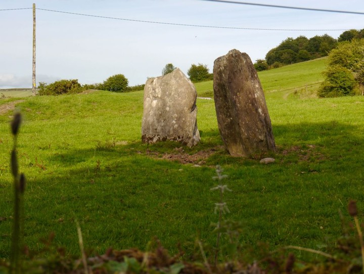
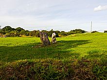 Image © Michael Mitchell
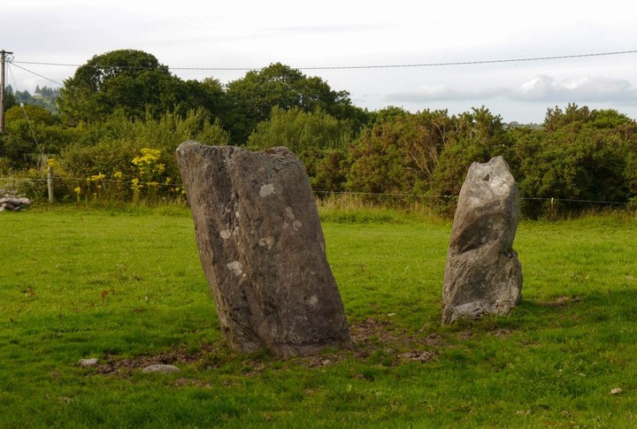