Having only ever seen these stones from the road, and at quite a distance, we took advantage of a lovely sunny day to get a bit closer and have a walk up to them. Parking up overlooking the sea near to the Earl’s Palace in Birsay, we walked back up the main road to Kirkwall as far as the small signpost to Vinbrake. Taking this lane to our right it’s not long before the stones are visible on the horizon, an open gate into their field inviting us in.
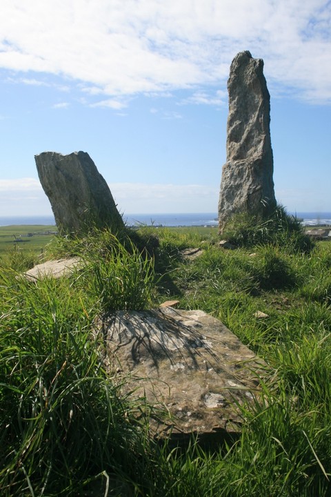
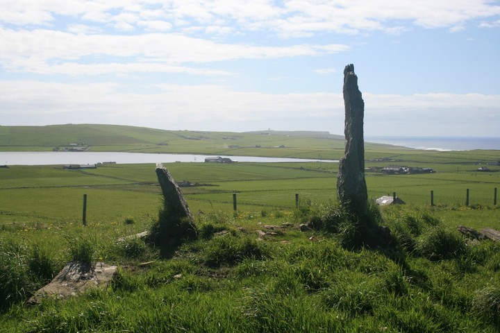
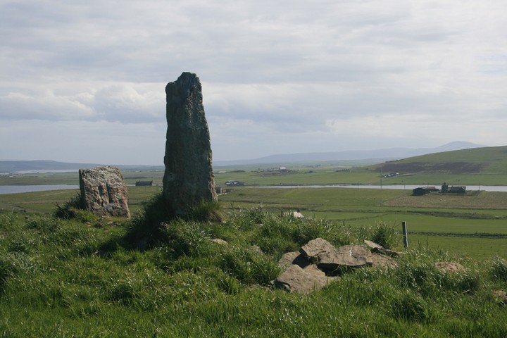
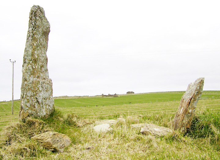
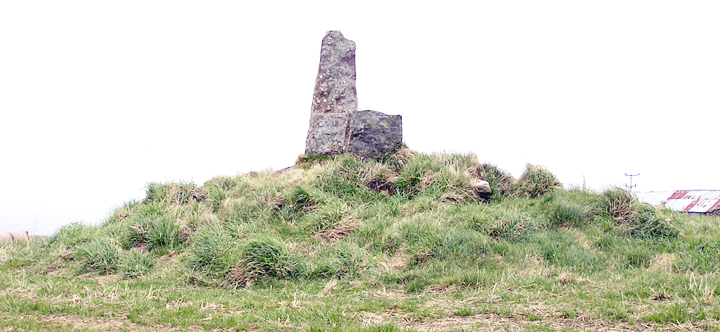
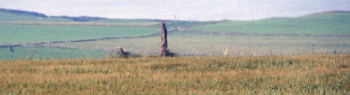
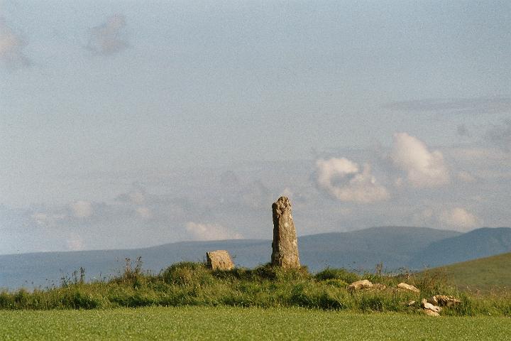
The two stones stand at either end of a low mound, a rough measurement taken by standing next to it, shows the taller of the pair must be around 6’ tall, its companion around half the height, due to having snapped in two, the broken half lying mournfully not far from the diminished stone.
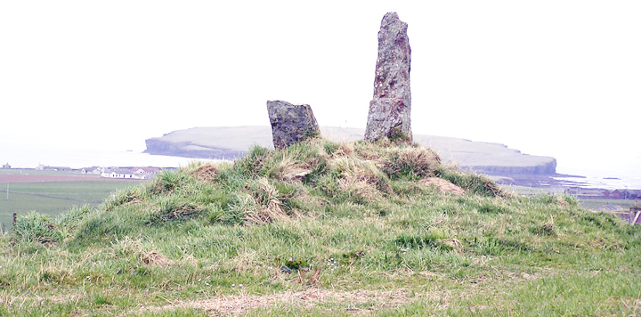
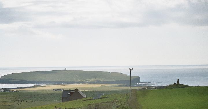
Fantastic views are to be had from here, the two stones framing a range of amazing vistas out over the Brough of Birsay, and Boardhouse Loch, and again it strikes me just how well these sites were selected by the people who built them for their place in the landscape. As I ponder the views I notice a very prominent alignment with the Wheebin standing stone across the loch, which although only a tiny point in the distance, directly stands between the two Stanerandy orthostats.
We spend some time in the gorgeous sunshine just taking in the views and soaking up the atmosphere of another top quality Orcadian monument.
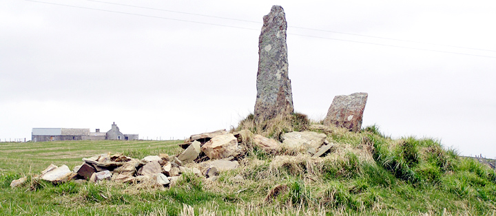
Last year's grain only stubble now, fallow field falicitating photography. The messiest view is from uphill, all those stones at the western end like builder's rubble. The 1882 map shows a stone 160 yards away slightly north of west in the next field (in the direction of a northern house wall). Didn't see this, only the usual standing stone as field boundary, and there are plenty of those on the track along to here.
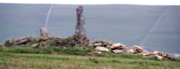
Coming up from Birsay village take the A967 until the Vinbrake junction and then take that. Cornfield right to the very edge, so a closer look will have to wait several months. The wheat being tall you can only see the tumulus in two places. Fortunately the views being at right-angles to each other partially compensates. Closest to is at the corner of the field behind a Nissen hut, with a big fencepost to rest the camera on - no-one objected at the time to my going to that point. The other view, about twice the distance, is after the road turns left. Though you can see it most of the way going down towards Newan (Newan Chambered Cairn is confusingly not here but beyond Stanerandy near a disused quarry on the hill) look out for a pair of flatface-aligned stones and between there and the fence above Newan you are looking straight across at it.
Strange place and we couldn't get close up to have a poke about to investigate properly. Looks like a cairn or mound with a coupla standing stones sticking out of it. Very odd. Fantastic views of the Brough of Birsay from here!
Traditionally Stanerandy was Earl Randolph's Stones, though the modern reading is 'stony ridge'/'ridge of stones'. The etymology of gervie is unknown but could be from either i) ge(y)r, an odd bit of land, angular and often left uncultivated, or ii) gør 'giantess/witch/trow'. Interestingly, these can be combined by the Northern Isles folklore that the 'White Folk' (Madruis or Queeda Folk) had enclosures surrounded by a dyke of earth or stones where there was often in one corner a rough affair, the White Chammer [i.e. chamber] where they lived. Certainly there are too many cut-off triangles of land in Orkney for coincidence.
RCAHMS NMRS record HY22NE 15 now considered to be a barrow into which stones were later inserted , and of the two latter only the stump of one remains . There are three definite barrows at HY275277 .

 Posted by Jane