|
|

|
|
Dun GrugaigStone Fort / Dun
|
||||||||||||||||||||||||
|
|
|
Images (click to view fullsize) |
|


|
Fieldnotes |
|
|
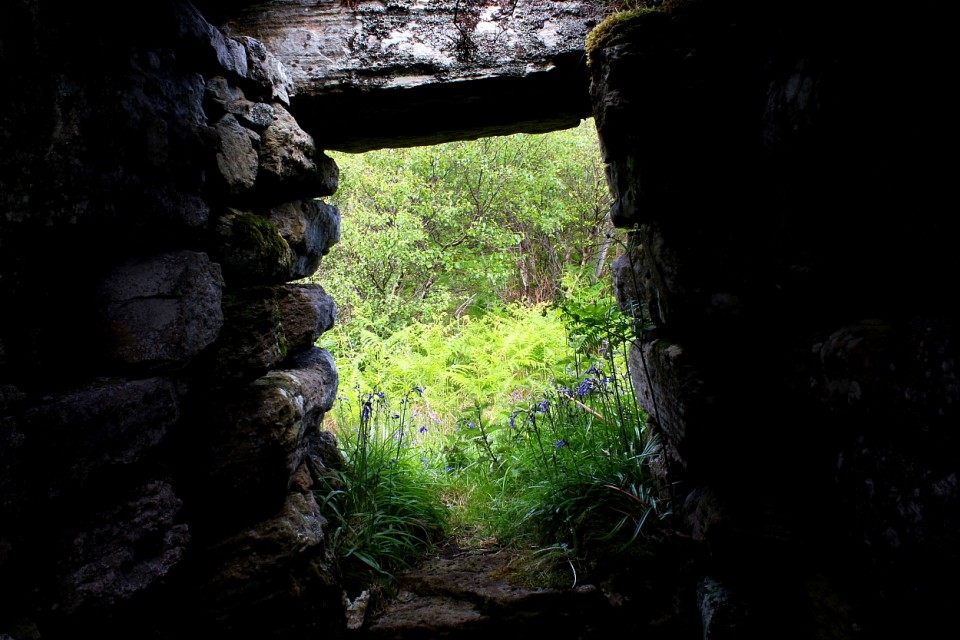
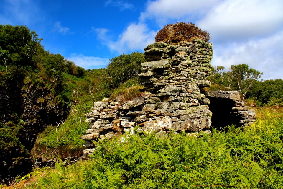
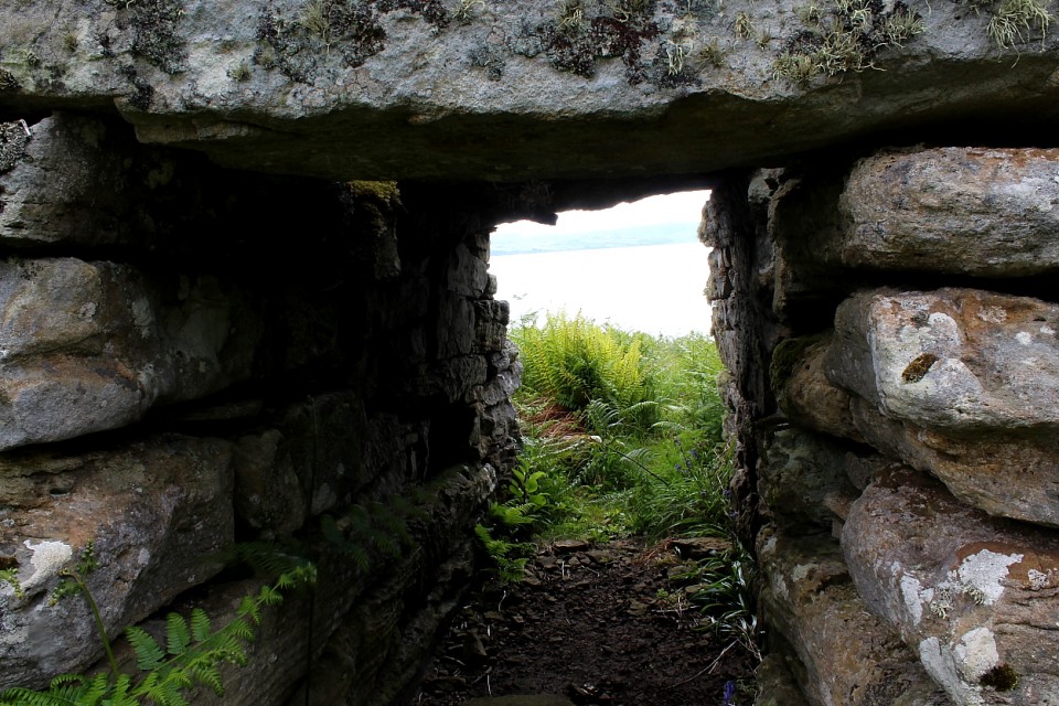
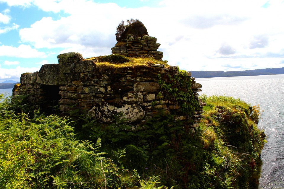
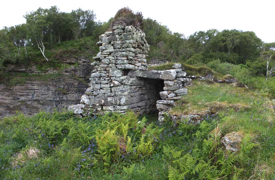
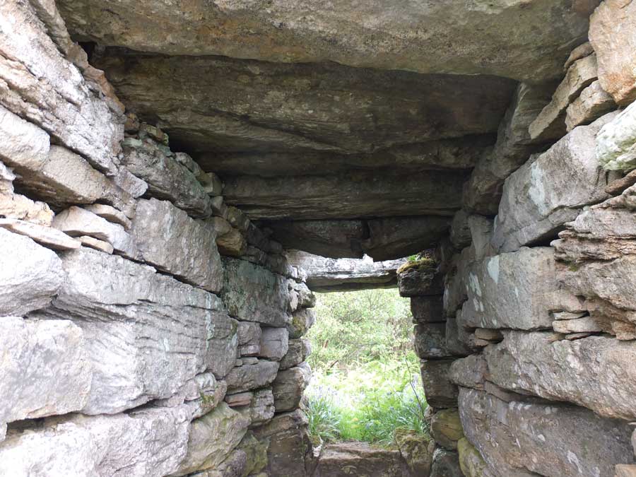
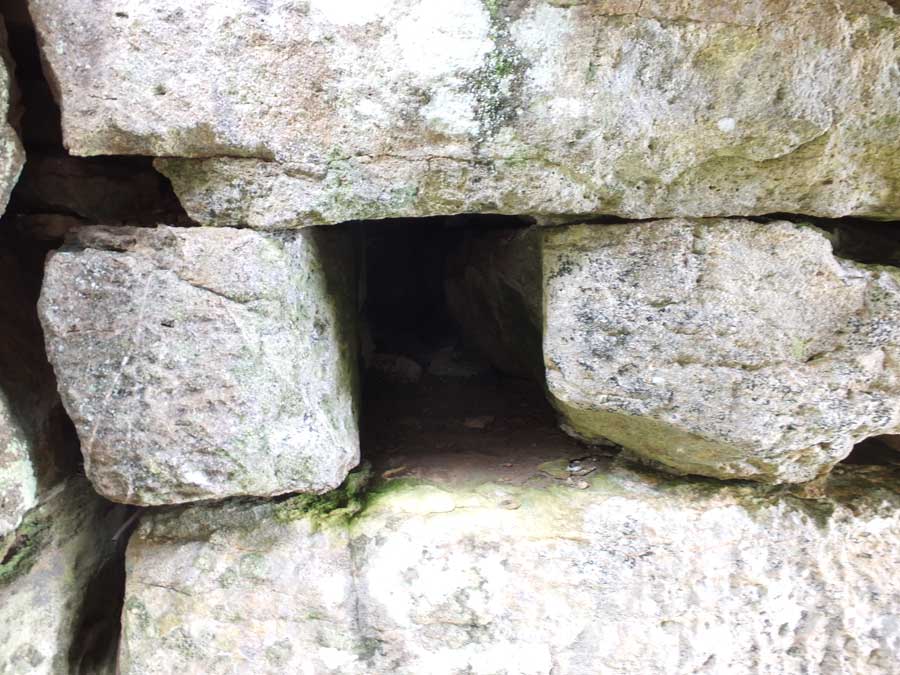
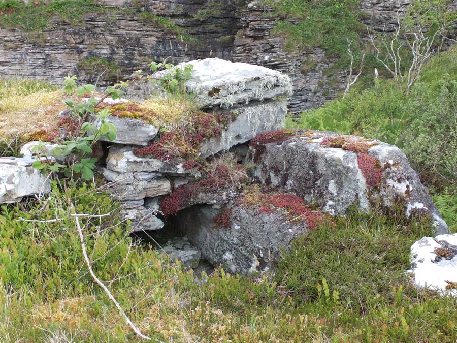
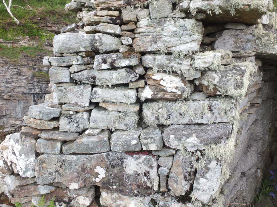
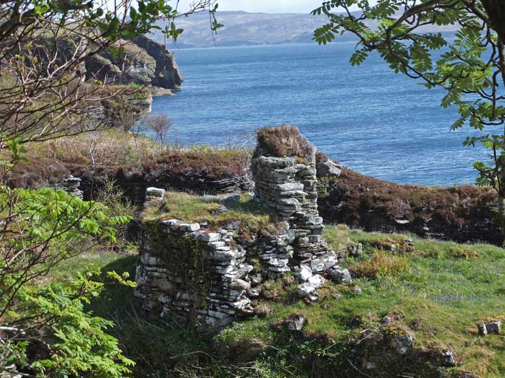
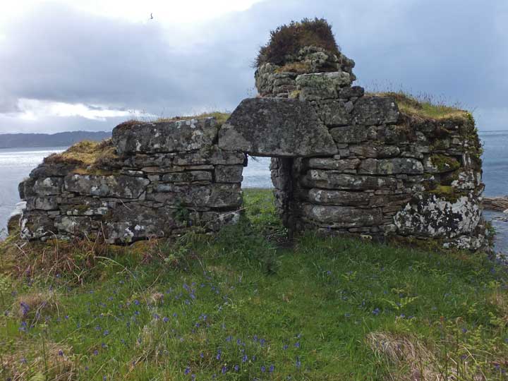
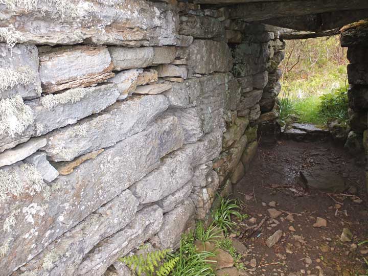
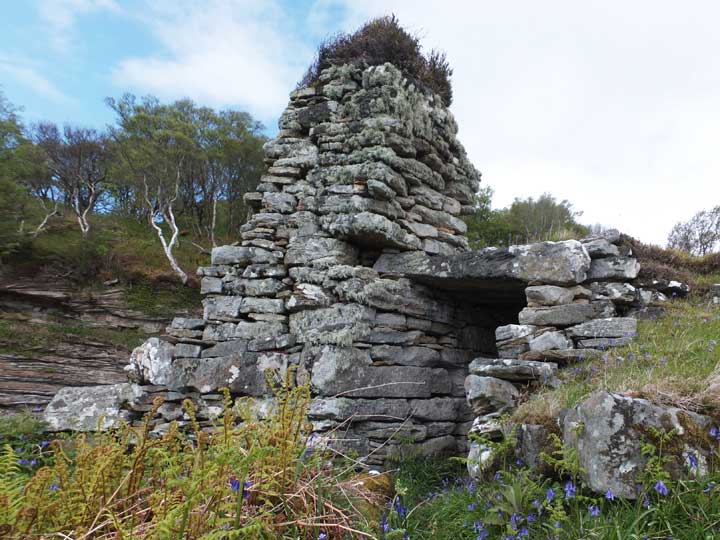
Visited: May 23. 2017 During this week on Skye I determined to revisit the amazing Dun Grugaig at Glasnakille, and if possible to find a more direct route to the semi-broch. This time I walked north from the same starting point as previously, and right to the northern boundary of the fenced area (almost opposite the next property on the road). Here I found a stile (which I had used previously, but which simply led into an almost impenetrable tangle of scrub and undergrowth). Ignore this stile! Instead, walk a couple of metres past this stile, and follow the outside of the fence towards the coast. A reasonable footpath has been tramped here, so Dun Grugaig must receive quite a number of visitors. Follow the path until it levels off at a point where the fence turns to the right and an open area dominated by bracken lies ahead. Here the path becomes obscured, but actually heads left through the bracken towards the next stand of birch trees. Just walk towards these trees, and you will resdiscover the path running between them directly to Dun Grugaig. Because the birch trees are now quite rampant, you don't actually see the dun till the last moment, when you step out from under the trees. The map below illustrates the path, including the short dog-leg from the fence through the bracken. With more time to spend at the dun (rather than hunting for it), several previously unnoticed features came to light. To the right of the broch wall (in the interior) is a short flight of three steps, remnant of an original stairway to a second level. Climb these, and you can just catch a glimpse of a section of second-level gallery. On the left-side of the wall is a promnent scarcement, a row of stones forming a ledge which would have supported one end of the original wooden flooring over the interior court. The entrance passage is extremely well preserved, although one of its original complement of seven massive lintels has been lost. The broch would originally have possessed a wooden door, and door checks to keep it in place are prominent, as are bar holes in each side wall into which bars to secure the door would have slid. This is a fascinating site, just five minute's walk from the road. The first part of the path is quite steep and could be tricky when wet, but poses no real obstacle. Good walking boots, though, are recommended. |
 Posted by LesHamilton
28th May 2017ce Edited 11th March 2023ce |
|
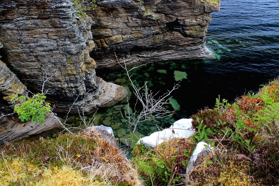
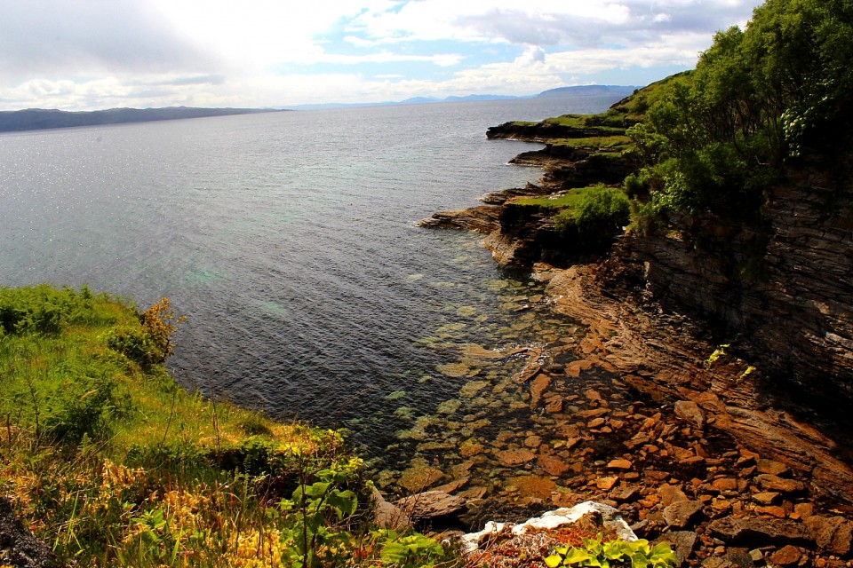
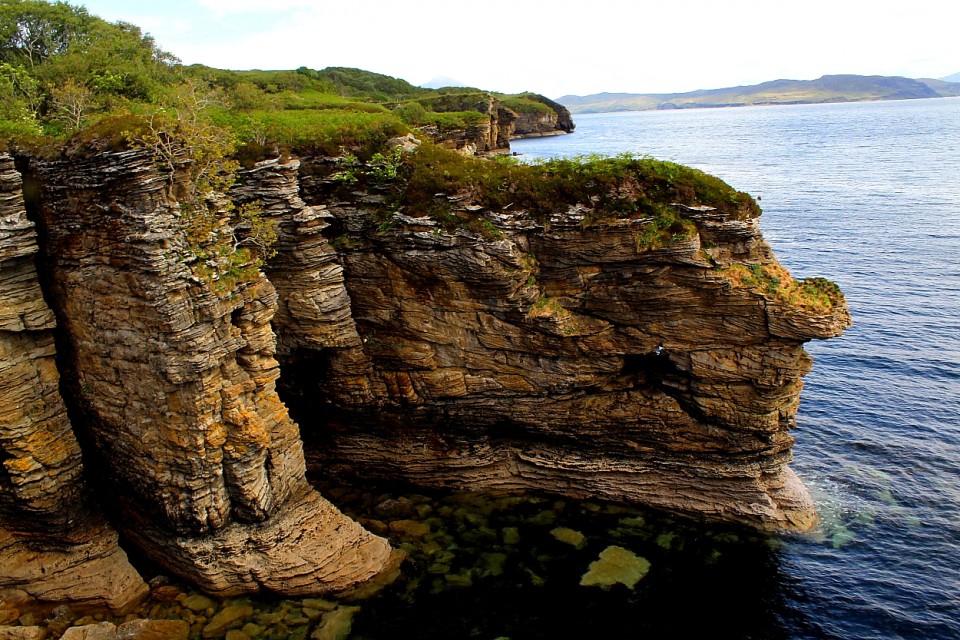
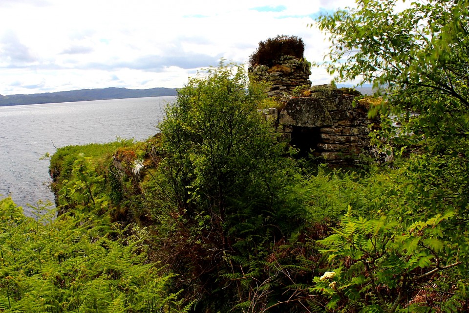
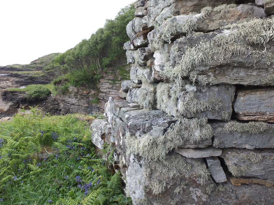
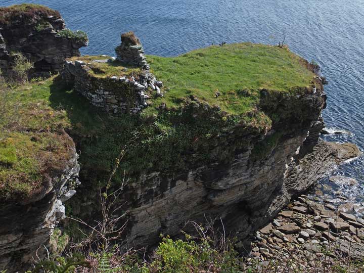
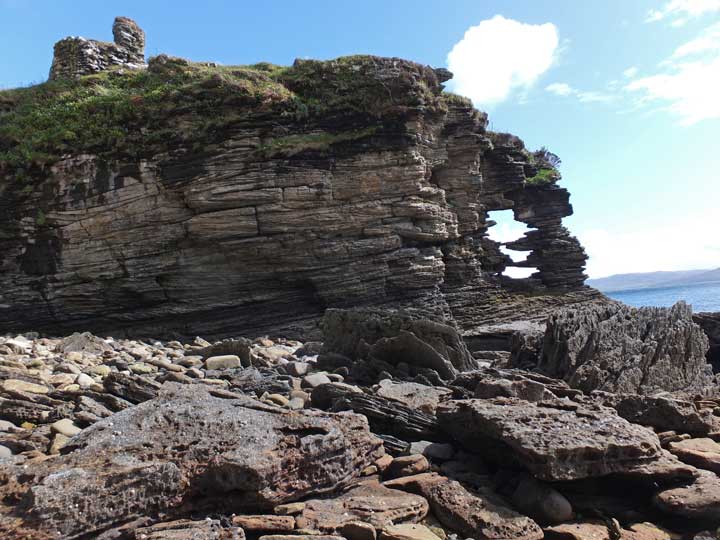
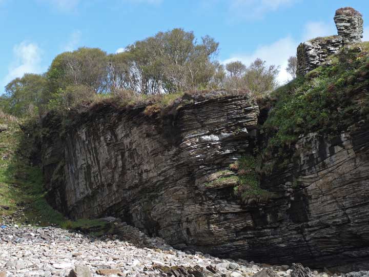
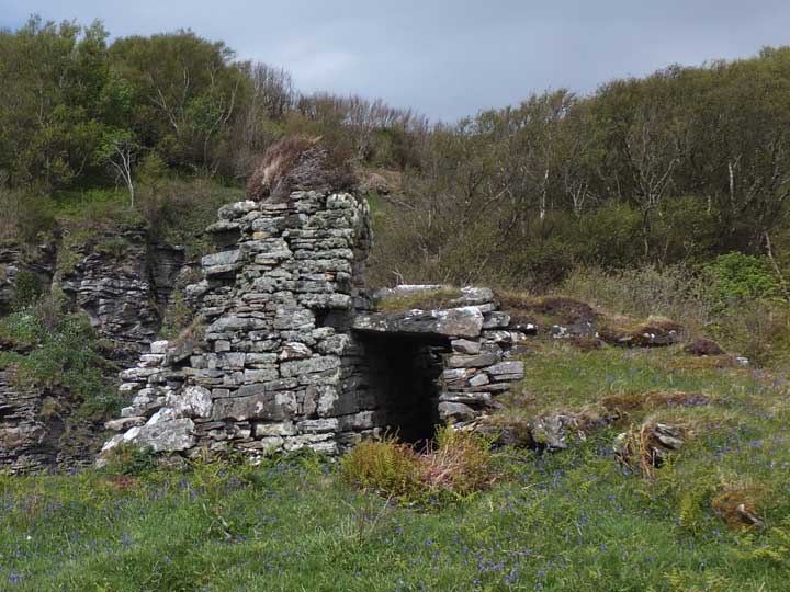
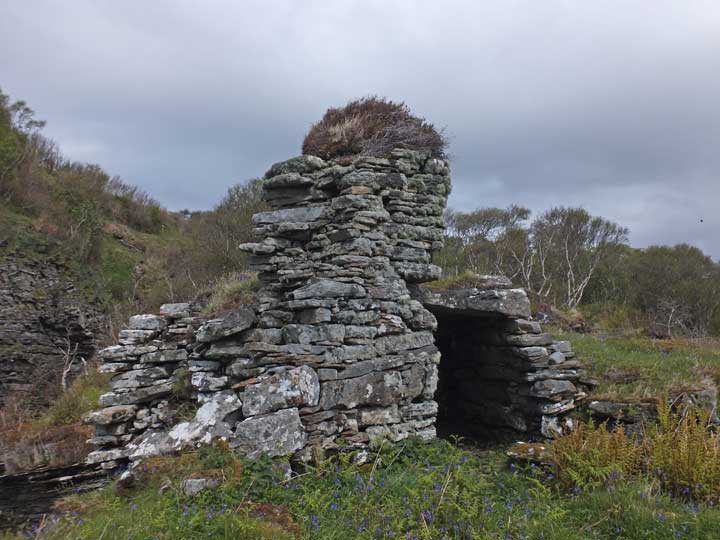
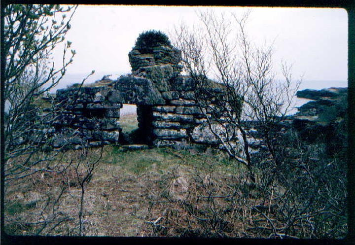
Visited: May 28, 2015 Finally, a successful foray to visit Skye's most elusive Early Iron Age fortification, Dùn Grugaig at Glasnakille on the Strathaird peninsula, just four kilometres beyond Elgol. Following an unusually cold spell during April and May this year, new growth of brambles and bracken was minimal, and underfoot conditions allowed a fairly straightforward excursion this time. I started from a few metres north of No 3 Glasnakille (see previous report), and found that the rickety stile had now been replaced with a much more robust one. My route proved somewhat circuitous as, to avoid as much of the birch scrub as possible, I followed the edge of the scrub in a southeasterly direction for about 40 metres till I saw evidence of a clearing through the trees ahead. On crossing the clearing, and heading for the sea, I soon picked up a path parallel with the coast, and headed north towards my target. Though somewhat muddy, the path, generally about two metres from the cliff edge, was easy to follow, and after covering 100 metres or so, the dùn was sighted through the trees. Dùn Grugaig stands about 15 metres above the sea atop a narrow, sheer sided promontory. I continued round the coast till I reached a fence across the neck of the promontory. The wire fence ends with a stout wooden section which acts as a stile for continuing towards the dùn. At first sight, you have the impression that there must be a vertical drop beyond the fence, but in fact a steep but manageable grassy slope leads to the shore below the dùn, and is well worth exploring to view the amazing rock scenery there. From the fence, a few strides along a grassy path takes you through a small stand of birch scrub and reveals the amazing 4-metre deep wall that separates the promontory from the mainland. According to Canmore, a much narrower version of the wall probably once encircled the entire grassy headland beyond, but today interest is confined to the remarkable stonework of the dùn with its near perfect entrance passage, surmounted by a triangular keystone, and above that the remains of a gallery. The accompanying photographs explain better than any words of mine, what a splendid monument Dùn Grugaig is. Leaving the dùn, I took as direct a line as I could to the skyline and emerged into the field just north of the point where I started. Although this was a much shorter route, it is steeper than my inward path, and is also heavily infested with rank vegetation (including prickly brambles, and tall bracken). There is an excellent, highly detailed, descriptive account of this monument on the Canmore website. |
Posted by LesHamilton 31st May 2015ce Edited 21st March 2017ce |
|
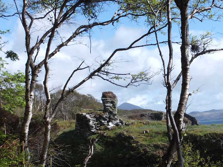
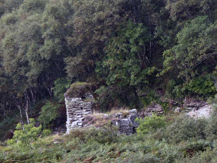
September 4, 2014 I had set out full of hope that I could visit this remote but remarkably well-preserved broch at Glasnakille on Skye's Strathaird peninsula. Little did I suspect the obstacles that would thwart me. There are stiles over the roadside fence to both north and south of the promontory bearing the broch (though the northern one is decidedly rickety). Both lead to paths that, at this time of the year (early September) rapidly become obscured by dense, head-high bracken. Together with the trees and brambles, this not only seriously impedes movement, but also prevents you from seeing where you are going and totally compromises your sense of direction. At one point I found myself suddenly standing close to the edge of a cliff! This site is going to have to wait for a springtime visit, when the bracken has died down and both underfoot conditions and visibility are easier. The red marker in the Google Map below shows the location of Dun Grugaig, on a narrow, sheer sided promontory. As a guide, the gate in front of the house nearest the foot of the map carries the legend 'No 3'. I did manage to photograph the broch, however, from a grassy headland 250 metres to the north. It shows Dun Grugaig at the foot of tree-clad slopes, and surrounded by thick bracken. You can read much more detail concerning this broch at Canmore. |
Posted by LesHamilton 7th September 2014ce Edited 5th April 2024ce |