|
|

|
|
Ty IsafChambered Cairn
|
|
|
|
Images (click to view fullsize) |
|
|
Fieldnotes |
|
| I have visited this site a couple of times and have to admit I have failed to spot the Cairn - despite using binoculars. I have tried to spot it from the lane which runs off the A479 towards the farm - to no avail. Perhaps I have been looking at it all the time but not distinguished it from any other 'lumbs and bumps' in the field? |
Posted by CARL 11th June 2010ce |
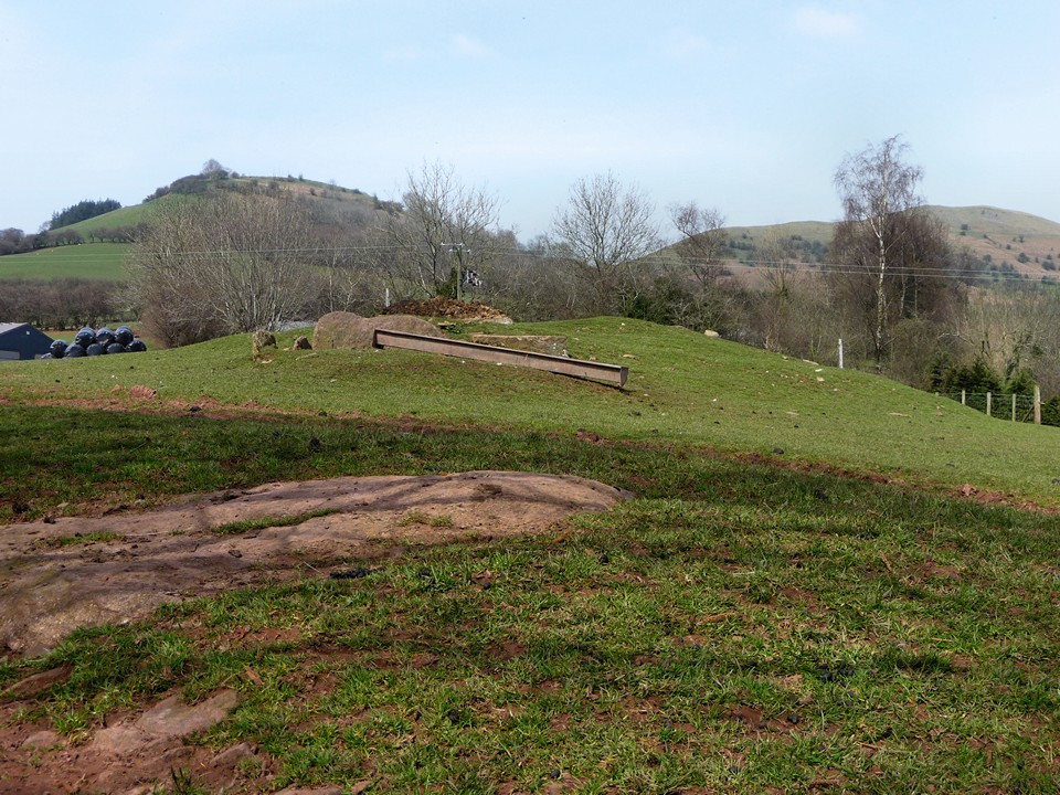
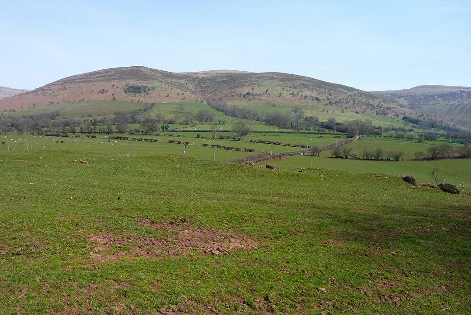
| After reaching the summit of Mynydd Troed (10.4.2010) I had a choice to make about whether to go back to Bwlch via Mynydd Llangorse (the way I came) or to go further east and then follow the valley. Seeing this "chambered tomb" marked on the OS - which I hadn't noticed earlier - decided it for me. The foot approach to the site was via minor roads and an adjoining byway. The field it stands in is sadly rather full of agricultural bits and pieces, and some loose dogs. I didn't make it in to the field, so contented myself with some photos over the fence. The previous fieldnotes give the detail of the archaeology, so I won't try to repeat that again. There is a visible long mound with some protruding megaliths, right on the lip of a slope in the ground. The situation is excellent, with views of Castell Dinas (obviously before the hillfort was constructed) and Mynydd Troed mountain, as well as eastwards to the lower slopes of the central Black Mountains ridge and Waun Fach in particular. Just 100m or so to the south is the Afon Rhiangoll river - the siting of the monument seems very likely to be linked to these natural landscape features. It would probably warrant a proper visit, with permission to get in and have a real look at the monument itself. |
 Posted by thesweetcheat
27th April 2010ce |
|
Black Mountains group of chambered long cairns. A 479 Up over the Black Mountains, from Talgarth to Crickhowell. Not far from the hamlet: Pengenffordd. Views of Castell Dinas hillfort from the road (access possible but a steep 100m climb). From Talgarth heading to Crickhowell: Take the first ‘real’ road on the left after Pengenffordd. 100m or so on right over fence in field you can see the grass covered cairn. The field drops away and the building you can see is Tyisha farm, where you need to ask permission. Several dogs running around loose, but farmer nice enough. I was a bit disappointed with this because I have an illustrated copy of the excavations that were carried here, and I was aware that the back of the cairn has an unusual circular setting. Of course it was all filled in and left for the next 60 or so years. So it was another undulating lumpy mound with a stone here and there. The impression of the site was also disappointing: two rusting farm trailers loaded with scrap wood next a large area of bare soil. The area of bare soil was where an earth mover had been used to clear a large area of ground either very close to or into the back end of the monument itself. Next to the cleared area was several pieces of Old Red Sandstone lying on the field (hopefully not from the monument). The mound is 30m long by around 18m and less than 2m high. No visible kerbing. I couldn’t make out any horns, but these were found during excavation in 1938. Close to a north-south alignment, with the false entrance to the north. Two protruding stones side by side indicate the false portal. Infront of these stones on the eastern side are two stones set one infront of the other at right angles to the portal stones, probably indicating a forecourt. Proceeding along the top of the mound about 4m is another visible setting of stones, which appear to be a central chamber with no capstone, but referring to a plan of the site there was not one. So it has to be one of the side chambers. There is a further jumble of stones towards the back on the west side, but it is difficult to imagine their location according to the plan. All in all, it is argued that it was a multi-phase monument, with possibly three phases of construction and use. It would have had horns in the Cotswold-Severn tradition, a false doorway or portal, two side chambers with passages, and most interestingly (though not visible now) a circular setting at the back. The circular setting was an oval cairn with a south-east facing passage and southwest-northeast orientated chamber (so the whole internal settings make a T shape). |
Posted by elderford 9th August 2003ce |
Links |
|
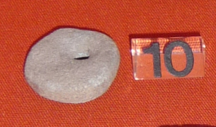
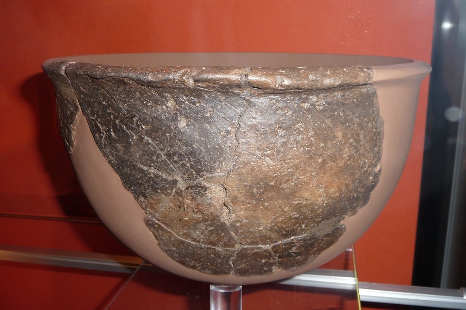
Wales PastThis page accompanies an article entitled The Stone Age tombs of south-east Wales by Steve Burrow, but I'm including it here because it contains a photograph of the bowl found at Ty Isaf. |
 Posted by Kammer
30th August 2006ce |