|
|

|
|
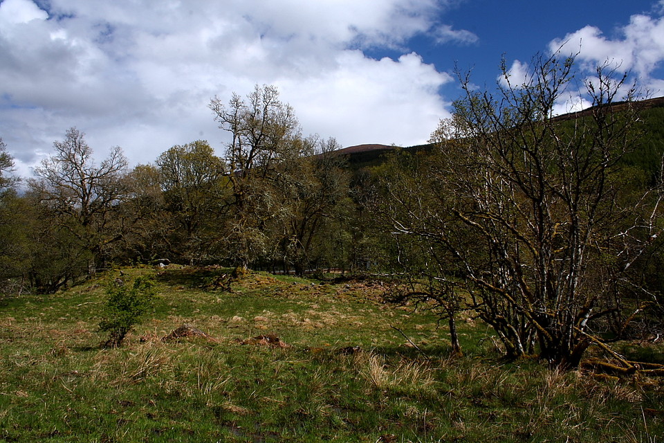
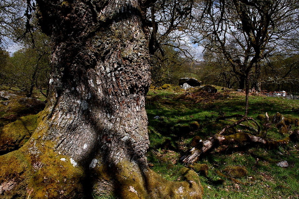
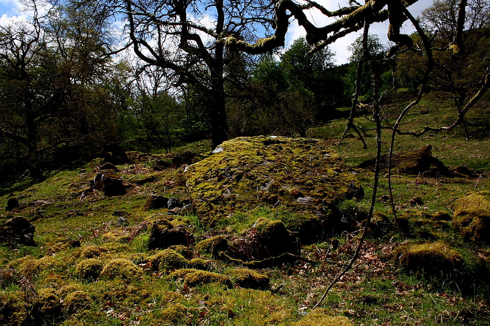
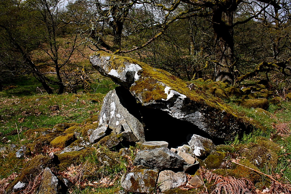
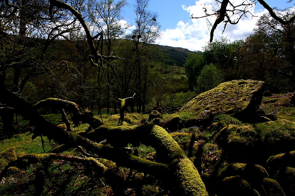
Edinchip Chambered CairnChambered Cairn
|
|
|
|
Images (click to view fullsize) |
|
|
Fieldnotes |
|
| I attempted to visit this site on October 8th 2015. It is easy to find the railway embankment referred to by BigSweetie and others - but now there are major earthworks under way with earth being removed from the embankment and much evidence of construction traffic, though no actual work was going on when I was there. Currently it is hardly possible to ascend the embankment because of this, so I had to leave disappointed. Maybe things will become easier again in the future - I hope so! |
Posted by rogerkread 16th October 2015ce |
|
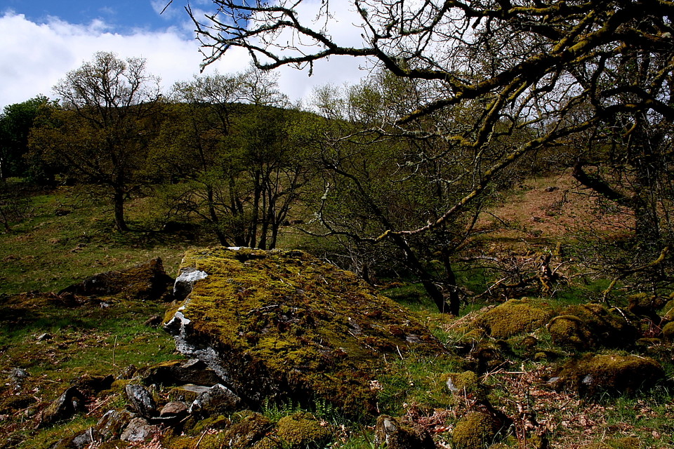
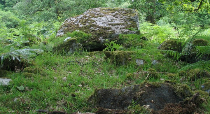
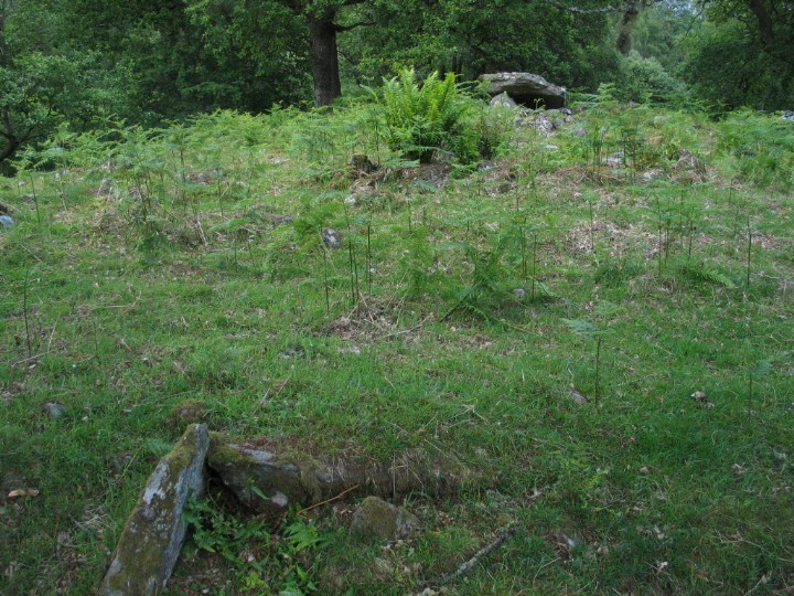
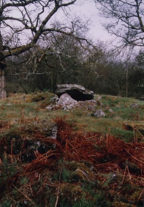
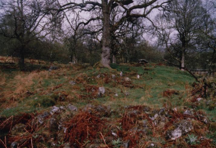
Getting here is very easy indeed - National Cycle Route 7 passes by the bottom of the railway embankment (so there's a good footpath from Killin, Balquhidder, Strathyre, Lochearnhead - take your pick!) The high gate doesn't appear to ever be locked. I've been up here twice now and both times there was no lock. It's a popular walking route too so access seems possible at all times. Walk along the railway embankment until you reach Moth's "metal framey-sheltery-type structures" (actually cattle feeding units) and go through the gate here behind them. Once through turn right amongst the tress and there is a large mound in front of you, next to the burn. The cairn is on top of this mound. |
 Posted by BigSweetie
24th September 2006ce |
|
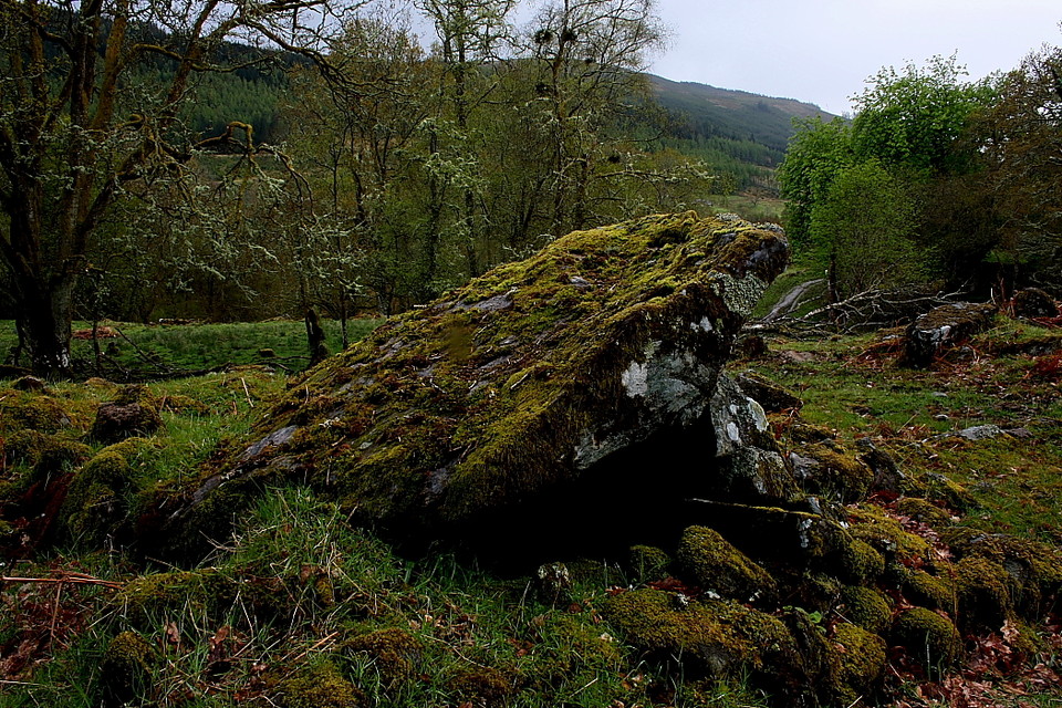
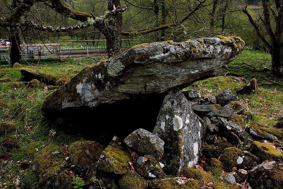
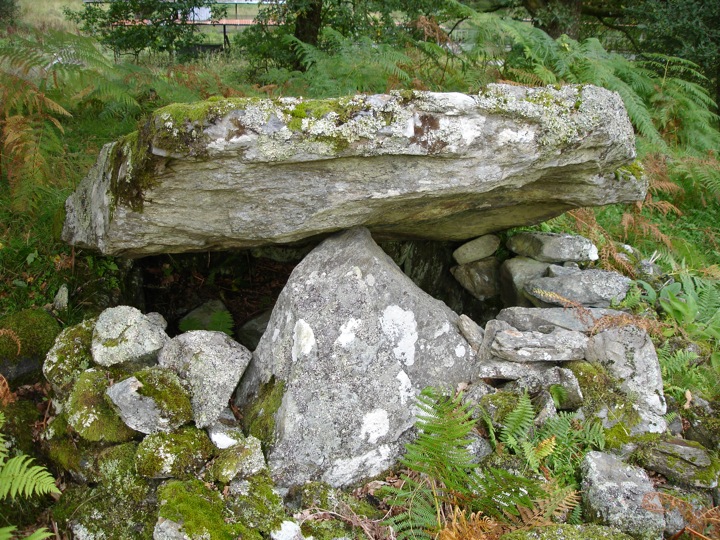
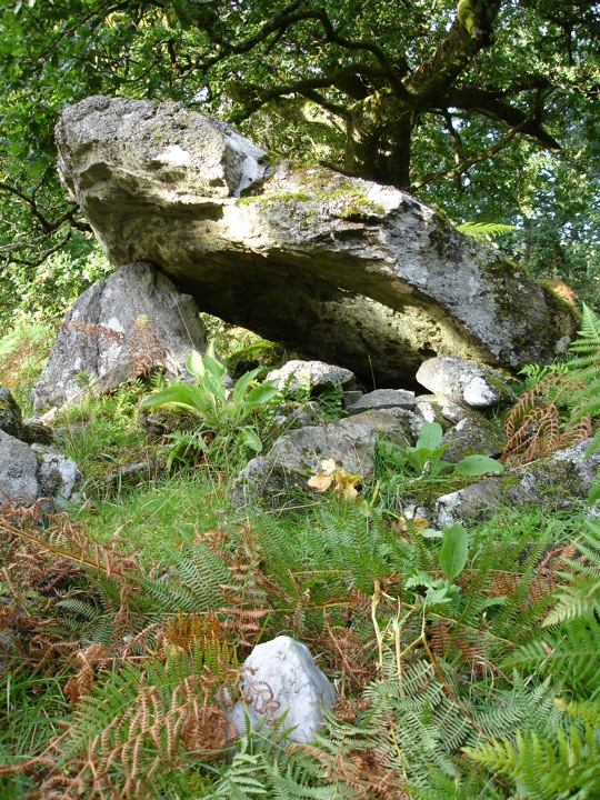
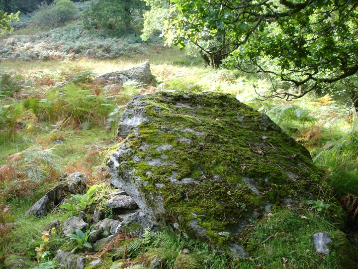
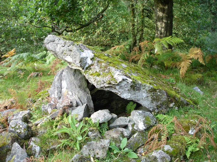
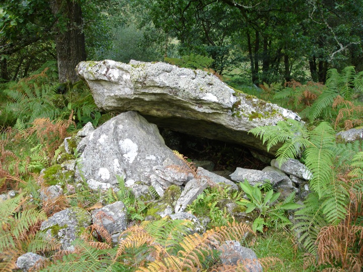
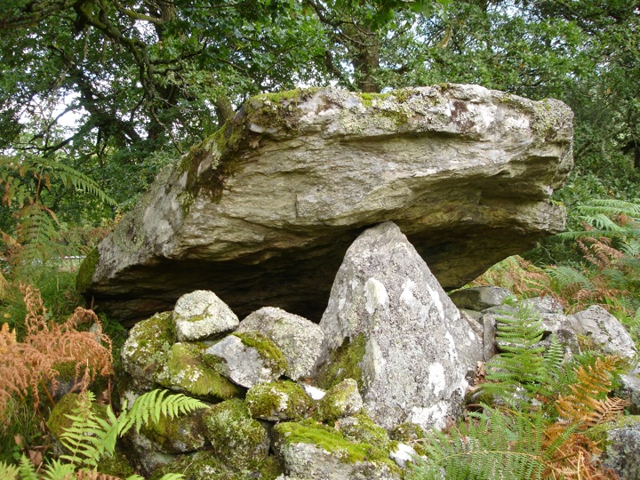
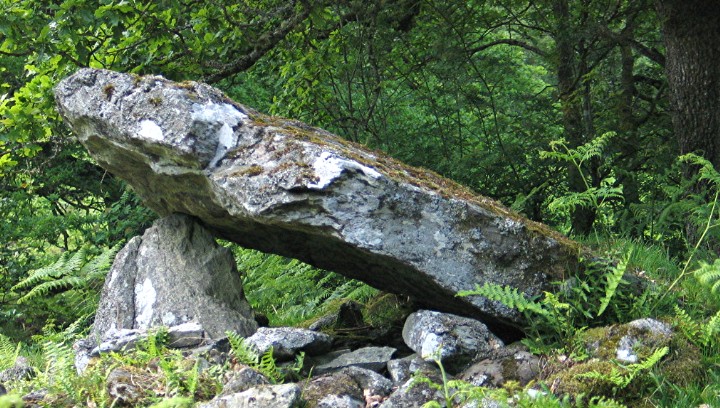
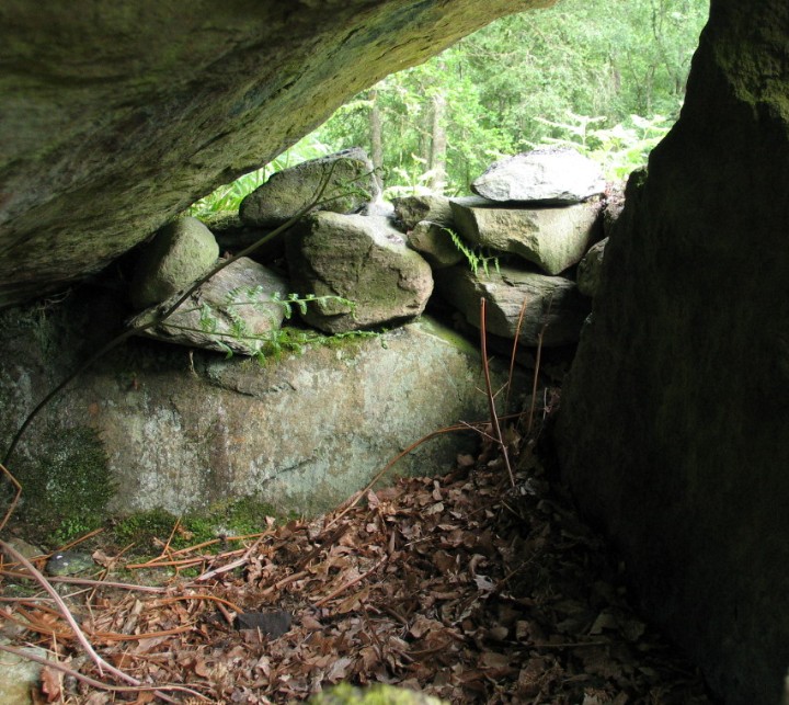
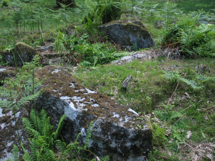
Having read the previous note, I had expected something of a challenge for the last site of the day. In the end, it was a dawdle - but I was probably lucky. There is now one of these new cycle path things running through the area (shown on new Landrangers but not on Streetmap) which may help access a little. It doesn't follow the railway line to the site but it does connect up (further SW) with the old military road which also runs past the site. I went for the railway embankment option having first parked (as recommended in the previous note, thank you) by the cottages at the N end of Balqhuidder (or Balquhidaer) Station village. The opening can be easily missed but it's right by the village name sign. It doesn't look much, but once in the whole of the old road opens up before you. Yes, I found the large gate and fence - but the gate was not padlocked. This was probably due to there being a clay pigeon shoot off the embankment but you can be sure I checked out the other way in/out over the lower fence just in case it was locked on the way back. (It wasn't even although the shooters had shot off.) The site's not bad. A standard Clyde cairn in average condition. Nothing notable about it apart from the fact that it wasn't discovered until 1980. There's a full description and plan in the link below. Visited 15 June 2004 |
 Posted by greywether
16th June 2004ce |
|
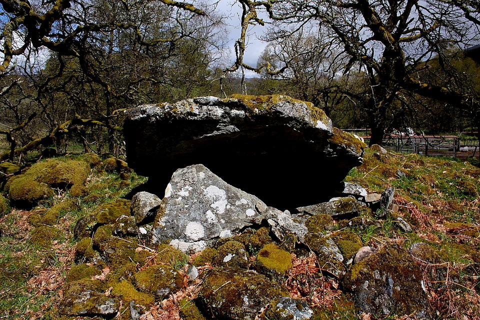
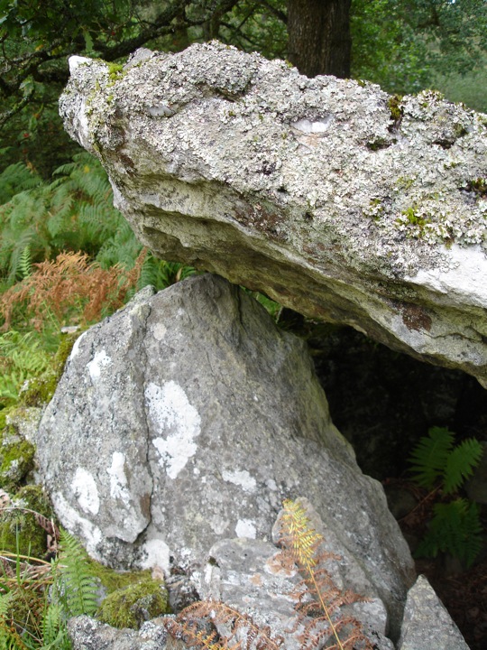
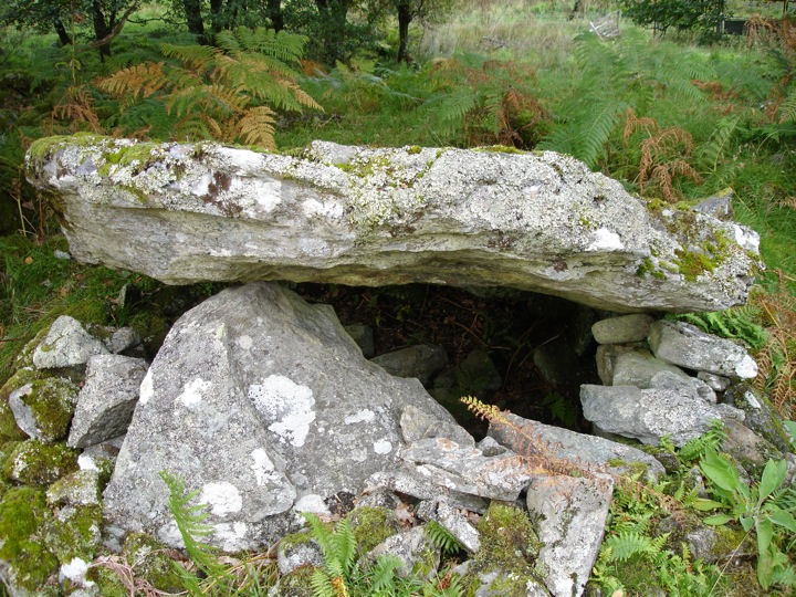
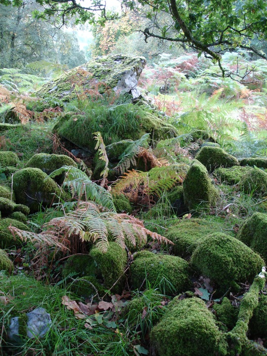
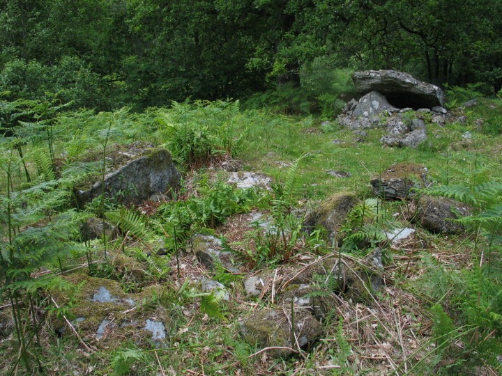
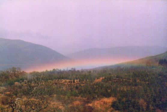
Wednesday 30 April 2003 We made an abortive approach via the lane off the A84 south of Lochearnhead to Edinchip itself, on the right when travelling south. Very unfriendly notices at an apparent dead-end with very little turning space. So we turned (carefully!) and continued down the A84. In no time we were pulling up at a little access road on the right of the A84 (still heading south) at the foot of Auchtubhmore Hill. There are a couple of very pleasant looking little cottages at the main road end of it, and access stops at a gate after around only 20 yards (guess!) or so. Map ref approx NN578212. It had stopped raining and the sun was coming out! We parked by the cottages, walked a few yards up the lane and turned right up a track that the OS map shows clearly as a path following a disused railway embankment. (Sorry, can’t remember if there’s a gate or style at the bottom of the path or what….) After a very short distance we reached the embankment and our hearts sank at the sight of an apparently very new, certainly very high, gate and fence, barring the track. It continued up the embankment and down the other side. (I don’t remember any signs by the way.) As we stood dejectedly contemplating our next move, John looked north east along the valley and pointed out that the moisture from the earlier showers was still hanging in the valley, lit by the sun. It was very pretty and lifted our spirits enough for us to become ‘philosophical’ about it. Confident statements such as ‘We’d never have found it’ and ‘It’s probably crap anyway’ were exchanged. Before turning on our heels however I nipped up the embankment ‘outside’ the fence, for a better look at the view of the misty valley. I had taken no more than a glance at the view when I realised that the construction of the accursed fence I was standing next to had been misconceived as it reached the top of the embankment. It was considerably lower than elsewhere. And fairly easily get-overable, even for a non-beanpole like me! (‘One’ hesitates to use the word ‘climbable’ of course) With a whoop of delight I summoned John. Confident that I knew exactly where we were on the map, I spent a few moments reassuring John on the ‘right-to-roam’ in Scotland and the legal ‘no-damage = no crime’ principle of which I have an in-depth knowledge (ie I read something once…). This was itself followed by a few moments reassuring the Moth underparts that they were safe from sharp, pointy, tearing, rending bits of metal. And (DEEP breath Moth) over we went. John of course just stepped over. Gangly freak. We walked for a very short time and looked again along the valley running off to our right. We both came to an immediate halt. As if a rainbow itself had drifted down to nestle in the bottom of the valley, the moisture still suspended in the air at the foot of the surrounding hills had now taken on rainbow hues! It was breathtaking! I quickly fired off a few photographs with rapid variations in exposure, depth of field and zoom. But as is so often the nature of hastily grabbed pictures of a natural lighting phenomenon, although worthwhile, they only partly capture the feeling. I’ll post one or 2 here when I have the facilities! Onwards. The (gated and locked) track that I mentioned follows along the bottom of the embankment on the left, and very soon the path along the top of the embankment (which was still clearly trodden, by the way) made its way down to the track. After following the track for around 5 or 10 minutes we were beginning to think our ‘we’d not have found it’ comments were going to come true. Some thin-ish woodland had started to develop to the left of our track and the ground there was rising to meet us as we progressed. Just as we approached some 5-6 ft high metal framey-sheltery-type structures on the left, we spotted what seemed to be one or more ‘extra-distinct’ (you know what I mean!) mounds behind them…. John spotted a big stone and we went to look. Oh yes!!! Good spot Mr Eagle-eye John!!!!! It’s a mess! But for us at least, WHAT a mess!!!! There is a special delight in a site that you’ve visited ‘on spec’ that exceeds (even low) expectations. Many of the retaining kerbstones are visible through the groundcover (or perhaps uncover?). And much of the mound is treacherous to walk on when damp because the ‘fill and cover’ stones of the mound are so near (or through) the surface. Mind your ankles! There are lots of pretty big lumps of (disturbed) partially buried stone. And yes, several bits that are unmistakably parts of a chambered cairn, most obviously a capstone still raised on one side by one of it’s supporting stones. It’s strange, I guess that to anyone who knows even a bit about burial chambers and cairns, the site was almost like a rather muddled ‘exploded’ or ‘cut-away’ diagram! The relatively tiny bit of knowledge I have left me fascinated but confident of what this site once consisted of. We liked. This post appears as part of the weblog entry Callanish via Perthshire with surprise guest stones – Part 2
|
28th June 2003ce Edited 16th July 2003ce |
Miscellaneous |
|
|
CANMORE calls it a ‘Clyde-type long chambered cairn’ and puts its overall dimensions as 56 metres long and 16 wide. Sounds about right. Full description is well written, very detailed and of course accurate, but possibly makes it sound a bit less impressive? Or perhaps not. Anyway, it’s at http://www.rcahms.gov.uk/canmore/details_gis?inumlink=24120 An aside… While writing this, at around 2am just before giving up for the day, I searched ‘Auchtubhmore Hill’ on the web, looking for info on Edinchip. The search returned various documents on the HMSO site, relating to restriction of movement, slaughter etc of possible ‘radioactive sheep’ as a result of the Chernobyl disaster. Honestly – I was afraid I’d fallen asleep and was dreaming of the person currently known on TMA as Atomic Mutton…! This post appears as part of the weblog entry Callanish via Perthshire with surprise guest stones – Part 2
|
28th June 2003ce Edited 16th July 2003ce |
Links |
|
Sustransthis site has a map of the cycle route |
Posted by BigSweetie 24th September 2006ce |
PSAS 113Short article about discovery of site. Plans and description. |
Posted by greywether 5th December 2003ce |