The Modern Antiquarian
Log in
|
Register
Home
Latest Posts
Forums
Maps
Help
Browse Sites
News
Blog
Contributors
The Books
Select
-
Belgium
Denmark
Eire
France
Germany
Greece
Italy
The Netherlands
Norway
Portugal
Republic of Malta
Spain
Sweden
Switzerland
United Kingdom
County Cork
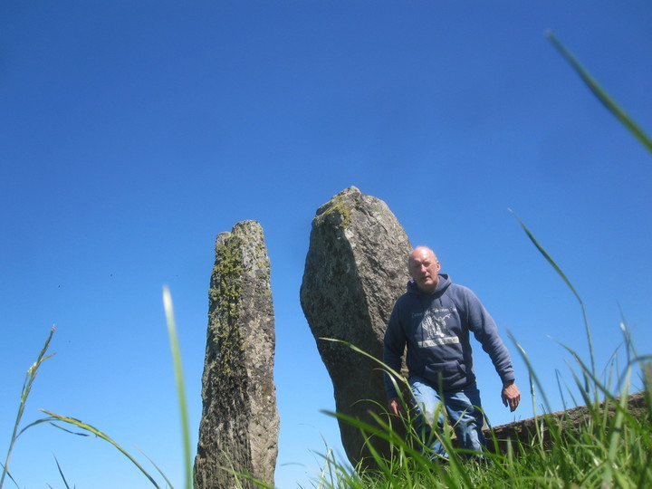
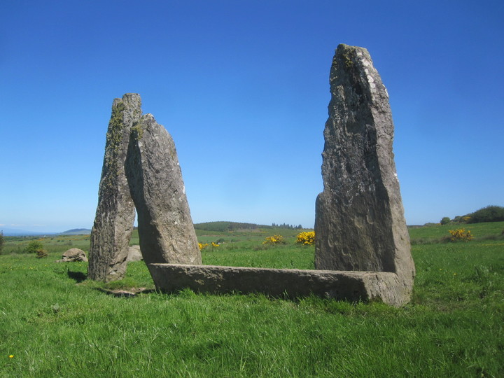
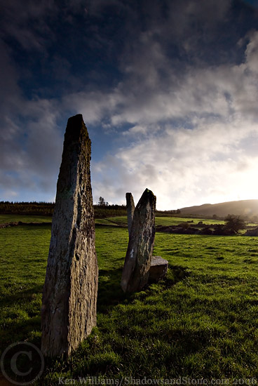
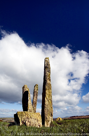
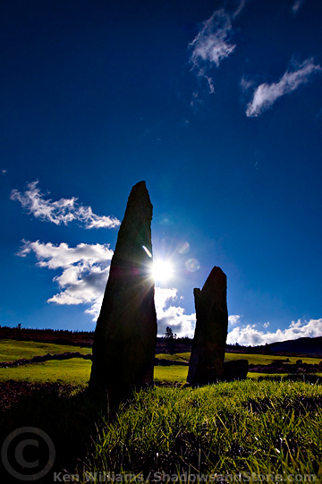
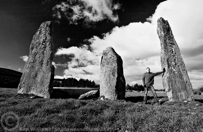
Garrane
Stone Row / Alignment
Garrane (Stone Row / Alignment) on The Modern Antiquarian, the UK & Ireland's most popular megalithic community website. 7 images, plus information on many more ancient sites nearby and across the UK & Ireland.
Image © Ken Williams/ShadowsandStone.com
Nearest Town:
Mallow (11km NNE)
OS Ref (IE):
W479911 /
Sheet: 80
Latitude:
52° 4' 10.38" N
Longitude:
8° 45' 35.53" W
Added by
FourWinds
Images (7)
0 discussions
Start a topic
Show |
Hide
Web searches for Garrane
Flickr
Google
Google Images
The Megalithic Portal
Bing
Stone Pages
Wikipedia
Show map
(inline Google Map)
- Sites within 20 km -
-
Gneeves (2.01km NW) (3 posts)
Glandine (Monkey's Bridge) (2.31km SSE) (15 posts)
Bweeng (3.65km ESE) (6 posts)
An Seisear (3.84km SSE) (14 posts)
Carrigcleena (4.46km E) (3 posts)
Nursetown Beg (4.86km ENE) (6 posts)
Gowlane North (5.43km SSE) (8 posts)
Kilmartin Lower (9.11km SSW) (1 post)
Rylane (10.4km SSW) (3 posts)
Ballyknockane (10.48km E) (2 posts)
Rylane (10.61km SSW) (5 posts)
Knockaroura (11.1km ENE) (1 post)
Maulmore (12.35km SW) (8 posts)
Island (12.36km E) (15 posts)
Oughtihery W (12.56km SW) (9 posts)
Oughtihery E (12.62km SSW) (9 posts)
Carrigagulla NE (12.91km SW) (17 posts)
Carrigagulla (13.31km SW) (20 posts)
Carrigagulla (13.44km SW) (7 posts)
Carrigagulla NE (13.52km SW) (10 posts)
Kilmaclenine (15.04km N) (8 posts)
Stone Row, partially ruined (15.51km WSW) (5 posts)
Knocknagappul (15.61km WSW) (5 posts)
Knocknagappul (15.7km SW) (3 posts)
Lios na Ratha/Loughane East (15.91km ESE) (4 posts)
Glenleigh (16.05km WSW) (3 posts)
Knockagappul 1 (16.11km SW) (5 posts)
Knockagappul 2 (16.12km WSW) (6 posts)
Knocknagappul (16.14km WSW) (2 posts)
Knocknagappul (16.14km SW) (3 posts)
Laharankeal (16.21km SSW) (1 post)
Gortdonaghmore (16.35km SE) (4 posts)
Kilberrihert large wedge tomb damaged (16.44km SW) (2 posts)
Laharankeal (16.86km SSW) (4 posts)
Loughane East (16.88km ESE) (6 posts)
Deelish (16.96km SSW) (4 posts)
Caherbaroul (17.23km SW) (7 posts)
Cloghboola Beg (18.31km WSW) (12 posts)
Knocknakilla (19.36km WSW) (24 posts)
- Add -
-
Add news
Add an image
Add fieldnotes
Add folklore
Add miscellaneous
Add a link
-
Add a site
Add a nearby facility
Add an alternative name/spelling
Images
(click to view fullsize)
Add an image