
12 April 2016 CE
12 April 2016 CE


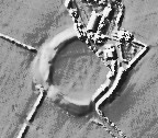
LiDAR Composite Dataset.
Contains public sector information licensed under the Open Government Licence v2.0.

The whole half a henge, they flattened half of it to build a farm house, like i needed another reason to mistrust and dislike farmers.


The Rivals of the Lleyn Peninsula occupy the central horizon.

Inside the henge is this big pile of henge material, must be, where else could it have come from.


Southern arc of the bank.

Gap in the southern arc of the bank.

Stone protrudes through the turf on the western side of the earthwork.

Approaching from Bryn Gwyn standing stones.

The site as you approach from the path.

Taken 2nd August 2003: The bank to the west of the site, with William for scale (he’s just over 1 meter tall). The gap in the bank that William is standing on appears to be ancient, but whether it’s part of the original design is anyone’s guess.

Taken 2nd August 2003: Viewed from near the modern entrance to the site, looking north west.

Yeah OK – they don’t quite match up...but it gives the idea!

Visited 8.9.12
I decided to walk across the fields from Bryn-Gwyn stone circle to the Henge as it is only a short walk and it was a nice sunny day. While crossing the farm drive I met the farmer who was busy cutting his grass. I smiled and waved and carried on my way.
All was well until I reached the stile which gives access to the field in which the Henge stands. Between me and the stile was a herd of cows who (for some reason) insisted on standing in front of the stile! Undeterred (after all this is a CADW site) I pushed my way between the cows that stubbornly refused to budge. I was soon over the stile and away from my bovine friends.
The Henge itself is pretty well preserved with the bank still about 1.5m high in places.
Pity about the house virtually in the middle of the Henge!
It’s not too often you get to visit a Henge and this is a good one.
Nice views over to Snowdonia.
Visited 31st December 2011
A henge before breakfast! Just across the field from the Bryn Gwyn stones, the cold light of a December dawn illuminates the horizon as I sit on the embankment to write my fieldnotes. The bank remains satisfyingly large, with a clearly visible entranceway. Castell Bryn-Gwyn has been cut in half though and a small farmhouse hunkers within its precincts, which make you feel a bit like an intruder, as if you are sat in someones garden!
I wonder about the links between the nearby Bryn Gwyn Tre’r Drwy stones, and whether the whole area was part of a larger ritual complex, certainly standing on the bank the stones are visible to the south-west. It’s peaceful here, magical in the early morning light.
Bryn Gwyn means ‘Gwyn’s Hill’ (or possibly it could be ‘Blessed’ hill, since the name Gywn means blessed) and I wonder if there are any folkloric associations with Gwyn ap Nudd here? I’ve not come across any, but it’s something I’ll look into. I certainly seem to have lost time whilst sitting in the henge, as if the Twywth Teg were around, half an hour having passed like five minutes!
Visited 2nd August 2003: We went on to Castell Bryn-Gwyn after Bryn-Gwyn Tre’r Dryw, by which time the sun had come out again. It was lunch time, so we had a picnic on top of one of the banks. After the food William and I played rolling down the bank. This is a great place to hang out, and I’d recommend it as a picnic spot.
The remaining bank and ditch of a henge, a farm has been built on the rest....monstrous views into Snowdonia
The Cadw sign at the entrance to Castell Bryn-Gwyn says,
The nature of this site is uncertain although it may have originally been a religious sanctuary. The earliest bank and ditch belong to the end of the neolithic period (2500-2000 BC) but the site was re-occupied and fortified in Roman times and later.
On the ground it’s easy to see why everyone is so cagey about defining this site.


