|
|

|
|
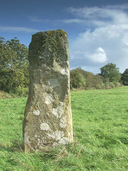
King's MountainStanding Stone / Menhir
|
|
|
|
Images (click to view fullsize) |
|


|
Fieldnotes |
|
|
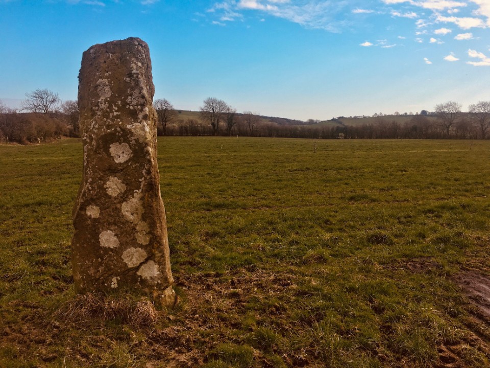
Nearly 15 years since I last visited here. The residents of the house to the right at the bottom of the lane that leads to the stone are as friendly as I remember. That last time I had met the farmer and his son in the field and they were more than happy, proud even, to let me have a look at the stone. This is well worth checking out if you're in the vicinity at Loughcrew about 4 kms to the south-west. The stone most probably came from a destroyed passage tomb in the locality. It would probably be worthwhile examining and surveying the ditches and hedgerows nearby and I would if I lived locally. |
 Posted by ryaner
8th March 2021ce |
| This is well worth checking out. Don't attempt to drive up the track marked on OS sheet 42 - park on the road at the bottom and walk the 200 metres up to the stone. The field had just been harvested the day we were there, 6/7/06. |
Posted by ryaner 7th July 2006ce |
Miscellaneous |
|
|
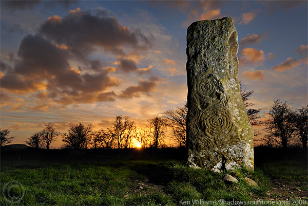
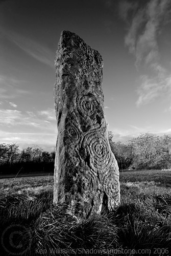
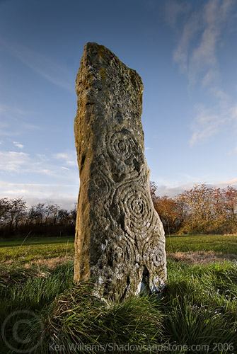
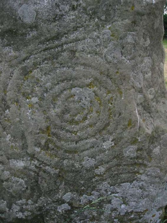
The SMR record at archaeology.ie: Class: Passage tomb art Townland: KINGSMOUNTAIN (Kells Upper By.) Scheduled for inclusion in the next revision of the RMP: Yes Description: Described by Eogan (2000) as follows: ‘According to Conwell (1873, 14) a mound existed at this site up to a few years previously when it was removed by the land owner and the material spread over the field as top dressing. This implies that the mound was of earth. The stone was in the centre of the mound and it is stated that it covered a chamber that was constructed from flag stones; these were smaller than the decorated stone. However, the size and shape of the decorated stone suggests that it was an orthostat rather than a capstone. To-day the decorated surface faces in a southerly direction, but as the stone has been re-erected, its original orientation is not known, nor can it be assumed that it was re-erected the correct way up. The chamber contained bones “all of which have disappeared”. The stone, rectangular in cross-section, is slightly over 2m in height and measures 0.85m in length at the base. The material is sandstone, the surface being uneven and flaked in places. Professor Phillips reports that “this stone is composed of well sorted cross-bedded quartz sandstone with a few circular calcareous concretions. This rock is of Lower Carboniferous age and could have been quarried in the Oldcastle area to the west.” The decoration is confined to the lower half of one of the two broad faces where it occupies virtually the entire surface. The motifs consist almost entirely of spirals. These are six in number. The bottom two are anti-clockwise; the remainder are clockwise. There are three main spirals and these extend diagonally along the face from top to bottom. The uppermost spiral is of four turns but portion of the top is now missing. At its base there are two sagging lines; perhaps these are all that remain of two further members. To its upper left there are traces of a curvilinear motif. The middle spiral consists of seven turns. The bottom example has five turns. It has been damaged due to the removal of part of the stone's surface, especially on the right hand side. To the left of the central spiral there are three further spirals, but smaller and not so well preserved. That on the top has four turns; the middle has three and the bottom possibly five. To the bottom right of the large uppermost spiral there are two further lines. These are parallel and almost vertical. Between the outermost one and the edge there appears to be same slight depressions, possibly pickmarks.’ (Moore 1987, no. 26; Herity 1974, 244; Shee Twohig 1981, 224-5; Eogan 2000, 4-6) Compiled by: Paul Walsh Date of upload: 21 April 2015 References: 1. Eogan, G. 2000 A group of Megalithic monuments at Kingsmountain - Clonasillagh, Co. Meath, Ríocht na Mídhe, 11, 1016. 2. Herity, M. 1974 Irish Passage Graves. Dublin. Irish University Press. 3. Moore, M. 1987 Archaeological inventory of county Meath. Dublin. Stationery Office. 4. Shee Twohig, E. 1981 The Megalithic Art of Western Europe. Oxford, Clarendon Press |
Posted by ryaner 8th March 2021ce |