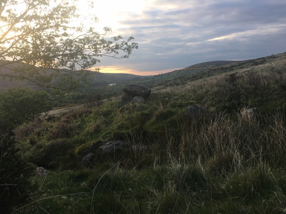
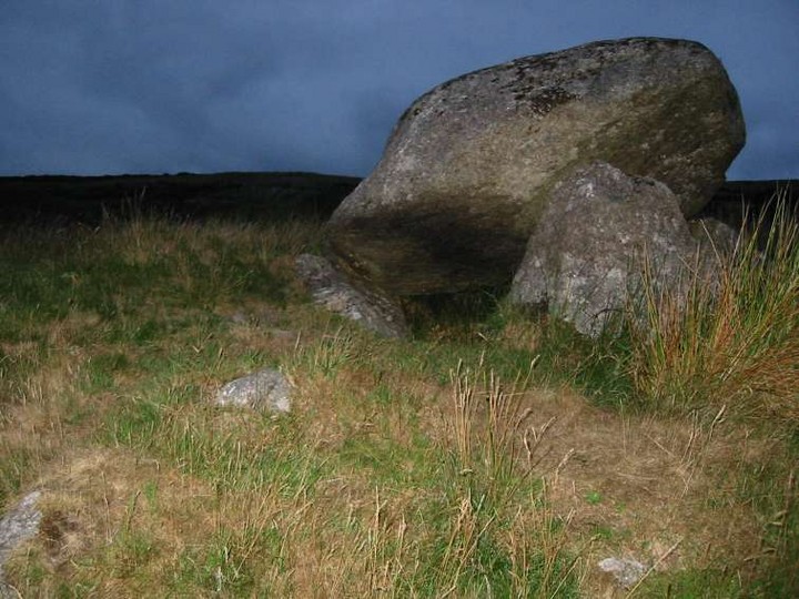
Cabin fever struck around 8pm last evening so I made a quick dash for the Shed Stone, slightly beyond the 5 kms limit set by the powers that be (6 on the odometer), but still a local monument. It is quite hard to believe that it's been 14 years since I was last here.
There's a parking space on the Upper Cunard Road, south after the brook (Trumandoo?) that you must follow to reach the 'tomb'. I parked here, changed into my boots and headed down. The first time I was here (taken to it by Fourwinds - it's not marked on the map) I'd gotten my feet soaked, the boggy ground of Glassamucky Brakes/Cunard unforgiving in Spring, but not today. The recent good weather made for easy hiking.
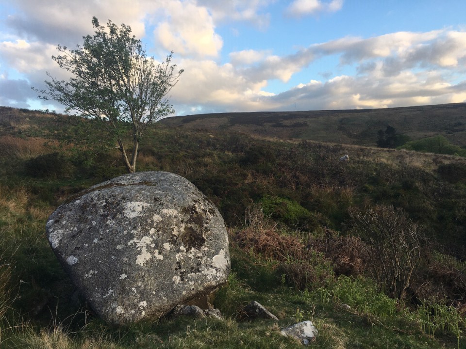
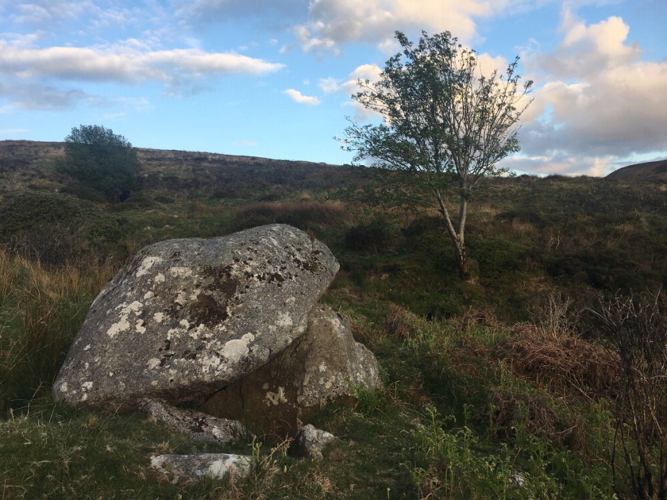
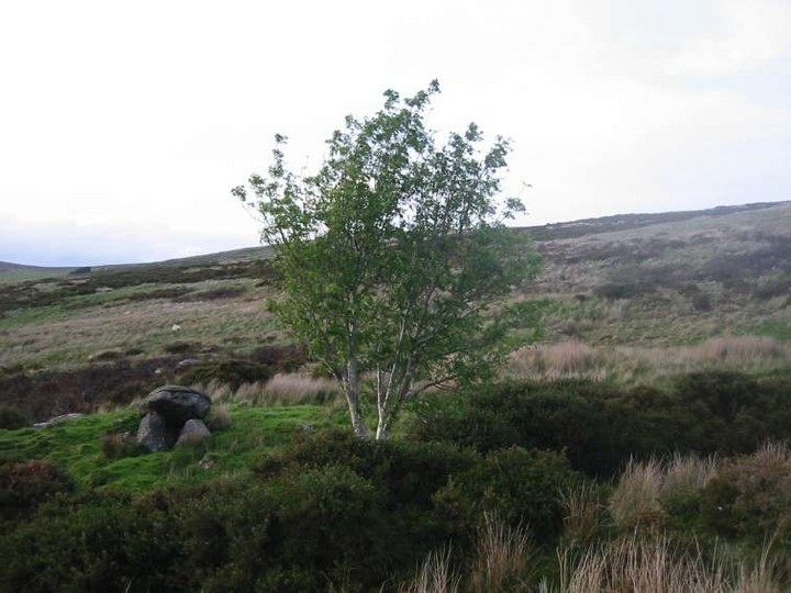
The monument is hidden from the road, maybe 350 metres down and on the northside of the brook. The beauty of the location, so close to the city, brings a gladness to the heart. And it's ultra-quiet now, a few sheep farmers hereabouts tending to their essential work. There's deer on the Brakes tonight, venturing further down the Dodder valley than might normally be their wont.
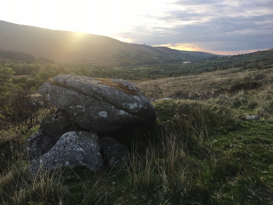
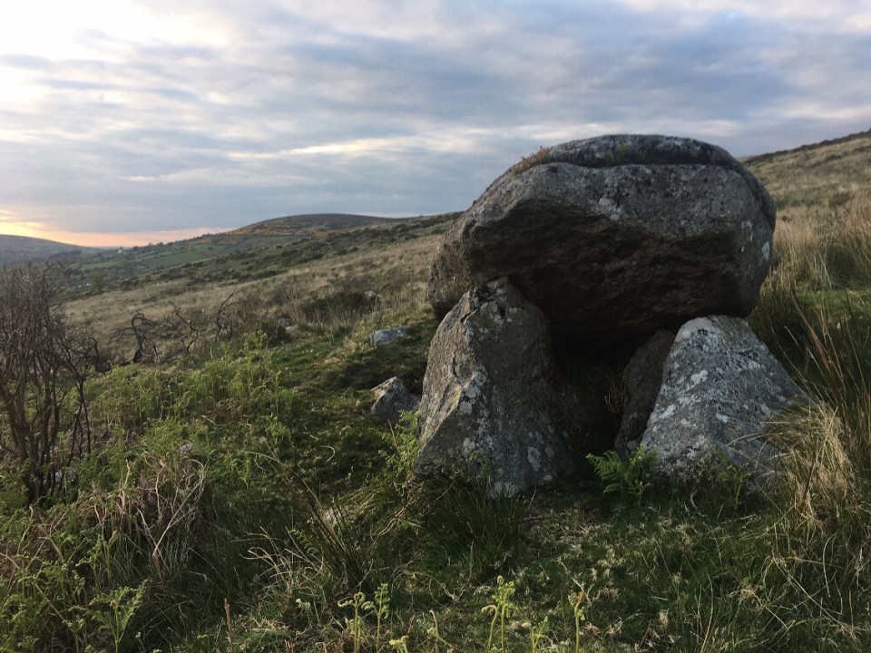
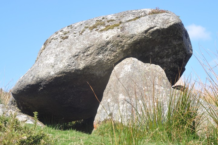
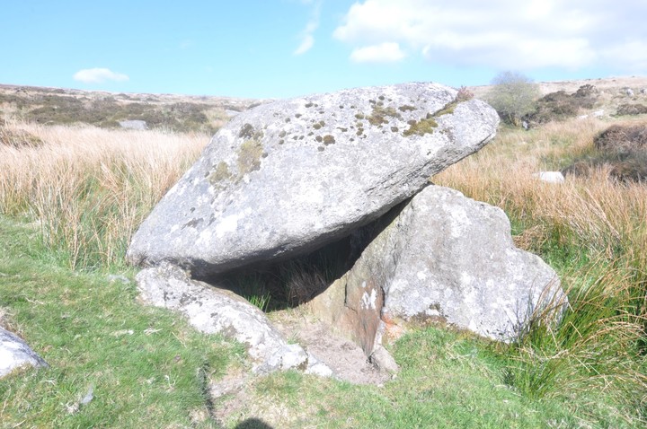
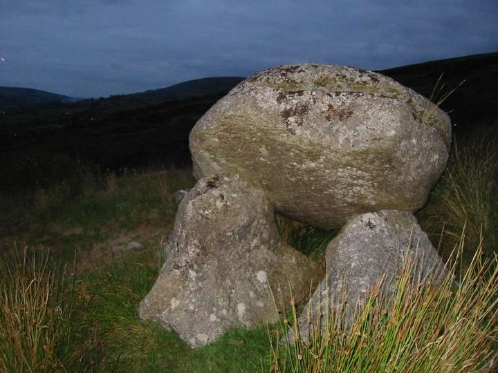
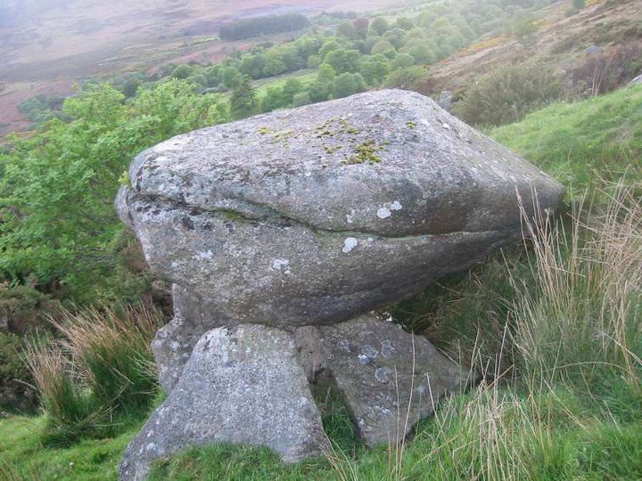
And then to the stone. It's nestled above the brook on what seems like a levelled out platform, but there are a few of these on the way down and they may be natural. In fact, everything about the Shed Stone may be natural. The debate is still ongoing as to whether this is a tomb at all. The supposed entrance faces roughly south, towards the brook that babbles not 5 metres away, portal tombs and water being a generally accepted conjunction.
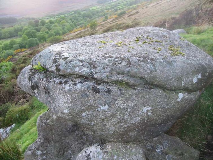
The capstone rests on two of the three stones beneath it. Healy says that these are three pieces of the one stone, split by the weight of the glacial erratic capstone, and I can see why he believes that. However, the underside of this capstone seems to have been worked to flatten it, though not into one sheer plane; there are two sections, the major one towards the ‘front’ of the stone. The rear of the ‘capstone’ rests on a fourth stone. There is the possibility that this small arrangement of stones were in situ and then the ‘capstone’ was placed on top of them, the assemblage being some sort of ritual monument and not a tomb. Maybe a fanciful theory, but an explanation for the working of the underside of the ‘capstone’. The natural groove around the ‘front’ of the ‘capstone’ adds to the theory that this stone was chosen, as opposed to to it being an accident of nature.
I spent a while here, drinking in the place. The colour of the day was leeching out as I headed back up to the road. Deer were heading south above me, back to the wilder hinterlands of Dublin county, and then the sun broke out over the back of Ballymorefinn, lighting up the hillside in an orange glow and I didn’t want the day to end. And then it was back to ‘civilisation’, and TVs and laptops, and pandemics.
From Glenasmole Roads, by Patrick Healy, published by South Dublin Libraries (copyright 2006 Local Studies Section South Dublin Libraries)
The Shed Stone
The Dodder flows along the eastern boundary of the demesne where it is joined by a small stream coming down from the Featherbed Bog. On the northern bank of this stream, at a point 300 yards up from the Dodder, is a large rock raised up on three smaller ones, known locally as the Shed Stone and said to mark the position of buried treasure. (MacNeill and Dix. "Dolmen at Glenasmole", J.R.S.A.I. 1926, p. 122-123) Although this has the general appearance of a prehistoric dolmen or portal tomb, it is obvious on close examination that the supporting stones are actually three pieces of one stone which must have been split by the weight of the larger one above. These fragments are not placed to form a chamber or enclosure which is one of the chief characteristics of a prehistoric burial place. It would appear therefore that the unusual arrangement of these stones is entirely fortuitous. The height is about 4 feet.


 Posted by ryaner