It may be only a 4 mile walk there and back to the Brockloch Fell Cairn, however its location in an isolated forest surrounded by difficult terrain make this a nightmare to find. Wellies are essential for a burn crossing and GPS navigation strongly recommended. There were several trees partially blocking access on the forest track and narrow forest lane on my visit. My route can be followed on Brockloch Fell Cairn.
Directions to Brockloch Fell Cairn: The access to the cairn is complicated by the construction of a nearby windfarm which may cause future restrictions. The following route is currently open: Take the unsigned New Luce turn off the straight on the A77 at NX 08557 63769, c. 0.3 miles N of the A751 Innermessan junction. There are traffic cones on the road restricting it to one lane. Follow this road for c. 5.3 miles to reach the disused Penwhirn Filter Station. Continue past the Penwhirn houses for c. 200 yards to a dead-end single track left turn over a bridge. This is the road to Lagafater Lodge. Take this road for c. 1 mile to reach Darnigap Farm. A track leading W into forestry starts opposite Dalnigap Farm. It is possible to park 50 yards up this track. The track runs for c. 1.2 miles through the trees. Follow this track on bike or foot to reach the dead-end. The track becomes a forest ride which is boggy underfoot. Follow this NW for 0.3 miles to reach a forest lane heading SW. Take the narrow grassy lane for c. 0.2 mile to reach open moorland. Head W across boggy ground, crossing a burn, towards a corner in the forest at NX 1105 7096. Follow the forest edge SW for c. 300 yards then head S for c. 50 yards into replanted forestry to a stony cairn surrounded by small trees.
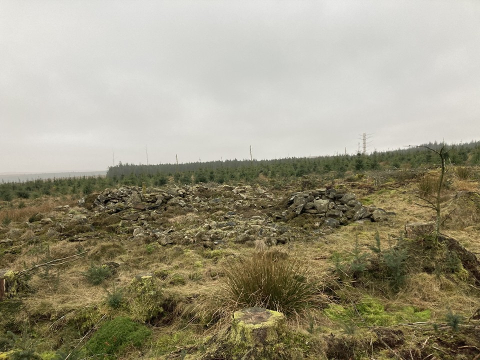
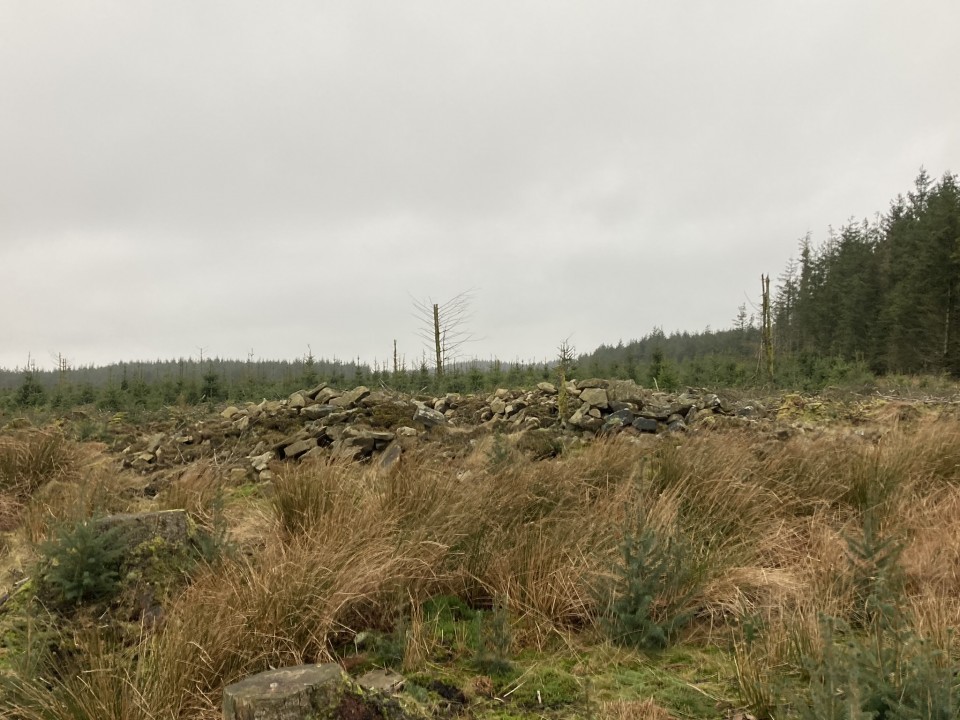
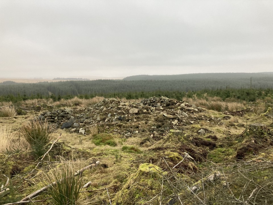
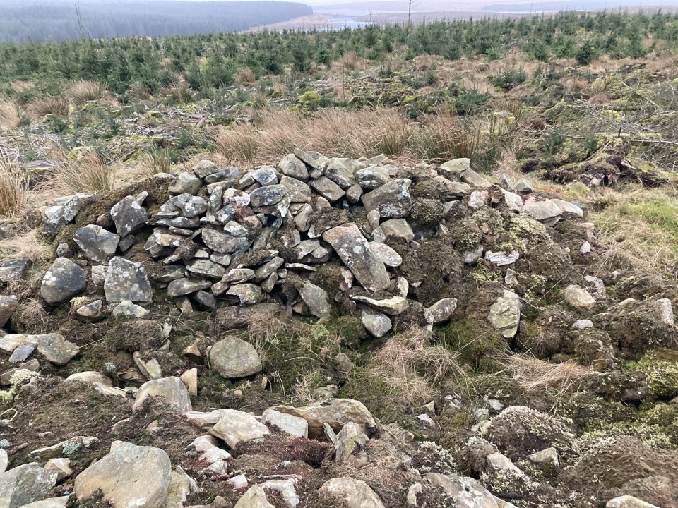
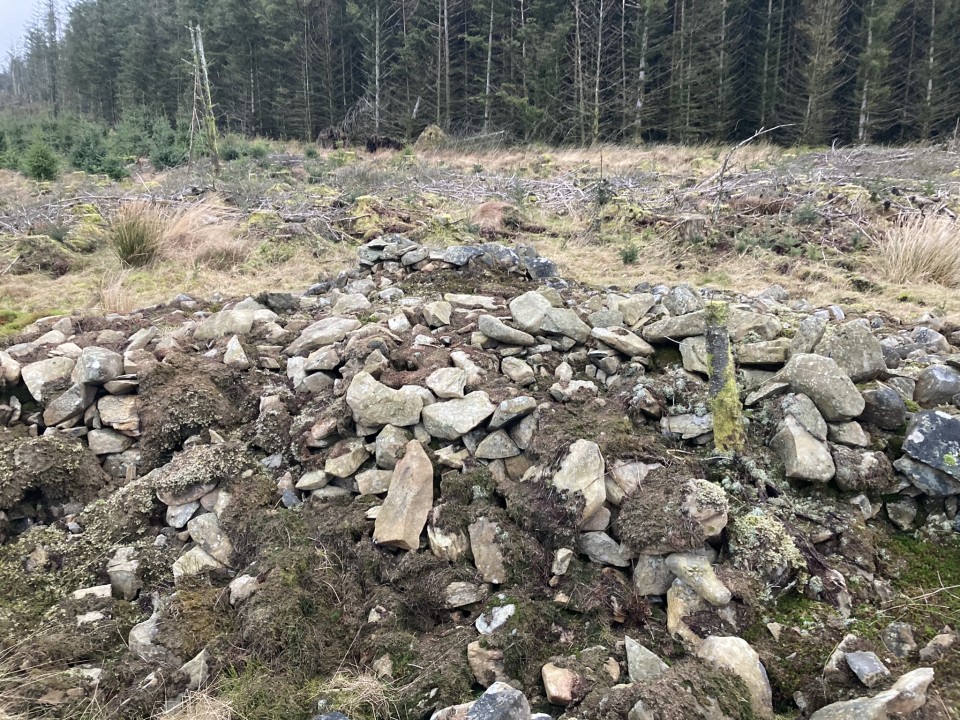
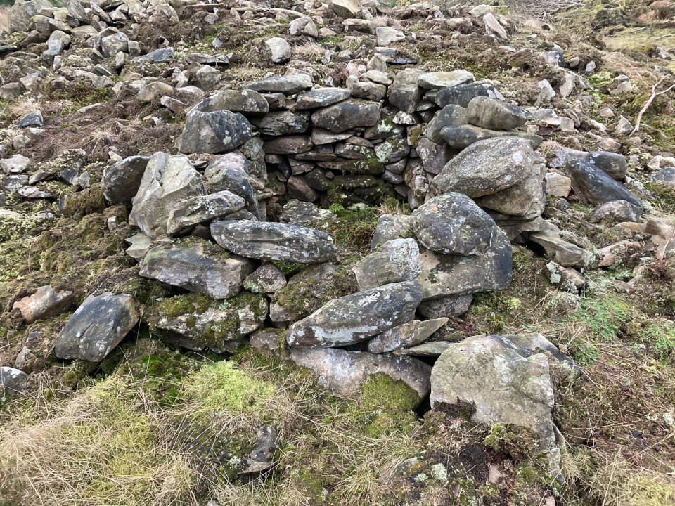
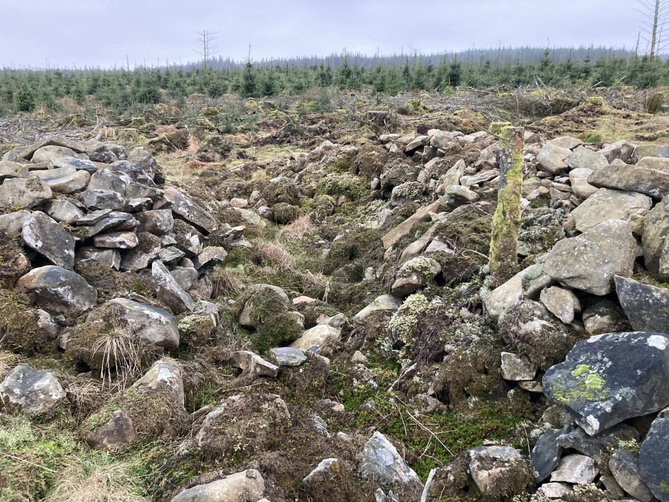
Brockloch Fell Cairn is a round stony mound in replanted forestry c. 1 mile NW of Penwhirn Reservoir in Dumfries and Galloway. The cairn, measuring c. 39 feet in diameter and 4 feet high, is surrounded by small trees. A small stone enclosure has been constructed on the NW perimeter and a trench has been excavated along the NE-SW axis bisecting the mound. Further details of the site are available on Canmore ID 61880.