The Modern Antiquarian. Stone Circles, Ancient Sites, Neolithic Monuments, Ancient Monuments, Prehistoric Sites, Megalithic MysteriesThe Modern Antiquarian


Galla Hill

Ancient Village / Settlement / Misc. Earthwork

<b>Galla Hill</b>Posted by markj99Image © Mark Johnstone
Nearest Town:Stranraer (3km W)
OS Ref (GB):   NX09205941 / Sheet: 82
Latitude:54° 53' 34.07" N
Longitude:   4° 58' 31.92" W

Added by markj99


Discussion Topics0 discussions
Start a topic


Show map   (inline Google Map)

Images (click to view fullsize)

Add an image Add an image
<b>Galla Hill</b>Posted by markj99 <b>Galla Hill</b>Posted by markj99 <b>Galla Hill</b>Posted by markj99 <b>Galla Hill</b>Posted by markj99

Fieldnotes

Add fieldnotes Add fieldnotes
Visited 16.10.22

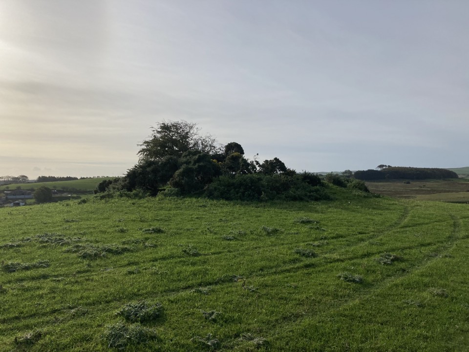
Galla Hill mound is a low earthwork c. 2 miles W of Stranraer. The round mound measures c. 12 yards in diameter and 1 yard high. The grassy surface, obscured by gorse bushes, has no visible stones. Canmore ID 60554 (go to Links) suggests that this may be a barrow with concentric ditches visible on aerial photography.
Posted by markj99
17th October 2022ce

Miscellaneous

Add miscellaneous Add miscellaneous
Directions to Galla Hill: Take the road for Blackparks Industrial Estate from the A75 on the W edge of Stranraer. After c. 300 yards take the unsigned left turn. After c. 1 mile park up at the junction with Culhorn House. Walk along the farm track for c. 350 yards to reach a gateway on the right. Gala Hill Mound is c. 100 yards E. Posted by markj99
17th October 2022ce
Edited 17th October 2022ce

Links

Add a link Add a link

Canmore ID 60554


Galla Hill Mound on Canmore
Posted by markj99
17th October 2022ce