The Modern Antiquarian
Log in
|
Register
Home
Latest Posts
Forums
Maps
Help
Browse Sites
News
Blog
Contributors
The Books
Select
-
Belgium
Denmark
Eire
France
Germany
Greece
Italy
The Netherlands
Norway
Portugal
Republic of Malta
Spain
Sweden
Switzerland
United Kingdom
Northern Ireland
County Tyrone
Churchtown
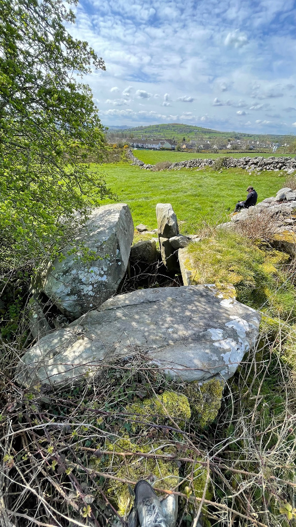
Portal Tomb
Churchtown (Portal Tomb) on The Modern Antiquarian, the UK & Ireland's most popular megalithic community website. 7 images, plus information on many more ancient sites nearby and across the UK & Ireland.
Image © ryaner
OS Ref (GB):
Latitude:
54° 42' 57.24" N
Longitude:
7° 35' 13.58" W
Added by
ryaner
Images (7)
0 discussions
Start a topic
Show |
Hide
Web searches for Churchtown
Flickr
Google
Google Images
Megalithomania
Bing
Stone Pages
Wikipedia
Show map
(inline Google Map)
- Sites within 20 km -
-
Churchtown (0.34km NE) (5 posts)
The Grey Stone, Cornashesk (6.51km W) (1 post)
Bullock Park (6.56km SSE) (5 posts)
Corradooey (6.65km W) (6 posts)
Leitrim (6.77km SW) (8 posts)
Ballyrenan (11.05km E) (27 posts)
Kimonaster Middle (12.19km N) (3 posts)
Scraghy (12.39km SSW) (8 posts)
Ally (12.91km S) (10 posts)
Scraghy (13.26km SSW) (3 posts)
Tawnydorragh (14.41km SW) (10 posts)
Glenknock or Cloghogle (14.68km ENE) (7 posts)
Glenknock/Crosh (14.75km ENE) (3 posts)
Beltany (14.92km NNW) (60 posts)
Beltany (15.22km E) (10 posts)
Crosh (15.24km ENE) (17 posts)
Dunwiley (16.49km WNW) (1 post)
Drumskinney (16.6km SSW) (26 posts)
Aghnaglarig (16.79km ENE) (2 posts)
Montiaghroe - Stone Row West (17.56km SSW) (7 posts)
Dromore Big (17.6km SW) (6 posts)
Montiaghroe - Stone Circle (17.61km SSW) (2 posts)
Montiaghroe - Stone Row East (17.67km SSW) (0 posts)
Montiaghroe (17.84km SSW) (4 posts)
Knocknahorna (19.65km NE) (4 posts)
- Add -
-
Add news
Add an image
Add fieldnotes
Add folklore
Add miscellaneous
Add a link
-
Add a site
Add a nearby facility
Add an alternative name/spelling
Images
(click to view fullsize)
Add an image
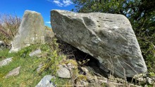 Image © ryaner