The Modern Antiquarian
Log in
|
Register
Home
Latest Posts
Forums
Maps
Help
Browse Sites
News
Blog
Contributors
The Books
Select
-
Belgium
Denmark
Eire
France
Germany
Greece
Italy
The Netherlands
Norway
Portugal
Republic of Malta
Spain
Sweden
Switzerland
United Kingdom
County Cork
Maughanaclea Centre
Stone Circle
Maughanaclea Centre (Stone Circle) on The Modern Antiquarian, the UK & Ireland's most popular megalithic community website. 7 images, plus information on many more ancient sites nearby and across the UK & Ireland.
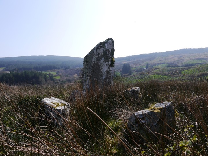
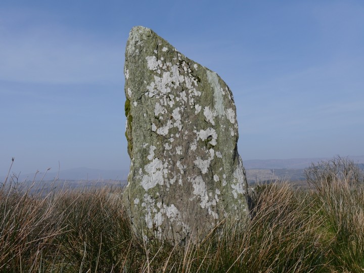
Image © Michael Mitchell
Nearest Town:
Drimoleague (11km SSE)
OS Ref (IE):
W089563 /
Sheet: 85
Latitude:
51° 45' 6.51" N
Longitude:
9° 19' 9.67" W
Added by
IronMan
Images (7)
0 discussions
Start a topic
Show |
Hide
Web searches for Maughanaclea Centre
Flickr
Google
Google Images
The Megalithic Portal
Bing
Stone Pages
Wikipedia
Show map
(inline Google Map)
- Sites within 20 km -
-
Cahermuckee (1.06km WNW) (5 posts)
Barnagowlane West (1.28km ESE) (9 posts)
Maughanaclea NE (1.5km ENE) (9 posts)
Gortnacowly (2km S) (15 posts)
Cousane (2.44km ENE) (10 posts)
Ardrah (2.61km SW) (20 posts)
Kealkil (3.48km WSW) (45 posts)
Cousane (3.61km ENE) (4 posts)
Cappaboy Beg (3.93km N) (4 posts)
Cappaboy Beg (3.94km N) (2 posts)
Breeny More (4.04km WSW) (30 posts)
Cappaboy Beg (4.07km N) (3 posts)
Cappaboy Beg (4.07km N) (2 posts)
Cappaboy Beg SE (4.17km N) (7 posts)
Derryarkane (4.51km SW) (0 posts)
Maughsilly (5km W) (1 post)
Cappaboy Beg NW (5.03km NNW) (6 posts)
Maughanasilly (5.08km W) (23 posts)
Goulacullin (5.13km E) (4 posts)
Illane (5.34km WNW) (7 posts)
Cloonygorman (6.17km SW) (3 posts)
Cappanaboul (6.29km WSW) (7 posts)
Glanbannoo Upper (6.87km SSW) (3 posts)
Shandrum Beg (6.98km WSW) (5 posts)
Glanbannoo Upper (7.07km SSW) (7 posts)
Derrynafinchin (7.25km WNW) (16 posts)
Garranes North (7.37km SE) (6 posts)
Derrynafinchin (7.43km WNW) (1 post)
Cullenagh (7.58km ESE) (11 posts)
Dooneens (7.61km NE) (4 posts)
Farnanes (7.66km E) (9 posts)
Dooneens (7.77km NNE) (9 posts)
Toughraheen (7.84km S) (1 post)
Cullenagh (7.98km E) (9 posts)
Clodagh (8.96km ESE) (19 posts)
Clodagh Row (8.96km ESE) (12 posts)
Borlin Valley Standing Stone (9.53km NW) (7 posts)
Gortnascreeny (9.66km S) (5 posts)
Trawlebane (9.69km SSW) (15 posts)
Western Pap (9.86km NNE) (9 posts)
Mill Little (9.87km W) (28 posts)
Trawlebane 1 (9.87km SSW) (7 posts)
Derrynacaheragh (9.99km E) (2 posts)
Inchireagh (10.06km ENE) (11 posts)
Gortafludig (10.51km N) (0 posts)
Trawlebane 2 (10.52km SW) (5 posts)
Shronacarton (10.55km ESE) (6 posts)
Dromore School (11km SSW) (3 posts)
Inchybegga (11.16km SSW) (2 posts)
Coolmountain (11.2km ENE) (7 posts)
Baurgorm (11.46km SW) (11 posts)
Inchinanagh (11.52km NW) (6 posts)
Knocknaveagh (11.74km SW) (4 posts)
An Screathan Mór (12km NNE) (3 posts)
Cullomane (12.05km SSW) (10 posts)
Cullomane East (12.1km SSW) (4 posts)
Cullomane East (12.14km SSW) (3 posts)
Cullomane East (12.28km SSW) (7 posts)
Cullomane East (12.28km SSW) (3 posts)
Cullomane East (12.28km SSW) (6 posts)
Baurnahulla (12.28km SE) (3 posts)
Keamcorravooly (12.35km NNE) (11 posts)
Keamcorravooly (12.44km NNE) (4 posts)
Currahy (12.6km NE) (4 posts)
Cullomane West (12.62km SW) (10 posts)
Baurgorm SW (12.65km SW) (1 post)
Scartbaun (12.92km SW) (5 posts)
Derreengreanagh (13.15km SW) (11 posts)
Derrynasafagh (13.19km E) (3 posts)
Farrannahineeny (13.2km ENE) (16 posts)
Scartbaun (13.51km SW) (1 post)
Grousemount (13.95km N) (3 posts)
Caherogullane (13.95km SSW) (5 posts)
Gorteennakilla (14.05km NNE) (6 posts)
Turnaspidogy (14.32km NE) (8 posts)
Feaghna (14.33km W) (10 posts)
Dunmanway North (14.33km E) (5 posts)
Dromourneen (14.49km SSW) (2 posts)
Keilnascarta NW (14.64km SW) (6 posts)
Keilnascarta (14.72km SW) (5 posts)
Beach (14.72km SW) (1 post)
Inchincurka (14.74km ENE) (15 posts)
Keilnascarta SE (14.79km SW) (5 posts)
Cullaba Lake (15.11km WNW) (5 posts)
Parkana (15.17km SW) (3 posts)
Lissangle (15.2km SSE) (5 posts)
Canrooska (15.41km W) (25 posts)
Dromclogh (15.63km SW) (5 posts)
Gurteen (15.7km WNW) (12 posts)
Barraboy Mountain (15.7km W) (3 posts)
Barraboy Mountain (15.7km W) (4 posts)
Barraboy Mountain N (15.8km W) (6 posts)
Barraboy Mountain S (15.8km W) (9 posts)
Maulinward (15.85km SW) (6 posts)
Maulinward (15.85km SW) (6 posts)
Gurteen (15.87km WNW) (24 posts)
Milleens (16.13km W) (3 posts)
Milleens (16.16km W) (4 posts)
Crossterry East (16.61km W) (7 posts)
Ballyhalwick (16.77km E) (3 posts)
Reavouler (16.8km ESE) (14 posts)
Ballycommane (16.96km SW) (2 posts)
Ballycommane (16.96km SW) (3 posts)
Nedinagh West (17.21km E) (3 posts)
Garryglass (17.32km ESE) (3 posts)
Garrygalss (17.35km ESE) (0 posts)
Bawnishall (17.49km SSE) (3 posts)
Derrynacoolagh (17.8km W) (2 posts)
Rooska East (18.29km SW) (6 posts)
Lack More (18.44km NE) (9 posts)
Cappaghmore (18.6km SSW) (6 posts)
Behagullane (18.65km ENE) (1 post)
Derryfineen (18.77km NE) (5 posts)
Derryfineen (18.85km NNE) (6 posts)
Ballybane (The Rock of the Rings) (18.95km SSW) (4 posts)
Ballybane West NW (19.08km SSW) (5 posts)
Toom (19.55km E) (4 posts)
Killinga (19.6km ESE) (6 posts)
Lumnagh More (19.77km NNE) (0 posts)
Skeagh (19.85km S) (3 posts)
Lettergorman (North) (19.88km E) (25 posts)
Knockanereagh (19.98km ENE) (8 posts)
- Add -
-
Add news
Add an image
Add fieldnotes
Add folklore
Add miscellaneous
Add a link
-
Add a site
Add a nearby facility
Add an alternative name/spelling
Images
(click to view fullsize)
Add an image
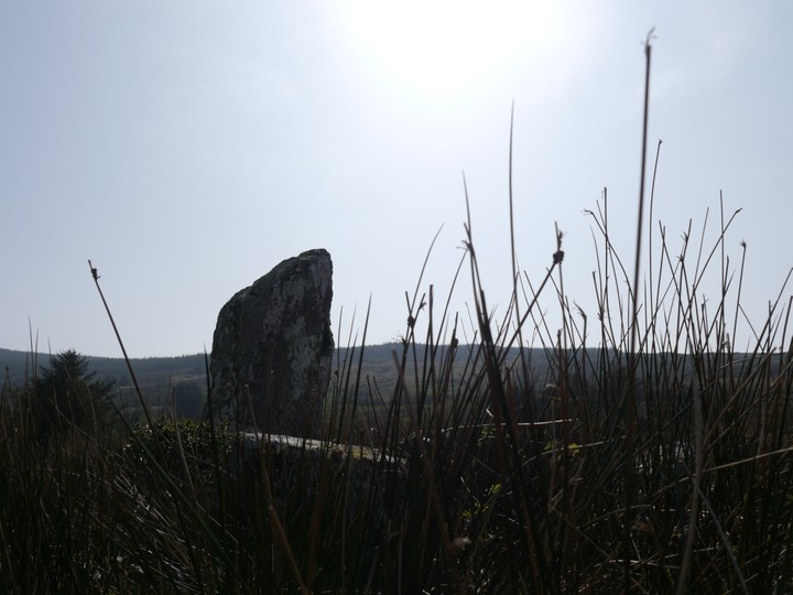
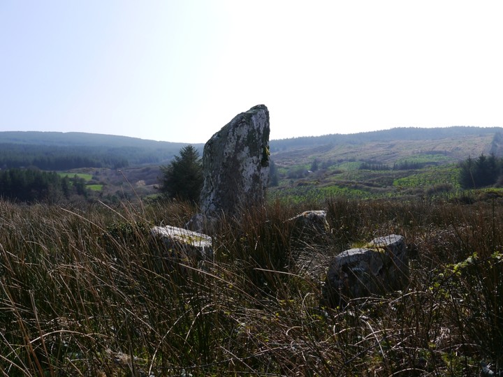
 Image © Michael Mitchell
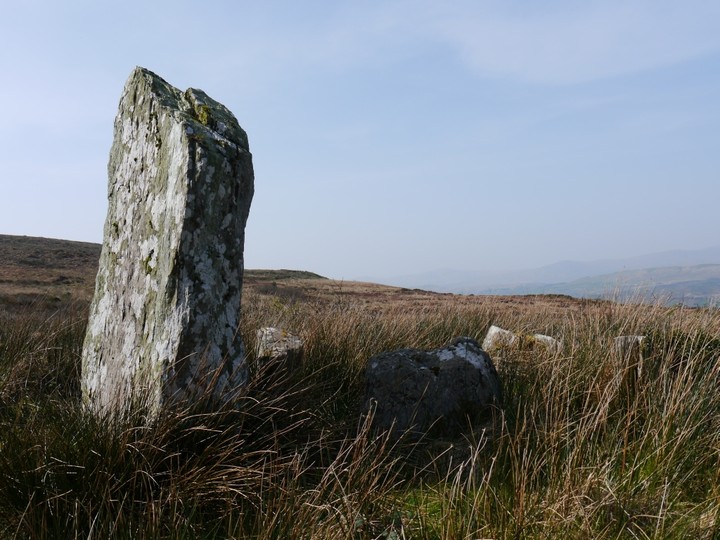
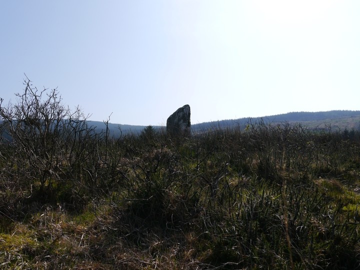