The Modern Antiquarian
Log in
|
Register
Home
Latest Posts
Forums
Maps
Help
Browse Sites
News
Blog
Contributors
The Books
Select
-
Belgium
Denmark
Eire
France
Germany
Greece
Italy
The Netherlands
Norway
Portugal
Republic of Malta
Spain
Sweden
Switzerland
United Kingdom
County Waterford
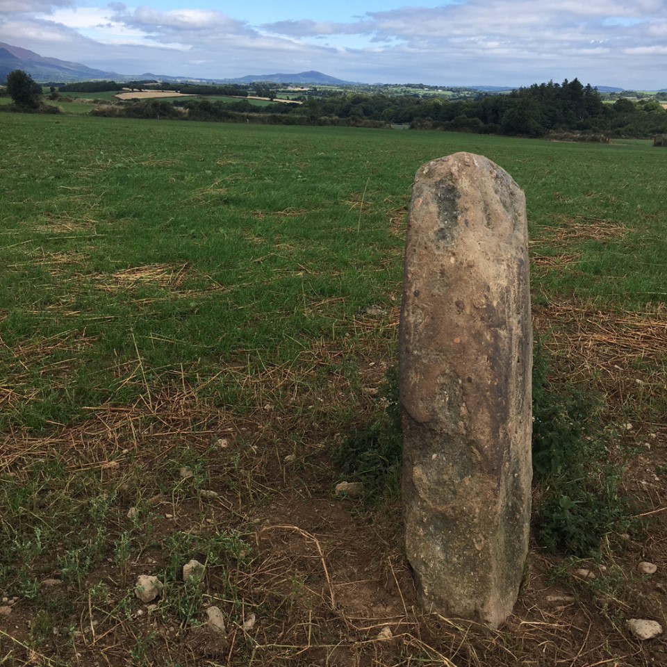
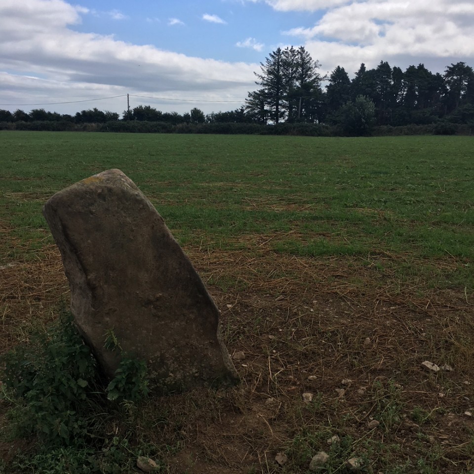
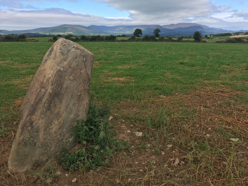
Sheshkin (near Stradbally)
Standing Stone / Menhir
Sheshkin (near Stradbally) (Standing Stone / Menhir) on The Modern Antiquarian, the UK & Ireland's most popular megalithic community website. 4 images, plus information on many more ancient sites nearby and across the UK & Ireland.
Image © ryaner
Nearest Town:
Dungarvan (9km WSW)
OS Ref (IE):
X346964 /
Sheet: 82
Latitude:
52° 7' 6.74" N
Longitude:
7° 29' 41.33" W
Added by
ryaner
Images (4)
0 discussions
Start a topic
Show |
Hide
Web searches for Sheshkin (near Stradbally)
Flickr
Google
Google Images
The Megalithic Portal
Bing
Stone Pages
Wikipedia
Show map
(inline Google Map)
- Sites within 20 km -
-
Ballyvoyle (0.1km S) (1 post)
Clogh Leabhrais (3.19km NW) (1 post)
Carrigmoorna (4.96km WNW) (2 posts)
Drumlohan (5.28km NNE) (12 posts)
Treenearla Commons (9.11km WNW) (3 posts)
Treenearla Commons (9.18km WNW) (3 posts)
Treenearla Commons (9.22km WNW) (5 posts)
Bohadoon Mountain (9.85km W) (4 posts)
Coumeraglinmountain South Barrow (10.98km WNW) (0 posts)
Coumeraglinmountain SW (11.05km WNW) (0 posts)
Monavullagh Standing Stone (11.2km WNW) (4 posts)
Coumeraglinmountain Standing Stone (S) (11.23km WNW) (0 posts)
Coumeraglinmountain Cairns (11.28km WNW) (0 posts)
Coumeraglinmountain Standing Stone (N) (11.3km WNW) (0 posts)
Coumeraglinmountain NE (11.37km WNW) (0 posts)
Coumeraglinmountain North Barrow (11.5km WNW) (0 posts)
Kealfoun (11.58km N) (0 posts)
Monavullagh South Cairn (11.85km WNW) (0 posts)
Coumeraglinmountain Megalithic Tomb (unclassified) (11.97km W) (8 posts)
Poul-na-maddra-ruadh (11.99km WNW) (3 posts)
Poul-na-maddra-ruadh (12.62km WNW) (3 posts)
Scartnadriny (12.63km WNW) (0 posts)
Monavullagh Central Cairn (12.68km WNW) (0 posts)
Kilbarrymeaden (12.89km ENE) (5 posts)
Monavullagh North Cairn (13.18km WNW) (0 posts)
Rathmaiden (13.4km NNE) (0 posts)
Castlecraddock (14.13km ENE) (0 posts)
Savagetown (14.13km ENE) (4 posts)
Ballynamona Lower (14.16km SSW) (18 posts)
Savagetown (14.49km ENE) (0 posts)
Ballyhussa (14.54km NE) (0 posts)
Croughaun Hill (14.97km N) (0 posts)
Knockboy (15.41km WNW) (0 posts)
Lissahane (15.46km NE) (0 posts)
Woodstown (15.47km ENE) (2 posts)
Coolnahorna (16.13km N) (0 posts)
Ballynageeragh (16.28km ENE) (19 posts)
Dunhill (16.87km ENE) (12 posts)
Glenaphuca (16.96km NNE) (0 posts)
Carrigeen (17.52km NW) (2 posts)
Tooreen Barrow (E) (17.55km WNW) (0 posts)
Crough (17.76km ENE) (0 posts)
Curraghaskin (17.99km WNW) (0 posts)
Tooreen Circle (18.08km WNW) (4 posts)
Tooreen Barrow (W) (18.13km WNW) (0 posts)
Tooreen Row (18.27km WNW) (2 posts)
Graigavalla (18.6km NNW) (0 posts)
Boherboy (18.74km SW) (2 posts)
Whitestown (19.08km NNE) (0 posts)
Knockanaffrin (19.32km NW) (4 posts)
Kilcolman (19.33km SW) (1 post)
Matthewstown (19.35km ENE) (9 posts)
Raheens (19.77km ENE) (0 posts)
- Add -
-
Add news
Add an image
Add fieldnotes
Add folklore
Add miscellaneous
Add a link
-
Add a site
Add a nearby facility
Add an alternative name/spelling
Images
(click to view fullsize)
Add an image
 Image © ryaner