|
|

|
|
DrumlohanSouterrain
|
||||||||||||||||||||||||
|
|
|
Images (click to view fullsize) |
|

|
Fieldnotes |
|
|
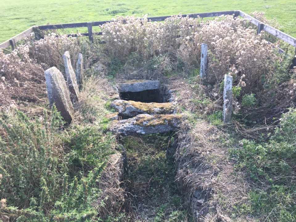
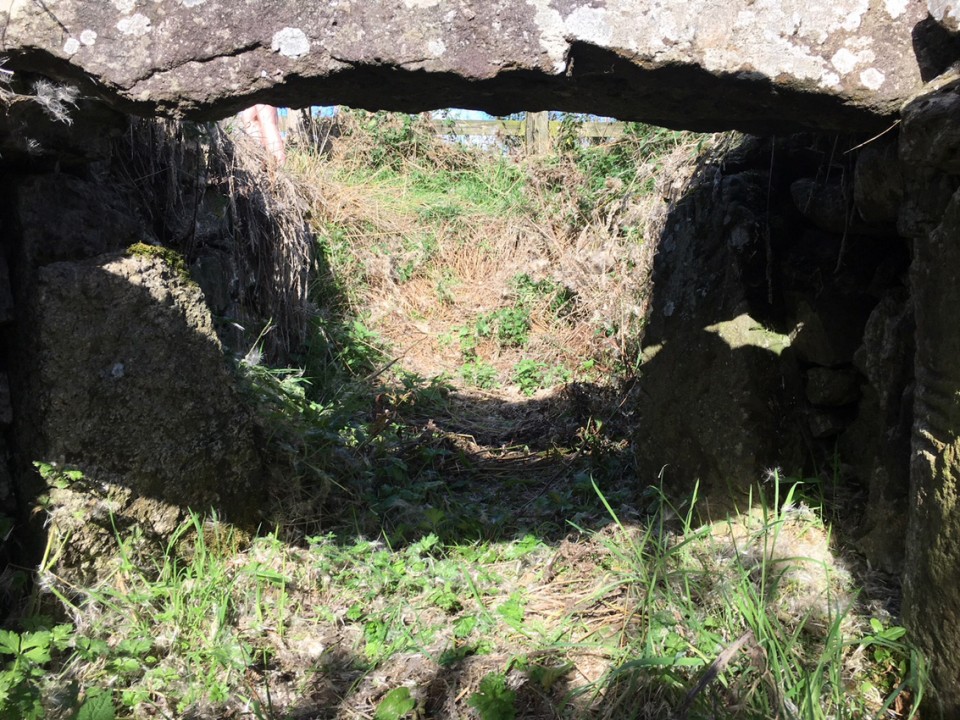
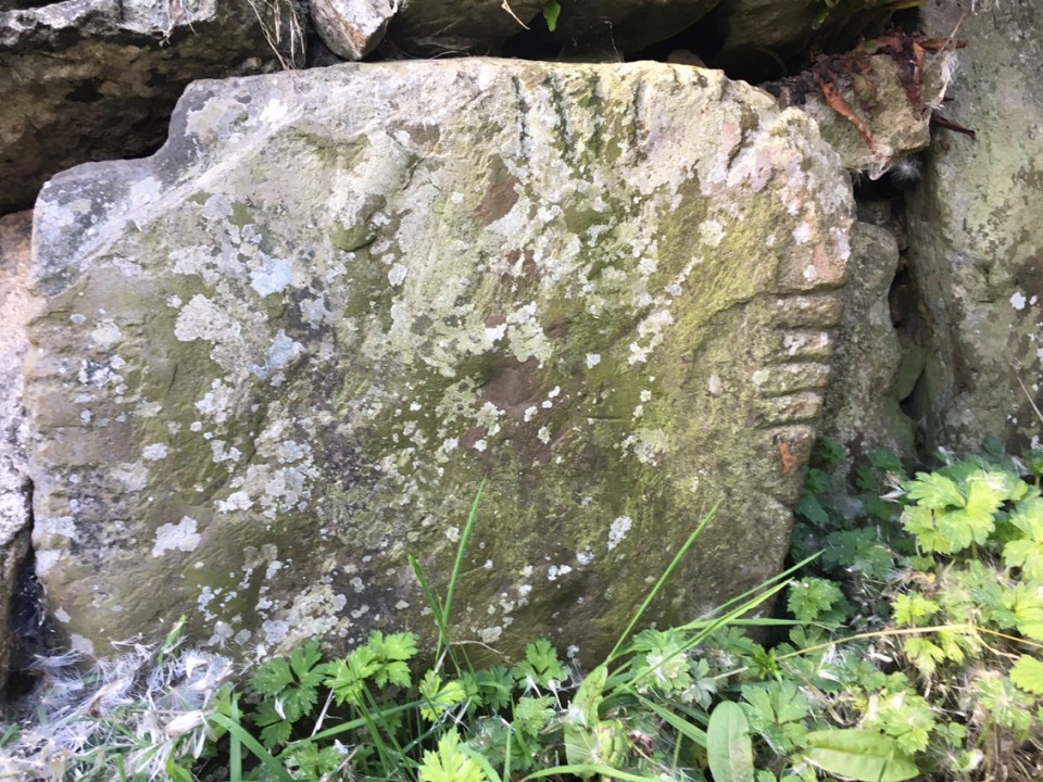
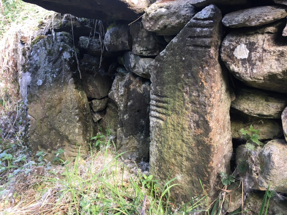
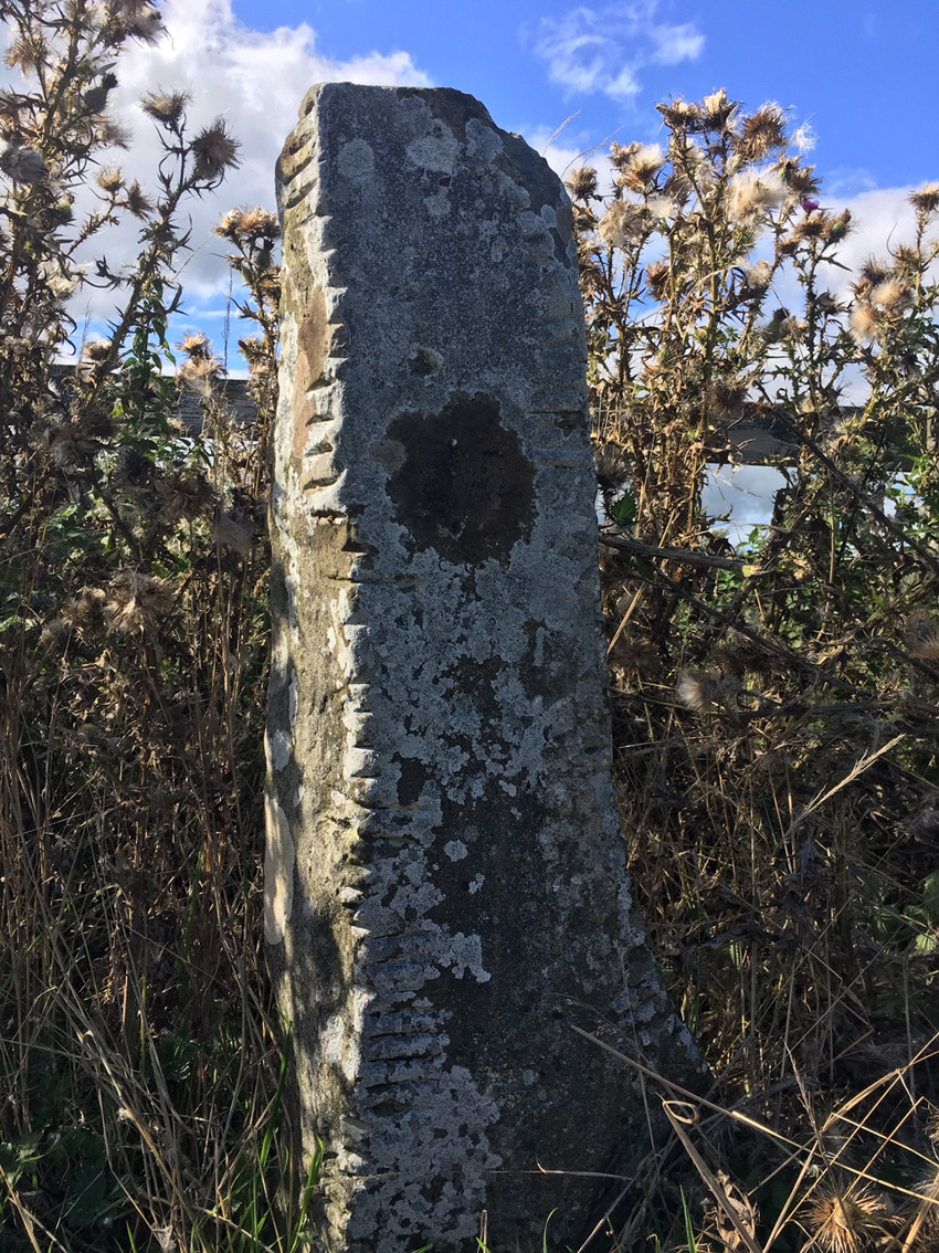
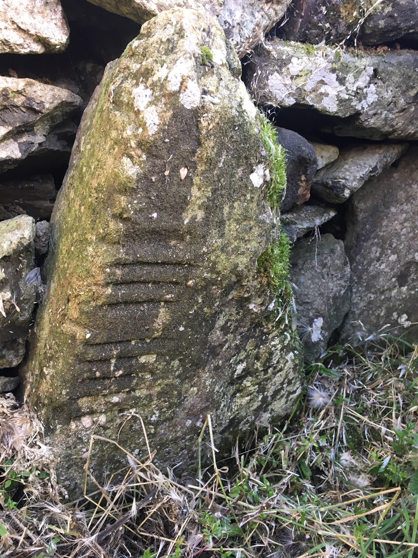
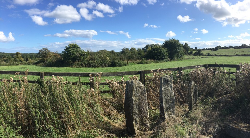
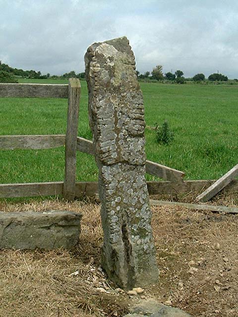
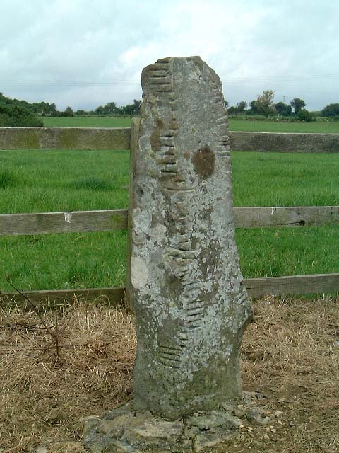
Another of Waterford's amazing sites left in a disgraceful condition, overgrown with nettles and thistles. We approached from the west, through an open gate and down a farm track. I wasn't sure that we had found the right place until we were right on top of it, the substantial standing ogham stones hidden by the summer growth. Once again I had a go at tidying the place up, giving the stones a bit of breathing space. The enclosure is in a large pasture field on a working farm and you would wonder had it had any visitors this summer. The monument is in state "care" but with the nearby Waterford Greenway now very popular, could this care not be more actual than theoretical? Five stones stand at the edge of the cut of the souterrain, all former lintels or roofstones of the reasonably short passage. Steps lead down into the passage where more ogham stones line the sides. There are three unmarked roofstones remaining over the passage, two almost midway down the passage and one over the end of the souterrain. Most of the passage is made up of dry-stone walling. Even with all the herbage, the power of this place couldn't be dimmed. I was affected by the stones here and the remnants of the souterrain more than I would be at a lot of the 'show' sites along the Tramore dolmen trail. Which is not to say that I'll be back anytime soon, if ever – but who knows? |
 Posted by ryaner
19th August 2018ce |
Miscellaneous |
|
|
From archaeology.ie: Description: Discovered during the removal of the outer bank of church site (WA024-033001-) at N in 1868 (Williams 1868-9). Rectangular chamber (dims. 3.35m x 1.5m; H at discovery 1.2m) with orthostatic walls and roofed with eight lintels. Ten ogham stones (WA024-033006- to WA024-033015-), which were utilised as lintels and sidestones, are preserved at the site. The inscriptions have been read by Macalister (1945, vol. 1, 267-77) as: 1, MANU MAGUNO GATI MOCOI MACORBO; 2, CALUNOVIC[A] MAQI MUCOI LIT[ENI]; 3, MAQI-INI[...MAQI QE]TTEAS; 4, CUNALEGEA MAQI C[...]SALAR CELI AVI QVECI; 5, BIGU MAQI LAG [...]; 6, BIR MAQI MUCOI ROTTIS; 7, ...] MAQI NE[TACUN]AS; 8, DENAVEC[A MU]COI MEDALO; 9, BRO[INION]AS; 10, SOVALINI/ DEAGOS MAQI MUCO[I...]NAI. (Brash 1866-9; Rhys 1899; Kirwan 1985; 1987; Harbison 1992, 325) The above description is derived from the published 'Archaeological Inventory of County Waterford' (Dublin: Stationery Office, 1999). In certain instances the entries have been revised and updated in the light of recent research. Compiled by: Michael Moore. Date of upload/revision: 9th May, 2011. This monument is subject to a preservation order made under the National Monuments Acts 1930 to 2014 (PO no. 12/1933). References: 1. Brash, R.R. 1868-9 On the Seskinan ogham inscriptions. County of Waterford. Journal of the Royal Society of Antiquaries of Ireland 10, 118-30. 2. Harbison, P. 1992 The high crosses of Ireland: an iconographical and photographic survey, 3 vols. Dublin. Royal Irish Academy. Bonn. Dr. Rudolf Habelt GMBH. 3. Kirwan, E.M. 1985 The ogham stones at Drumlohan reconsidered. Decies, no. 29, 6-12. 4. Kirwan, E.M. 1987 Drumlohan: a survey of its antiquities. Decies, no. 35, 33-40. 5. Macalister, R.A.S. 1945 Corpus inscriptionum insularum celticarum. Dublin. Stationery Office. 6. Rhys, P. 1899 The Drumloghan ogams. Journal of the Royal Society of Antiquaries of Ireland 29, 390-403. 7. Williams, W. 1868-9 On an ogham chamber at Drumloghan, in the County of Waterford. Journal of the Royal Society of Antiquaries of Ireland 10, 35-9. |
Posted by ryaner 18th August 2018ce |