The Modern Antiquarian
Log in
|
Register
Home
Latest Posts
Forums
Maps
Help
Browse Sites
News
Blog
Contributors
The Books
Select
-
Belgium
Denmark
Eire
France
Germany
Greece
Italy
The Netherlands
Norway
Portugal
Republic of Malta
Spain
Sweden
Switzerland
United Kingdom
County Meath
Thomastown
Rath
Thomastown (Rath) on The Modern Antiquarian, the UK & Ireland's most popular megalithic community website. 1 image, plus information on many more ancient sites nearby and across the UK & Ireland.
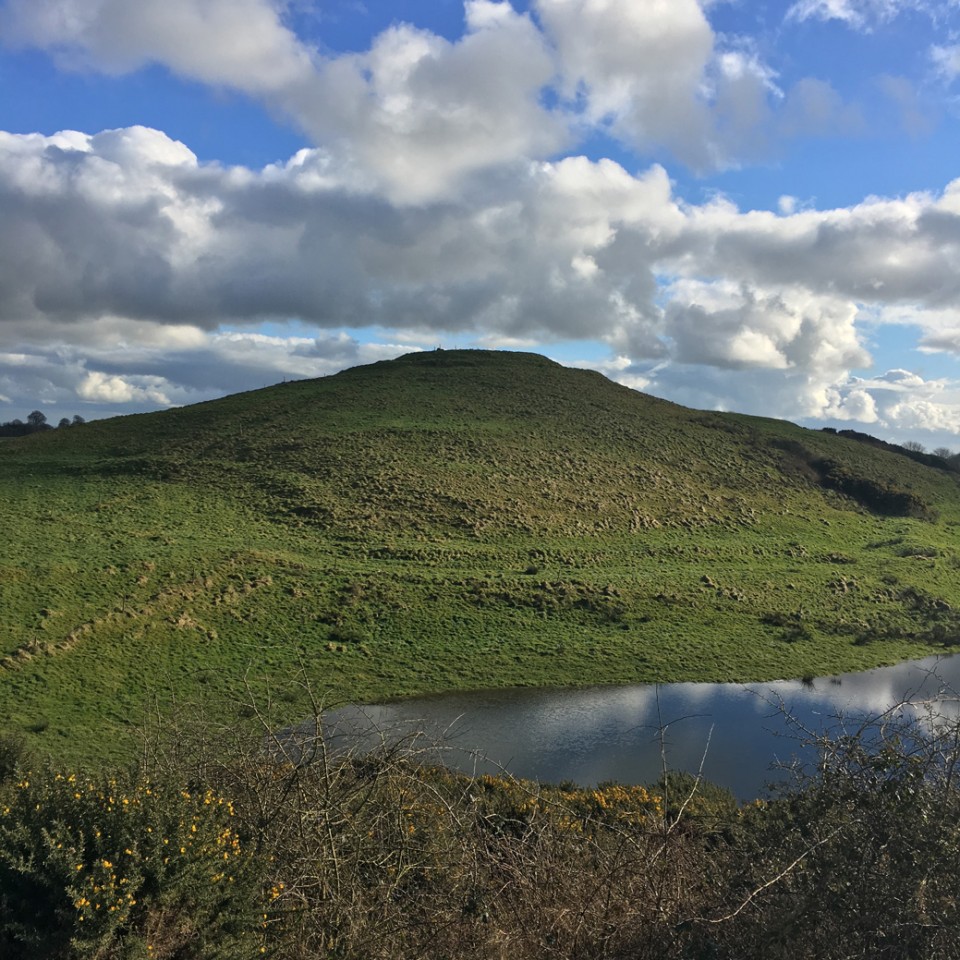
Image © ryaner
Nearest Town:
Oldcastle (7km NW)
OS Ref (IE):
N597744 /
Sheet: 42
Latitude:
53° 42' 57.01" N
Longitude:
7° 5' 44.34" W
Added by
ryaner
Images (1)
0 discussions
Start a topic
Show |
Hide
Web searches for Thomastown
Flickr
Google
Google Images
The Megalithic Portal
Bing
Stone Pages
Wikipedia
Show map
(inline Google Map)
- Sites within 20 km -
-
Bobsville (1.89km E) (8 posts)
Thomastown (1.89km NE) (8 posts)
Ballynanoma (1.97km W) (1 post)
Cairn N (3.03km NW) (7 posts)
Corstown (Fore By.) (3.04km NW) (1 post)
Corstown (Fore By.) (3.17km NW) (2 posts)
Cairn Q (3.21km NW) (5 posts)
Cairn P1 (3.21km NW) (4 posts)
Cairn P2 (3.21km NW) (1 post)
Cairn W (3.25km NW) (9 posts)
Cairn U (3.28km NW) (18 posts)
Cairn T (3.28km NW) (58 posts)
Cairn M (3.29km WNW) (2 posts)
Cairn S (3.32km NW) (18 posts)
Carnbane East (3.32km NW) (17 posts)
Cairn R1 (3.32km NW) (4 posts)
Cairn R2 (3.32km NW) (3 posts)
Cairn O (3.35km NW) (2 posts)
Cairn V (3.38km NW) (7 posts)
Corstown (Fore By.) (3.41km WNW) (2 posts)
Cairn X2 (3.5km NNW) (3 posts)
Cairn X3 (3.5km NNW) (1 post)
Cairn X1 (3.5km NNW) (13 posts)
Ballinvally (3.53km NNW) (2 posts)
Corstown (Fore By.) (3.58km NW) (1 post)
Cairn Y (3.6km N) (5 posts)
Ballinvally Cashel (3.63km NNW) (4 posts)
Ballinvally Standing Stone (3.72km NNW) (2 posts)
Patrickstown Standing Stone (3.73km N) (4 posts)
Cairn I (3.88km WNW) (16 posts)
Cairn G (3.88km WNW) (1 post)
Cairn F (3.88km WNW) (8 posts)
Cairn H (3.88km WNW) (21 posts)
Cairn E (3.88km WNW) (0 posts)
Cairn C (3.88km WNW) (4 posts)
Cairn A2 (3.88km WNW) (2 posts)
Carnbane West (3.88km WNW) (11 posts)
Cairn L (3.9km WNW) (20 posts)
Cairn K (3.9km WNW) (4 posts)
Ballinvally Rath (3.93km NNW) (0 posts)
Cairn D (3.95km WNW) (13 posts)
Cairn J (3.96km WNW) (3 posts)
Cairn B (4.02km WNW) (2 posts)
Stirrupstown (4.14km SE) (2 posts)
Patrickstown (4.29km N) (6 posts)
Mullagh (4.35km WNW) (0 posts)
Ballinvally (4.38km NW) (5 posts)
Ballinvally (4.39km NW) (1 post)
Ballinvally (4.39km NW) (17 posts)
Drumsawry or Summerbank (4.42km NW) (3 posts)
Drumsawry or Summerbank (5.01km NW) (2 posts)
Ballinvally (5.37km NW) (6 posts)
Moylagh (5.37km W) (1 post)
Boolies (5.71km NW) (4 posts)
King's Mountain (6.23km NE) (11 posts)
Galboystown (6.86km ESE) (1 post)
Glenidan (7.12km SW) (2 posts)
Clonasillagh Decorated Stone (7.17km NE) (5 posts)
Clonasillagh Cairn (7.25km NE) (5 posts)
Newcastle (7.52km NW) (1 post)
Newcastle (7.52km NW) (2 posts)
Clonasillagh (7.58km NE) (6 posts)
Balnagon Upper stone pair (7.61km ENE) (4 posts)
Christianstown (7.92km SW) (5 posts)
Crossdrum Lower (8.83km WNW) (0 posts)
Fore (9.25km WSW) (4 posts)
Farranagloch (10.39km WNW) (2 posts)
Brackloney (10.53km WNW) (0 posts)
Lakill and Moortown (10.96km WSW) (0 posts)
Lakill and Moortown (11.03km WSW) (12 posts)
Southhill (11.67km SSE) (2 posts)
Barconny (11.7km NW) (2 posts)
Delvin (11.78km SSE) (1 post)
Clonbockoge (12.64km WNW) (0 posts)
Virginia Park Estate (13.38km N) (3 posts)
Lickbla (14.35km W) (10 posts)
Bigwood (14.36km W) (7 posts)
Killulagh (14.5km SSW) (2 posts)
Killeter Hill (15.19km NE) (3 posts)
Raffony (15.23km N) (0 posts)
Curry (15.38km W) (0 posts)
Tullystown (15.4km W) (0 posts)
Mullaghey (15.69km ENE) (5 posts)
Greenan (16.79km S) (1 post)
Wardstown (18.71km ESE) (12 posts)
Tullaghanoge (19.23km ESE) (2 posts)
Cornaville North (19.8km NE) (8 posts)
- Add -
-
Add news
Add an image
Add fieldnotes
Add folklore
Add miscellaneous
Add a link
-
Add a site
Add a nearby facility
Add an alternative name/spelling
Images
(click to view fullsize)
Add an image
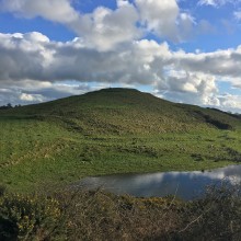 Image © ryaner