The Modern Antiquarian
Log in
|
Register
Home
Latest Posts
Forums
Maps
Help
Browse Sites
News
Blog
Contributors
The Books
Select
-
Belgium
Denmark
Eire
France
Germany
Greece
Italy
The Netherlands
Norway
Portugal
Republic of Malta
Spain
Sweden
Switzerland
United Kingdom
County Carlow
Aghade
Bullaun Stone
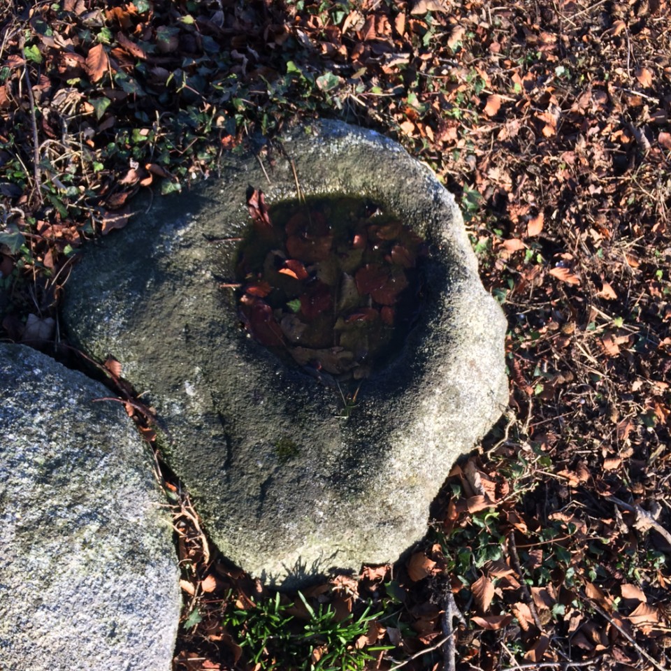
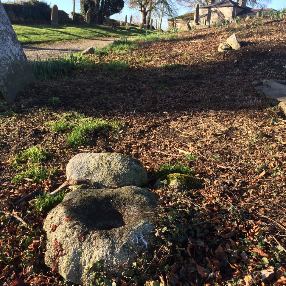
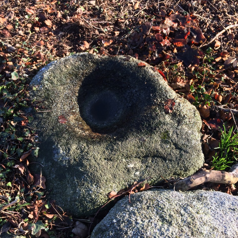
Aghade (Bullaun Stone) on The Modern Antiquarian, the UK & Ireland's most popular megalithic community website. 4 images, plus information on many more ancient sites nearby and across the UK & Ireland.
Image © ryaner
Nearest Town:
Tullow (5km NNW)
OS Ref (IE):
S853683 /
Sheet: 61
Latitude:
52° 45' 32.7" N
Longitude:
6° 44' 10.82" W
Added by
ryaner
Images (4)
0 discussions
Start a topic
Show |
Hide
Web searches for Aghade
Flickr
Google
Google Images
The Megalithic Portal
Bing
Stone Pages
Wikipedia
Show map
(inline Google Map)
- Sites within 20 km -
-
Ballynoe (0.92km N) (1 post)
Cloch An Phoill (Aghade) (1.39km NW) (9 posts)
Ardattin (2.15km E) (3 posts)
Kilmurray (2.46km SW) (0 posts)
Craans (2.81km E) (6 posts)
Rathglass (3.1km NNE) (0 posts)
Ardristan (3.19km NW) (11 posts)
Ardristan 2 (3.32km NW) (0 posts)
Sragh (3.83km S) (0 posts)
Blacklion (4.42km E) (0 posts)
Coolroe (5.37km E) (3 posts)
Ballynavortha (5.57km E) (2 posts)
Knockbarragh (6.69km S) (0 posts)
Rath Gael (6.91km NE) (17 posts)
Knockbrack (7.05km S) (2 posts)
Knockbrack Cairns (7.09km S) (0 posts)
Rath East (7.13km NE) (0 posts)
Huntsman's Cross Road (7.18km WSW) (0 posts)
Glenoge (7.27km WNW) (2 posts)
Moylisha (7.81km E) (8 posts)
Aghowle Lower (8.14km ENE) (3 posts)
Killenora (8.32km WNW) (0 posts)
Myshall (8.74km SSW) (3 posts)
Kilmagarvoge (9.15km N) (1 post)
Aghowle Upper (9.16km E) (5 posts)
Knockbower (9.22km W) (0 posts)
Tobinstown (9.25km NNE) (0 posts)
Knockballystine (9.5km NE) (0 posts)
Killabeg Stone (9.7km ENE) (0 posts)
Clonegall (9.71km ESE) (0 posts)
Straboe (9.86km NNW) (0 posts)
Busherstown (10.37km WNW) (0 posts)
Rathmore (10.59km N) (0 posts)
Haroldstown (10.71km NNE) (38 posts)
Kildreenagh (11.23km WSW) (5 posts)
Bennekerry (11.36km WNW) (0 posts)
Kildreenagh 2 (11.41km WSW) (2 posts)
Seskin (11.83km ENE) (0 posts)
Coolasnaghta (12.34km SSW) (2 posts)
Toberbride (12.34km SW) (0 posts)
Williamstown (12.95km NNE) (7 posts)
Clonmore (13.44km ENE) (3 posts)
Browne's Hill (13.7km WNW) (38 posts)
The Nine Stones (14.14km SSW) (4 posts)
Mount Leinster (14.24km SSW) (5 posts)
Slievebawn (14.27km SSW) (5 posts)
Patrickswell (14.29km NNE) (0 posts)
Dunleckny (14.43km WSW) (1 post)
Curraghacruit (14.45km WSW) (0 posts)
Rathwade (14.81km WSW) (0 posts)
Tombeagh (15.42km NE) (2 posts)
Rathoman (15.44km WSW) (0 posts)
Leighlinbridge (15.98km WSW) (5 posts)
Rossard (16.62km SSE) (0 posts)
Knockscur (16.69km SSW) (0 posts)
Killoughternane (16.7km SSW) (0 posts)
Killoughternane/Knockscur (16.7km SSW) (4 posts)
Crannagh (17.06km SSW) (0 posts)
Ballinkillin (17.42km SW) (3 posts)
Crannagh (17.47km S) (3 posts)
Ballinkillin (17.71km SW) (0 posts)
Carnew (17.94km E) (3 posts)
Kilcruit (18.25km SW) (2 posts)
Fenniscourt (18.38km WSW) (7 posts)
Knockroe (18.91km S) (9 posts)
Spahill (18.96km SW) (2 posts)
Ballinasilloge (19.26km SW) (11 posts)
Humewood Castle (19.33km NNE) (4 posts)
Kilgraney (19.93km SW) (11 posts)
- Add -
-
Add news
Add an image
Add fieldnotes
Add folklore
Add miscellaneous
Add a link
-
Add a site
Add a nearby facility
Add an alternative name/spelling
Images
(click to view fullsize)
Add an image
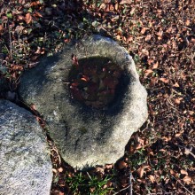 Image © ryaner