12/11/2016 - Posting really just to give a different route up than Drew's. It's no better or worse but more options are always good, access wise.
We parked opposite the lovely church at Tullynessle, east of the hill. It's a nice walk west along a tarmac road to Terpersie. As the road splits at NJ 5482 2007 (good parking here too and close to Corrie cairn stone circle as well) we turned left to cross the Esset Burn and followed the track past Dubston. From here it's just a case of keeping to the track as it climbs Fouchie Shank (hut circle half way up) to the top of Lord Arthur's Hill. For a longer walk, cross the burn just before the start of Fouchie Shank and head north along the old right of way past the disused quarry for a long loop round the Correen Hills to the Lord Arthur's Hill.
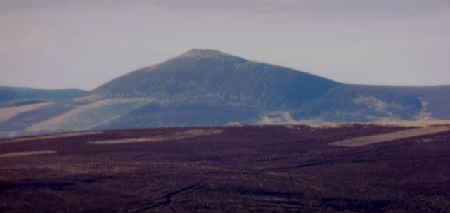
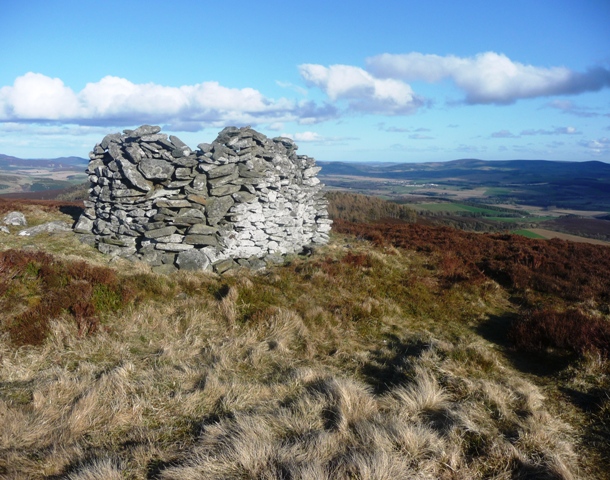
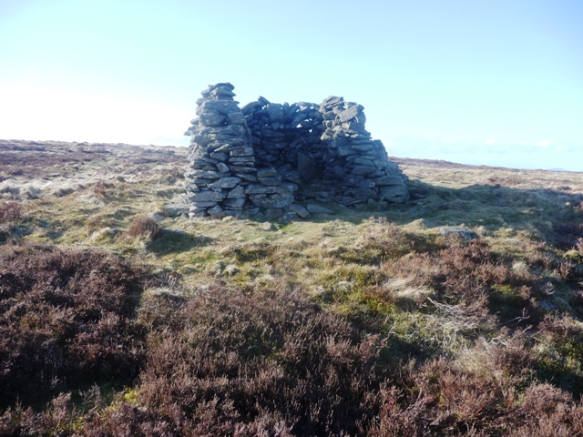
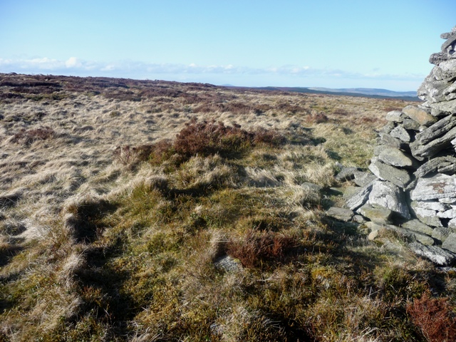
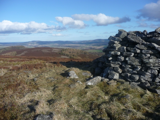
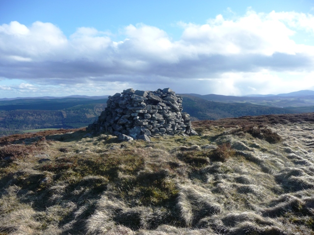
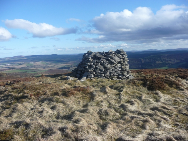
The cairn is just east of the trigpoint. A modern shelter has been built on top but the cairn footprint is still visible. The top is lovely. Great views all round from Bennachie to the east and west to the Cairngorms. The Correen Hills are usually a quiet place to visit and you would normally have the cairn to yourself. It's a lovely spot to sit and while away a few hours.
From Damil I headed back north on the A980 and then onto the A944 heading west towards Mossat. This used to be a terrible junction but has now been sorted so no more driving difficulties here. I stopped at Littlewood Park as it was a safe bet I could park here. Permission was given so on I went.
Follow the track behind the saw mill/logs to the north west and basically head up the hill which is quite steep in parts. A junction is reached about half way up. Go a short distance west then head uphill following another track. You'll notice plenty of 'shooting butts' on the way up. Once on the top plateau you'll be in between the trig point and the cairn, which is some 30 meters east of the track. Fantastic views all round, in particular Tap O Noth to the North. Lord Arthur's Hill is the highest point of the Correen Hills.
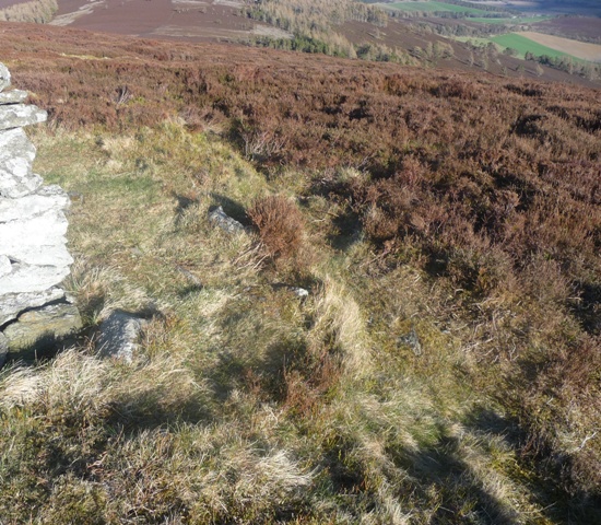
The cairn is easily spotted as a 'wind break' has been built on top of it. (going back down the hill this would have proved a handy shelter.) Turf/grass covers most of the cairn but several kerbs are in evidence and cairn material pokes it head thru the covering. It sits at almost 9 meters wide and 0.5 meters tall. Whoever this cairn was made for certainly had a beautiful place to rest. A Bronze Age axe was found here in 1863.
After a good and long look round at all the scenery it was time to head back down. Looking south towards Damil did not look promising. Heavy snow was coming from the south and for 20 mins approx. I walked in blizzard type conditions. Good fun!
'A lofty hill over which the boundary between this parish from that of Auchindoir. It derives its name from the following incident, when the of Lord Arthur Forbes commonly called 'Black Arthur' was being carried over this hill for internment in Kearn Church Yard. The bearers rested on this hill during a snow storm. There is no cairn as the name would imply on or about the hill.'
Parish Records.
(They rested the coffin near where the trig point is nowadays. The cairn is some 70 meters to the south east.)
This is also a name of a Scottish Reel (fiddle music) written in G Major. Composed by Alexander Walker it is part of the 'A Collection of Strathspeys, Reels and Marches' published in 1866.


 Posted by thelonious